Day 1
Doing the Great Glen Way has been on the radar ever since we seriously took up cycling, and extending it to Beauly made sense for us, due to family connections there as well as at Fort William. So I worked out a route that included some of the off-road Great Glen Way and also some cycling on relatively quiet roads, with a stop-off at the Whitebridge Hotel at the end of the first day. For this trip, we teamed up again with Colette’s brother Damian for another west coast to east coast expedition.
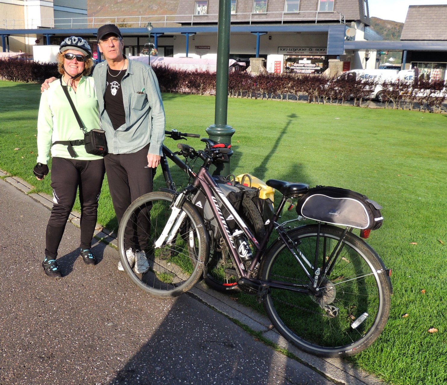
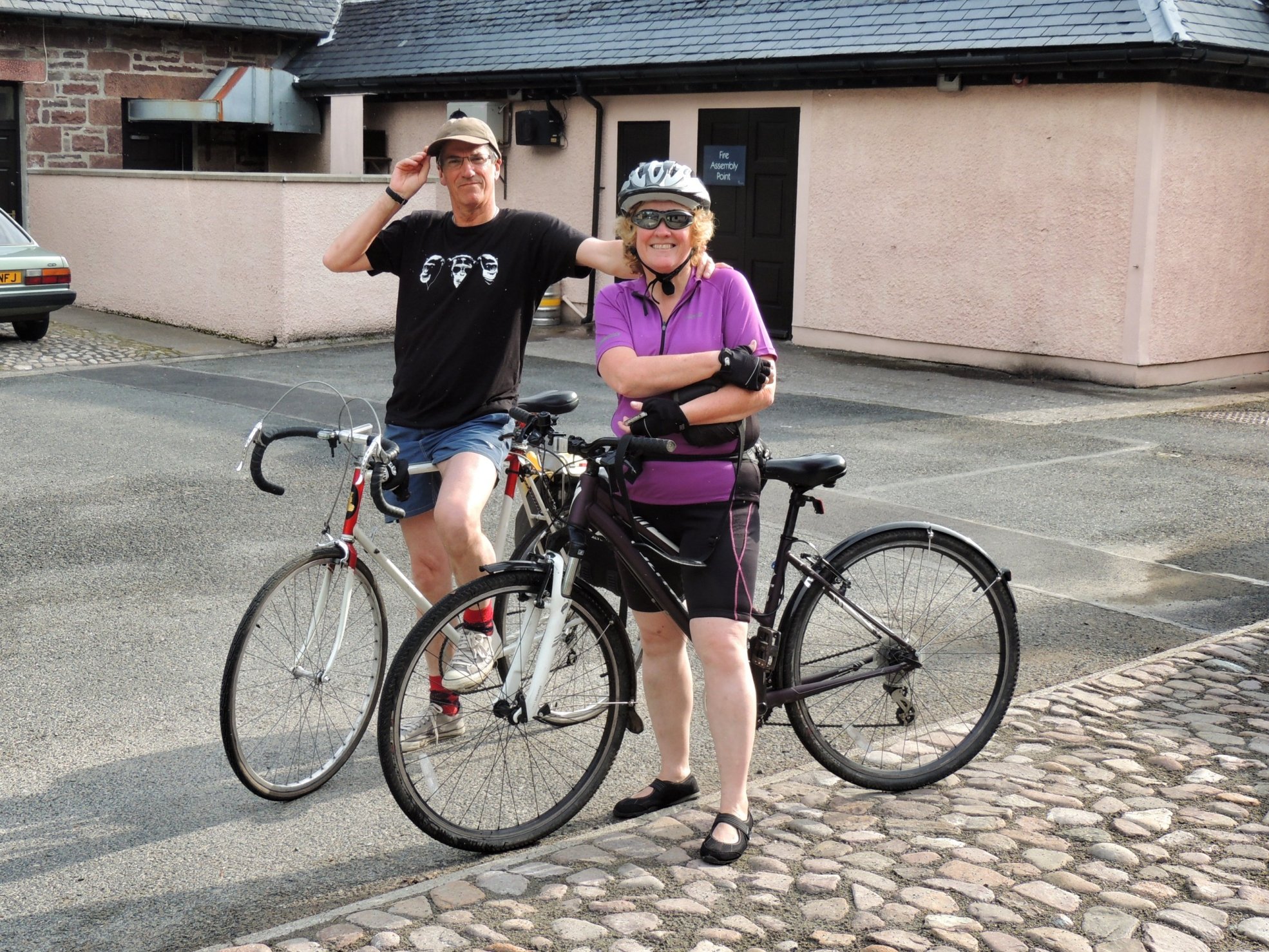
Day 1 saw us getting up early and driving off in the dark towards Fort William with our bikes on the back of the car and fully packed panniers in the boot. We got there about 9am and as arranged, were parked in the driveway of the house on Achintore Road where Colette and Damian grew up. We caught up with Damian close to the Alexandra Hotel where he had stayed the previous night, and was waiting with the mountain bike he had hired from a local bike shop. The day was calm and dry and the sun was even threatening to come out, which we hadn’t dare hope for: a perfect start for our long-awaited journey.
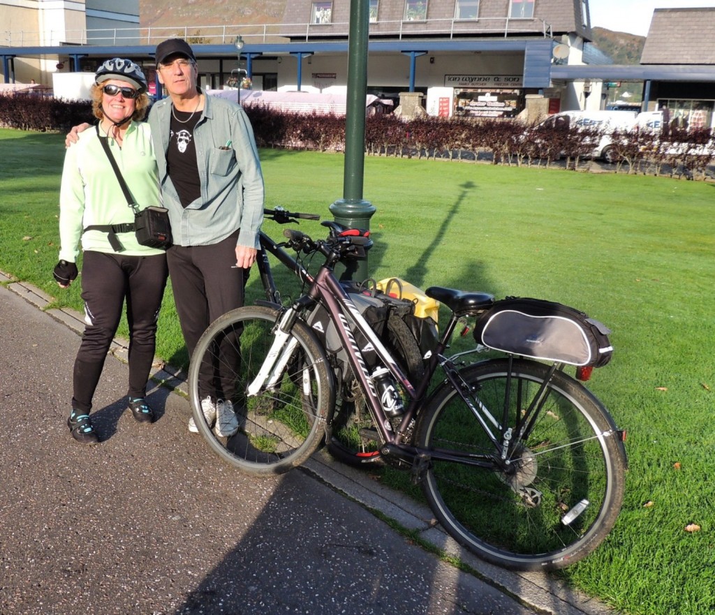
Raring to go…
We started off by heading to the back of Morrisons supermarket and then past Lidl, which might not seem a very inspiring beginning, but it took us to a footbridge crossing River Nevis and into Inverlochy, picking up the Great Glen Way trail, which we continued to dip in and out of for much of the trip. This took us along past the Nevis Cycles shop and onto a single track road that ran parallel to the train track for a while. As we passed, there was the sound of coal being dispensed from a large bunker, possibly to fuel the steam train that runs to Mallaig.
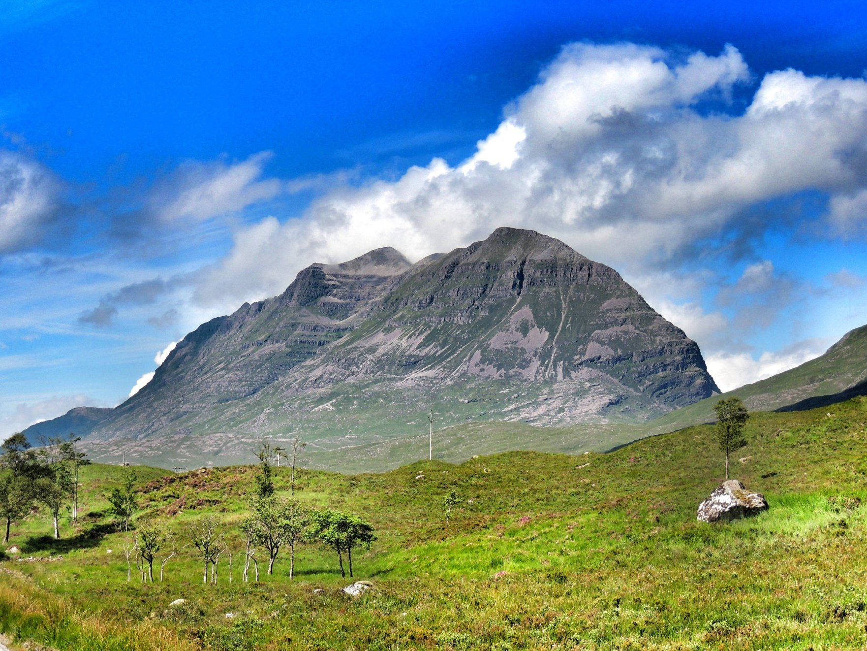
Soon, we reached the Soldiers Bridge, where we dutifully dismounted and marched our bikes single file across to the opposite bank of the River Lochy. Once there, we turned left and cycled on through Caol and met up with the Caledonian Canal for the first time. The sun was now shining strongly from just above Ben Nevis, spoiling Colette’s attempt at photographing the mountain from this prime vantage. I suppose we can live with that under the circumstances!
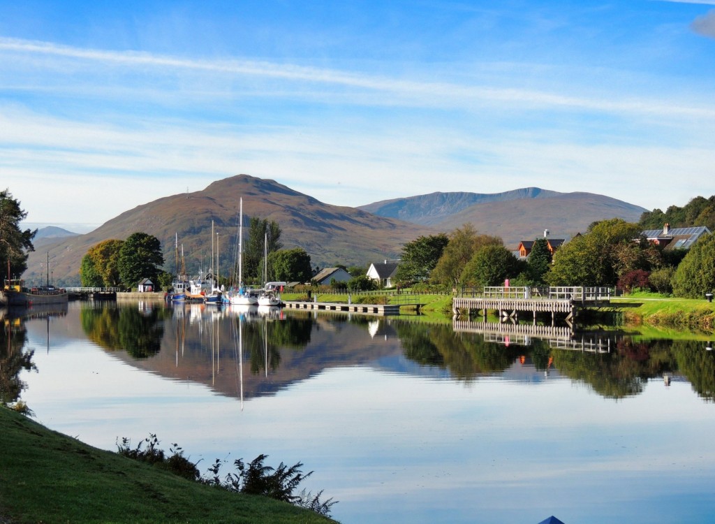
Reflections on the Caledonian Canal
We cycled along the towpath for a short distance to Banavie and Neptune’s Staircase: a series of locks raising the canal well above sea level. From there, we continued on the right side of the canal along the towpath. The morning was just perfect and the canal reflected the scenery like a mirror.
Merry isthmus
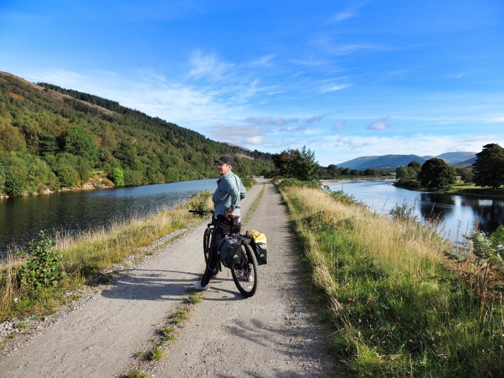
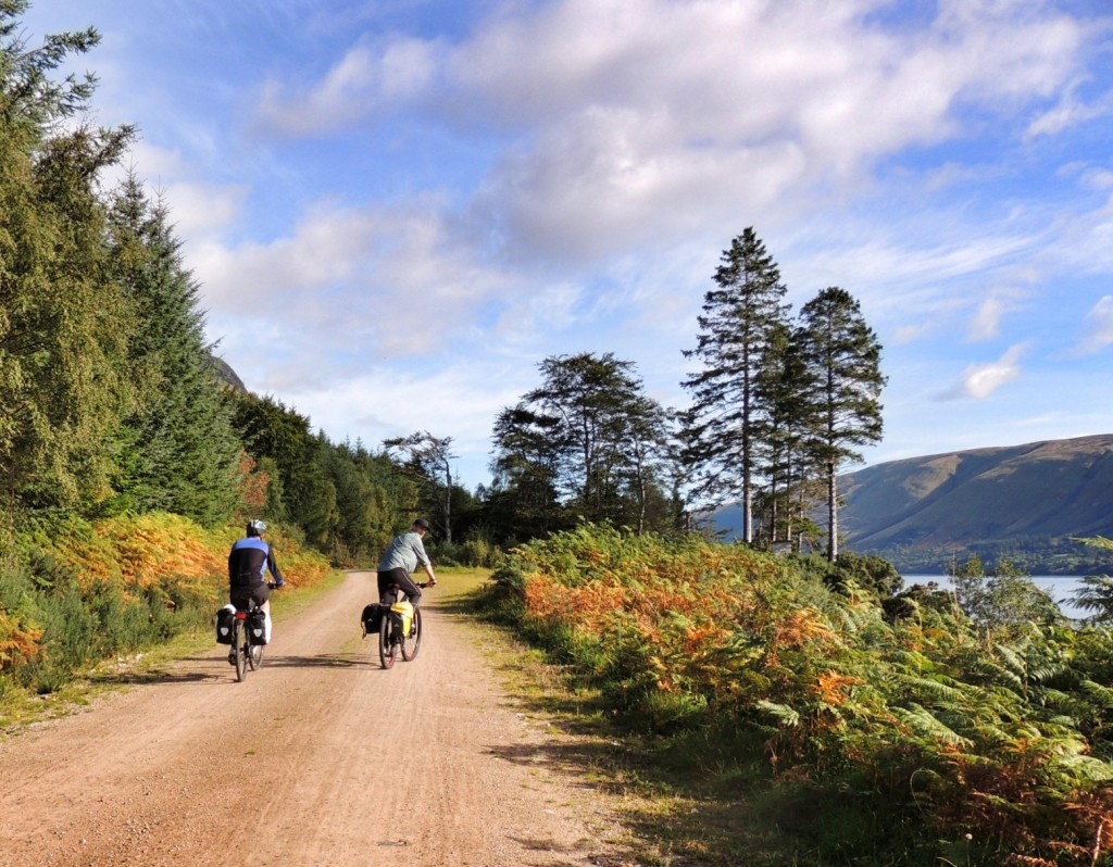
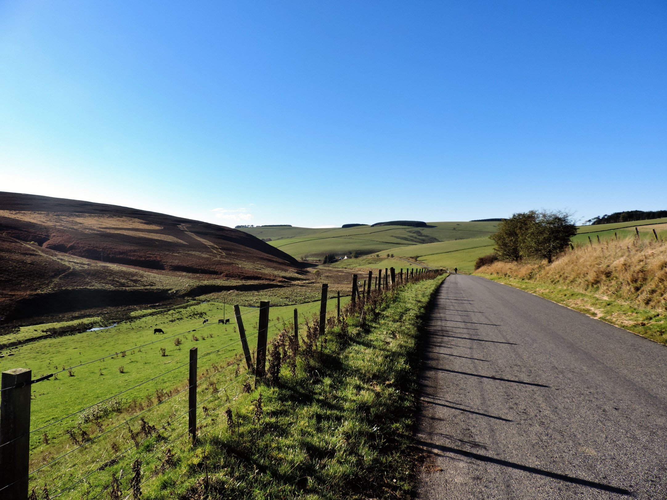
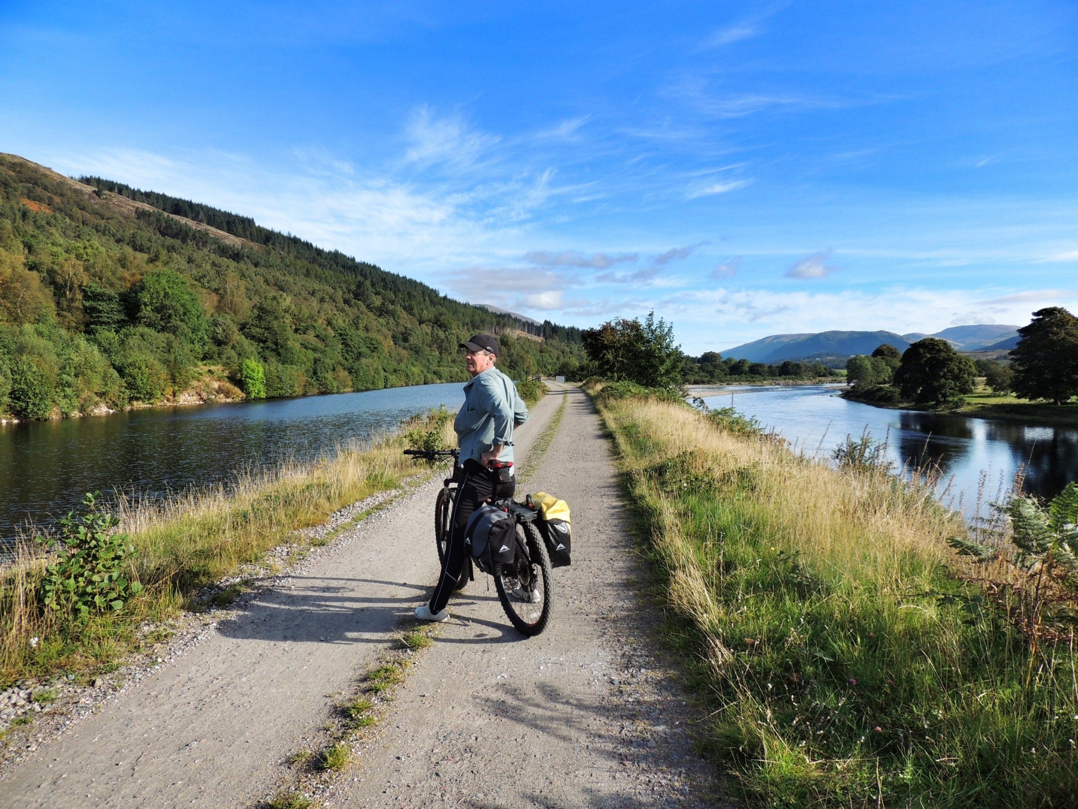
After a few miles, we came to Gairlochy, where the canal opens out into Loch Lochy. We turned left there across the swing bridge, then right along the B8005. This quiet road took us up through trees and down close to Loch Lochy, past some houses with the most perfect lochside locations and on to Clunes. There we turned right onto a forest track that ran along the west bank of Loch Lochy. The track was slightly hillier than I’d expected, but nothing compared to what lay ahead later in the day. We rode for what seemed a good number of miles through the trees, with occasional glimpses of the loch to our right. Finally, the trees thinned out and we descended to the locks at South Laggan, where Loch Lochy ended and the Caledonian Canal took over again.
Forestry track alongside Loch Lochy

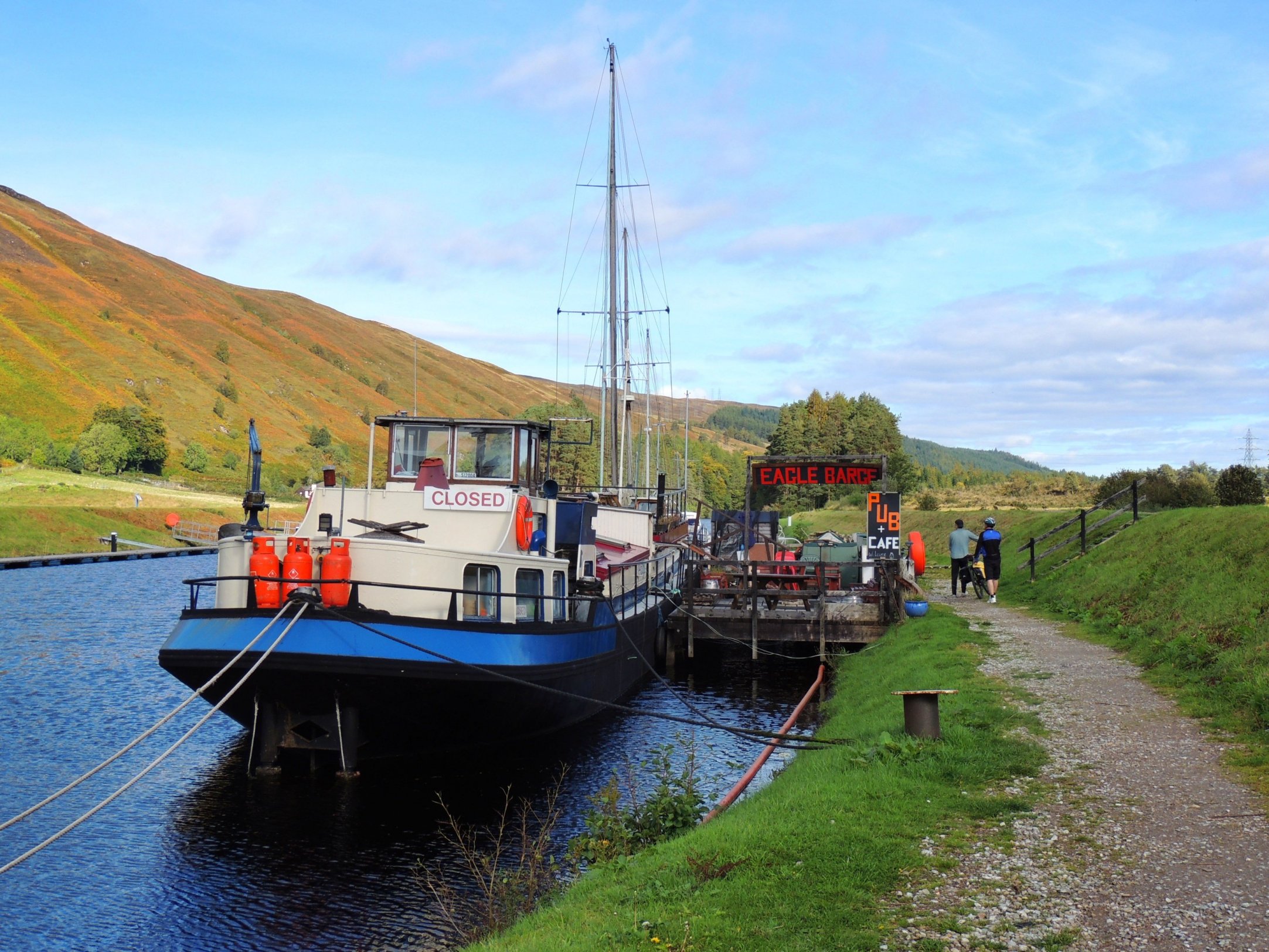
Arriving at the Eagle Barge, at Laggan
I had heard that there was a floating pub / restaurant at Laggan, so we looked around and found the Eagle Barge. It was displaying a closed sign, but there were signs of life. We were in dire need of a cup of tea and bite to eat, so we were greatly relieved when the place opened up a few minutes later. The barge is run by a young couple who have made something a bit special in this wonderful location. The bar is small, but boasts several real ales and the cosy dining area is booked solid every night. We took our tea and excellent fruit scones on the top deck, overlooking a large yacht in the process of refurbishment. This was another project that the couple were undertaking: converting the 1960s yacht, originally sailed round the Med by Dutch nobility, into a floating bunk house. Along with the floating pub, that would make Laggan into a perfect stopover point for the future!
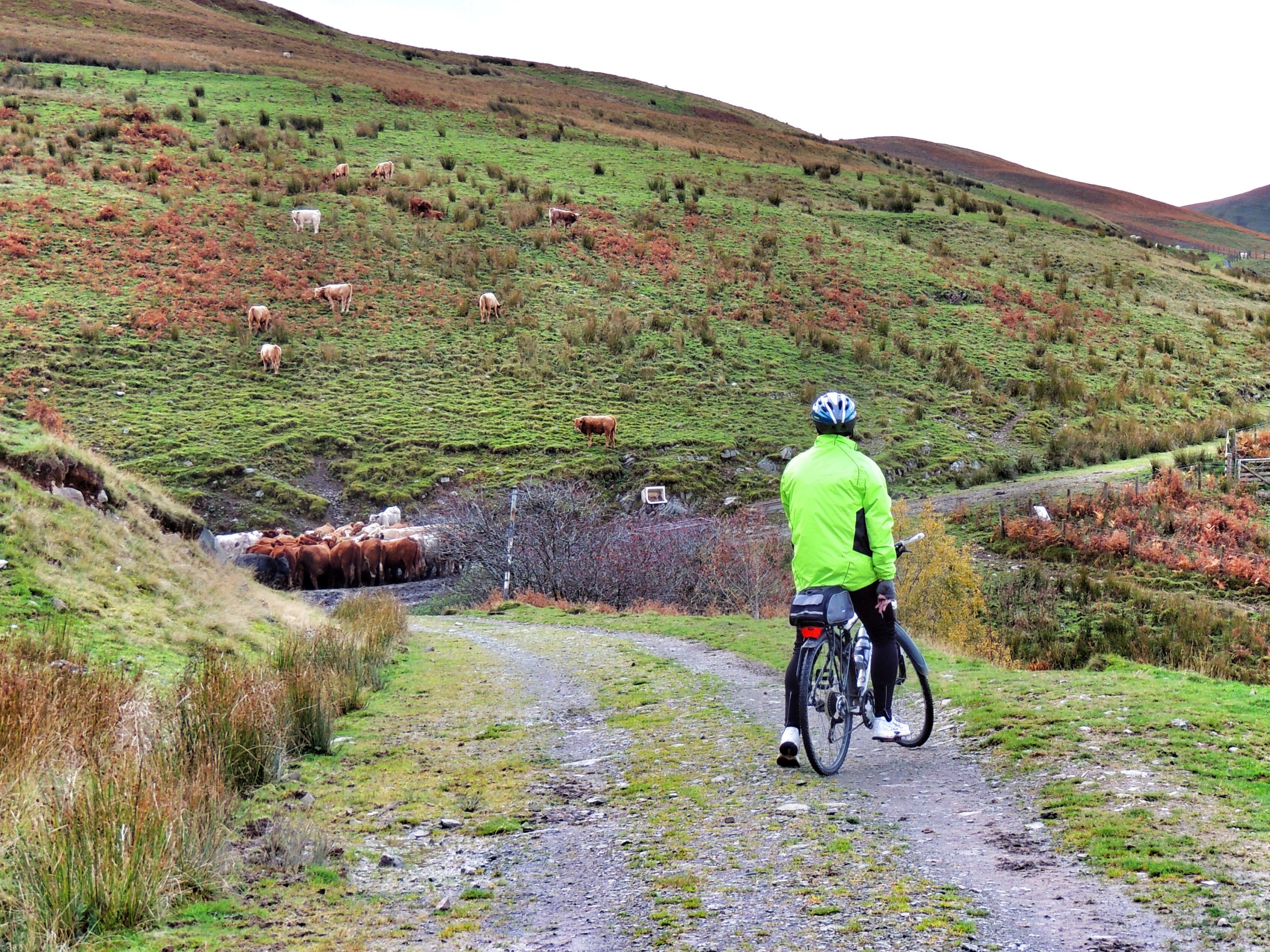
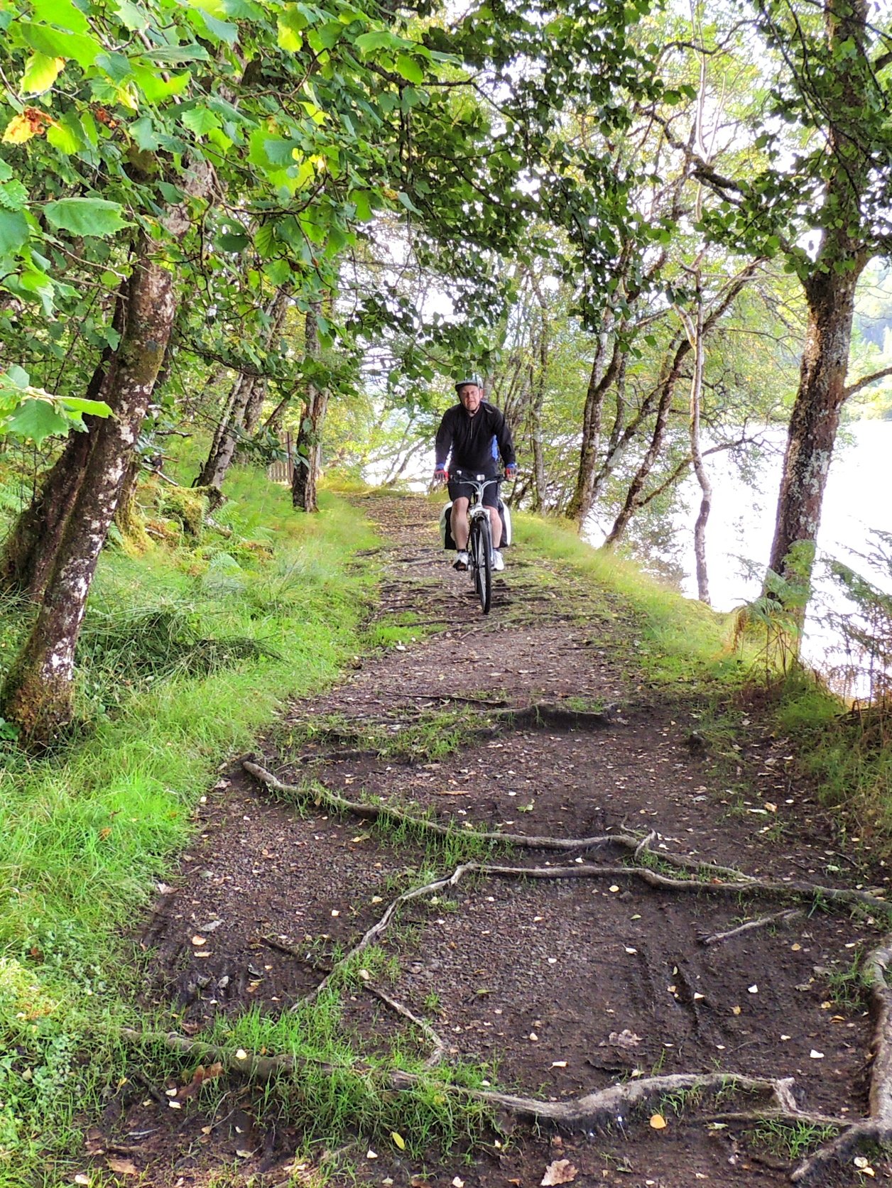
We then continued along the canal path, which rose well above the canal and through a wooded area which made for a very pleasant ride. The path took us to North Laggan just south of the lock leading into Loch Oich. There, we crossed the A82 and headed towards the Great Glen Water Park. However, we skirted along the side and followed the Great Glen Way sign that took us up to an old, long disused railway station. The path ran along the east side of Loch Oich through what looked to be native woodland. It was a bit muddy in places, but the main problem was tree roots, which made our progress very bouncy. At one point, Damian’s bike got stuck in the middle of a mass of roots and ejected him sideways, in what looked like slow motion, onto a patch of grass at the side of the path. No major injuries, but annoyingly the fall put a hole in his new cycling trousers.
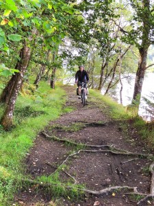
Roots were a feature of the path along Loch Oich
On a slight downhill section I got up a bit of speed and surprised a small animal on the path, As it scurried off, I could tell it was a red squirrel – the first I’ve ever seen in the wild. Luckily, it only went as far as the nearest tree, so it was still there for Colette and Damian to see when they caught up.
Further along the path was a section of grass alongside the loch set aside for “trailblazers”, with areas to build campfires and further up the hill, a composting toilet. I investigated the latter while Colette and Damian explored an abandoned cottage that stood alongside.
Our journey then continued north along the Great Glen Way until we reached Bridge of Oich at the head of Loch Oich. We stopped for a few moments to inspect the old 19th century suspension bridge, then pressed on along the eastern canal bank. After a mile or so, we crossed to the other side using a lock and cycled the remaining few miles to Fort Augustus and the southern shores of Loch Ness.
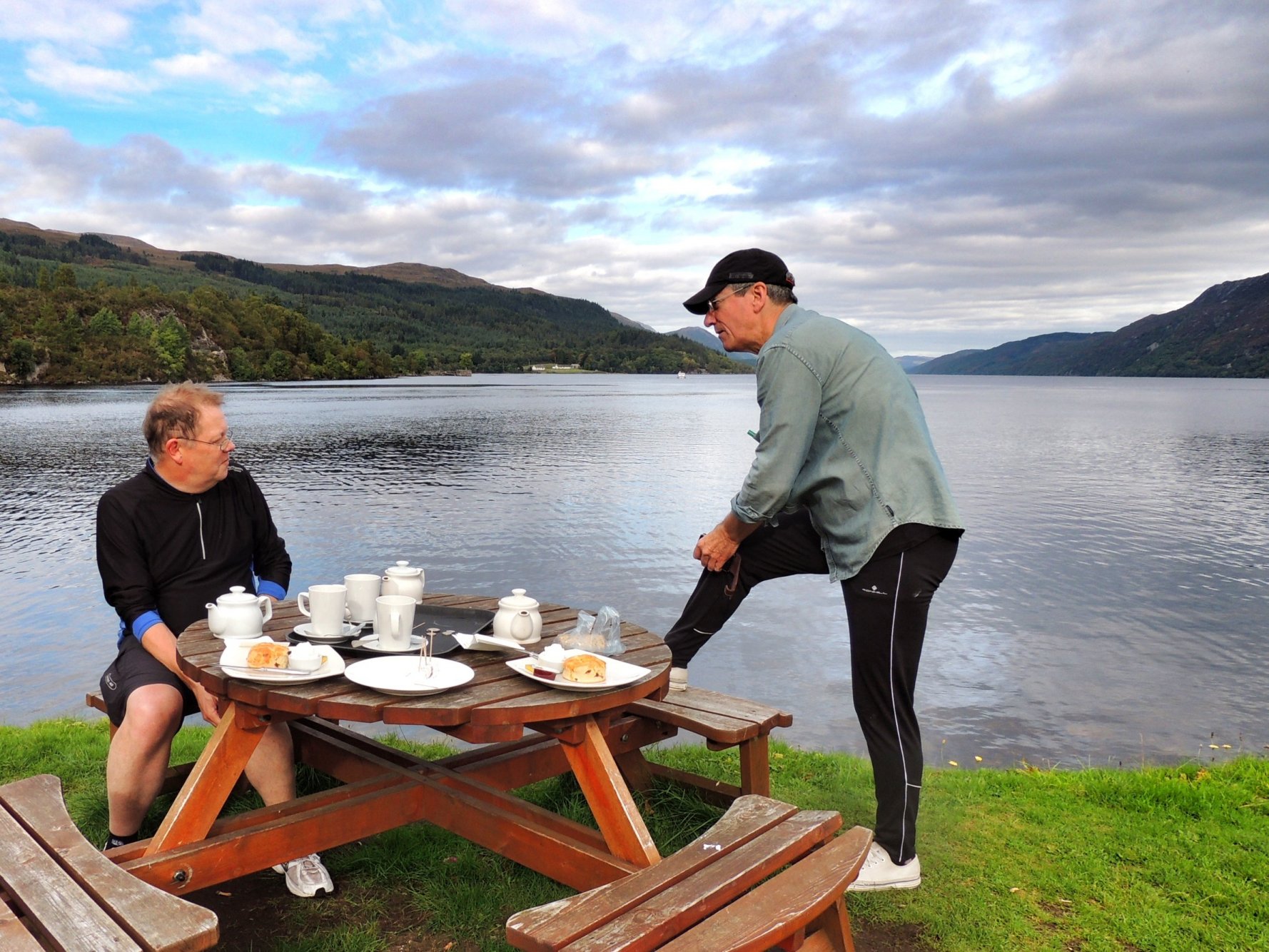
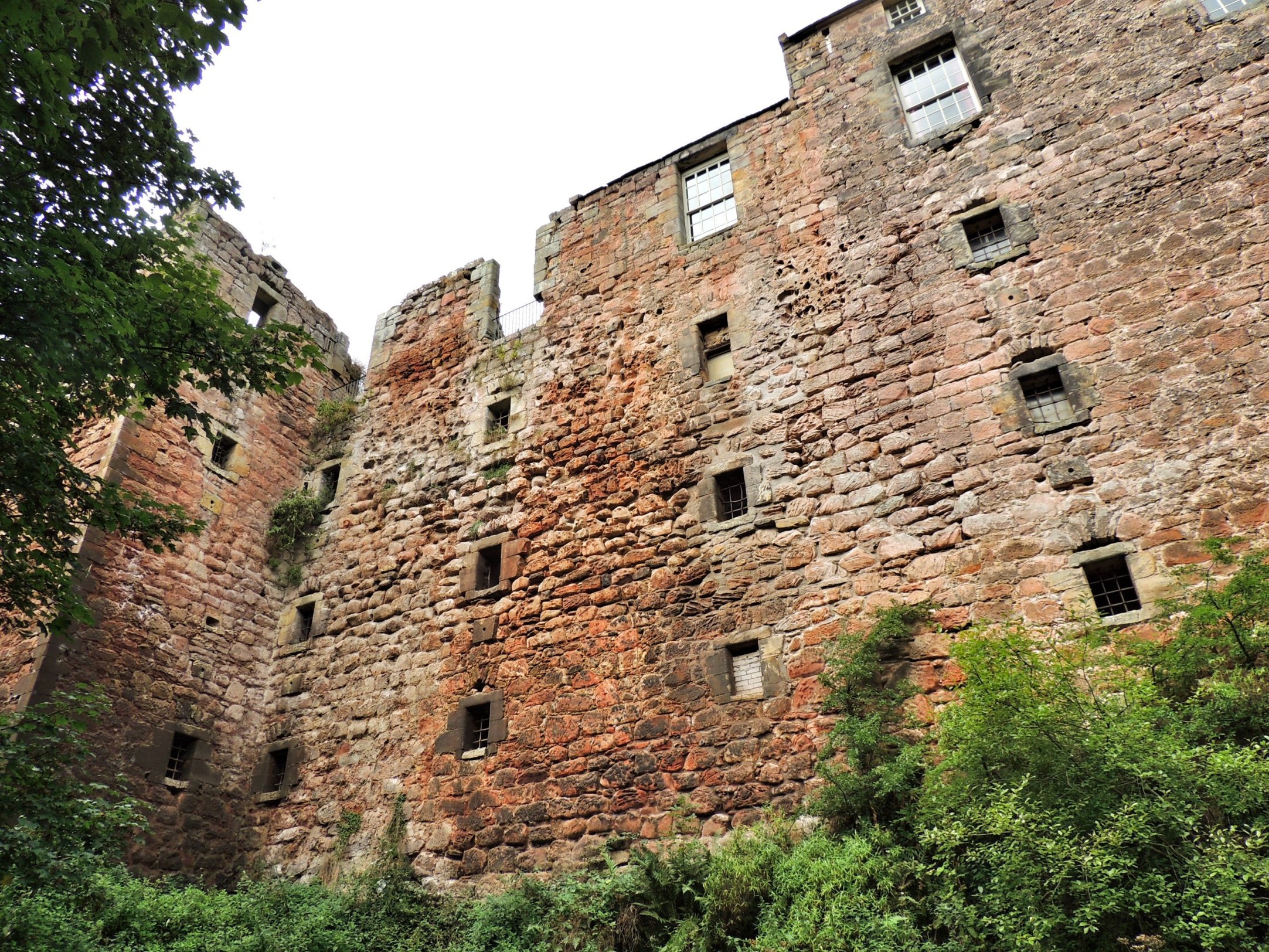
We headed round to the abbey, where Damian had spent a few of his school years, so he could show us some of the sights. Alongside the stone pier is the Boathouse restaurant, where we thought we might get something to eat. It was about 3pm and it looked as if they were tidying up after lunch. We weren’t all that hungry anyway, so ended up getting tea and fruit scones again. The scones were fine, but not as good as those at the Eagle Barge. We watched boats going in and out of the canal, but Nessie was nowhere to be seen. Damian told us that some of the monks he spoke to at the abbey were convinced they had seen the monster. It would be nice to think there is something hiding there in those deep, dark waters.

Tea at Fort Augustus. Damian: “Look at the state o’ me strides, guv’nor”
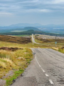
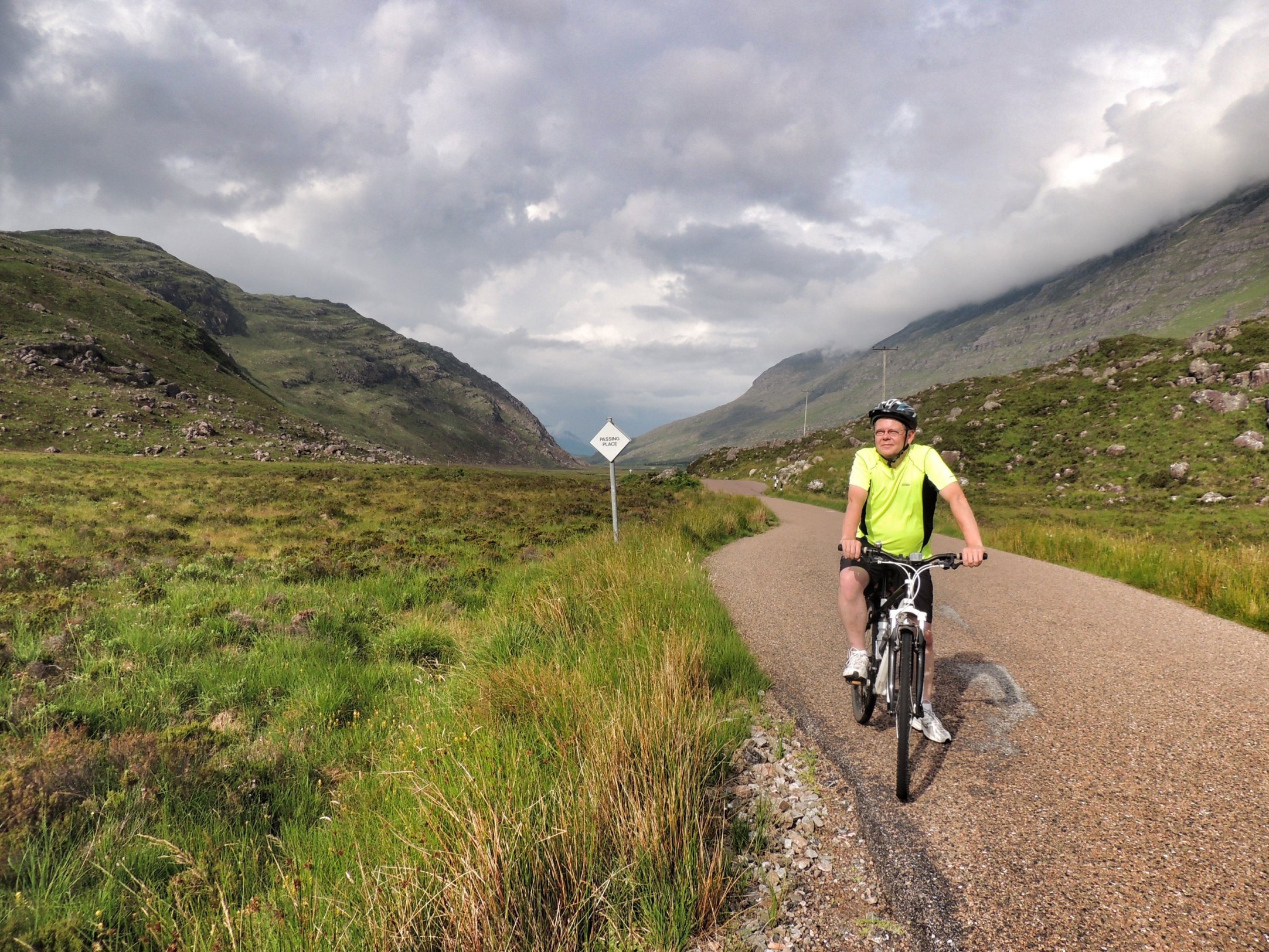
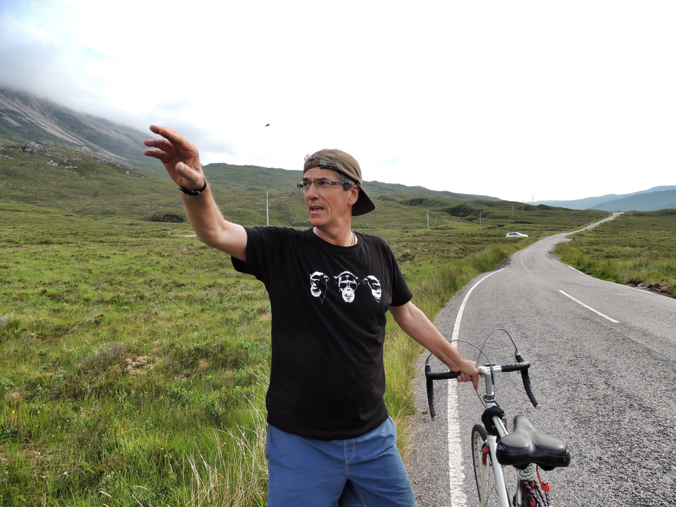
After that, we got ourselves ready for the final leg of the journey: going northeast along the B862 in the direction of Whitebridge, where we were going to spend the night. Damian wanted to pick up some things from the shops in the town, so he suggested that Colette and I go ahead and he would meet us at the hotel. So we did that and headed towards the main challenge of the day – a huge 5 mile climb which took us from the shores of Loch Ness up to a height of nearly 1300 feet!
The climb started off gently enough, but soon ramped up to a seriously steep gradient that saw me quickly changing down to the lowest gear possible. I was aware from looking at maps that the climb was separated into three sections of just over a mile each, with respites inbetween. So I resigned myself to just grinding it out at more or less walking pace – with a degree of effort that I could just about maintain over at least a mile. In fact, I have to say that I quite enjoyed it – after all the planning and thinking about it, I was actually doing it! Colette managed it too, but at a slightly slower pace. I stopped at the top of the first section to let her catch up then we enjoyed a brief downhill respite before the hill started again. The second section seemed just as hard as the first, and I was getting really tired by the time the road flattened off as we reached Loch Tarff. We stopped there for a few minutes then tackled the final section, which was thankfully less severe. Just over an hour after leaving Fort Augustus, we reached the top, where we found a great viewpoint over the surrounding hills and lochs. What was even better, we could see our road snaking off into the distance, going downhill as far as the eye could see!
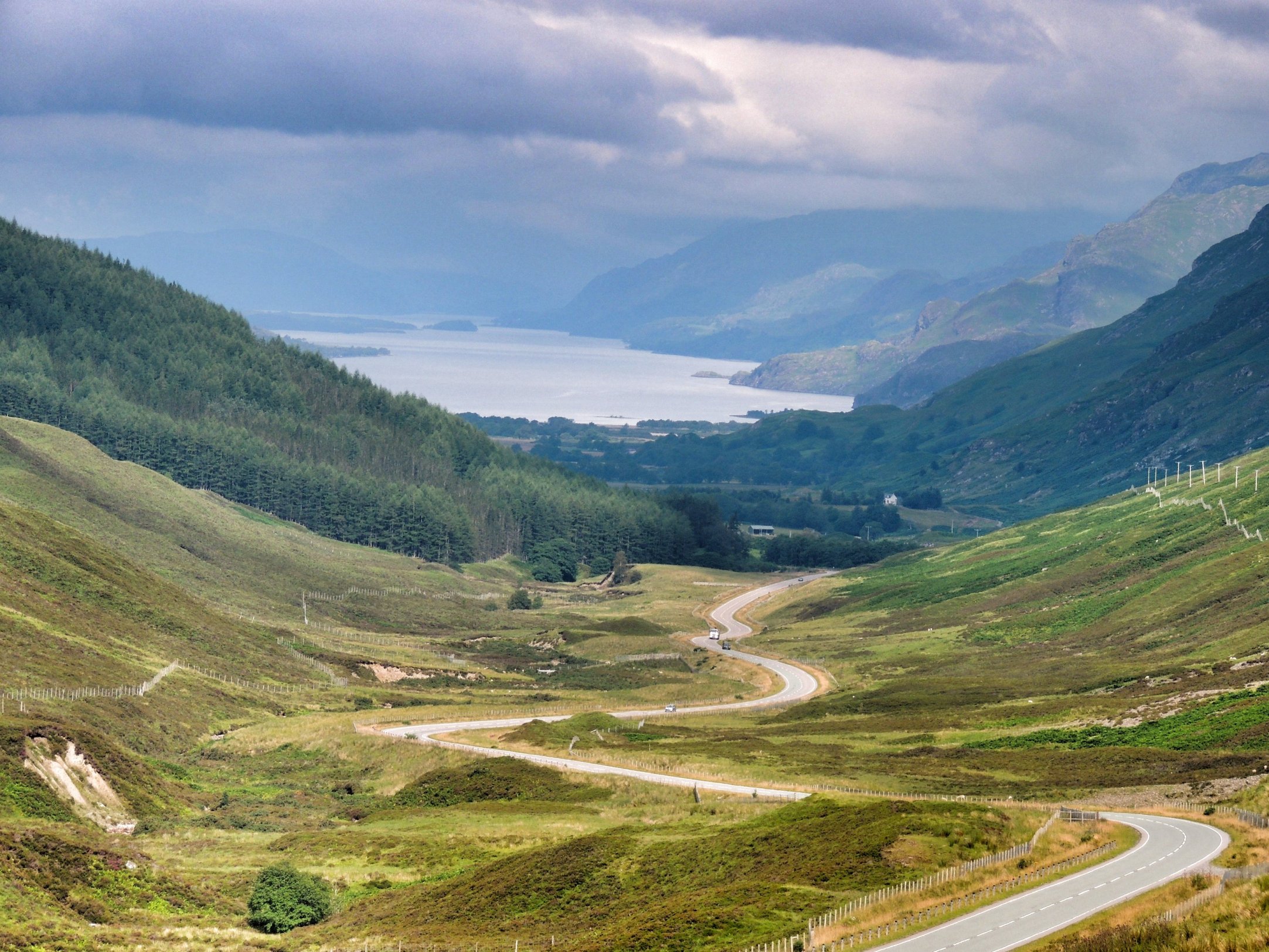
Downhill all the way to Whitebridge
So we set off again and freewheeled downhill pretty much all the way to the Whitebridge Hotel. We got our bikes stowed away in a shed then went to our room for a shower and got changed for dinner. Looking out the window, we saw Damian arrive, who had taken an off-road option for part of the route and managed to go even higher than we did!
The hotel itself looked in need of some modernisation and repair work, but the welcome was warm. The big question was what would the food be like, as we were starving. We all met up in the bar for a drink and ordered from a standard-looking menu. The bar was really quite busy for a Thursday tea time, with lots of people eating. We were very pleasantly surprised by the standard of the food – my steak & ale pie was delicious – a real high point of the day. After that however, our exertions caught up with us and we headed up for bed around 8.30pm!
 Day 2
Day 2
It was hard to sleep, thinking about another exciting day ahead. Colette and I got up a bit early and went down for breakfast, and while we waited for Damian to join us, we went outside to look at a collection of falcons that had been arranged on the lawn by their owners. This group of falconers were staying at the hotel along with their birds and dogs, which they had been taking out onto the moors to hunt for grouse. They were delighted with the weather this year and had got out virtually every day of their holiday, although with mixed success on the hunting front.
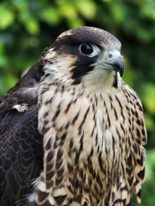
Peregrine falcon
We shared the breakfast room with the falconers and were treated to a perfect cooked breakfast with barely a trace of grease in sight. I probably had a little to much to eat but it would soon be worked off when we got going.
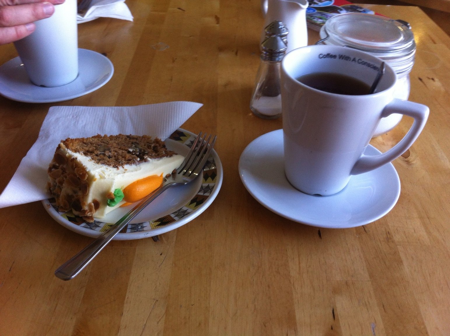
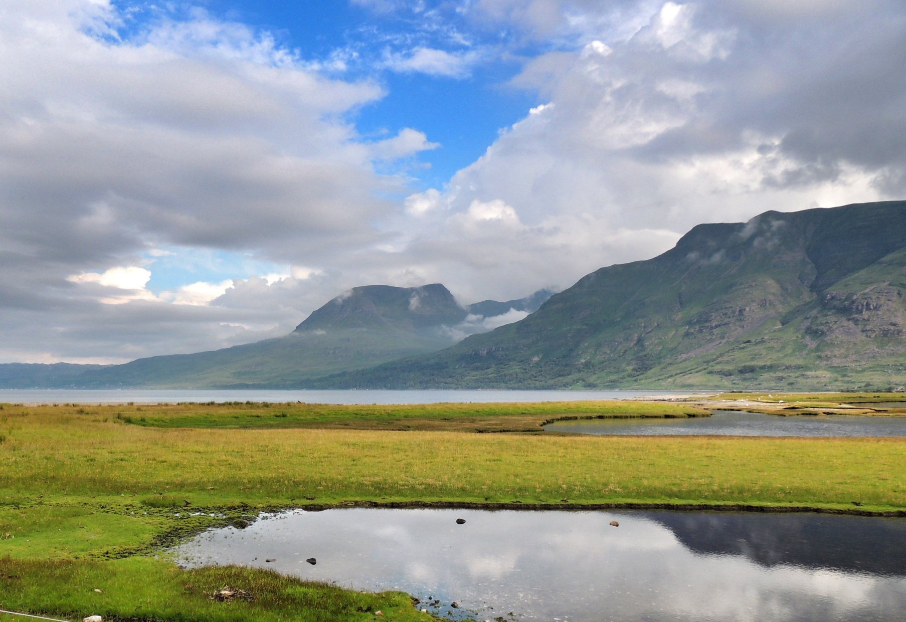
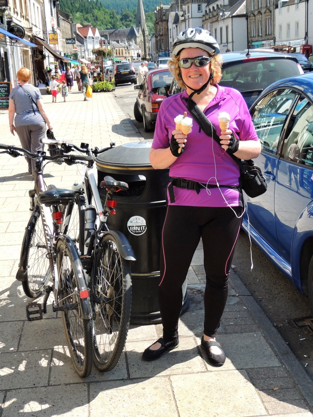
Leaving the hotel behind, we headed in the direction of Foyers and stopped for about 30 minutes while we explored the red squirrel trail (on foot) and checked out the waterfall. Sadly, we didn’t see any red squirrels this time. The road out of Foyers was steep and rapidly took us down to water level as we progressed north along the east shore of Loch Ness on General Wade’s military road. The road here was flat with gentle undulations, meaning we made comparatively rapid progress and reached the top of Loch Ness at Dores in time for a nice cup of tea, courtesy of the Dores Inn. We decided not to have any more scones, and took some lemon slice instead.
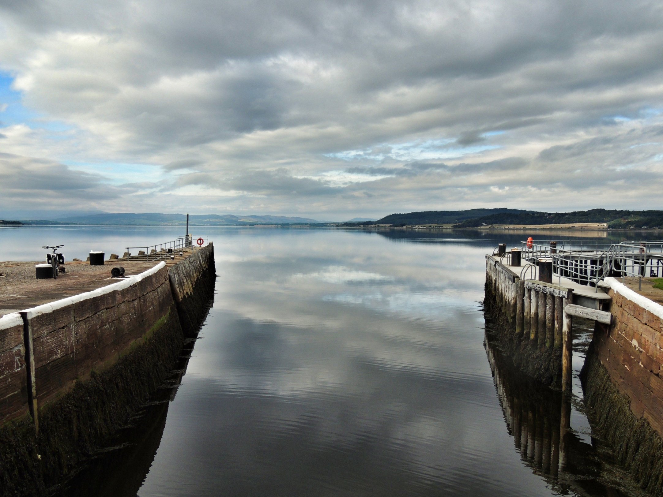
After a bit of a look around at the Nessie Hunter’s shack, which is parked next to the inn, we got back on our bikes and headed onwards towards Inverness. This section of the road rose steadily uphill through more cultivated land than we had seen before. From the top, there followed a long descent into Inverness, the final part of which was along the east bank of the River Ness. We then left the road to go halfway across the river along a footbridge leading to a long, thin island. At the other end of the island, we completed the crossing to the west bank of the river, then followed the road on the left until we came back to the Caledonian Canal. The towpath took us all the way to the end of the canal at Clachnaharry, and we decided to carry on as far as we could, to the final lock where the canal flowed out into the Beauly Firth. On our way there, we noticed the funnels of a large 1:10 scale model of the Titanic, and we decided to go back and investigate the Titanic museum, but not before having lunch at the Clachnaharry Inn.

The end of the Caledonian Canal at Clachnaharry
After a large, rather stodgy lunch and a certain amount of beer, my stomach was saying that it wasn’t time to get back on my bike just yet. So the Titanic museum sounded like a good idea. The museum is one man’s labour of love, fuelled by an obsession with the Titanic in particular, and seafaring in general. The museum has taken over most of his house, into which entry is free, at your own risk (and there is scope for tripping or banging your head if you’re not careful!). You could spend a whole day there and not discover everything there is to see; the place is packed with models, plans, pictures and snippets of information, as well as audio-visual displays. Going down to B-deck there is a fun area with dressing up and a lifeboat and small motor boat to play in. The latter is hooked up to a speedboat simulator game, which Colette and I both had a good go at. As we left that part, we exited to the back yard and straight in front was the massive titanic model. There we met the “curator” Stan Fraser, who blew the foghorn to signal that he had just put the kettle on. He was leaving to pick up his kids from school and told us to just help ourselves to tea and coffee. I made myself a nice cuppa and sat down to drink it in the Parisian cafe, located inside the Titanic model. We had to go back in and increase our donation before we left, we were so impressed!
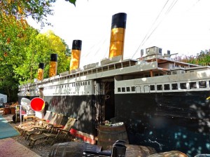
At the wonderful Titanic museum
However, we had to leave and get back on the road for the final leg of our journey along the A862 to Beauly. This was the least pleasant part of the route, with quite a lot of traffic to contend with, although the road itself was quite flat. We finally rolled up outside Colette’s mum’s house feeling tired but very proud of ourselves, and with memories of a wonderful trip that we will remember for ever.
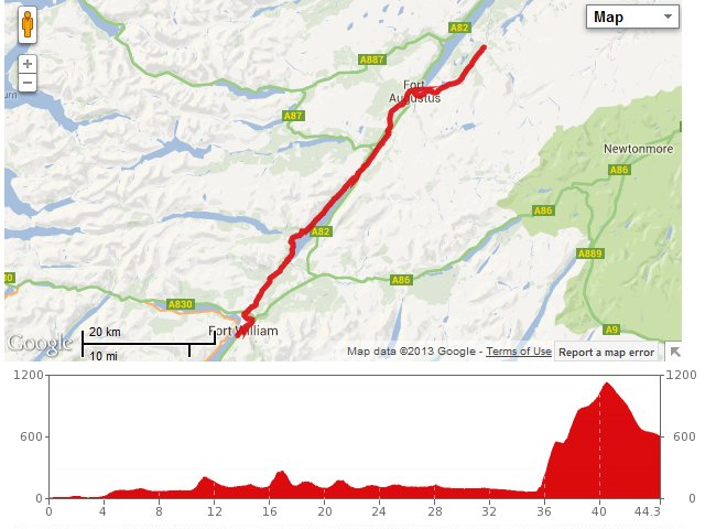
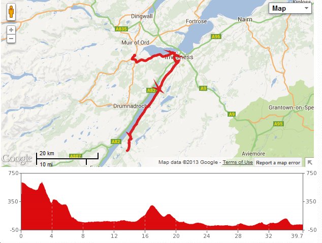
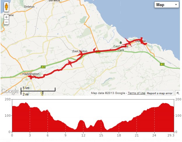
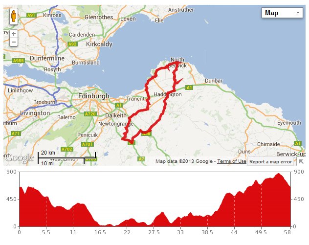
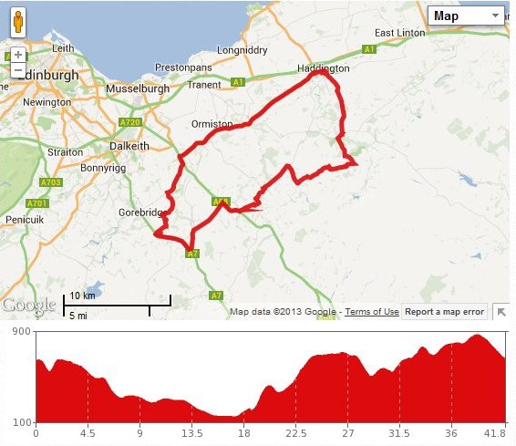
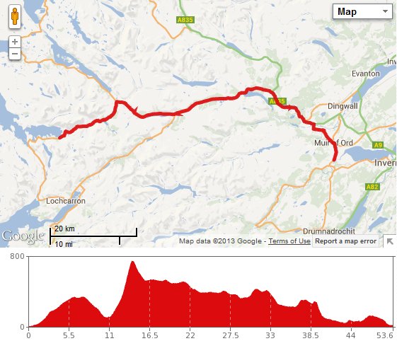
As for the stats, the trip measured up to a total of 84 miles according to Mapmyride, with 44 on the first day and 40 on the second. The off-road cycling was preferable to the on-road stuff, so there is scope for doing it again and sticking to the mountain bike route. Whenever we do it, we would be hard pushed to match the beautiful weather we enjoyed on this trip. Amazing!!!

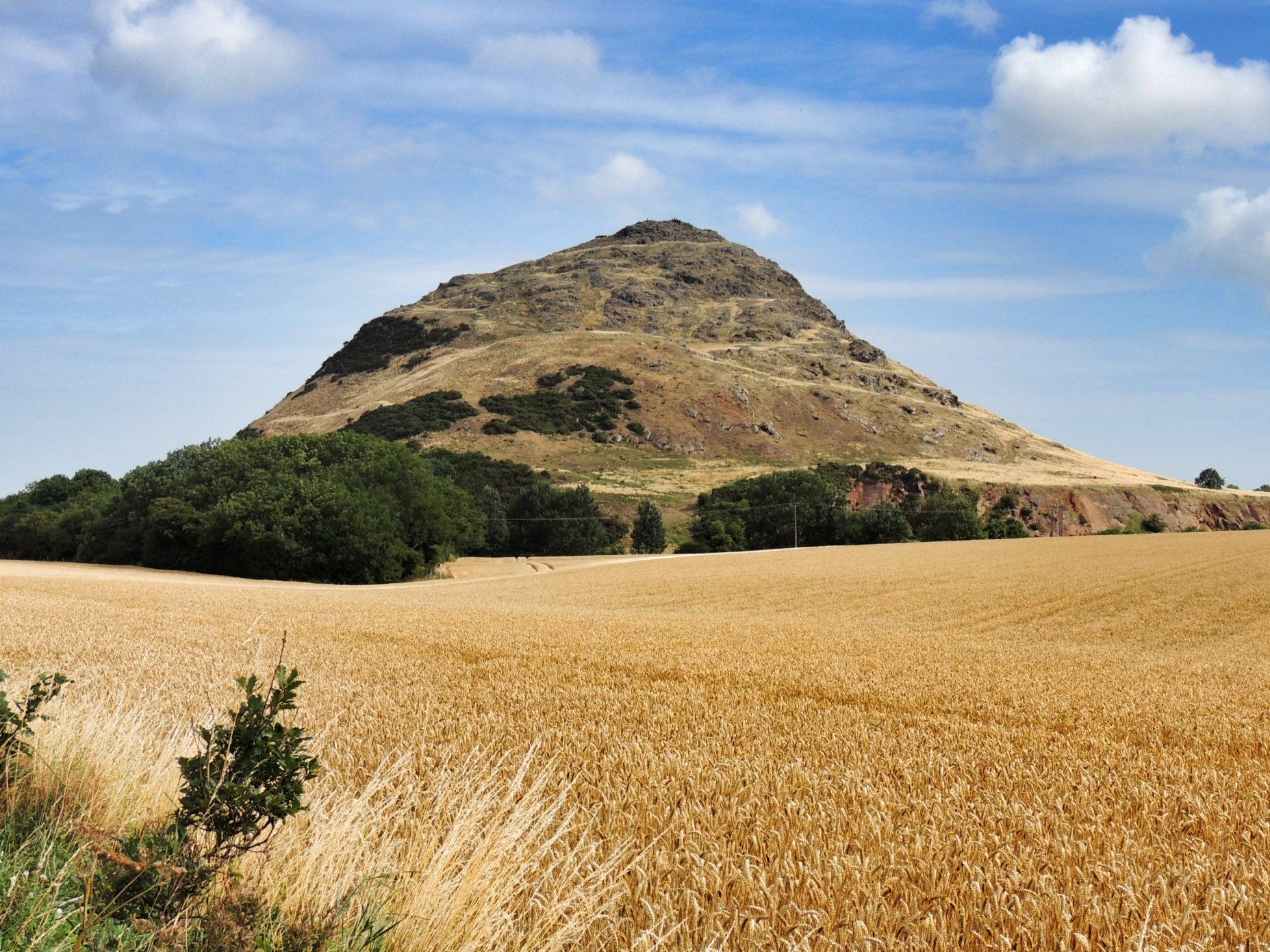
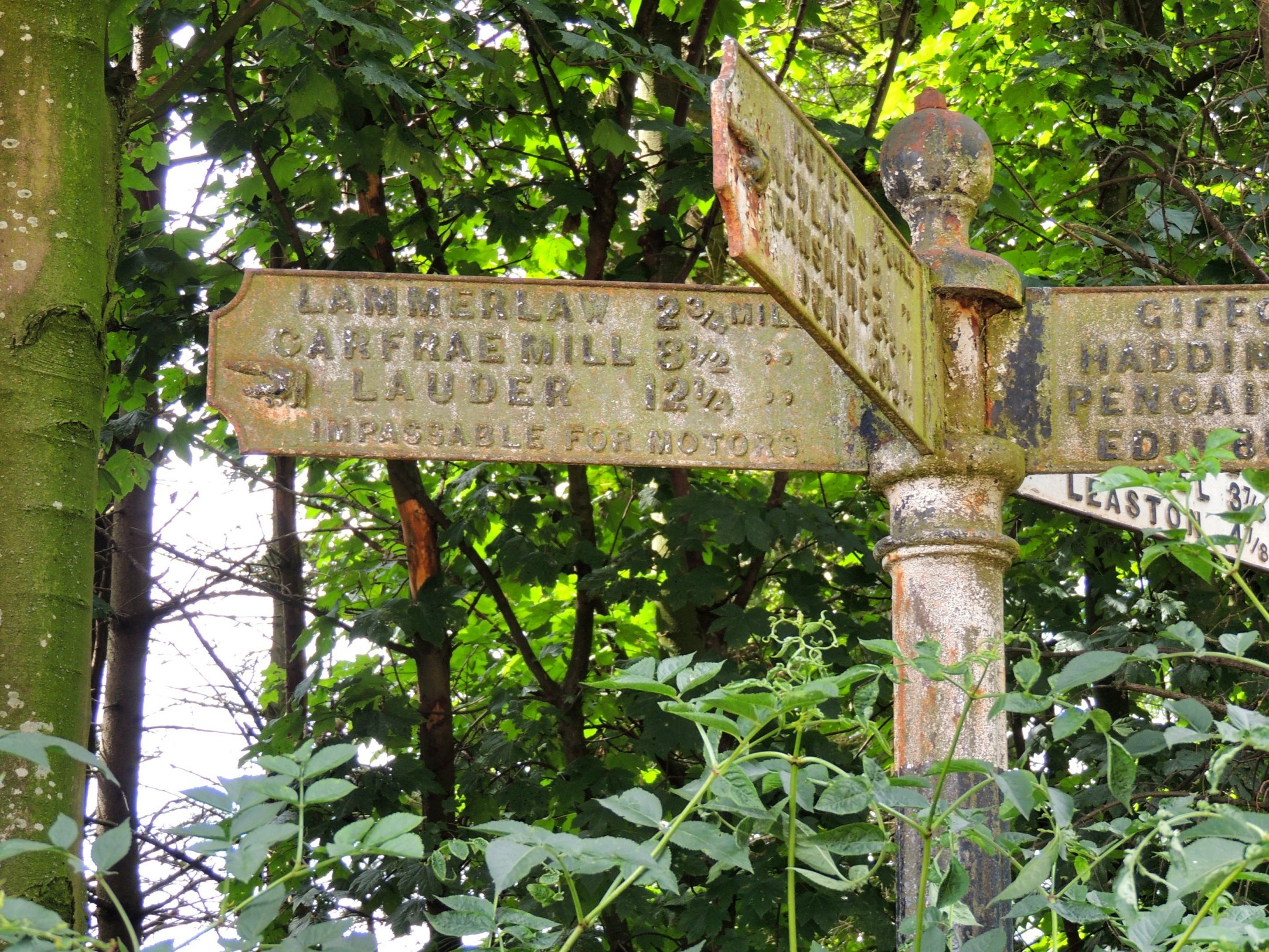
 This time of year, the chances for a good bike ride are few and far between, so we took advantage of a great forecast and headed out straight after breakfast in bright sunshine with only a slight breeze. There was some frost on the ground, but we were well wrapped up. Today’s plan was to cycle past Soutra Aisle for the first time.


