
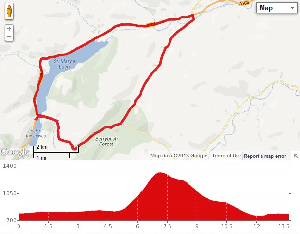
 Earlier this week, we drove down to Moffat and with time to spare, we took the scenic route past St. Mary’s Loch for the first time. We were amazed at how beautiful the scenery was, and decided to come back with the bikes ASAP. As we prefer circular routes, we went for the most obvious one going round the loch. OK, it’s a bit of a short route, but it has a challenging climb in the middle.
We parked up a mile or so north of the loch and got the bikes ready on a cold (6 C) but sunny morning. Soon we were pedalling into a stiff headwind and I had to stop to put on my waterproof, as the layers I set out in weren’t up to the windchill. We overshot our route slightly to check out the Glen Cafe, which was open. Too early for a cuppa but we decided to come back after we were finished.
Then we crossed the bridge that divides St. Mary’s Loch and the Loch of the Lowes. This took us past the historic Tibbie Shiels Inn and joined up with the Southern Upland Way. The walking route at this point goes along the path of a long disused road that runs uphill from St. Mary’s Loch between the peaks of The Wiss (1932′) and Earl’s Hill. The road ran quite steeply at places but I didn’t find the surface too tricky – gravel at either side with grass inbetween. Maybe it was down to my new tyres, as Colette found it more difficult keeping a good grip. With the headwind coming into play, I ended up slowly cycling along at walking pace while Colette walked her bike up, also at walking pace. As long as it gets you up the hill, who cares!
Just pondering whether the locals are going to be friendly…
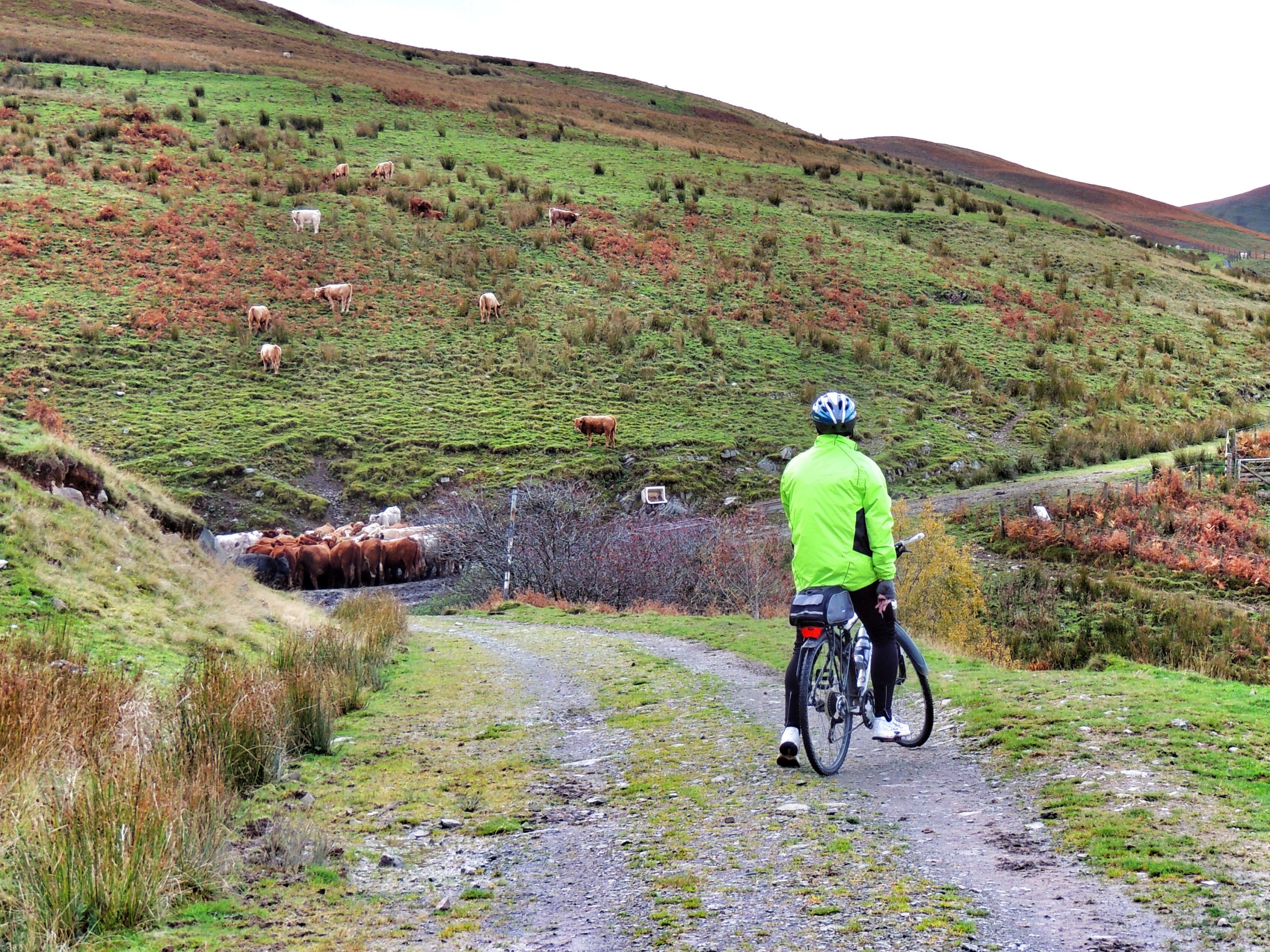
There was just one tricky bit, where a small herd of cows was encroaching on the path as they fed from a feeder alongside the road. We weren’t entirely sure they would be happy with us passing by so close. To add to the uncertainty, the immediate vicinity had been turned into a mud bath, so we proceeded with caution. As it turned out, the cows were completely unfazed by us, and the mud was only a couple of inches deep, so we escaped without incident.
After a comparatively short time, we reached the gates of the Berrybush conifer plantation. Here, we parted company with the Southern Upland Way and continued through the plantation on a forestry track made from hard packed stones and gravel. The ugly utilitarian track and densely planted trees made for quite a harsh change of scenery. After a while, we came across a well-preserved sheepfold situated at the side of the road, seemingly lost in the middle of the woods. We stopped there for some tea from our flask and marvelled at the abundance of mosses that had grown on the stones in the damp, sheltered environment.
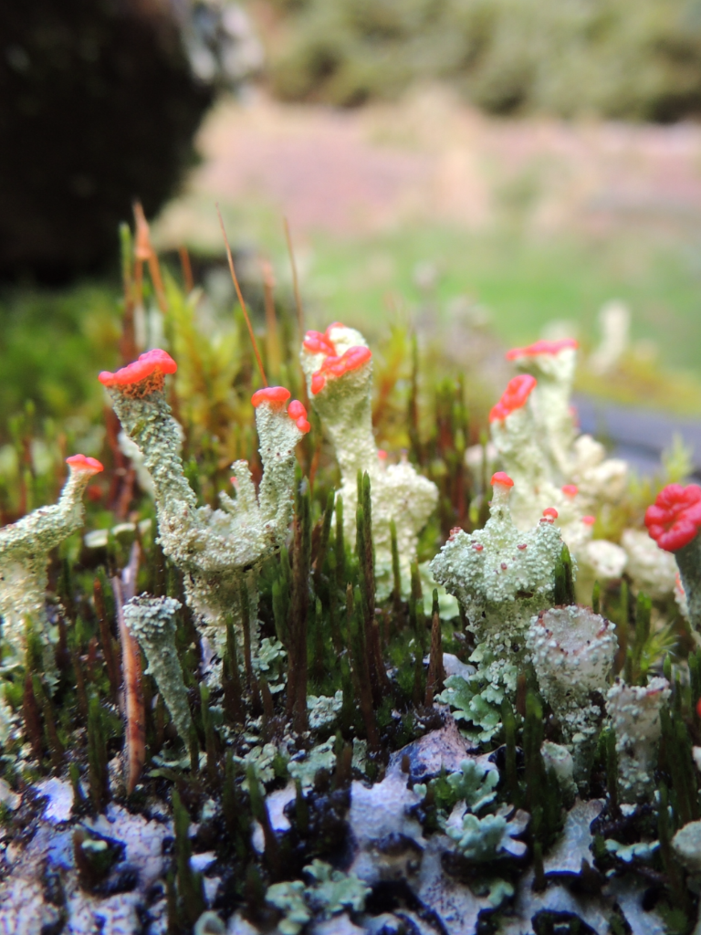
Lichen jungle (or it is moss???)
Carrying on, the road reached its summit and we started a slightly bumpy descent along the stony track. Without any visible landmarks, it was useful that I’d brought a map, so we took the correct turnings to get us out of the wood and rejoin tarmac in the shape of the B709. We then enjoyed nearly 4 miles of glorious freewheeling along the east side of a small valley, full of late autumn colours, lit by soft, low sunlight. It was so good that it would have spoiled the experience to stop and take photos (we came back again later in the car for that!).
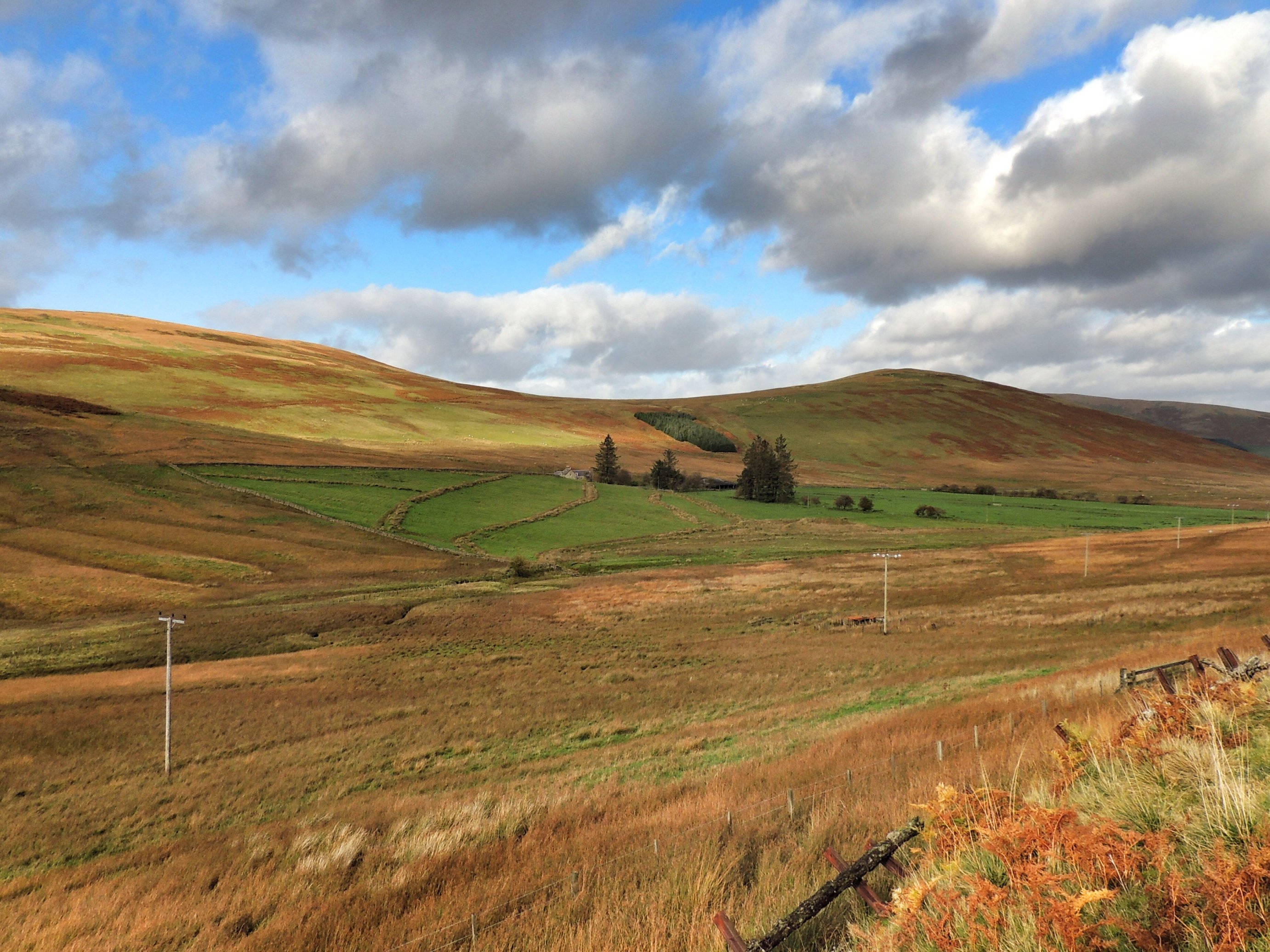
Autumn colours
The descent took us as far as the Gordon Arms Hotel at the crossroads, where we turned left and back into the headwind once more till we returned to the car to complete the short 13.5 mile circuit. Then it was back along to the Glen Cafe for some lunch. I’m sure it won’t be long before we’re back again for more!