
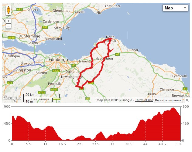
 We have thought for a while that cycling to North Berwick, although quite a challenge, should be within our capabilities. A few weeks ago, I devised a route using the coast road to get there and returning through the middle of East Lothian. Yesterday we tried it out for real.
The morning was cloudy but bright when we started out: a bit colder than of late but with the promise of the sun possibly breaking through at some point. Firstly, we headed for Pencaitland, which is now quite a familiar route for us. On the way there, the only difficult section is the climb out of Borthwick. I took it as gently as possible in low gear, trying to pace myself for the remaining 50+ miles.
On leaving Pencaitland, we branched off to the left taking the road signposted for Longniddry. This took us through Bogs Holdings, which isn’t as bad it sounds, then Penston, where we were very taken by the garden of the last house (called Brigadoon), which contained a romantic ruined cottage.
We then crossed over the busy A1 by a series of roundabouts and then passed underneath the east coast railway as we entered Longniddry. We turned north out of Longniddry heading for the sea, with the impressive gates to Gosford House estate on the right as we passed.
After a quick stop at Longniddry Bents to take some photos, we carried on along the coast road (A198). We paused for more photos outside another picturesque gate to Gosford estate, which explicitly states “NO CYCLES”. Ah well, this seems a common theme in East Lothian.
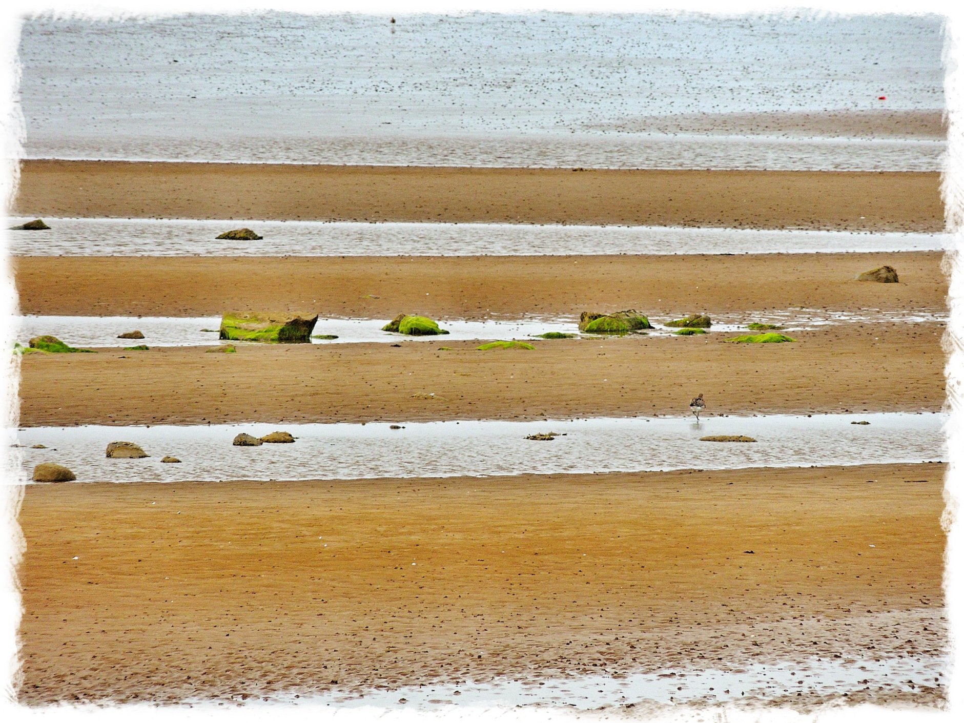
Aberlady Bay
So we carried on as far as Aberlady, where we stopped for a lovely cup of tea from the flask that I had packed. The tide was out, giving a good view of the stream bed meandering through the sands towards the sea, and the gulls and wading birds feeding from it.
After our break, we hopped back on the bikes and continued along “Scotland’s Golf Coast” to Gullane, where we had the luxury of a cycle lane most of the way. When Direlton came up next, we had the idea of taking a detour away from the main road and through the village for a photo opportunity of the castle. However, it turns out that you can’t get a good view from this side and we didn’t feel like doubling back, so no photo this time!
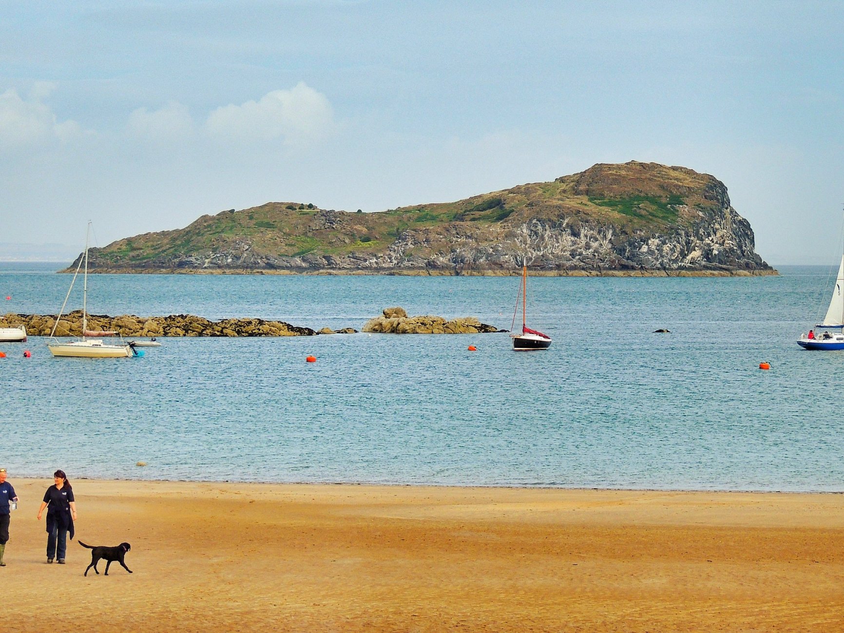
Craigleith island from North Berwick
Pretty soon, we were entering North Berwick (about 27 miles from home in just over 2 hours). We paused in the hazy sunshine for a look across the sands to the harbour and Craigleith island, before picking up something for lunch from Greggs. We should have eaten it there and then by the seaside, but it was only just after 11am, and I thought we should continue for another half hour or so, looking out for a nice place to stop by the side of the road.
Getting out of North Berwick via Law Road involved consulting the map and negotiating a few back streets, in order to avoid going round the one-way system again. When we reached Law Road, it was a bit of a shock to the system to find ourselves going uphill again. The road (B1347) took us up, past Berwick Law and carried on in the direction of Haddington, through the centre of East Lothian.
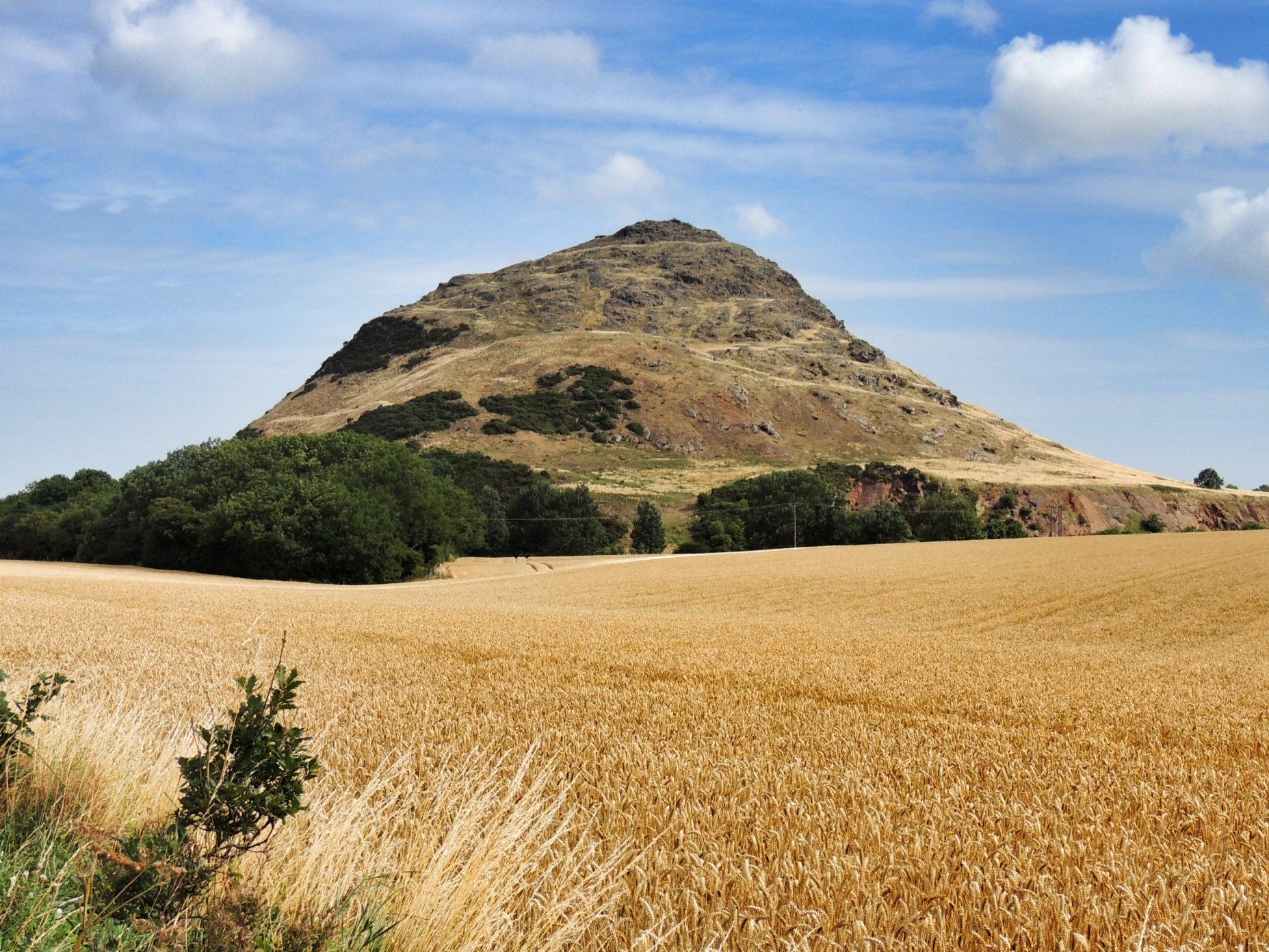
Berwick Law
All the time, I was looking out for a good place to stop for lunch, ideally with a picnic bench, but nowhere looked really suitable. Eventually, we came across signs for the Museum of Flight at East Fortune. I thought we should head there, as it was a good bet that there would be a car park and picnic benches at the entrance. As it happens, the entrance is about half a mile down a lane, so we decided to take a chance and headed down the lane. This took us the the museum, which was not exactly what we expected. It is actually a collection of sheds, hangars and Nissen huts of what looks like WW2 vintage, and clearly there was a significant airfield here during the war. Most of these huts were housing specific exhibits, so visitors spend their time flitting from one to another.
All of this meant that we were right in the middle of the museum already, with no intention of paying, but simply wanting somewhere to sit down and eat. We found a bench outside one hut (the bus stop), but at the same time noticed an official-looking pair of eyes gazing in our direction from the aircraft restoration hangar. As the last thing we wanted to do was pay £9.50 each for admission, we sat down on the grass on the other side of the hut and hastily scoffed our Greggs steak bakes. In retrospect, we were back on our bikes way too soon and we would pay for that later on.
After leaving East Fortune, the road took us down to meet the old A1 (now A199), which runs alongside the “new” dual carriageway for a mile or so from where we joined it to Haddington. Once we entered Haddington, I wasn’t very sure of exactly where we were, but didn’t want to take out the map in the middle of some busy traffic, so we followed the signs for Humbie. This worked perfectly in guiding us through the town and out again on the right road. Leaving Haddington was quite tricky, crossing a single lane bridge with traffic queued up behind us, going sharply uphill then turning right with that constant stream of traffic now trying to overtake us. It was good to get away from the town and onto the quieter country roads again. Colette spotted a signpost for Humbie, proving that we had managed to get through on the right road. It said Humbie was 7 and 7/8 miles away. Good, we thought, that won’t take us long.
As it turned out, the B6368 that we were following was just one hill after another. None were particularly difficult, but after 30-odd miles and not enough rest, it was beginning to get tiring. Although the scenery was nice, as we headed towards the Lammermuirs, keeping going was all we could think about. It was very demoralising when after what seemed like an age, we came across another sign for Humbie that said it was still 6 miles away!
The final approach to Humbie village is a short downhill, round the monument, then steeply uphill again. I crawled up there and ground to a halt outside the Post Office. We had seen a sign advertising teas and hot & cold food the last time we passed, so we went in for a cup of tea. Colette paid and shortly afterwards, our teas were brought out to us at one of the tables outside. We took the chance to have a proper rest this time.
Cycling out of Humbie, I felt refreshed in a way, but unfortunately my left knee was feeling quite painful, so the last leg of the journey wasn’t going to be so enjoyable, especially as there were a few hills left. After Fala, we turned right onto the A68, then left onto the B6458, which had been closed for months but was recently re-opened. It seems as if this road was designed as a short cut for trucks, as lorry after heavily laden lorry thundered past in both directions. I definitely preferred this road when it was closed!
Finally, we reached the A7 and turned right for home. By this time Colette was well ahead of me, as I was now only capable of minimal effort in the pedalling department. At last we rolled up outside the house, where ibuprofen and showers were taken in short order. Not sure why we found it quite so hard, but now, the day after, with my knee feeling a bit better, it’s time to start planning the next one!