
Colette and I were spending a week’s family holiday in Aberdovey, at the very south of Snowdonia national park. We had brought our bikes and planned one full day’s cycle as well as the odd short excursion fitted around childminding responsibilities. For the big ride, I’d planned to start at the south side of the Barmouth bridge, an interesting dual rail and foot/cycle bridge that takes you over to the town of Barmouth on the other side.
From there, we would cycle north to Harlech, for a quick look at the famous castle, before looping round and uphill to Trawsfynydd, where we would return via a meticulously planned path through myriad quiet mountain roads.
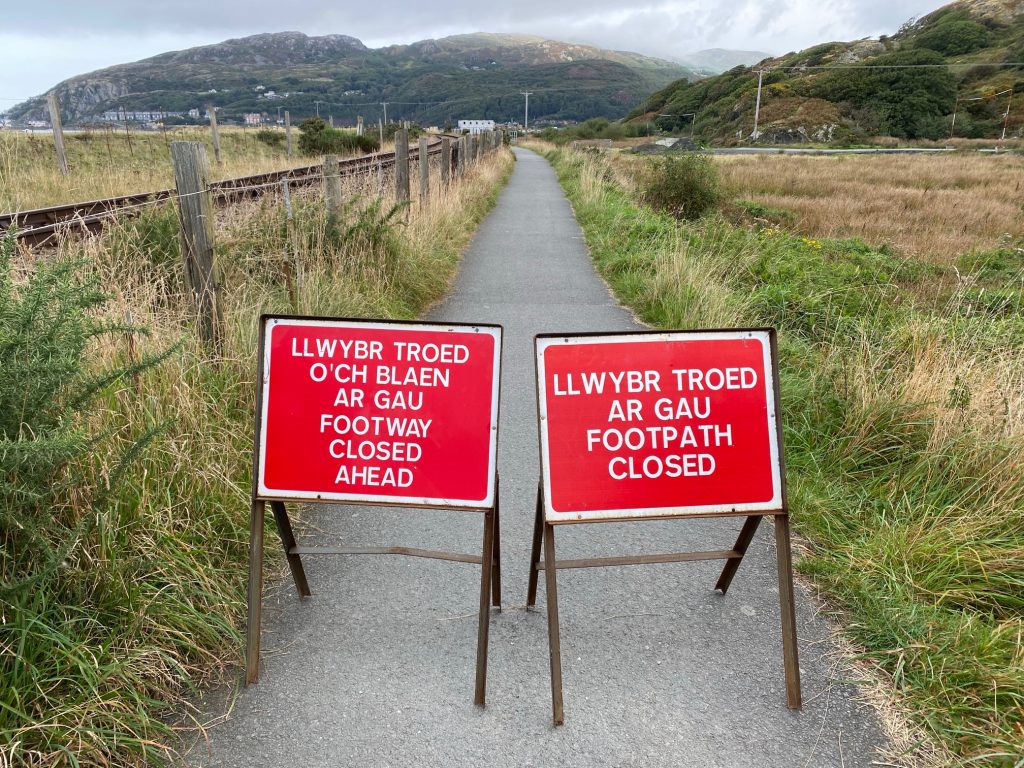
We parked up at Morfa Mawddach railway station car park and headed for the bridge, only to be confronted by a “path closed” sign. I was quite taken aback by this, but it was clear from the work going on ahead, that we would not be able to squeeze past. My initial instinct was to head back to base and start planning a completely new route on the laptop. However, on second thoughts, we could start by reversing the route as far Dolgellau, where we could devise an alternative outing over a coffee.
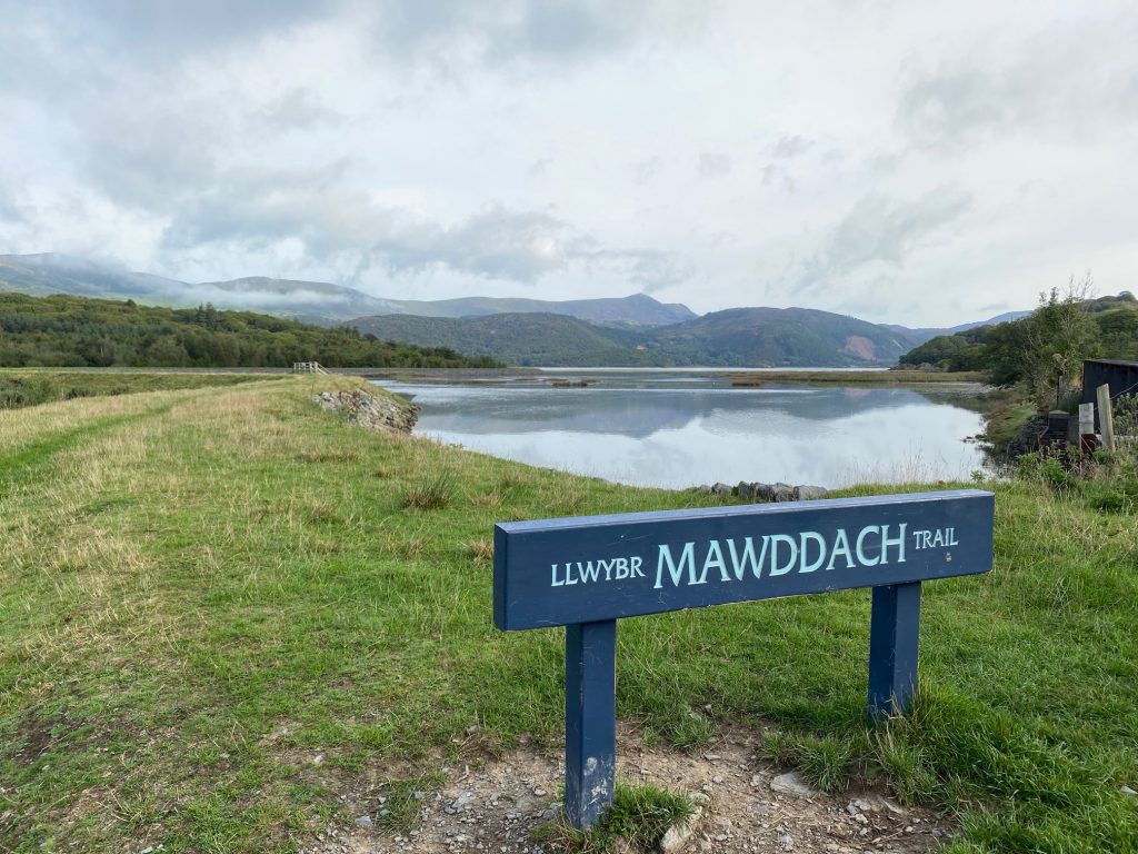
So off we went along the Mawddach trail. This is a hard-packed gravel biking trail that runs along the Barmouth estuary for a good 7 or 8 miles. The tide was high, and as soon as we reached the edge, we just had to stop for photos. In the quiet of the morning, egrets and herons were scattered around, fishing in the glassy water. In the channels running between the banks of seagrass, we could see bow waves made by large fish (possibly grey mullet), patrolling just below the surface. And in the background, the mountains of Snowdonia overlooked the scene.
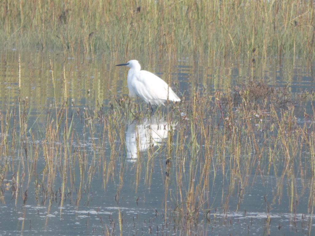
Little egret
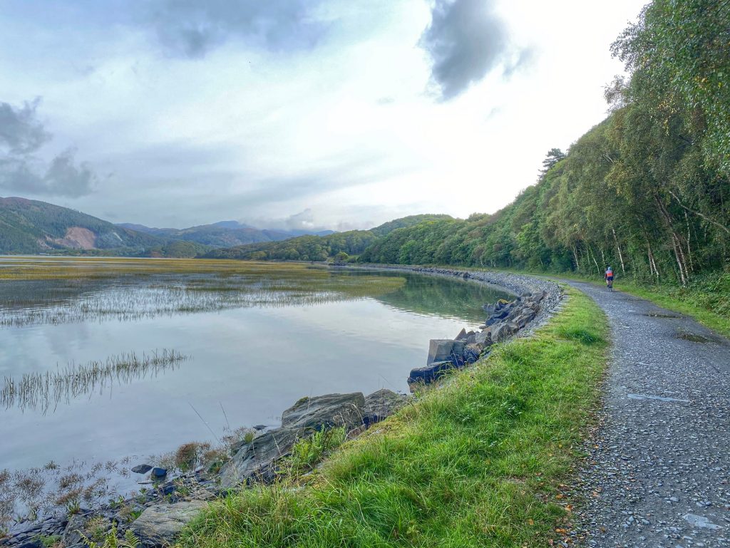
It was a magical landscape, which we might have missed if the bridge had been open and we had then only reached this point at the end of the day, with the tide out. So we had an easy, flat ride to start with along the estuary, till we reached the quaint wooden toll bridge at Penmaenpool. We could possibly have crossed there and continued to Barmouth to restart the original route, but the detour would have added too many miles to an already long day, so we carried on towards Dolgellau.
The gravel trails took us all the way to the a car park in the centre of Dolgellau, where we found the Crasdy’r Gader cafe. Once installed at a table with coffees to hand, we began planning our alternative ride.
We still wanted to visit the high ground to the north of Dolgellau, but it would just have to be 10 to 15 miles out, then return. I had the thought initially to buy a sandwich for a picnic lunch in the mountains, but on closer inspection, the map showed up a cafe where we might get a proper lunch. This was at the Coed y Brenin mountain biking visitor centre. The cafe was reputedly open all year round, so we would aim for that. We would head north on the roads I’d intended would take us back on the original route, then loop round onto national cycle path 82, which passes through the mountain biking park.
There was a touch of jeopardy in that route 82 is not recommended for road bikes for some of its length. We would just have to keep our fingers crossed that it wasn’t the bits that we wanted to do…
Our route from Dolgellau was route 82 to start with: a single track road through wooded countryside. After several miles of undulations, a short steep climb took us to the place where we would diverge from 82, and launch into what on the map looked like a maze of small roads and tracks.
Pretty much straight away, we were into 15%+ territory, and I puffed all the way up to the next junction, a kind of letter H shaped crossroads. Immediately on turning left, I was confronted by a “Road Closed” sign. Oh no, here we go again!
I headed back to intercept Colette so she wouldn’t need to climb all the way to bad news, but she suggested that we just forge ahead and chance it. So that is what we did.
The tiny road was a delight to cycle along, running along the west side of a small, wooded river valley. It couldn’t last though; we finally came across workmen repairing the road. In fact, it looked like a small bridge where the repairs spanned the whole of the road. There would have been no possible way to get past, so we U-turned and headed back.
A short way further along, I noticed a fairly well-used track leading down through the trees towards the river. I knew there was a parallel road on the other side of the valley, so I took the chance that we could get down and back up again onto the other road.
We carefully walked our bikes down the track, which would have been ride-able, even for me, on a mountain bike. At the bottom, amidst the moss-covered rocks and trees, we found a footbridge. Interestingly, alongside was a sign saying that gold panning was forbidden. There must be gold in them thar hills then.
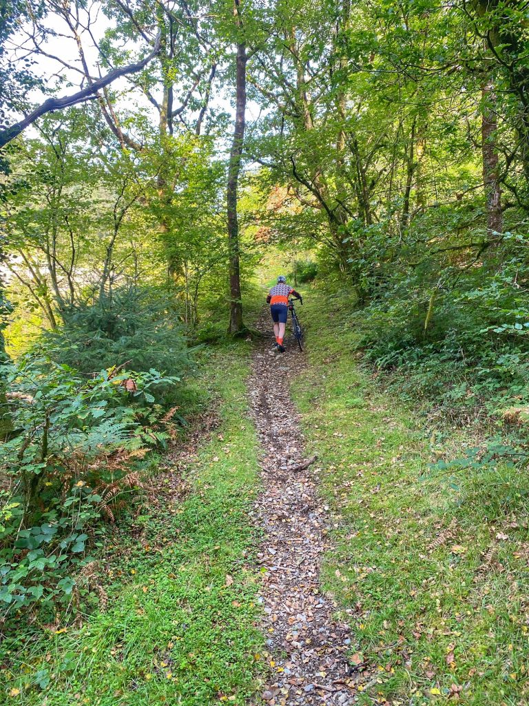
A steep scramble took us up to the joining road, where another sign, pointing down the track from which we had just emerged, was showing “trail closed”. Oh well, that was one closure out of three that we managed to dodge.
Getting to the parallel road didn’t mean that our problems were over. This one was a fairly rough gravel surface, through which I had to pick my way carefully on my road bike. It was also fairly steep in places, but it did the trick of finally linking us to the road that we were aiming for, to take us higher into the mountains.
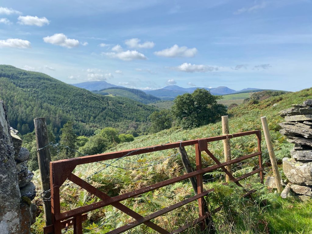
Once back on track, we had a few more challenging steep sections through the woods before emerging into more open countryside, giving better views of the fields and mountain peaks beyond. After topping out, we had the rare treat of some swift downhill, followed inevitably by more steep uphill.
Although it was hard going in places, we were in the kind of countryside we love to cycle: remote, quiet and scenic. Add in a sunny day with hardly a breath of wind, then it was hard to beat. We had a clear view to the north, where all the peaks bar one were visible. The one clouded peak was most likely Snowdon itself.
We stopped heading north when we intersected with route 82. That took us downhill to a bend in the road, where under a bridge, a river had cut a deep channel, before opening out into a wide pool. This was very similar to the place we’d found earlier in the month near Dalry, except this time we didn’t have time for me to take a dip. We needed to press on to our lunch stop.
This meant another few steep climbs, before route 82 took a turn for the worse. That being a right turn away from good quality tarmac onto rough gravel. Although the track was heading downhill, this wasn’t a good thing, as my road bike was bumping and rattling and I was afraid it might break, or at least have a puncture if I went any faster than about 7 mph. I was happier when we got to uphill sections, which could be negotiated in more comfort.
Colette on the other hand, was surprised to hear my complaints, as she wasn’t having the same problems. Oh yes, that would be because she was riding a gravel bike! A gravel bike would be very advisable for anyone living in this area.
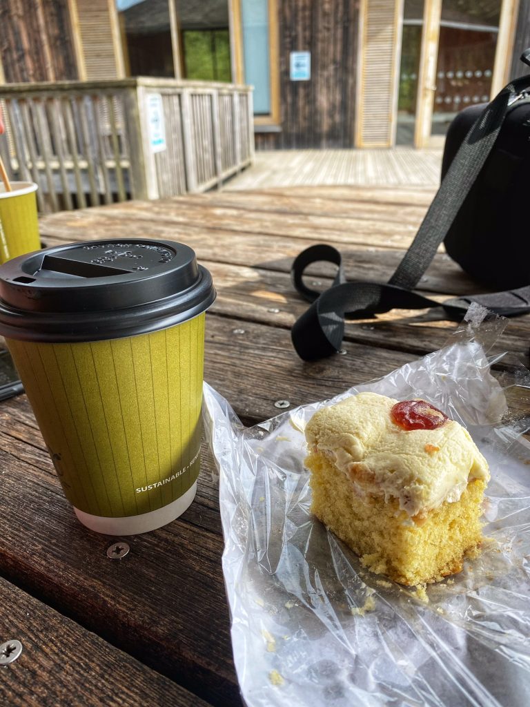
Lunch!!!
Eventually, we found ourselves outside the Coed y Brenin visitor centre and cafe. We locked up the bikes and went into the cafe at around 2pm. I was shocked to see that the hot food counter was empty. I stood speechless with my head in my hands, as the lady serving told us that they had staff shortages and she was just about to close up. So we hastily ordered a coffee and one of the remaining bagged sponge cakes for our lunch. Not exactly the sort of lunch we had in mind, but it filled a gap. Colette wasn’t so happy and declared that she doesn’t want to eat another cake ever again. I wonder how long that will last!
Although route 82 continued through the mountain biking centre, I didn’t expect it to turn back to tarmac any time soon, so we took the decision to decamp to the nearby A470, which took us in the same direction, only a lot faster. The traffic wasn’t too bad, and it wasn’t long before we has passed through the village of Ganllwyd (I think it is pronounced something like “ganshwee”).
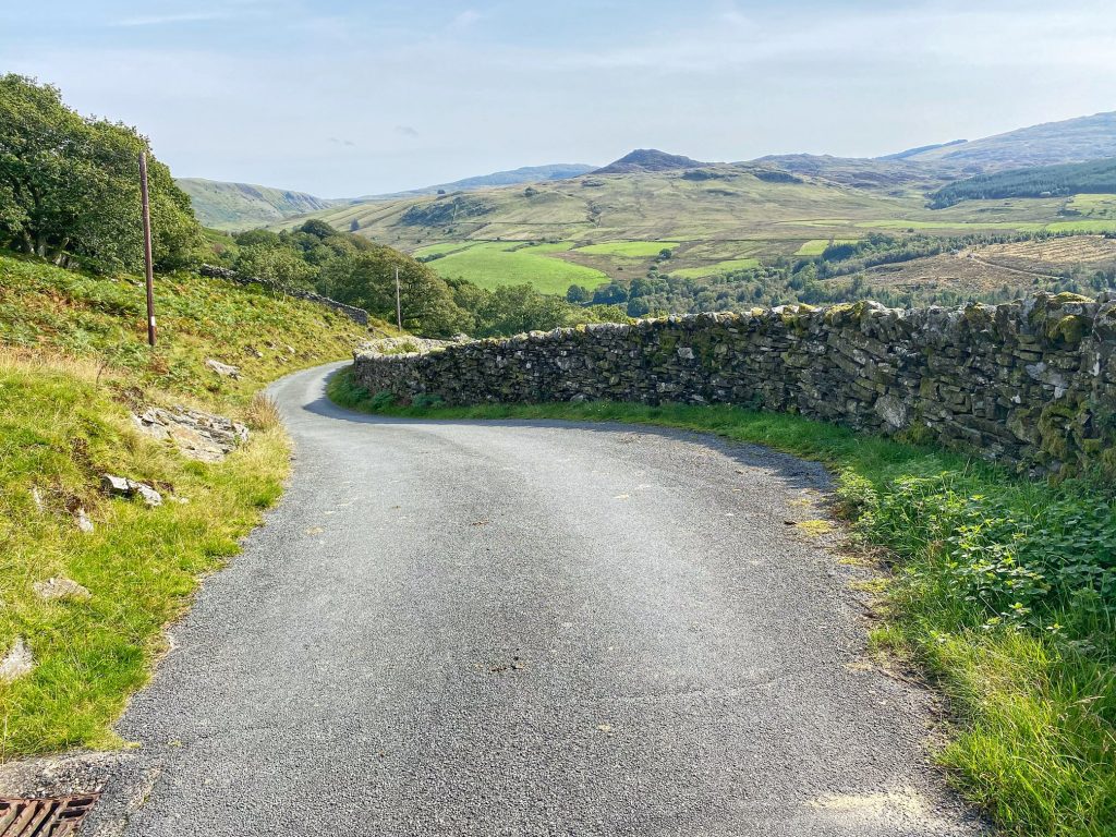
Shortly after that, I took a risk and turned left off the main road, to cross the river and rejoin route 82. As I’d hoped, we were back onto tarmac, and the road here zig-zagged joyfully through the forest.
Quite soon, we reached the part of route 82 by which we’d arrived earlier, then continued onwards past Dolgellau and back onto the flat gravel path along the estuary. The path was much busier now, and as expected, the tide was now out. There were no more interesting birds to be seen, but that was fine. They were already committed to Colette’s memory card from our earlier passage along this track.
When we arrived back at the car, we were very satisfied with our day out, despite it being a cobbled together afterthought compared to the original plan. We weren’t at all disappointed that it was one of our slowest rides ever, due in part to going carefully on the almost 50% gravel path component, and also to the numerous very steep sections. The day provided us with quiet roads, beautiful scenery and glorious weather, as well as a few moments of jeopardy to make it that bit more memorable. It might also not come as a surprise that with a big birthday coming up, I’ve been Googling gravel bikes!