
Scotland’s second Covid-19 lockdown that began just after last Christmas has now been lifted, but the order is still to stay within your local authority area. So “stay local” was the theme of this tour, which has been planned to stay close to the outskirts of Midlothian. Yes, I know that we have always been allowed to go beyond in order to take exercise, but I needed a theme to plan out the route.
At 62 miles, this turned out to be a bit longer than I’d expected, which in metric terms comes out at 100km. I changed my Wahoo to show kilometers rather than miles for a bit of a change.
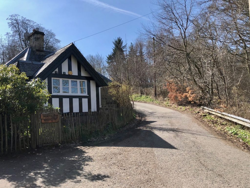
I set off in beautiful sunshine with hardly a breath of wind, but it was only about 5 degrees, so I had four layers on. My route took me from North Middleton over to the lime quarry, currently being filled in by an endless procession of NWH lorries. I headed south from there and met Colette coming the other way as she was already out on her own ride as she didn’t fancy 100km!
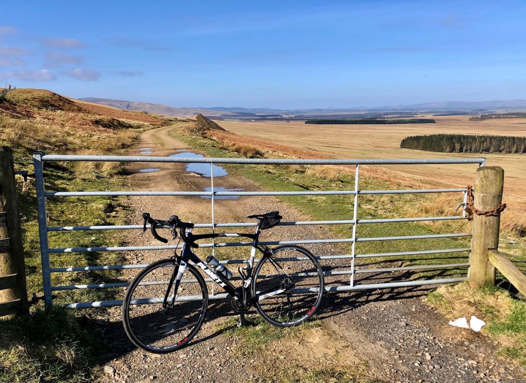
A few minutes later, I turned right onto the B7007 and began the Granites climb. This is one of the few long, gradual climbs in Midlothian, and today I was certainly taking it gradually – in no hurry, as I was planning on stopping for photos anyway, and was enjoying listening to the twittering of the larks and the curlew’s call.
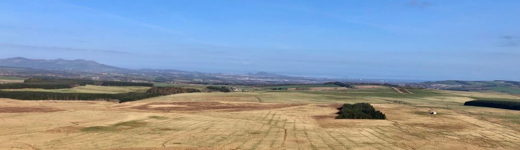
Close to the top, I stopped at the layby on the right to survey the view to the north. The whole of Midlothian was laid out before me, going all the way to the Pentlands in the distance. This was to be my playground for the day, or field of conflict perhaps (depending on the traffic).
5… 4… 3… 2… 1…
The layby where I stopped is also the entrance to a disused quarry, which is due to be developed (planning permitting) into a rocket test firing facility. We can expect a quite different soundscape to accompany our rides up the Granites in the future.
As the climb topped out a little further along, I passed the welcome to the Scottish Borders sign. I then descended and looped back on very familiar roads towards Midlothian via Heriot and a left turn onto the A7. Shortly after passing Falahill, I reentered Midlothian and turned right onto the Tynehead road.
A few miles of easy cycling took me to the junction with the A68, which I joined briefly before turning off in the direction of Fala Dam. It’s a steep down and up there, through this curious little hamlet. Where exactly is the dam, I often wonder? Well, I finally Googled it, and according to Wikipedia, the dam is a long-lost medieval structure, so I can rest easy on that point now.
The road climbing up from Fala Dam is bordered by high beech hedges, leading to Fala village itself. After Fala, I headed for Humbie, passing the Midlothian boundary in the process, and entering East Lothian.
Entering East Lothian
At Humbie, cyclists were gathered to order their takeaway coffees from the hub. It was certainly a nice day to hang around outside drinking coffee in the sun, but I so much look forward to a time when we’re allowed to go inside and sit down for tea/coffee and a cake at a table like civilised people!
From Humbie, I turned northwest, following the B6371 down to Keith Water and back up again, and all the way down past Peaston to the junction with the A6093 Haddington road. I turned left here, back into Midlothian once more, then turned right onto the minor road heading to Cousland.
The unseasonably good weather combined with the holiday weekend had ensured that pretty much everyone who owned a bike was out riding and having fun. I was waving and saying hello all the way up to Cousland, down the other side and beyond, entering East Lothian once more.
As I approached the traffic lights at Crossgatehall, they turned green with about 30-40 meters to go, so I broke into a sprint. Luckily I managed to just sneak through on amber and got my breath back on the following downhill that goes past Carberry tower.
Left at the roundabout took me through Whitecraig, where I picked up cycle route 1 for a short while. This took me onto cycle path, over the River Esk and into Monktonhall. That was as far north as my route took me, at which point, I turned southwest, in the direction of Old Craighall.
I wasn’t looking forward to this stretch of road much, as it felt very bumpy and uncomfortable the last time I did it. However, it wasn’t nearly as bad this time, on my carbon road bike. Fairly soon, I was back into Midlothian and entering Millerhill.
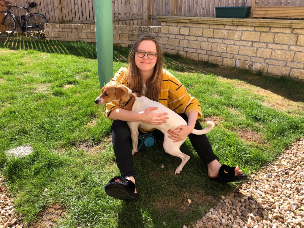
Enjoying the break with Lucy and Marnie
I was now just over halfway into the route, and due for a refreshment stop. Cue a visit to my strategically located daughter Lucy, whose house came into view! Thanks to Lucy and Dave for providing the refreshments and comfortable seating in their suntrap of a back garden. If I shut my eyes, I could have been relaxing at a cafe in Mallorca, it was so hot.
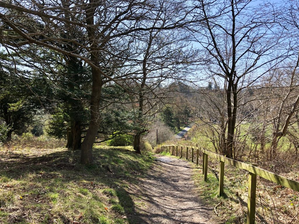
I had to force myself to get going again, as I was in danger of losing the will to carry on and just lounge in the sun instead. Next, I headed to Shawfair, where I joined the cycle path that takes you all the way to Roslin.
Start of the Shawfair to Roslin path
The path was quite busy, so I was glad that I’d remembered to fit a bell to the bike just before leaving. The path goes quite close to Gilmerton, by which time I had no doubt strayed into the City of Edinburgh local authority area. Not long after, I passed through the underpass beneath the city bypass, where a couple of graffiti artists were just starting on their next creation. I’d have stopped to take a photo, but they were just spraying out the background, so I carried on, entering Midlothian once again.
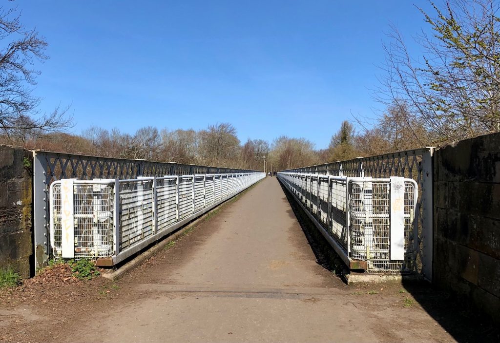
Bilston viaduct
I passed through Loanhead, over the viaduct and past the former site of the Roslin Institute, which is now a housing estate at the early stages of construction.
A little further on, I reached the centre of Roslin, with its famous chapel to my left, where some believe the Holy Grail to be buried in a deep, inaccessible vault. My own personal quest took me in the opposite direction, towards Bilston.
Once in Bilston, I realised that it must have been a long time since I went along Seafield Road, since the field that was once on my right was now a massive housing estate. I went straight on after the traffic lights at the end of the road, heading towards Easter Bush, which was my place of employment many years ago.
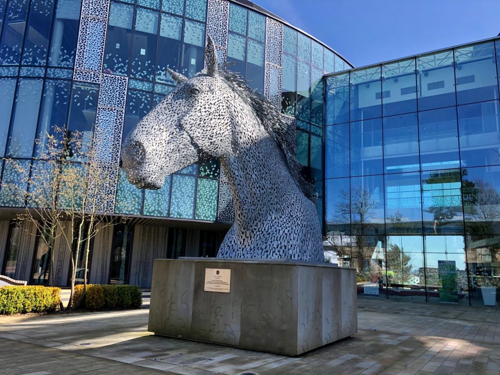
The relocated Roslin Institute was there, along with the whole of Edinburgh University’s Veterinary School. The old Veterinary Field Station was gone, replaced by an impressive modern facade and Midlothian’s own Kelpie standing in pride of place before that.
From there, I carried on through into Bush estate, where I was hoping to find a path that I’d noticed on the map, hoping that 1) it was cycleable, and 2) that it actually existed!
So far, so good…
Well, I found it and first impressions were good, but I had to dismount as the path went steeply downhill with a deep, muddy rut in the middle. It flattened off next to a cottage, but the path was then diverted along a very narrow strip that was thick with black mud. I struggled to push the bike along this section, but luckily it wasn’t particularly long. That was good, as a big group of walkers was assembled at the other end, waiting for me to emerge.
I had come out near Glencorse, where a quaint-looking cottage was nestled in the elbow of a road that descended steeply towards me. After a short, sharp climb, I then sped downwards towards Glencorse House. I got off the bike there to try and catch a glimpse of Glencorse Old Kirk, where my son was married in 2015.
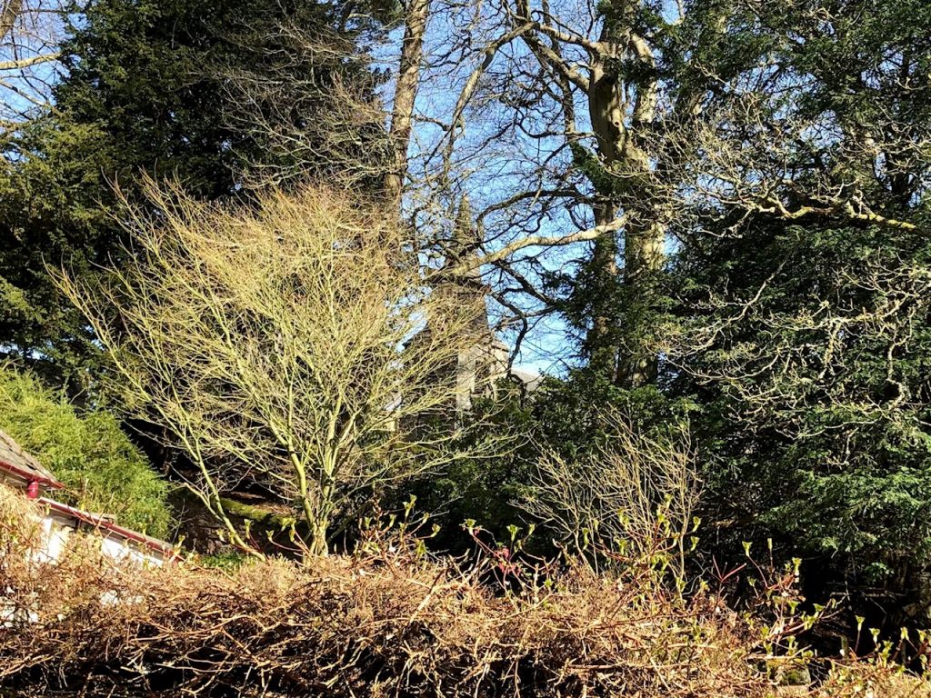
Spot the steeple
Continuing the descent, I came out at the A701 and turned right, passing Glencorse Barracks on my way into Penicuik. The journey into Penicuik was punctuated by a seemingly endless wait at road works, after which I cycled straight through and down some bone-jarring worn out road before turning left onto Pomathorn Road.
The Pomathorn ascent is familiar to me, and not nearly as hard as some people would make out, but at the top of the climb, I turned right onto the B7026 and continued down into Howgate for the first time.
Up to now, I have resisted cycling this section of road, joining Howgate and Leadburn, as the traffic is usually quite heavy. As I expected, the cars were queued up behind me as I cycled slowly up the two climbs out of Howgate. Once over the top of the hill, on the descent to Leadburn, it wasn’t quite so bad.
It came as a surprise to me when planning my route that Leadburn was actually within Midlothian, but pretty much as soon as I turned left from the Leadburn junction onto the Peebles road, I entered the Borders.
After a wee while, at 80km into the ride, I stopped in the layby on the left and took a gel to give me energy for the final push. The landscape here is flat moorland with views for miles in all directions. The road was quite wide, straight and fairly well surfaced too, meaning that cars could overtake safely.
I arrived at Waterheads, where I took the left turn, following the sign for Gorebridge. The road here climbs through two large sweeping bends, then less steeply to the entrance to Portmore Loch. I was now close to the final stretch, and what little wind there was, was behind my back.
It carried me along, past what I call “Pothole Alley” (fairly recently resurfaced), round “Windy Corner” and into Midlothian again. The last border crossing of the day.
Soon, I turned right to go past Gladhouse Reservoir. Given the weather, it was no surprise to find that the crowds had descended. I counted 70 cars parked along the verges of the single track road. So many people have “discovered” Gladhouse during lockdown, that it’s hard to believe that things will go back to peaceful normality next year.
Leaving Gladhouse behind, and turning right after the steep descent, I entered what I think of as “The Shire”, i.e. within walking distance from home. A few kilometers later, my Wahoo told me I’d done 100km, just as I was approaching North Middleton. The tour was over, and what a lovely day out it was too.