
After visiting Aberdovey last September, we were back for more; this time with more days of cycling. Our first cycle explored some of the rare flattish roads in the area, which was just as well, as I discovered that my front brake wasn’t working. Thankfully, all it took was to give the pads a good scrub in soapy water once we were back at the holiday place and the bike was ready for a much more challenging ride the next day…
Our plan was to follow a recognised loop using national cycle routes 82 and 8. The only difference was that the southerly part of our route was going to be along the coast road rather than through Happy Valley, as it was more convenient for our starting location in Aberdovey (not to mention shorter and less hilly than it would otherwise have been).
So off we went as soon as the shops opened, briefly stopping in Aberdovey itself to buy and apply some sunblock and also a sandwich in case it took longer to reach Dolgellau than anticipated.
It was warm and sunny, with no noticeable wind as we left Aberdovey heading east on the A493. We were also lucky in picking a time when the traffic was relatively light. The road undulated gently along the coast, without any challenging gradients, making a nice and easy start to the day.
Last time we were in Wales, we rode this road in the other direction, where the low wall and steep drop off to the left gave Colette the heebee jeebies. Going the other way, there were no such worries.
After a while, we left the coast behind and came to a long queue at roadworks just after the turnoff for Machyllneth. Colette felt pressurised by the cars close behind as we eventually got the chance to ride through the new bit of road in construction, but luckily we left all the traffic behind upon taking a right turn shortly after passing through the roadworks.
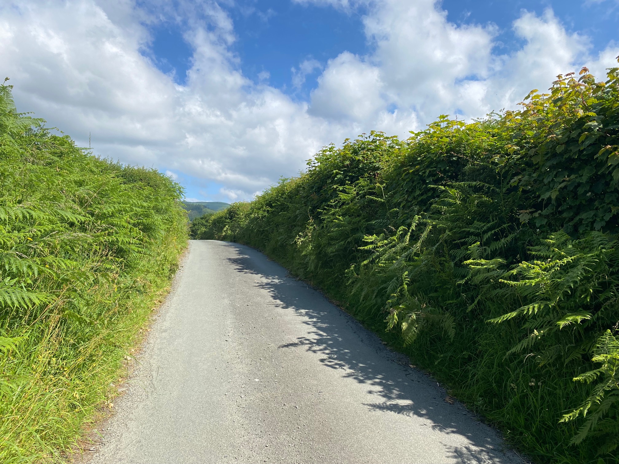
We missed the next turn and had to backtrack to find the narrow lane that we were directed up by the route on my Wahoo. It was particularly narrow and particularly steep too, with high hedges of vegetation on either side and no sign of any passing places. I was glad we didn’t meet any cars on the way up that wee leg breaker of a climb, followed by an equally steep drop on the other side, after which the road was gentle to us for a while.
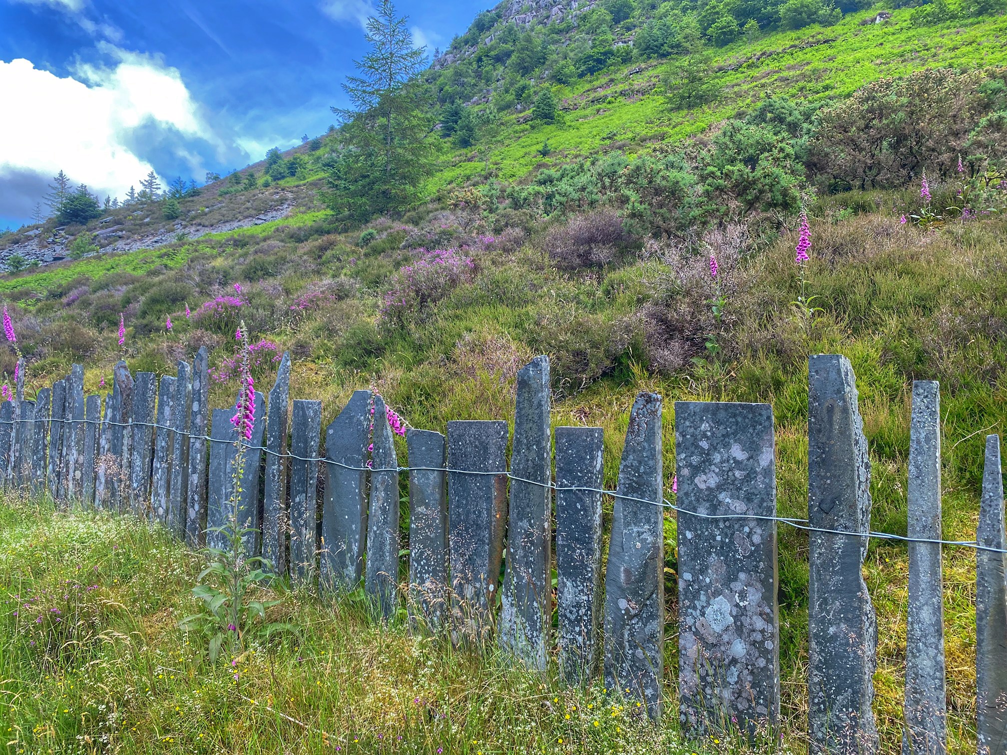
We were cycling along a very quiet road on the east side of a valley, with the A487 on the other side and the Afon Dulas river in between. Occasionally we passed through picturesque little villages and stopped to take photos of an old water mill.

After a while, we reached the slate mining village of Aberllefenni. According to the info board I found, the slate quarry here was the longest continually operating one in the world at the time the quarry closed in 2003. There were still slate processing businesses to be seen in the village, and after passing through, we were routed left up past the quarry itself, which has an impressive rectangular cave cut out of the cliff.
This also marked the start of the first big test of the day – the mountain before lunch if you like. It started out gently enough, with a gradient of about maybe 5%, where I could easily find my rhythm and keep pedalling along quite happily. Sadly, this didn’t last all that long, and we were faced with a bit of a wall, where the gradient went up to 20% if not a bit more at times. Luckily, the mega steep part didn’t last all that long, and I stopped for a rest as soon as it flattened out. Colette caught up and we ate our sandwiches here. If we’d held on till we reached Dolgellau to eat anything, we would both have run out of energy long before then and be in real trouble. We’ve realised that eating and drinking early and often is key to surviving these hard days. There was always a second lunch to look forward to when we reached Dolgellau…
I confidently told Colette that the worst was probably now over, and shortly after setting off again, we had another hard section to deal with, though it didn’t seem quite as bad as the first. Then we reached a gate, after which the road was just relentless. It maybe didn’t quite hit the heights of 20%, but was in the high teens for long stretches, sending my heart rate higher and higher. I decided there was nothing to be gained by beating myself up on this climb, especially as Colette was already pushing further back, and I would have to wait at the top either way. So I got off and pushed for the first time (on a proper road) in a very long time. My heart rate dropped quickly and I had more of a chance to enjoy the remote and rugged scenery. Perhaps I should do this more often!
As I walked along, I could also hear the sound of what I though at first were motorbikes, so I kept well in to the left in case they appeared suddenly. But they didn’t appear. Colette heard the noise too, and we were quite confused as to what it might be. She suggested drones, which might not be far off the mark, as there was a track leading down to a cliff out of sight to us, which might make a popular place for flying model aircraft.
Once both of us were at the top of the steep climb and had caught our breath back, we continued on a false flat for a while before reaching the descent proper and catching sight of the next valley. This was fairly wide, with a main road running right through the middle.
A few gates slowed down our descent, and the last of them took us out onto the A487, where we turned right, then left again, through another gate, following signs for route 8. This put us onto a gravel track to start with, then over a cattle grid towards some houses, after which, route 8 continued as a well-surfaced path with some new-looking gates. There were quite a few more gates to be negotiated, taking us between farms before the route returned to “proper” road. The final gate warned of the possibility of stampeding cattle, which was quite alarming. However, there was no sign of cows, save for their leavings on the road.
A few twists and turns later, this gentle country road turned into a quite fearsome descent. High vegetation along the sides gave little warning of any oncoming traffic (of which there was none, thankfully), meaning we had to keep the speed down to a suitably safe level. By the time we reached the bottom, a quick spit test proved that my brakes were roasting hot. Not a surprise really, and I was glad to have two fully functioning brakes for this route. Colette appeared a little later, feeling like her hands were about to cramp up with all the squeezing of her brakes.
Looking around, we discovered that this descent had delivered us right into the middle of the town of Dolgellau. Next up was a bit of exploring to find a suitable place for our 2nd lunch. After a couple of false starts, we found Y Sospan – a great little cafe, where the only bad thing Colette could say about the food was that there was too much! Well, it was our 2nd lunch after all.
After lunch, we found a Spar so we could replenish our water bottles, then we looked to join up with cycle route 82 to take us out of town. It did so by means of a stiff climb. It wasn’t mega steep though, so we could just find a good pace for the mile or so that it lasted, taking us to a plateau of sorts, at about 500′ elevation.
To our left was the prominent ridge and steep slopes of Cadair Idris, nearly 2500′ higher up. The road became very narrow, which meant we had to stop and pull off whenever a car wanted past. Luckily that only happened a few times. It was a very pleasant few miles of cycling, but in the back of my mind was the mountain after lunch, which lay in wait not far ahead.
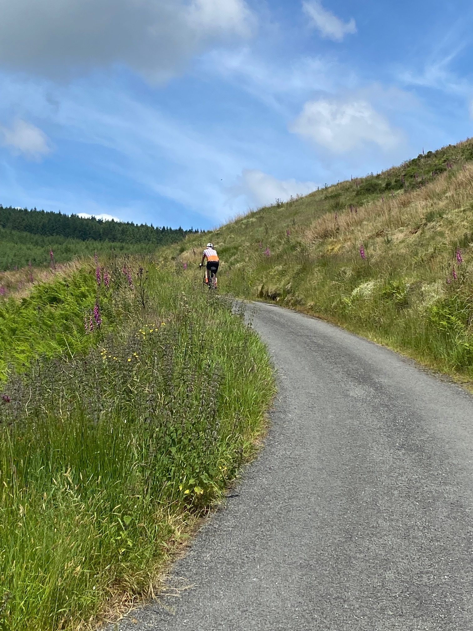
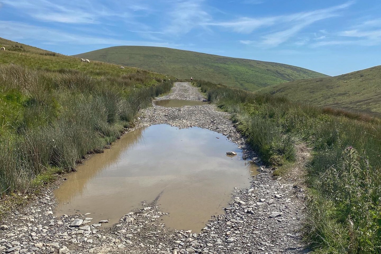
Even though I was expecting it, the mountain road that loomed into view looked much steeper than I had feared. Then, to make things harder, the route went from good quality tarmac to rough gravel just as it started to get steep! I did my best to ride up it, but only got as far as the first gate. After that, the big chunky gravel and loose surface made the going too difficult and it was back to pushing.

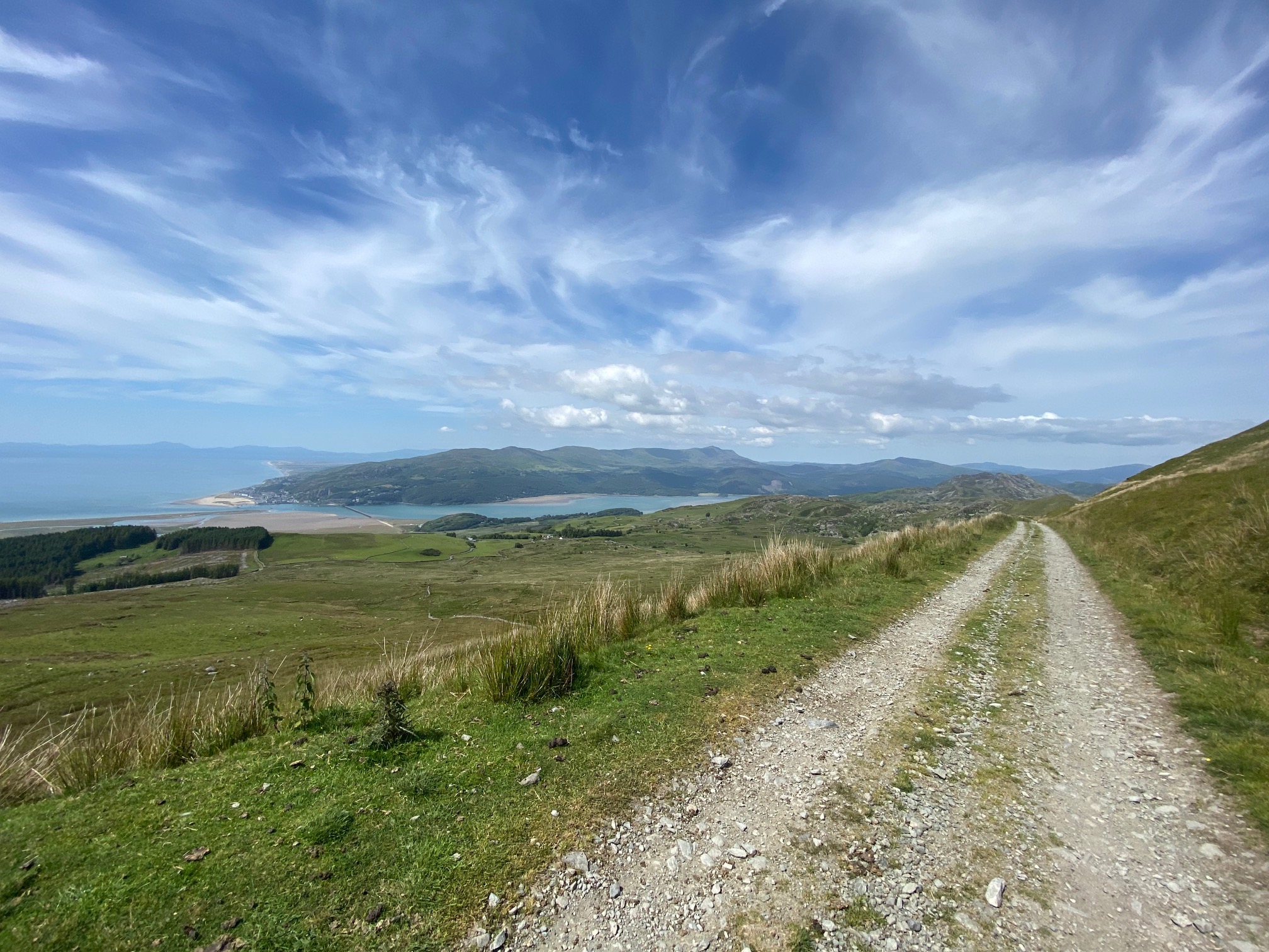
It took about 50 minutes for us to push our bikes in the baking heat to the top of the climb, with a few short stretches of pedalling in the odd place where the surface would allow. Our reward was a spectacular view over to the Mawddach estuary, with the Barmouth bridge clearly visible.
Then started the descent. It was not too steep, but still being on rough gravel, it was pretty bumpy. Colette felt it was just too dodgy for long stretches, so she was forced to walk her bike down hill. I could see that it was going to become very steep downhill not far ahead, and was dreading walking my bike down there too, but just as we crossed the final cattle grid before the descent, the road turned back to perfect tarmac! We cried for joy!!!
One thing that we noticed about this route was how few other cyclists we saw. Apart from in town, we only saw three other cyclists all day. Why this is, I can’t fathom, but the upshot is that the sheep here are not used to cyclists, and when alarmed, they shoot out across the road in front of you without warning. For that reason, we needed to keep the speed in check on this descent, and I had one very close call where my hydraulic disc brakes were given a good emergency stop test by a couple of frightened lambs.
The steep little road took us out onto a flat valley, and with that, the adrenalin rush was over for the day. The final 8 miles were predominantly flat, taking us through Bryncrug, after which we used the roadside cycle path as far as the outskirts of Tywyn. There, we found an extremely narrow road that bypassed the town, taking us back onto the A493 with just a few easy miles back to Aberdovey.
And so the epic day was over. The stats don’t make the day look as hard as it felt, mainly because a lot of the climbing was on very steep roads, and also the gravel sections were almost too gnarly for a gravel bike. But the upside was beautiful scenery for pretty much the whole ride, and once off the main roads, we felt like we had the whole place to ourselves.