
Glentroool has been on our radar for a long time, after hearing good things about it from a friend, shortly after we took up cycling. We would have tried it earlier, but it is just at the far end of what I see as a comfortable length of drive for a day trip. On the day in question however, the forecast was great for there and not so great for home, so we decided to get up early and give it a go.
After over 3 hours of driving, we reached the start point at Clatteringshaws visitor centre. I I hadn’t expected that the car park would be pay and display, and since we didn’t have any coins, it was a good job that we arrived just after the visitor centre opened, where we could buy a ticket by card.
It was a bright, sunny start with not much wind, and a downhill from the off. The plan was to reach Glentrool by road. then return to Clatteringshaws using the off-road track. The first part of our route was southwest, along the A712, with the Galloway Forest to our right. As with most “A” roads in this area, the traffic was very light.
We passed a number of laybys to our right. which might have come in handy had we arrived before we could pay for the parking at Clatteringshaws. The visitor attractions included a red deer range and further down a wild goat park, where we could see quite a number of goats just beyond the fence.
A few miles further along, we took a right turn onto a minor road, which led upwards into remote-looking countryside, before bending to the left and gently undulating its way down to the village of Minigaff, on the outskirts of Newton Stewart. There, we took a right over a bridge onto another quiet road that led us northwest, away from civilisation once more.
After passing through some open countryside, we rejoined the Galloway forest, which was to our right, with the River Cree to our left. The road had some quite steep little ups and downs and some gravelly sections, but that was fine as we were riding our gravel bikes.
At this point, I realised far too late, that I hadn’t put much thought into the preparation for the day’s outing. Although I was riding 35mm gravel tyres, Colette’s bike still had the narrower 28mm road tyres that I fitted for our Mallorca trip. She had used them successfully off-road recently, but today’s outing was a bit of an unknown, and they might not be up to the job. Also, we were only carrying one spare inner tube each, which could be a bit risky for a trip taking us well away from potential help.
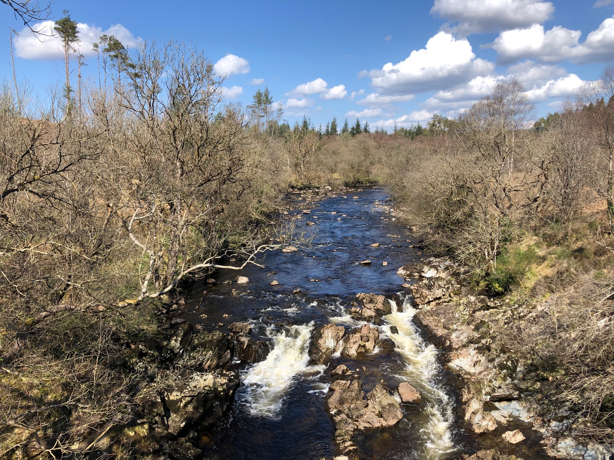
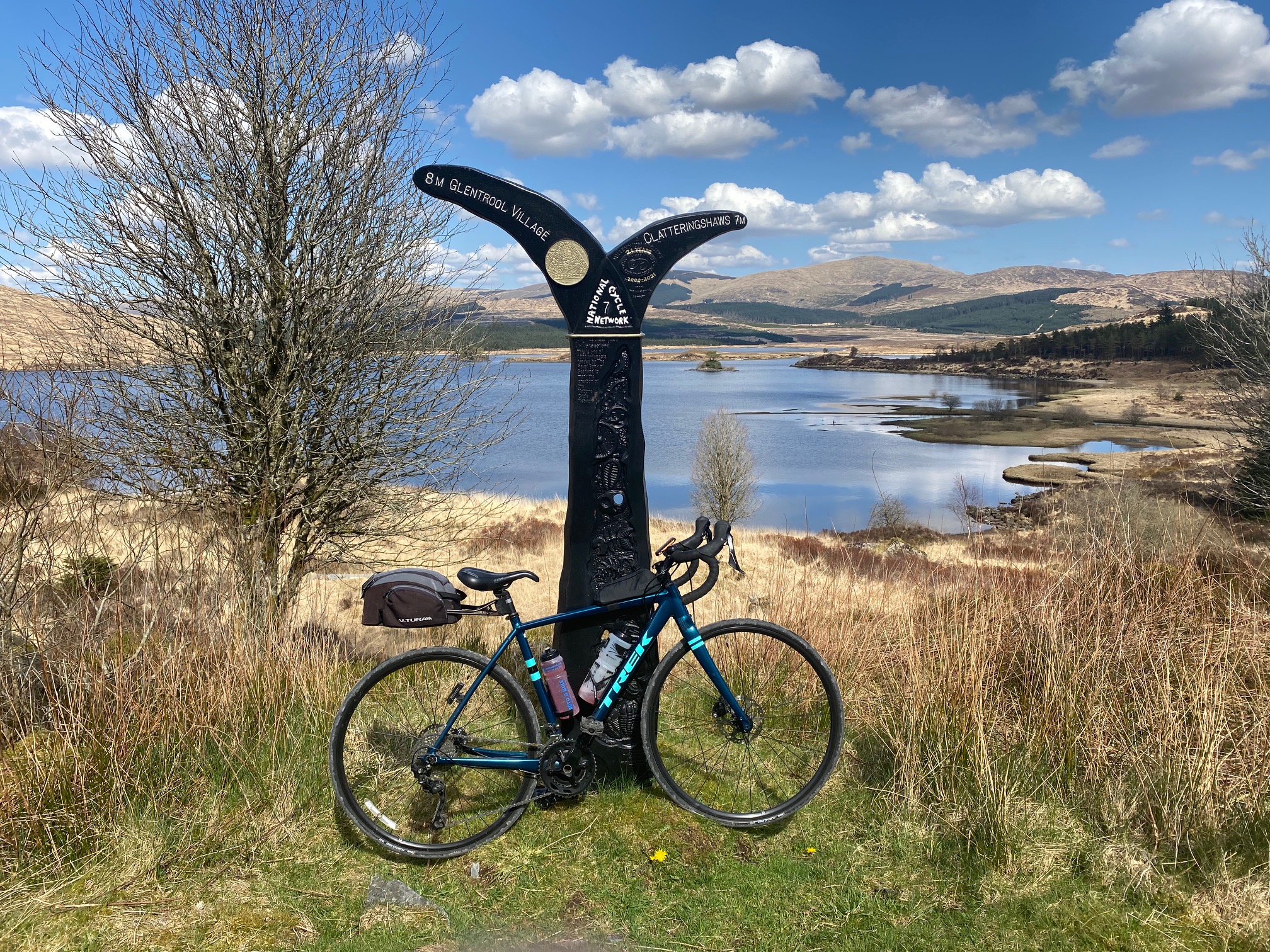
Water of Minnoch
The sound of a waterfall alerted us to a possible photo opportunity, and we took a very short detour to check it out, before carrying on towards Glentrool. We had made pretty good time to this point, so we arrived at the Glentrool visitor centre, crossing the very picturesque Water of Minnock, right on lunchtime.
Although there were some grumblings from Colette about her microwaved baked potato, this was the only place for miles that we could possibly get anything to eat, and I was perfectly satisfied with my tuna and onion toastie, so no complaints from me!
After lunch, we headed east, following national cycle route 7 (off-road version). To start with, the road was tarmac, taking us through a couple of car parks and up some short, sharp climbs, to the end of the road and the start of the gravel track. Route 7 went steeply down from this point on loose gravel that I found uncomfortably bumpy and Colette elected just to push down.
The track flattened off and went over a couple of bridges with more lovely waterfalls to admire. It continued to be bumpy for a bit longer, then became very steep again as well, where I struggled to keep pedalling. Once at the top, I walked back to Colette to help her push her bike up.
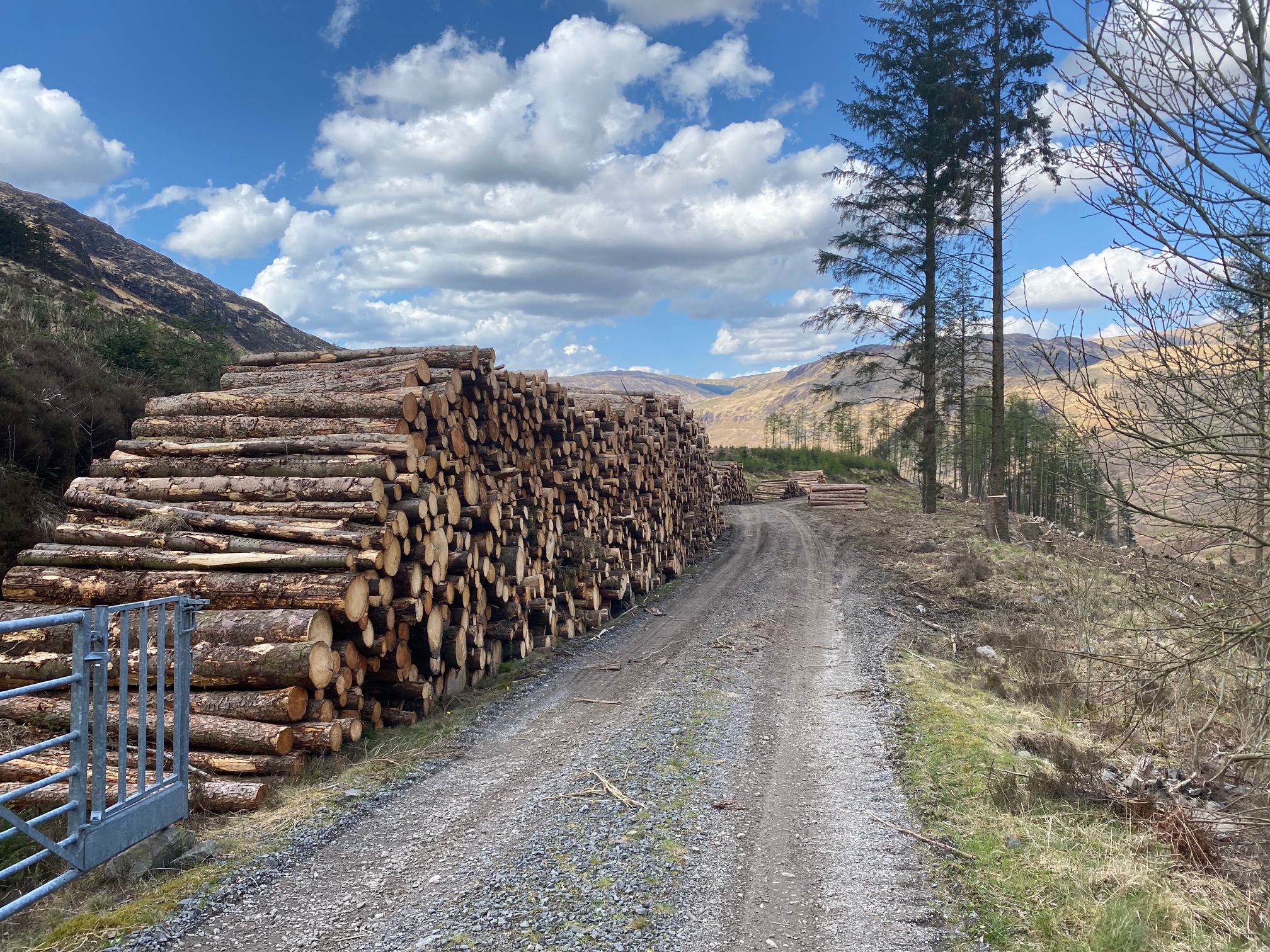
At the top of this steep section, we reached a T-junction with a well-used logging trail, where the gravel was more compressed and easier to ride. We went left here, but as we had started the main climb of the day, the direction was still up. Colette expressed disapproval for the lack of gravel-capable tyres on her bike, for which I apologised. We then proceeded slowly to navigate the climb. That gave plenty of time to admire the scenery, which to be honest, after waiting such a long time to do this ride, was slightly disappointing. For me, the logging operations gave the hillside a bit of an industrial look. On the other hand, without logging and wind farms, there wouldn’t be half as many gravel roads to ride.
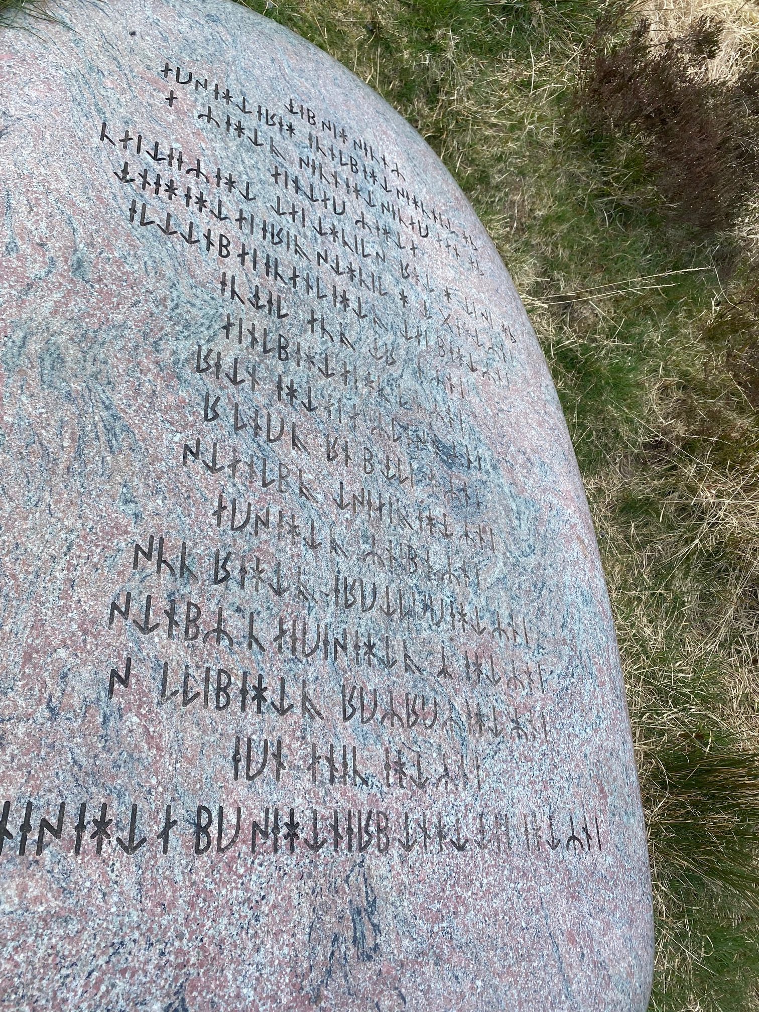
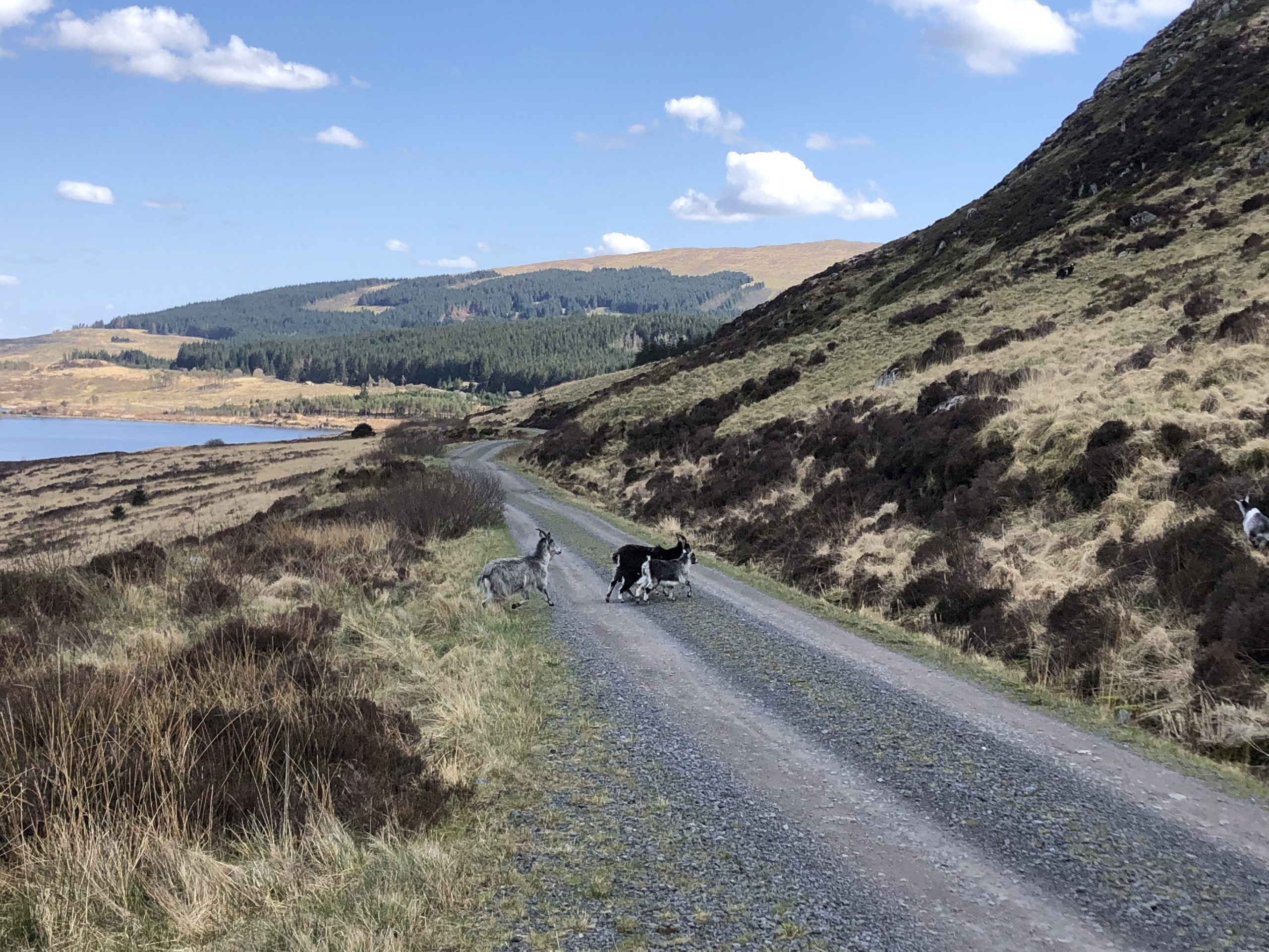
At the top of the climb, there is a large stone covered with runic inscriptions, which Colette stopped to investigate. Somehow, I managed to completely miss it and carried on over the top, till I had to stop for wild goats crossing the road.
Loch Dee came into view as we cycled on, and with it, the scenery improved markedly. There were a few ups and downs still, but nothing major. I paused at the top of one for Colette to catch up, and she just breezed past. I started after her, speeding up on a fast downhill till I hit something with a bang. Shortly after, I started losing control and had to come to a stop after seeing my front tyre was flat. Then a sinking feeling came over me when I heard a hiss from the rear tyre and soon it was flat too.
I shouted “puncture” but Colette didn’t hear me and disappeared off downhill. My phone didn’t have any signal, so with only one spare inner tube, I had no option other than to shoulder the bike and start walking.
A few minutes later, the phone signal must have come back, as I got a call from Colette asking what was the problem. I told her and she met me a short while later to work out what to do.
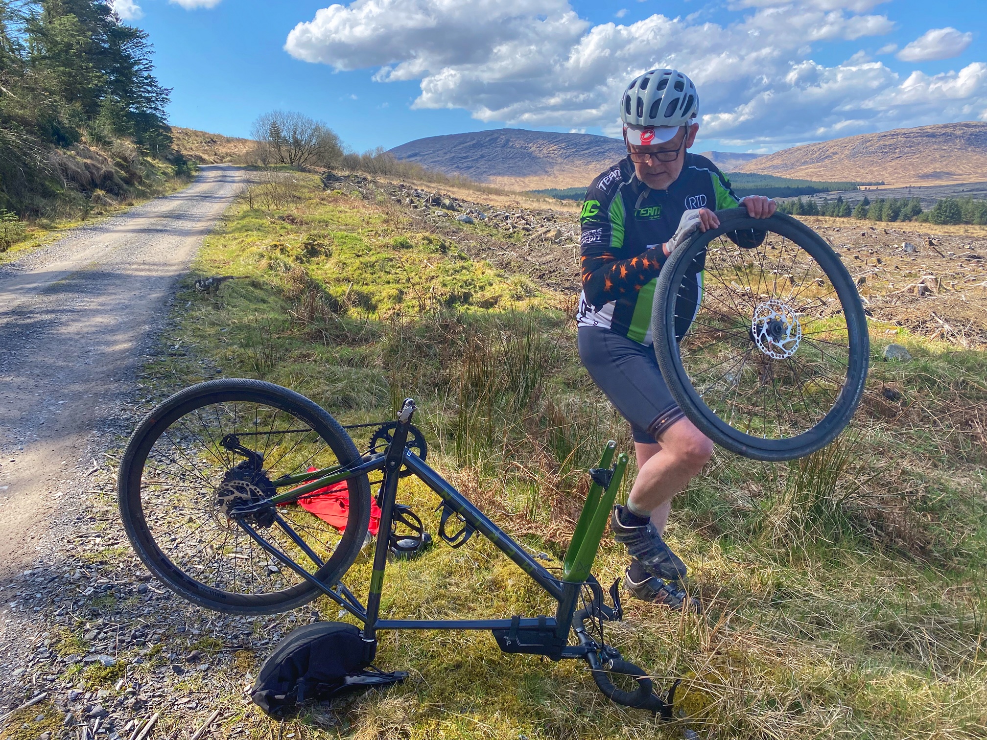
We were about 7 miles from the road and I didn’t fancy walking all the way back. The question was whether I could use Colette’s spare 20-28mm inner tube in my 35mm tyre. The tyres were quite tight, so they were tricky to remove and even more care had to be taken getting them back on so I didn’t nick either of the inner tubes. The 20-28mm tube looked way too skinny, but I went carefully and it seemed to inflate successfully.
While I was in the middle of this, some forestry traffic went past, and one driver stopped to offer help. He said if I didn’t manage, there was a bothy a few miles back the other way. I certainly didn’t want it to come to that!
After more than 20 minutes fiddling with wheels, we set off again very carefully, as any more punctures would mean a long walk. Luckily, there were no more mishaps, and a few miles further along, route 7 took us away from gravel trail and onto a very old and very narrow tarmac road.
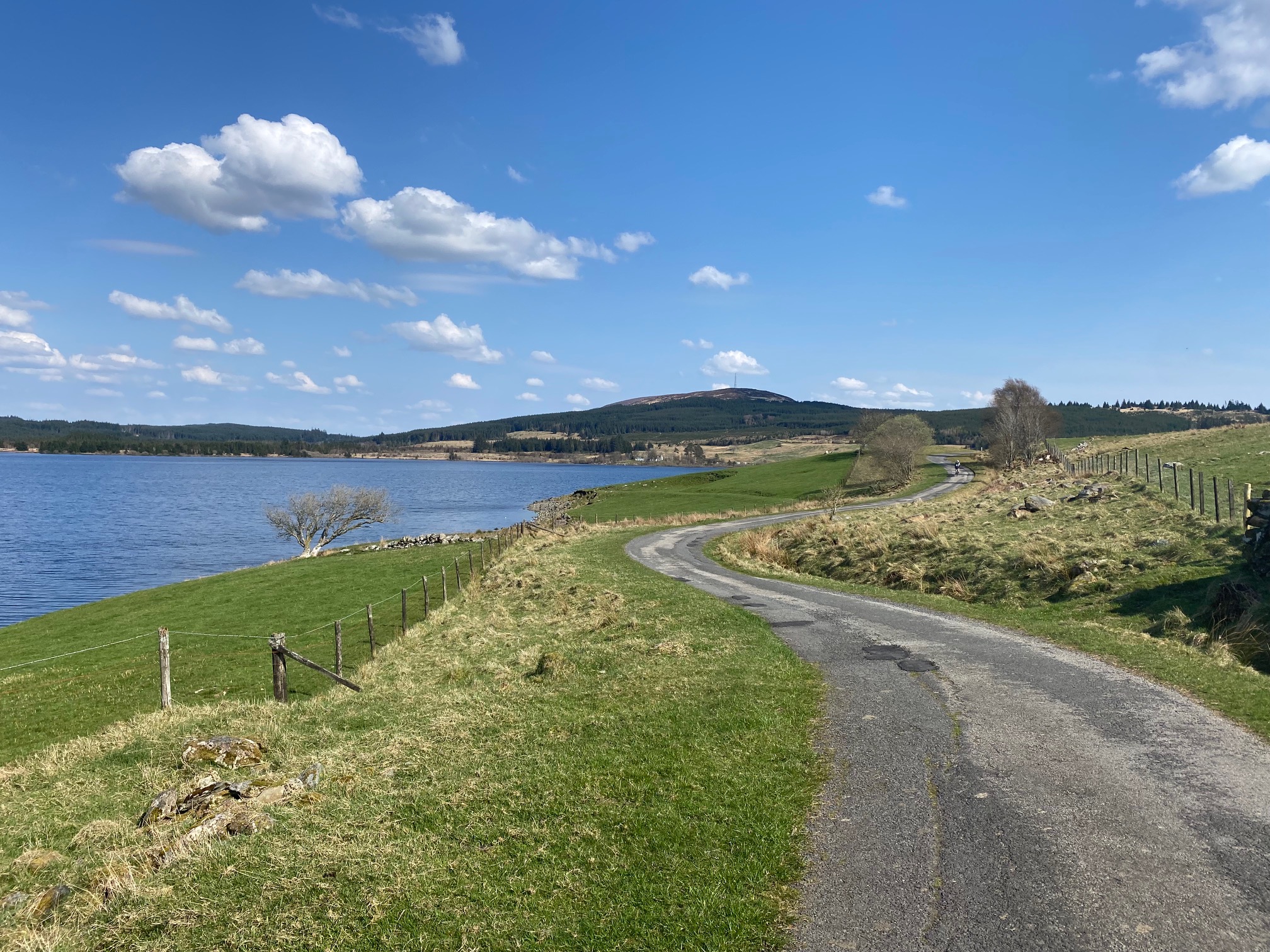
This road went up and round a small hill, and by the time we were going down the other side, Clatteringshaws Loch came into view. We could see the visitor centre and our car in the car park just on the other side. However, we needed to go all the way round the dam before reaching the A712 again.
It was on my mind that since we started this ride with a downhill, the final section back to the car might be a drag. Luckily, the wind was behind us at this point, and it eased us up from the bottom of the dam to water level and then back to the car.
Luckily, we arrived a few minutes before the visitor centre shut, so we could visit the facilities before starting the drive back. A long day, but a good one, with great weather, mostly great scenery and a chance to (re)learn some important cycling lessons.