
There is the ruin of what looks like an old castle on top of a hill not far from us, which Colette has tried to point out to me on several occasions while I was driving past, but it wasn’t till I went past recently on two wheels that I finally noticed it. It is referred to on the map as “Fala Luggie, Tower, rems of” and some Googling brought up mention of it being the ruins of a 16th century hunting lodge, reputedly used by kings of Scotland. So reaching it was the aim of this specific outing.
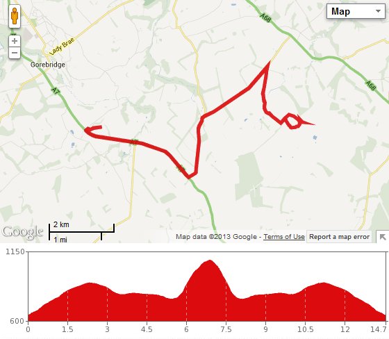
We set out on a fairly overcast day with a significant SW breeze and using the most direct route, we headed up the A7. This isn’t my favourite road, but it bypasses a killer hill at Crichton, so I just put up with the traffic whizzing by for the mile or two before we could take the Fala turnoff. That put us onto the B6458; a quieter but very potholed road that heads roughly northeast till it reaches the A68. We didn’t want to go quite that far though, and taking the right fork at Tynehead, we carried on quite speedily as far as the sharp right turn for Cakemuir Castle. Then we turned right into the wind and although we were going downhill now, it felt as if we were going up!
Soon enough we were within sight of Cakemuir Castle, a 16th century tower that has been extended and updated through the years, and is occupied as a private residence. So we couldn’t really have too much of a nosey. Instead, we continued on our quest, heading up a rough and steep farm track on the left. Pretty soon, I had to jump off my bike and push! We stopped to catch our breath where the track levelled off a bit, then got back in the saddle and slowly continued to climb the track till it came to a wooded strip of land. Here the path took a left turn into a ploughed filed. We followed it as far as possible but where the track ran out, we had to leave our bikes and continue on foot.
Alongside an apparently electrified fence, we carried on till we reached a gate and went through onto open moorland. This was quite hard going, moving steeply uphill on rough uneven ground, under a barbed wire fence, then on over heather till Fala Luggie came into sight. As we approached, it became clear that all that remained of what we had from a distance imagined to be a major ruined castle, was just a single wall with two windows. Although somewhat disappointing at first, it was possible to envisage what it might have looked like back in the days when it was being used as a hunting lodge. Its location right on top of the hill was stunning, as was the view away in all directions, from the Pentlands to the west, the hills of Fife to the north and Berwick Law and Bass Rock clearly visible to the east.
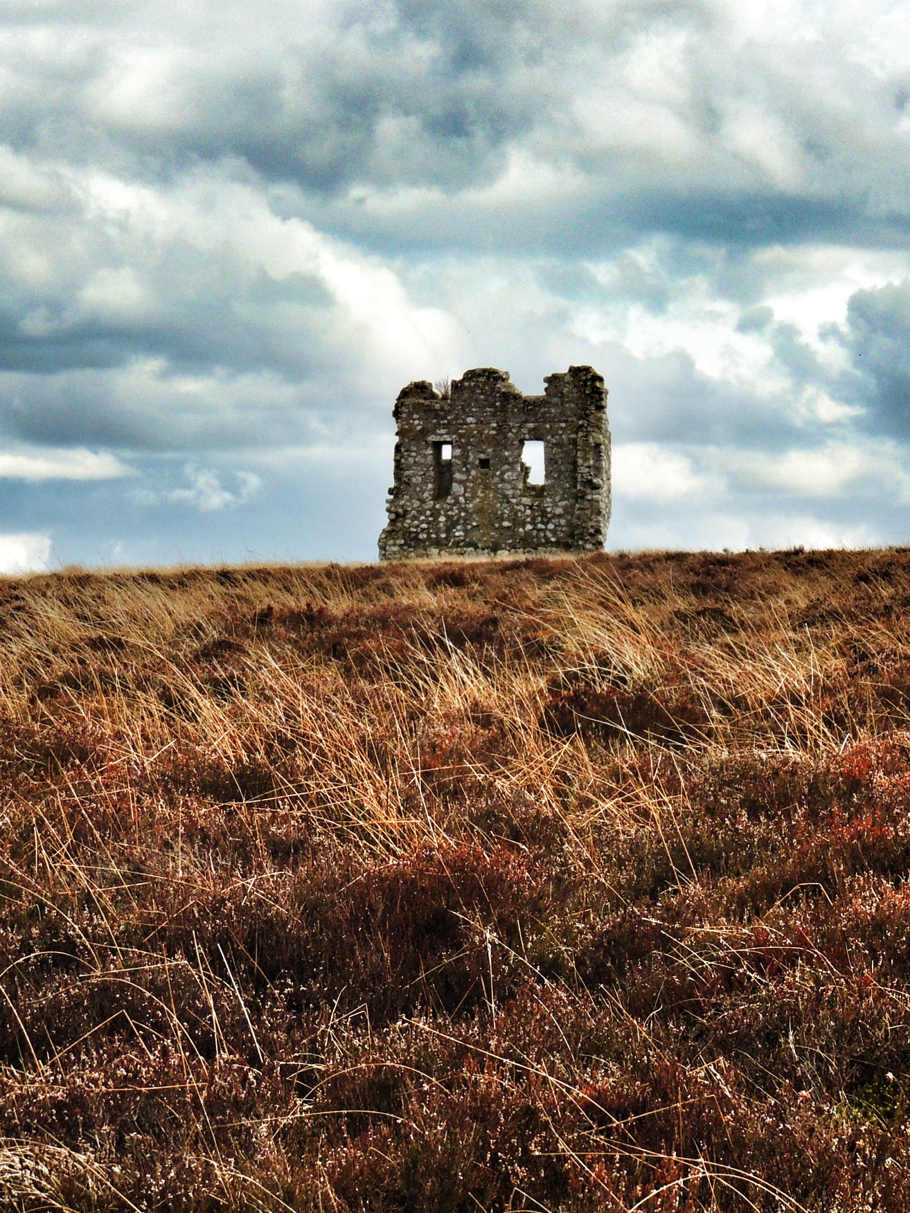
Fala Luggie tower
We paused for photos and finished off all the chocolate in my bag (must make sure it is replensihed before the next outing!). It was quite surprising to find that there were no visible paths of any sort leading away from the ruin, although we picked up a sheep track about 50 yards away from the structure and followed that back in the direction of the tree line. We then followed the trees back to the field where we left the bikes and enjoyed a bumpy fun downhill ride to the bottom of the farm track.
The rest of the return journey against the wind was a bit of a slog and it had also started raining lightly, so any thoughts of returning via Crichton were dismissed and we just went back the way we had come. I think we might do this one again on a better day to make the most of the fantastic panoramic view from Fala Luggie.