10-11 April 2018 – Two cold days in Angus

Day 1

After mentioning in passing to our friend Lynne that I fancied a wee cycle up Glen Clova, the next thing I knew she had organised a stay in the Airlie Arms hotel in Kirriemuir with a Groupon deal: two double rooms and evening meal at a great rate. That date got put away on the calendar and we endured the long winter till spring finally started to make its presence felt as the day approached. Then on the appointed day, the east wind came back to haunt us, and we were looking at a cold, cloudy and windy day, with occasional rain. Not the sort of day we would normally choose to go out, but we were committed, so off we went, hoping that we’d brought enough layers.

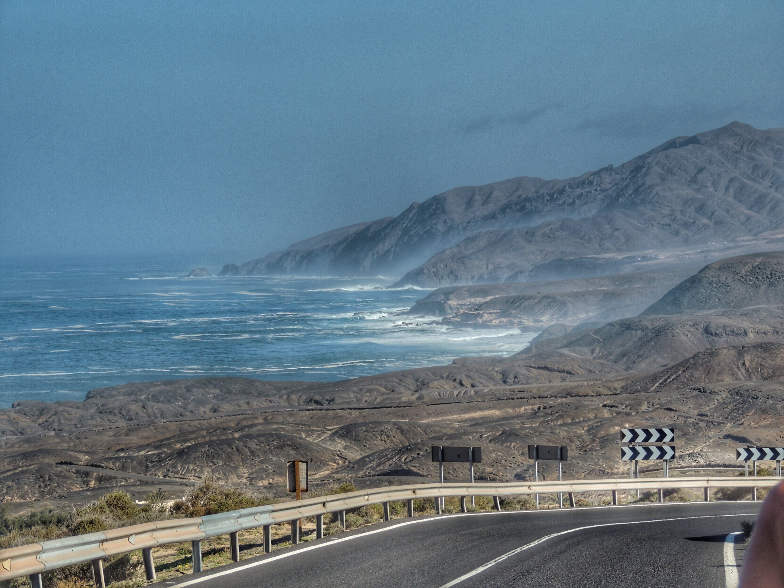
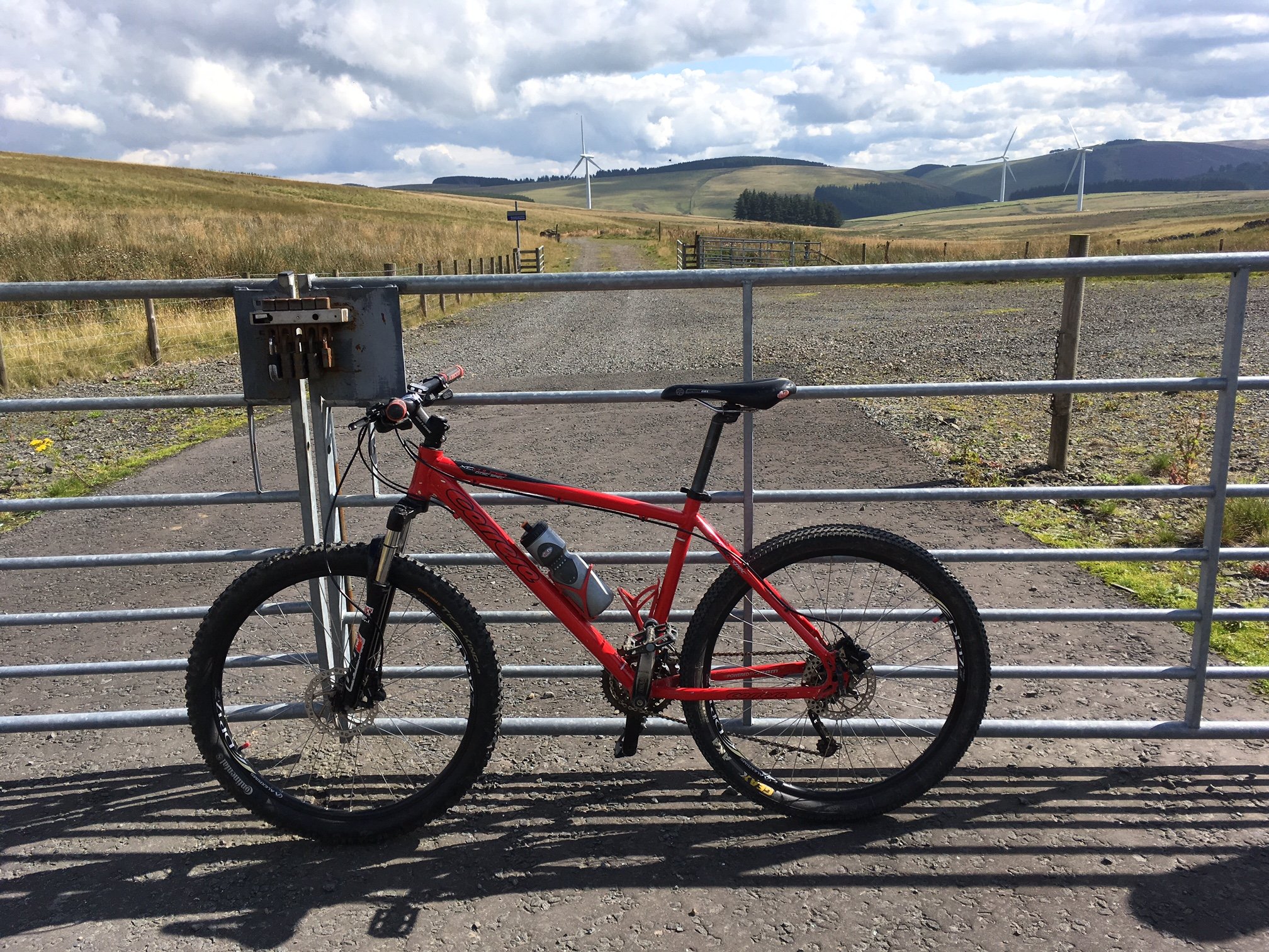
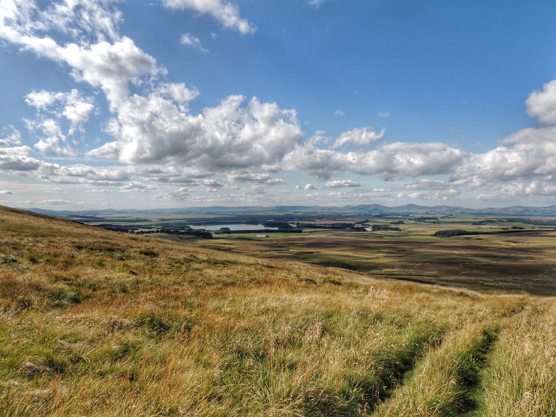
We parked at the RSPB reserve at Loch of Kinnordy and got ourselves ready. The bikes were loaded up, not forgetting two flasks of hot tea/coffee, and we set off west at first, skirting our way clockwise round the loch, till we got onto the Glen Clova road. There was some intermittent drizzle, but not really enough to dampen our spirits.

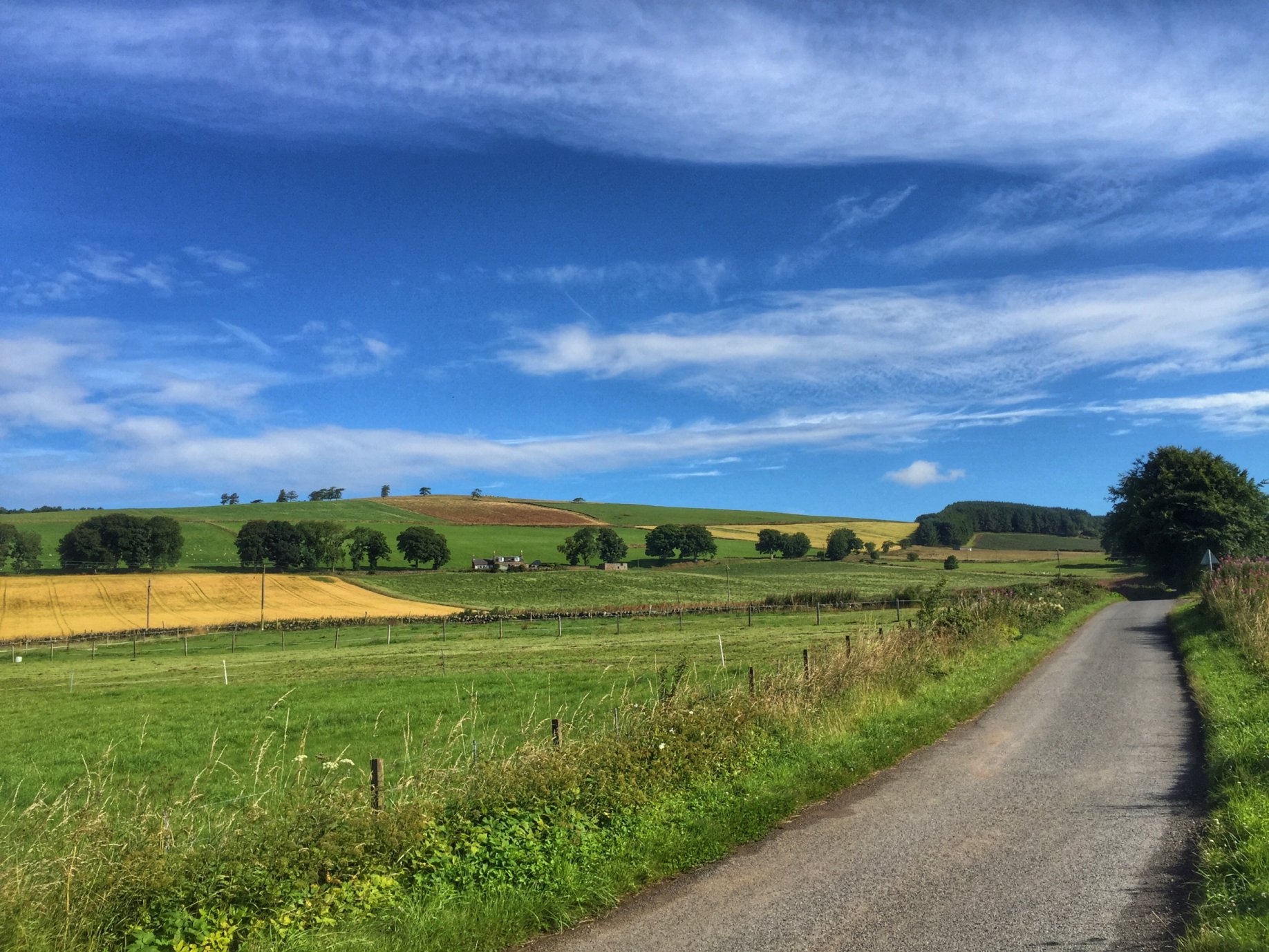
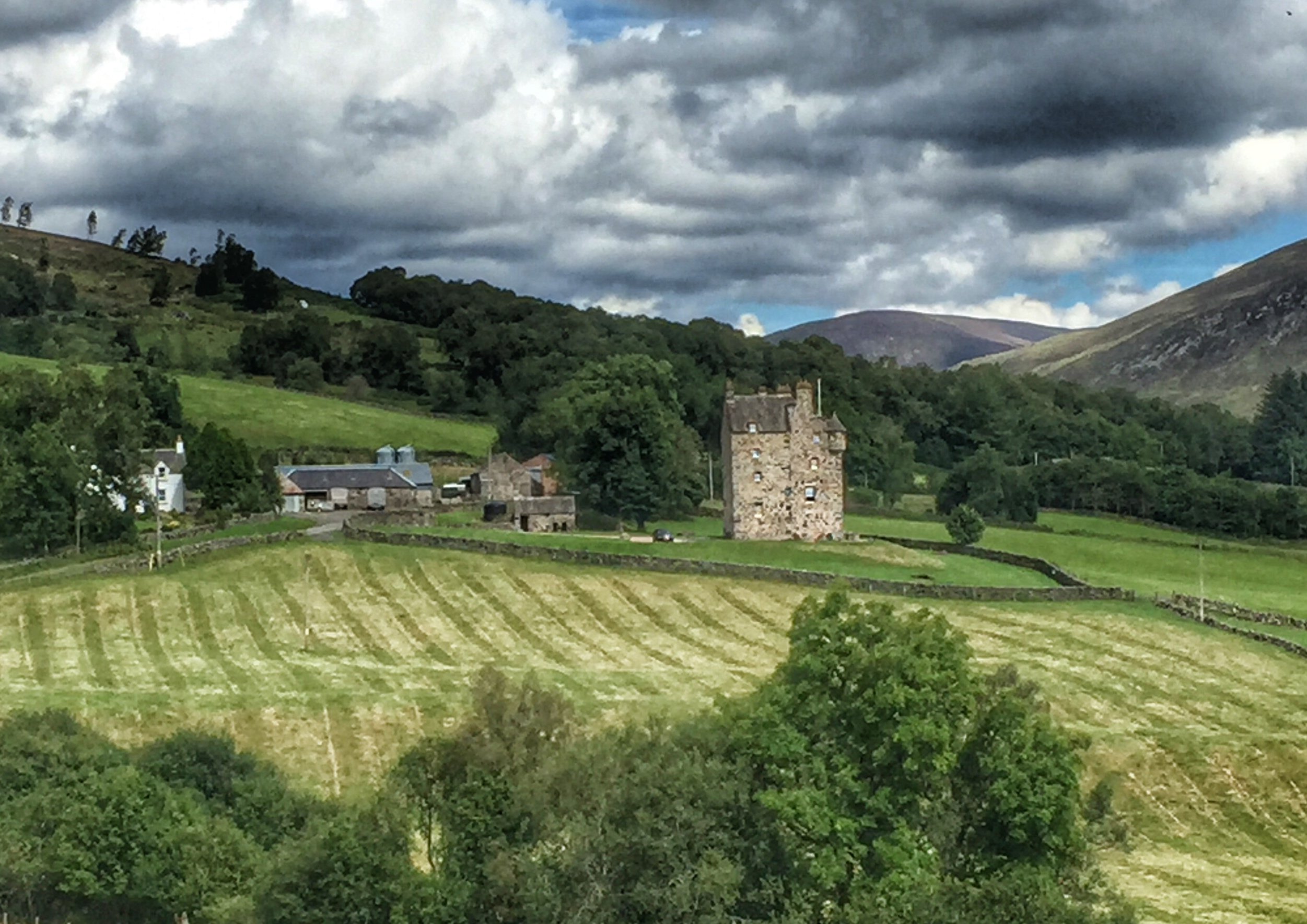
A few undulations took us to Dykehead, where the sad-looking derelict Royal Jubilee Arms hotel was up for sale. We took the right fork there for Glen Clova, rather than the one on the left, for Glen Prosen.

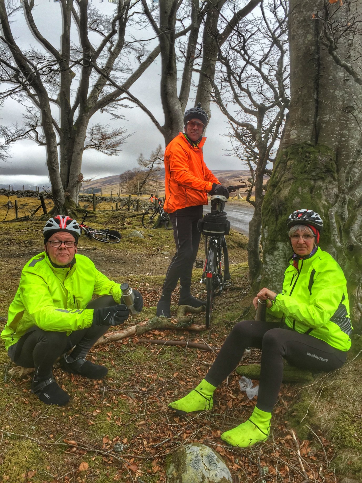
Oh what a cheerful picnic!

After about 10 miles of cycling, we were feeling cold and tired from battling the inclines and the headwind, so we stopped beside a wood for a warming drink from our flasks. Lynne had made some delicious truffles, which also helped recharge the batteries.

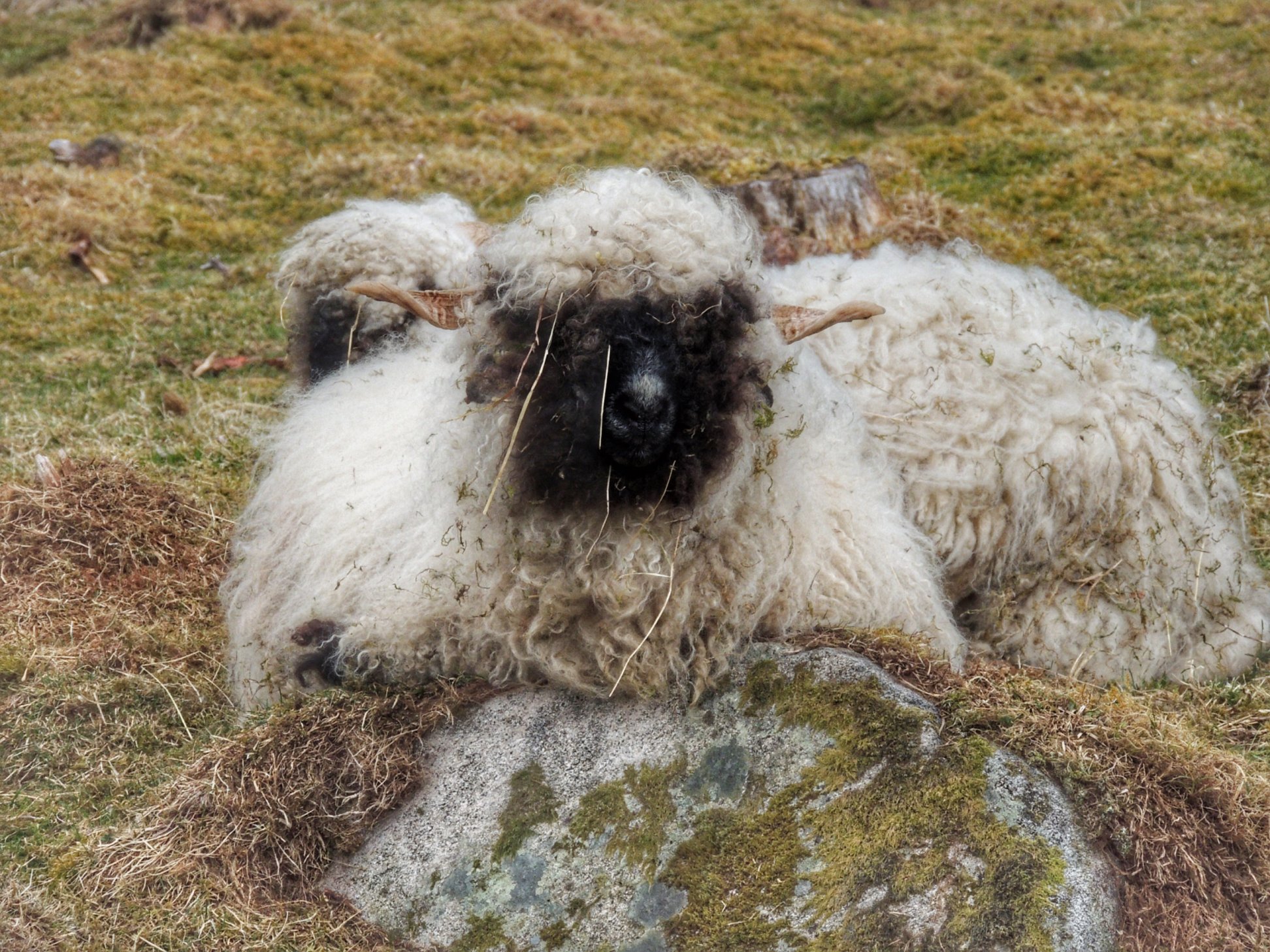
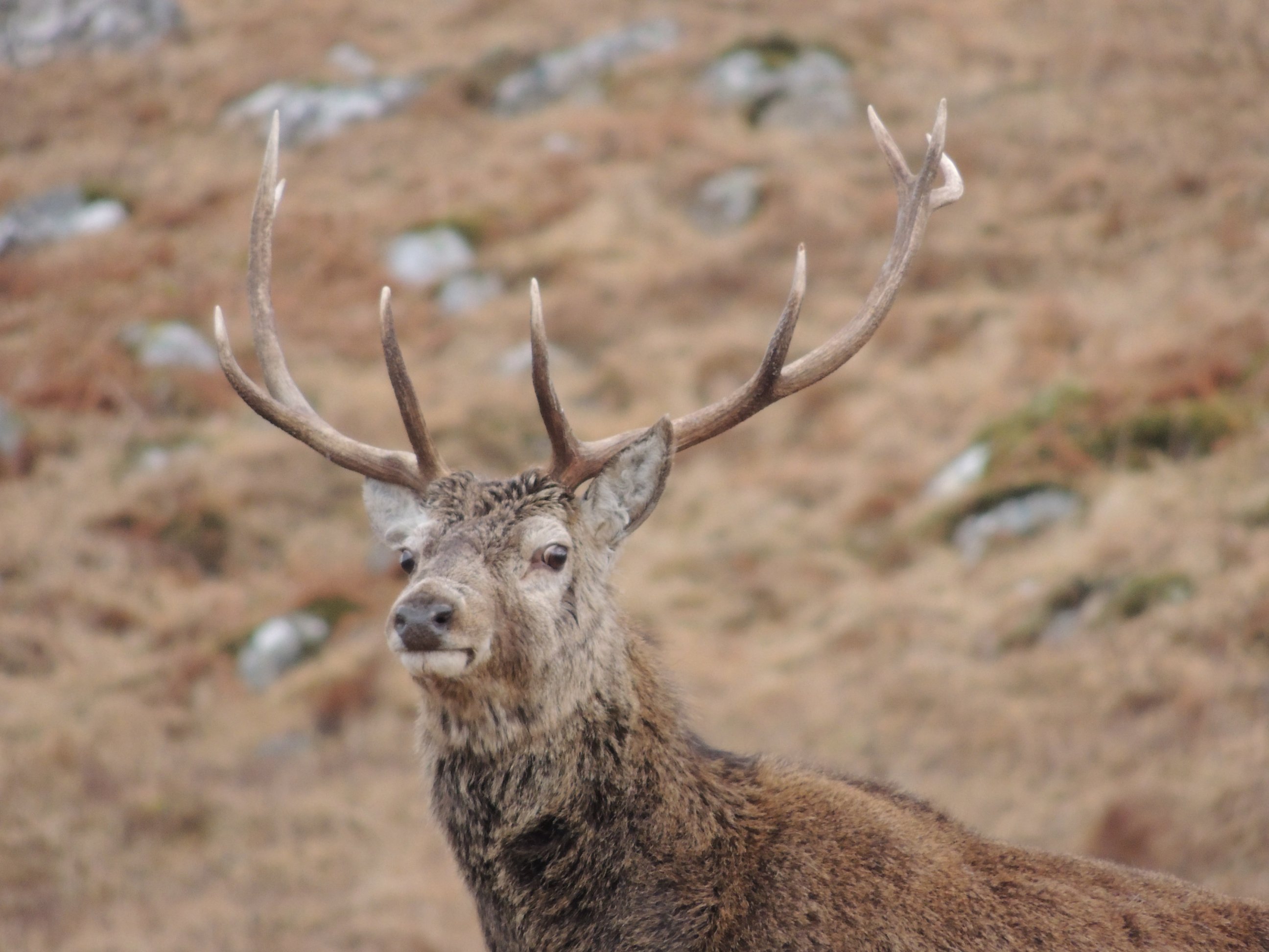
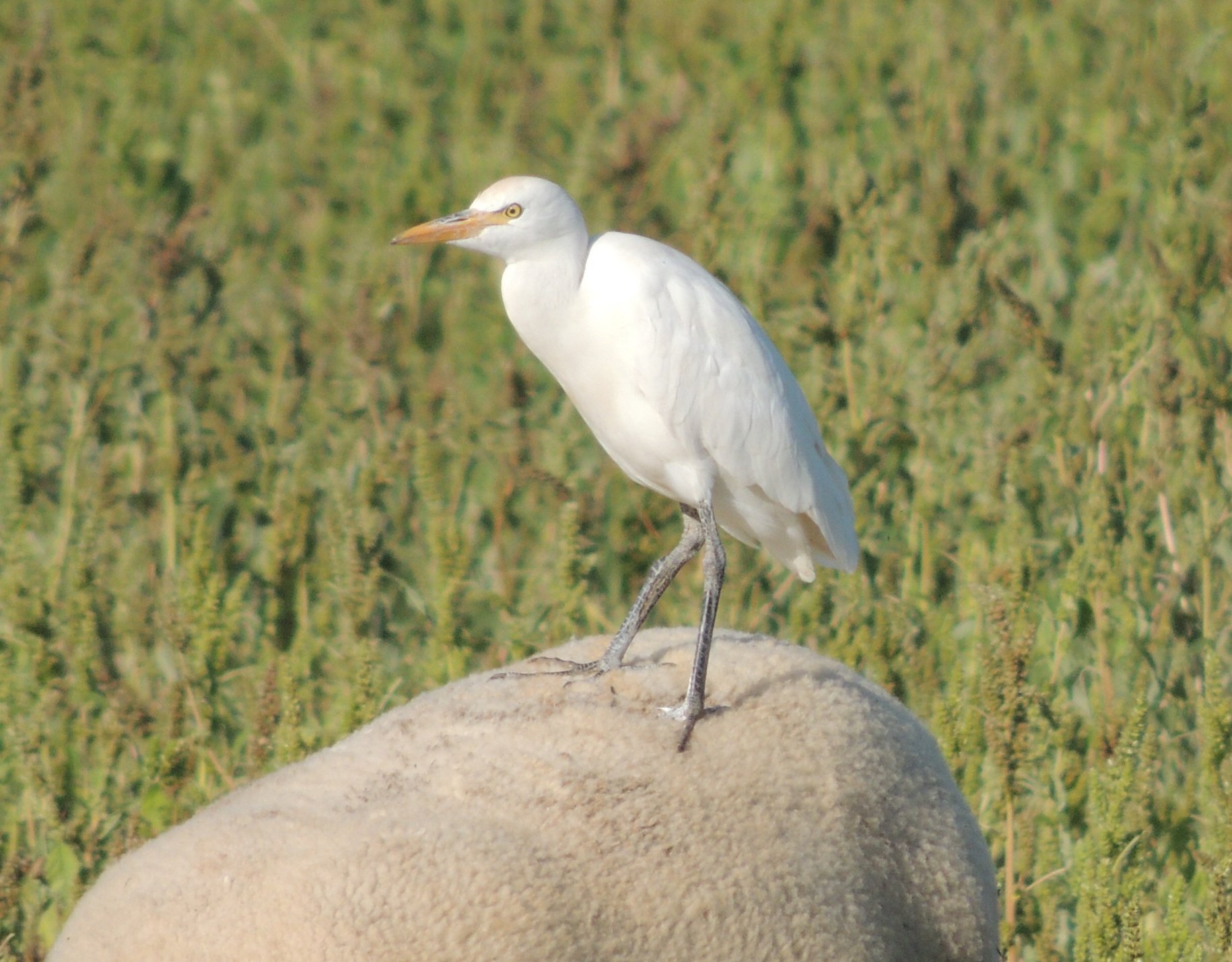
This unusual chap is a Swiss Valais blacknose sheep, so we’ve been told

Not long after we had got going again, while we were freewheeling downhill, Colette and I both spotted a sheep behaving strangely in a field, close to the road. We were both distracted by that, and what I didn’t realise was that she had started slowing down. I looked round too late to prevent a collision and went into the back of her. Luckily she stayed upright, but I went sprawling onto the road. I suppose I was lucky too, getting away lightly with just some grazing and bruising. The worst affected was my right hand, which had slapped off the road and was feeling quite sore. I needed a few minutes to compose myself before getting back on the bike, feeling a bit stupid. It could have been worse I suppose.

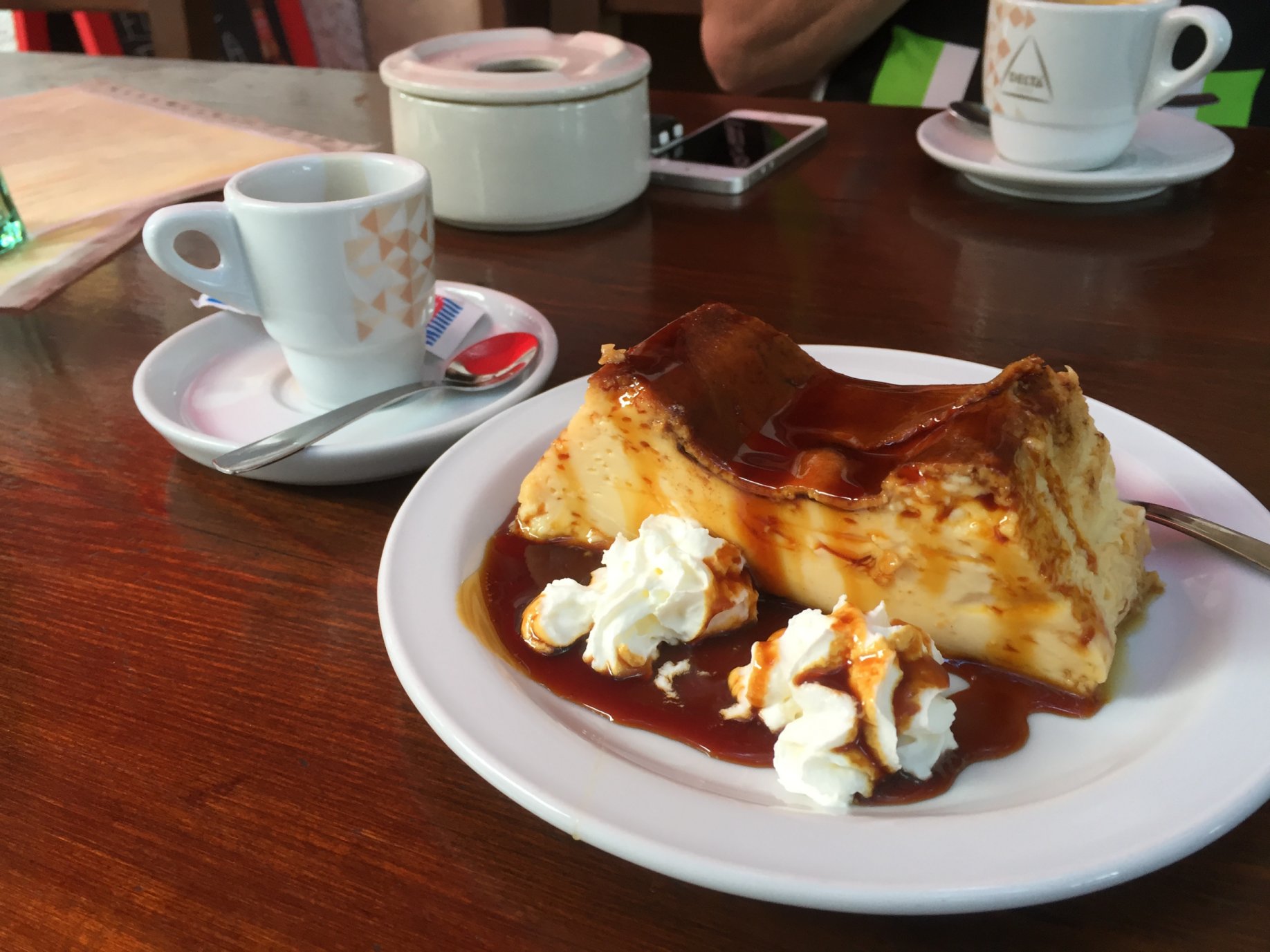
By this time, it was past 1pm, so we decided to press on to the Glen Clova Hotel for some lunch. Keith and I went ahead to get there and secure a table in case they stopped serving at 2pm, but in fact they kept serving all afternoon. Arriving at the bar, I had to order a medicinal snifter, which I took with two ibuprofen to dull the pain.

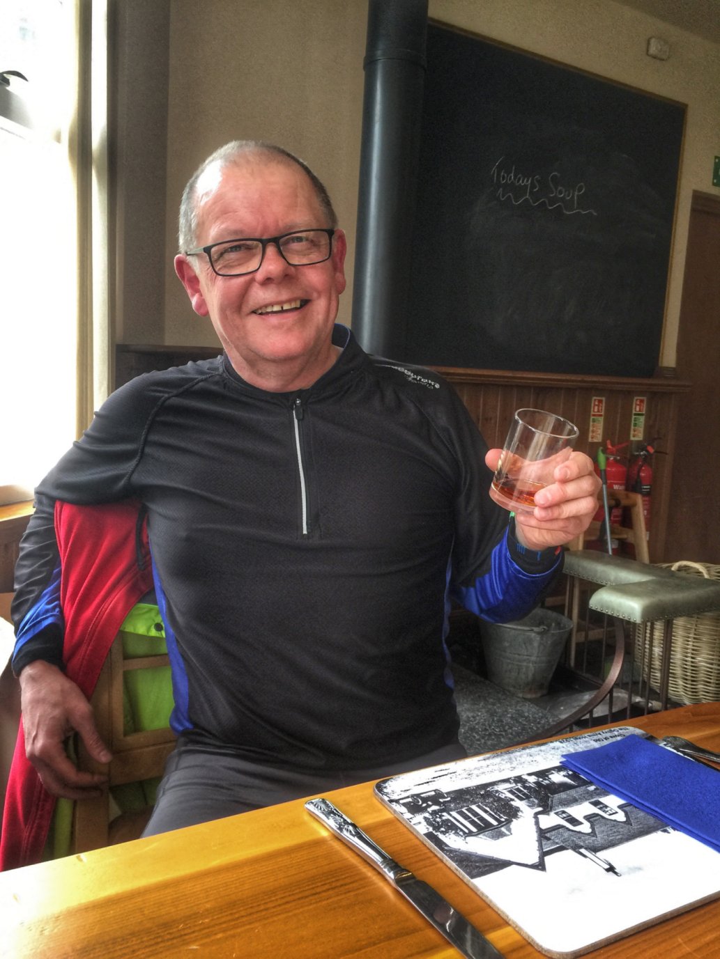
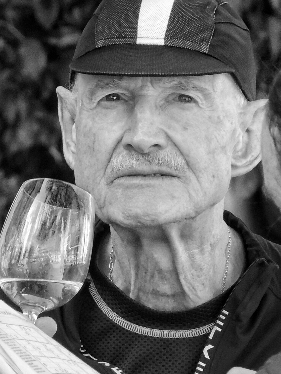
Time for my medicine

Colette and Lynne then arrived, and we ordered lunch. The other three took reduced portion size versions of fish and chips seeing as it was only lunchtime and we had a big meal to look forward to in the evening, while I felt I needed a full size steak pie to cheer me up! There was a log burner alongside, which we asked to be restoked, as the ladies were feeling the cold. We lingered alongside the fire to build up some heat before we ventured back outside.
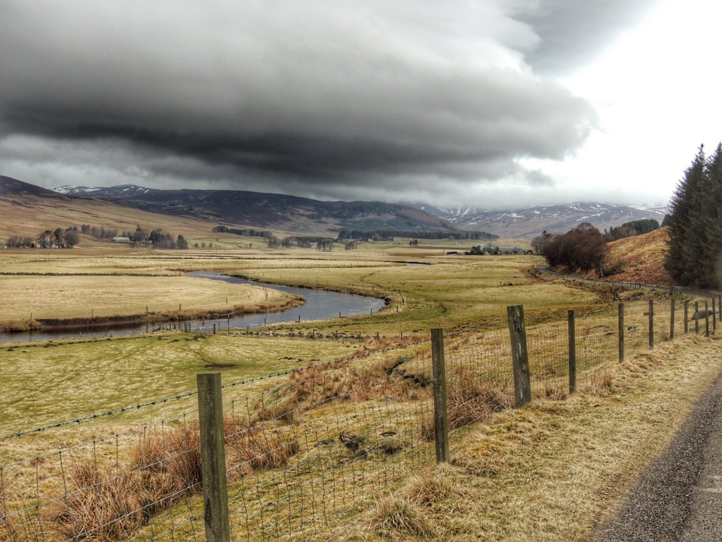
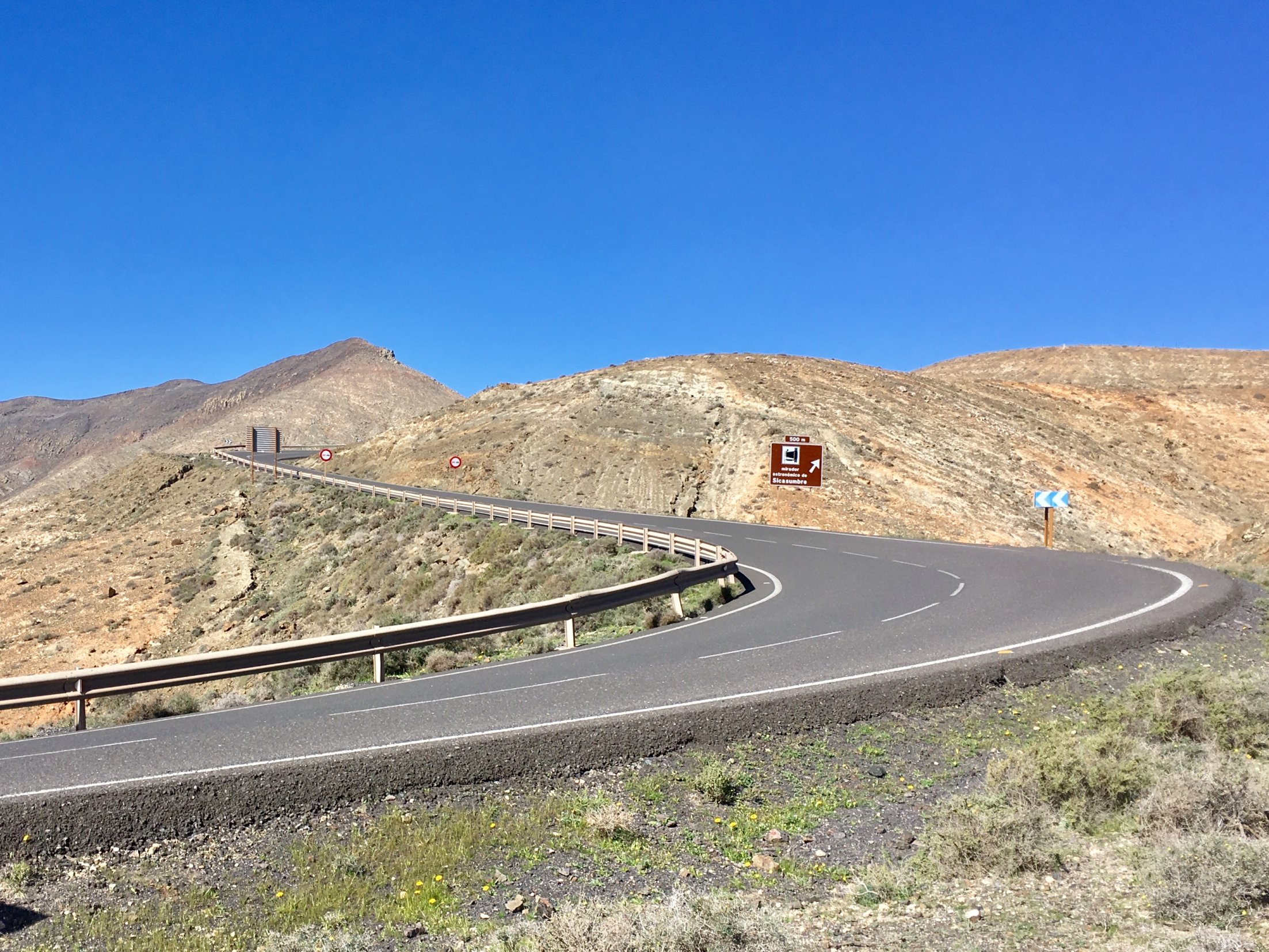
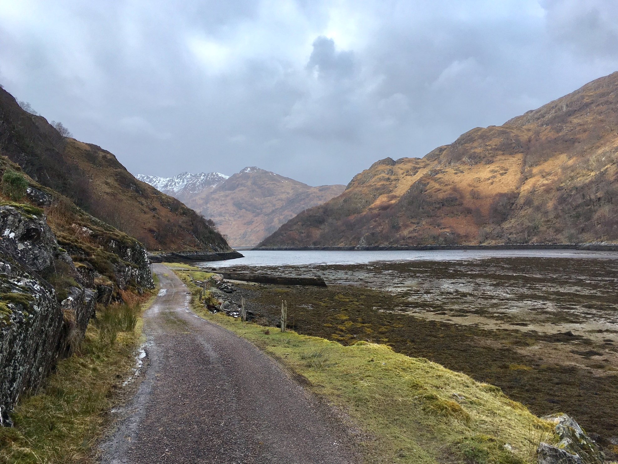
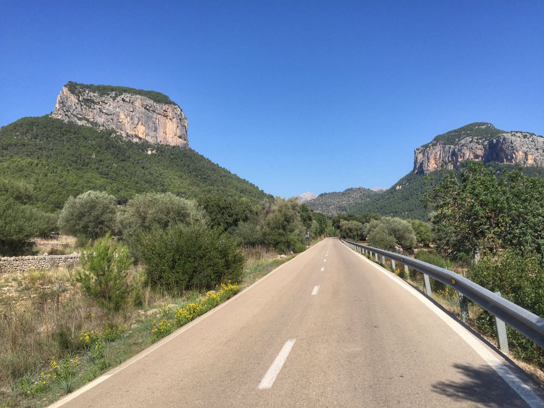
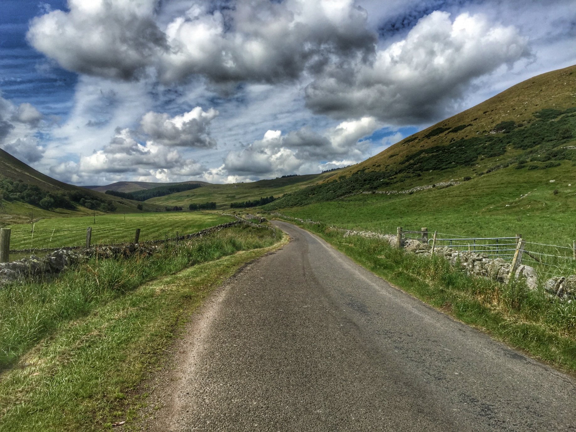
Glen Clova

The top of Glen Clova was still a few more miles to the north and it was our plan originally to go as far as the road would take us. However, in view of my circumstances and the overcast weather spoiling the views, we decided to just head back. We took the road on the east side of the glen for our return journey, and quickly found it was much easier going with the wind behind our backs.

We must have been going almost twice as fast on our return, which took a slighlty shorter route that ended by skirting the edge of Kirriemuir before reaching the RSPB reserve from the other side.

With the ride over, we headed for our hotel, where I had a long soak in the bath to soothe my aches and pains. We then headed for the bar for some drinks and another lovely meal.

Day 2

My night’s sleep wasn’t perfect, but it could have been a lot worse. I awoke still stiff, but definitely ready for another day’s cycling. I was also ready for breakfast, which was a generous full Scottish version with a big plate full of sausages, egg, bacon, haggis and black pudding. We all indulged in that, albeit in differing combinations, that also included tomato, mushrooms and beans. Fantastic, but I couldn’t manage it every day!

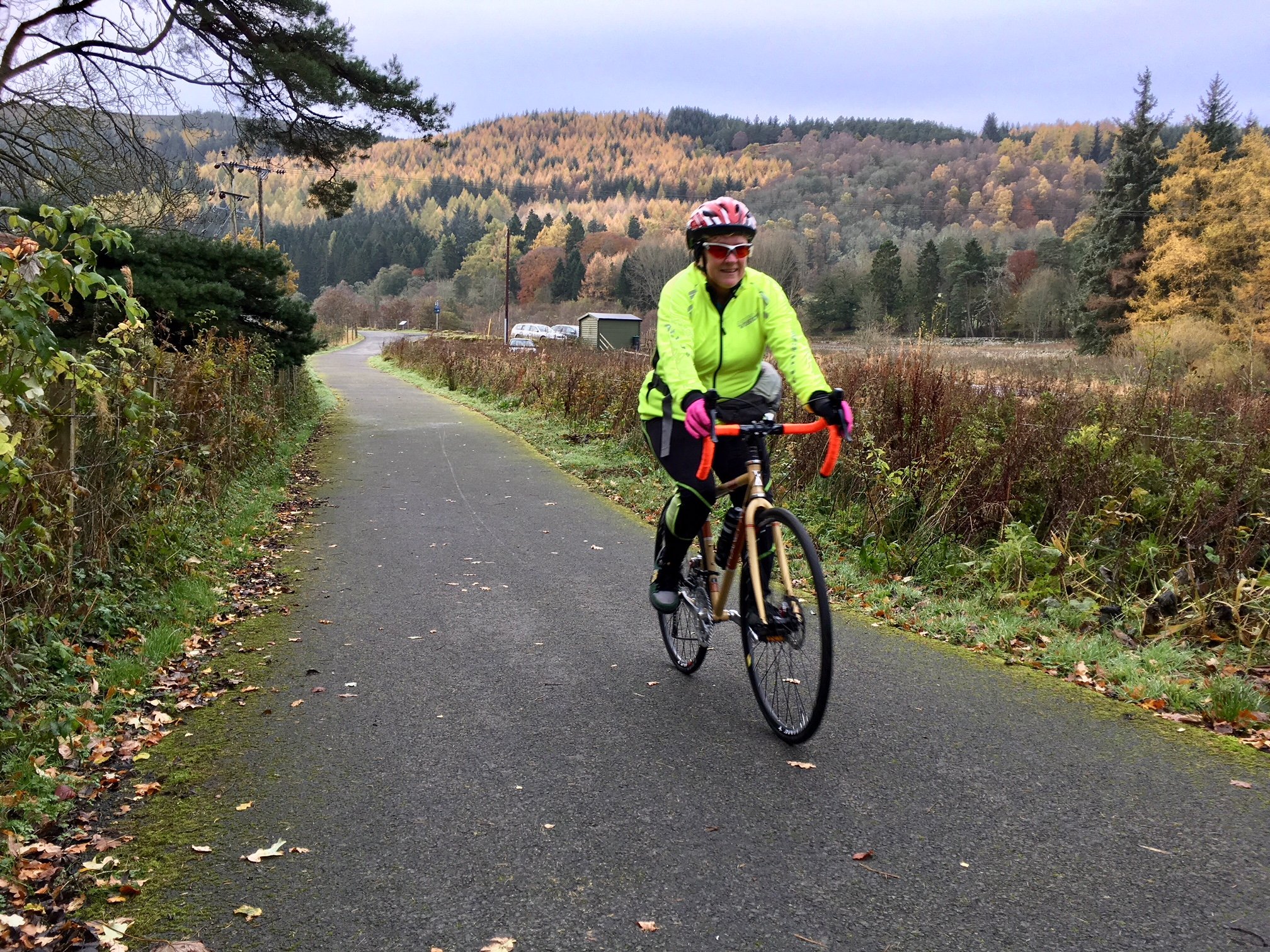
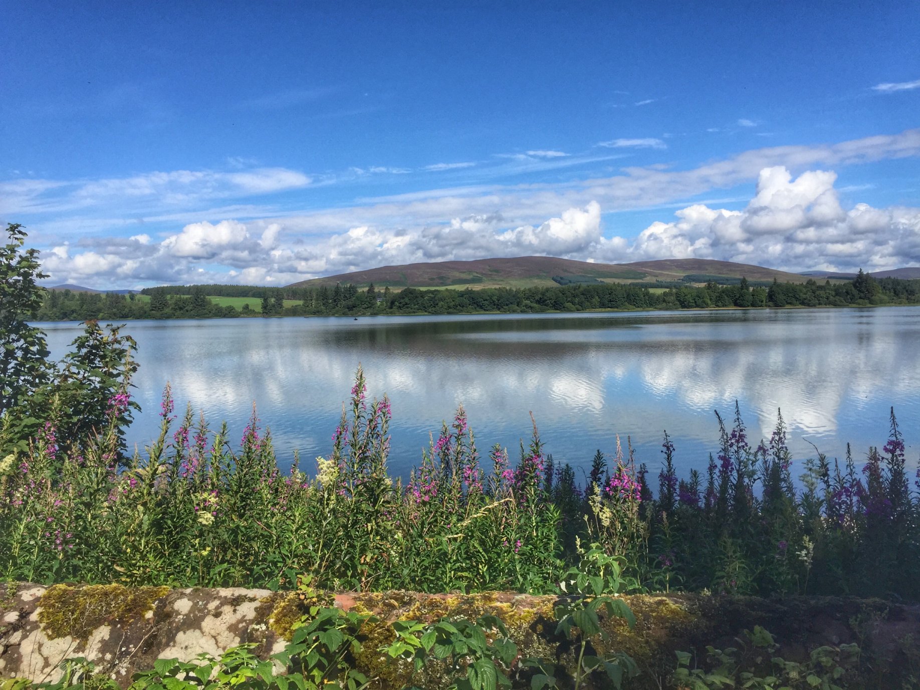
For day 2, I had planned a half-day’s cycle, ending in lunch followed by the drive home. The start point was a few miles out from Kirriemuir at Loch of Lintrathen. We parked our cars in a suitable opening at the side of the road, then quickly got going, passing Peel Farm a few minutes later, which would be our lunch stop later, after first riding a loop of Glen Isla.

It was just as dull as the first day and almost as cold, but with a little less wind and no rain, it felt marginally warmer. There were also quite a few hills to get up close to the start, which meant we weren’t exactly feeling the cold.

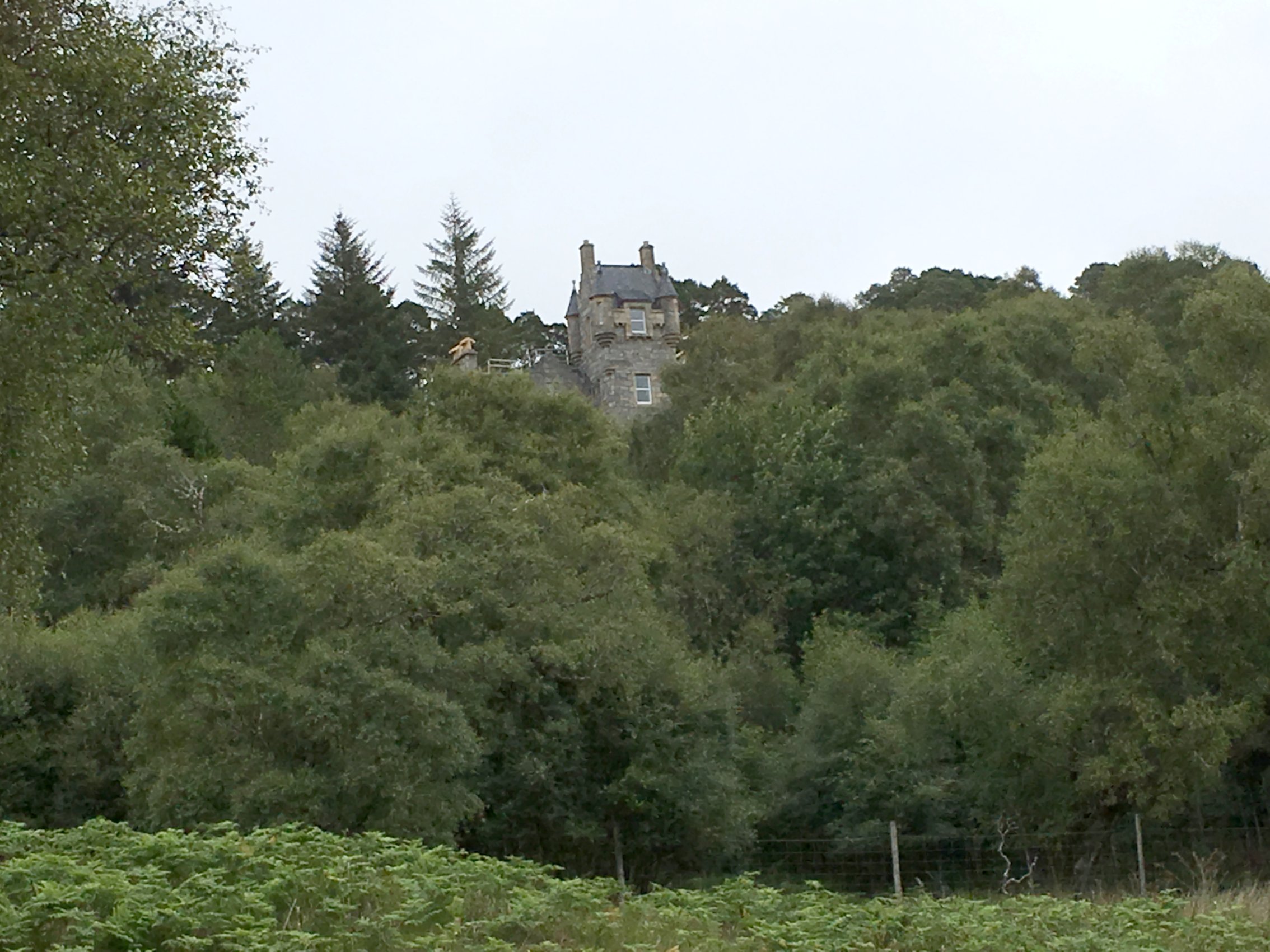
We turned right at Formal farm and rode north for a couple of miles before turning left onto the Glen Isla road. It was a little flatter here for a while, as we rode towards Kirkton of Glenisla. The hotel there was still closed, as we had found it last time, though our host at the hotel suggested that there might be some moves to open it up again.

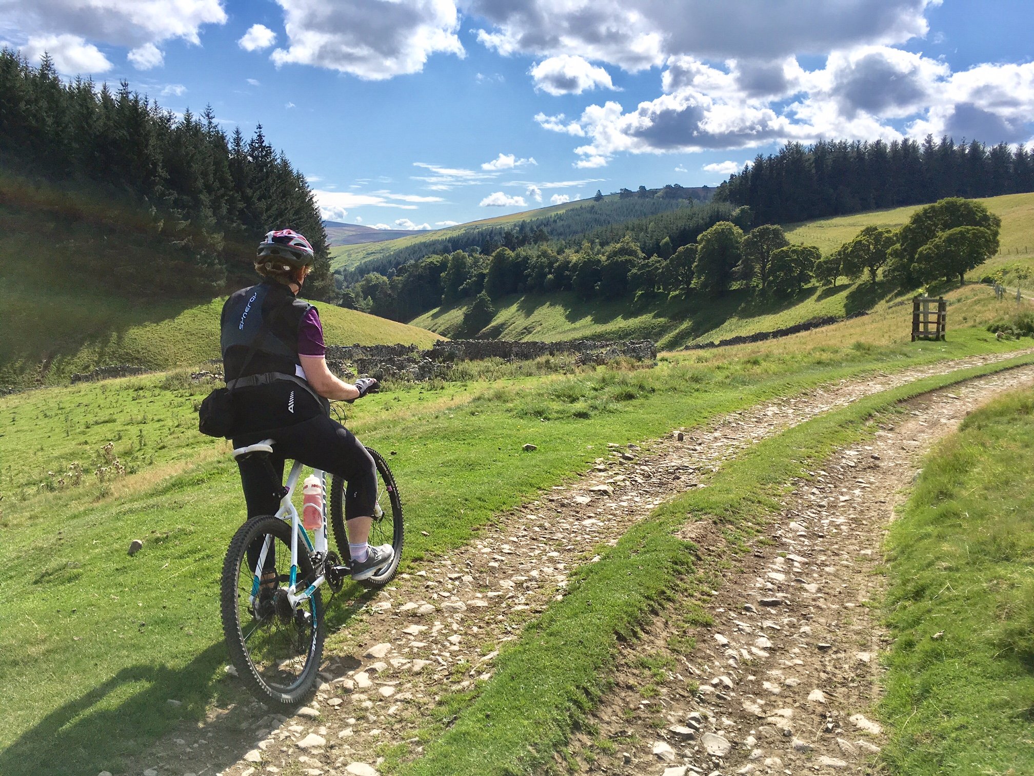
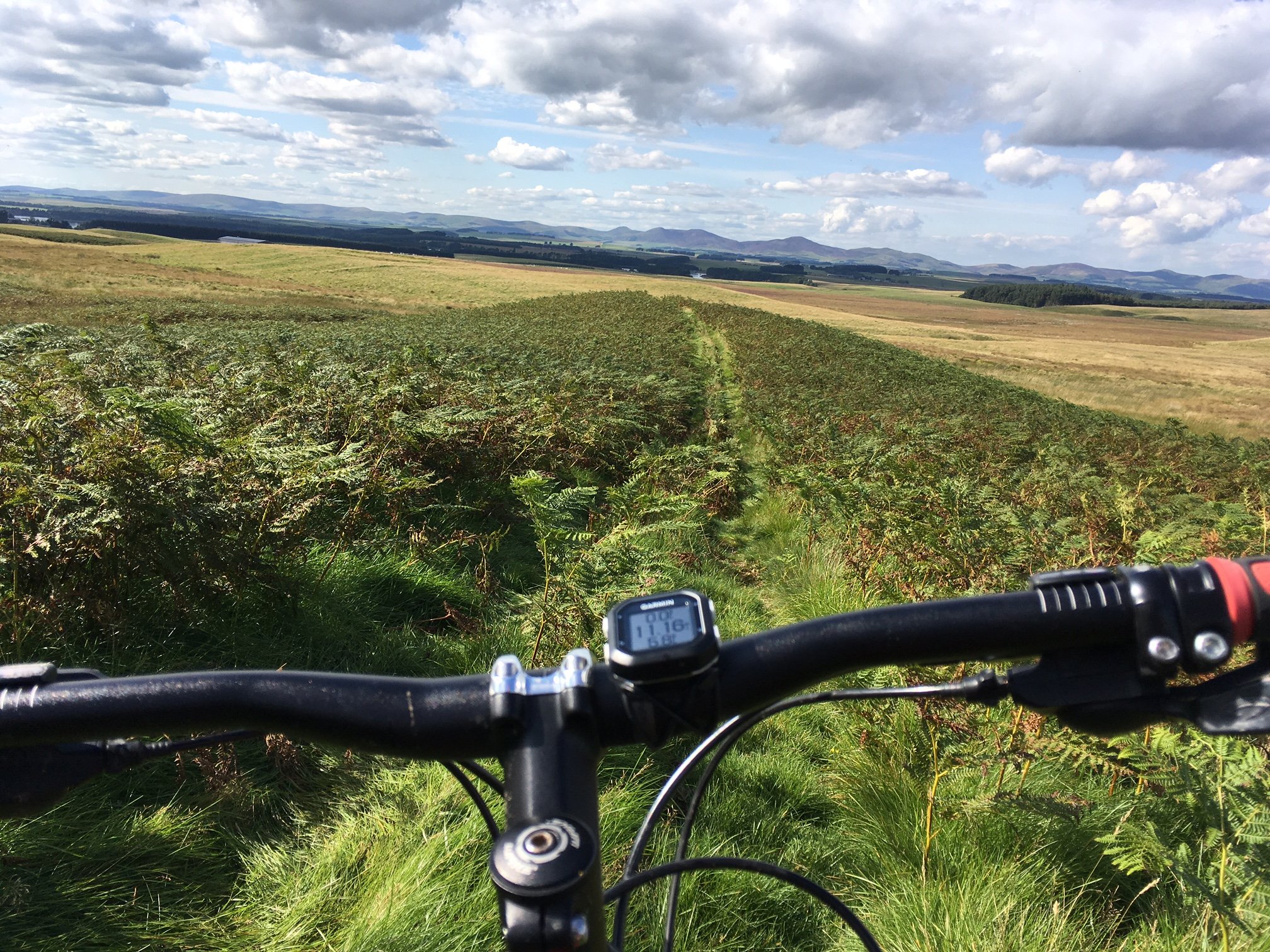
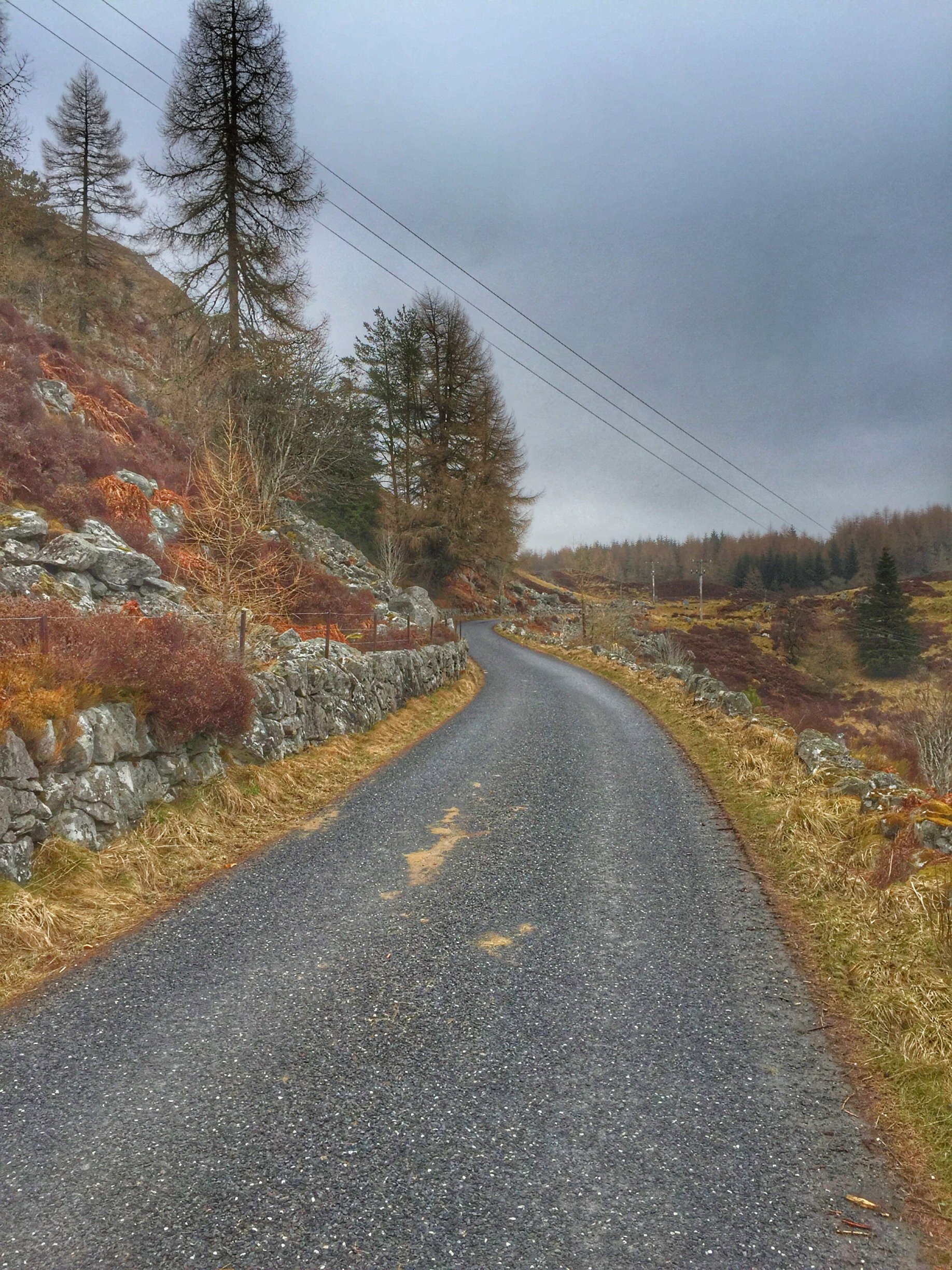
On the positive side, there is a public toilet in the village, which came in handy. While Keith and I paused in Glenisla, Colette and Lynne forged ahead, so we didn’t catch them up again for another mile and a half, where they were waiting on a bridge. We turned left there, away from the main road, then right, taking us onto a minor road that climbed for about 2 miles. The climbing was eased by the friendly gradient and the wind at our backs. It was definitely one of the type 1 enjoyable climbing experiences (i.e. that is fun at the time, rather than type 2 fun, that you only enjoy in retrospect).

The views would have been magnificent on a good day, but were muted by the overcast sky. Even so, we stopped a few times for photos on the descent that followed, which took us out at Blacklunans. We propped up the bikes close to the gates of the country house and sat on the wall to have a coffee stop, having previously refilled our flasks at the hotel. And what’s more, Lynne still had four truffles left. Result!
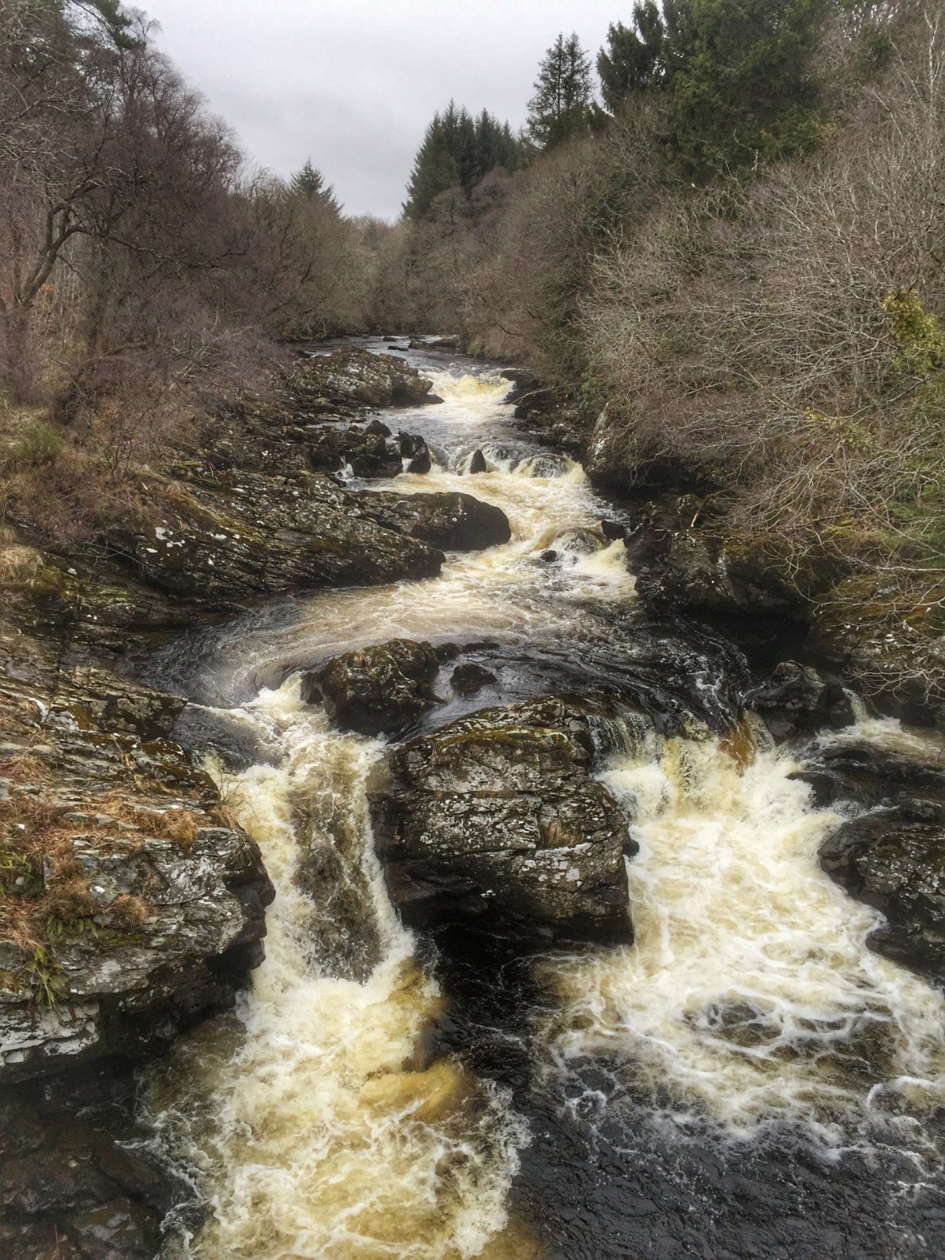
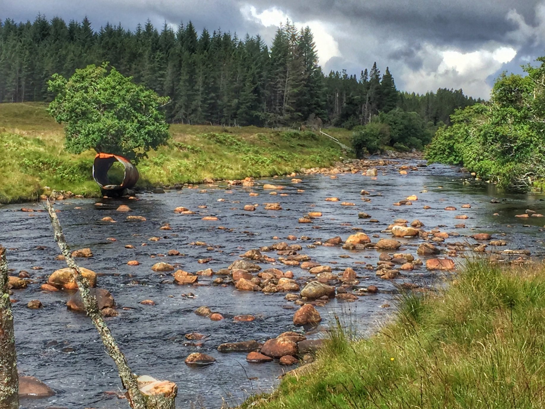
Black Water

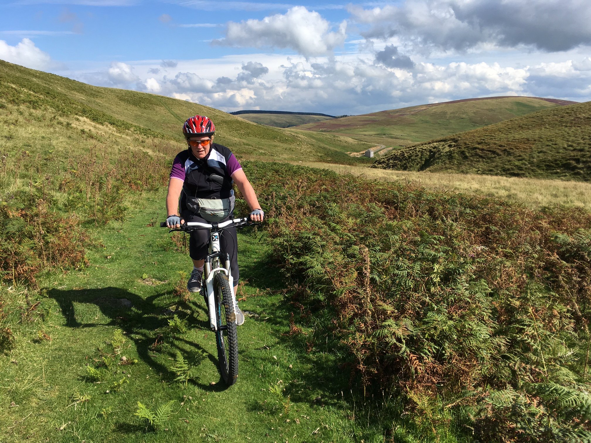
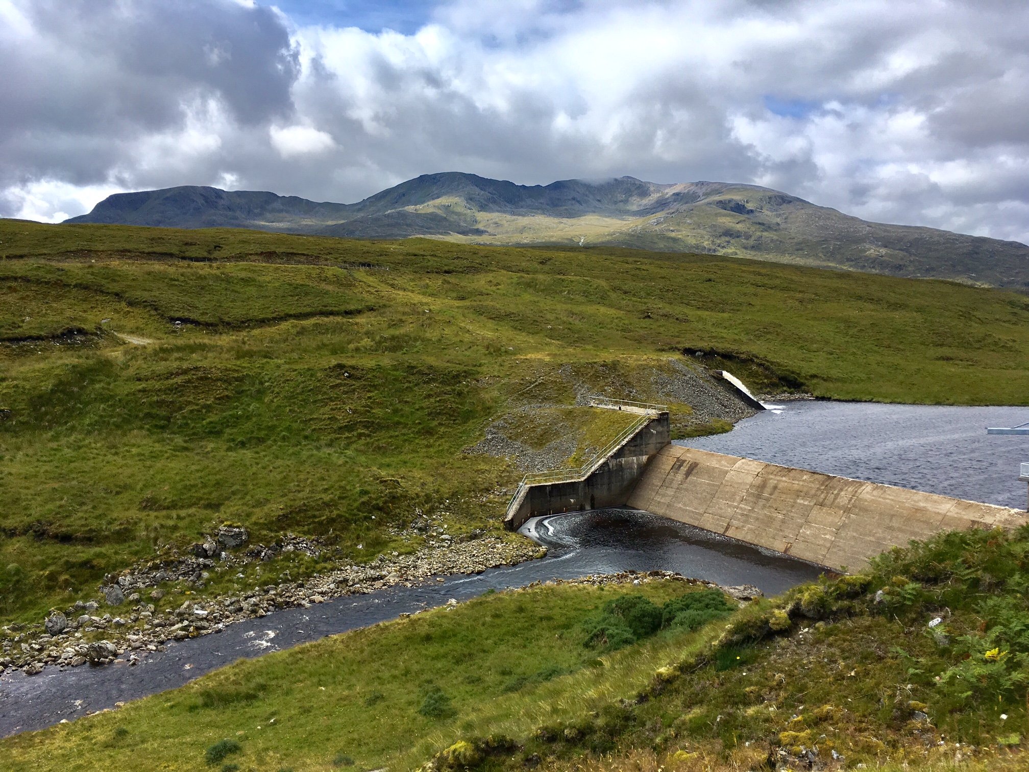
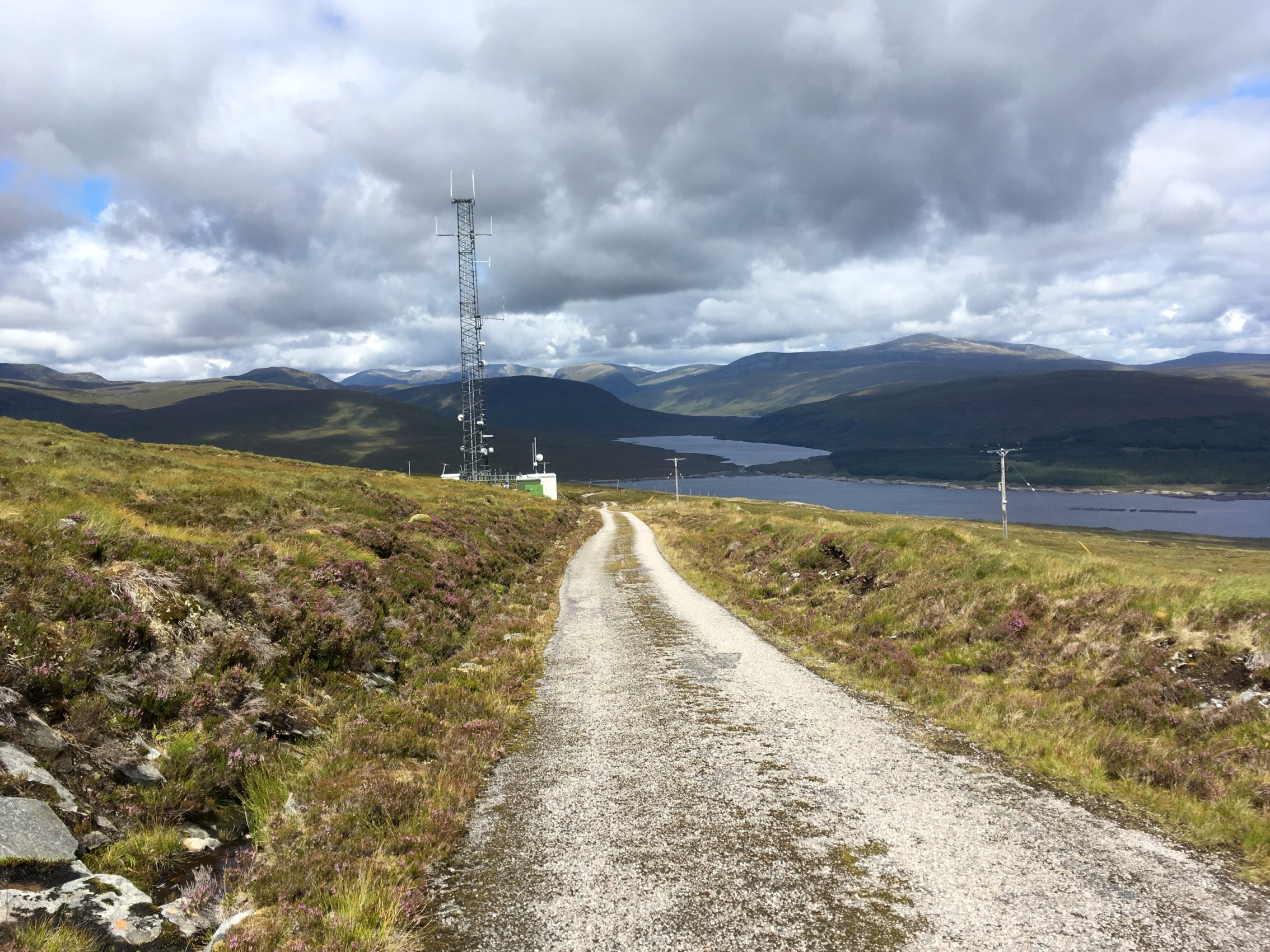
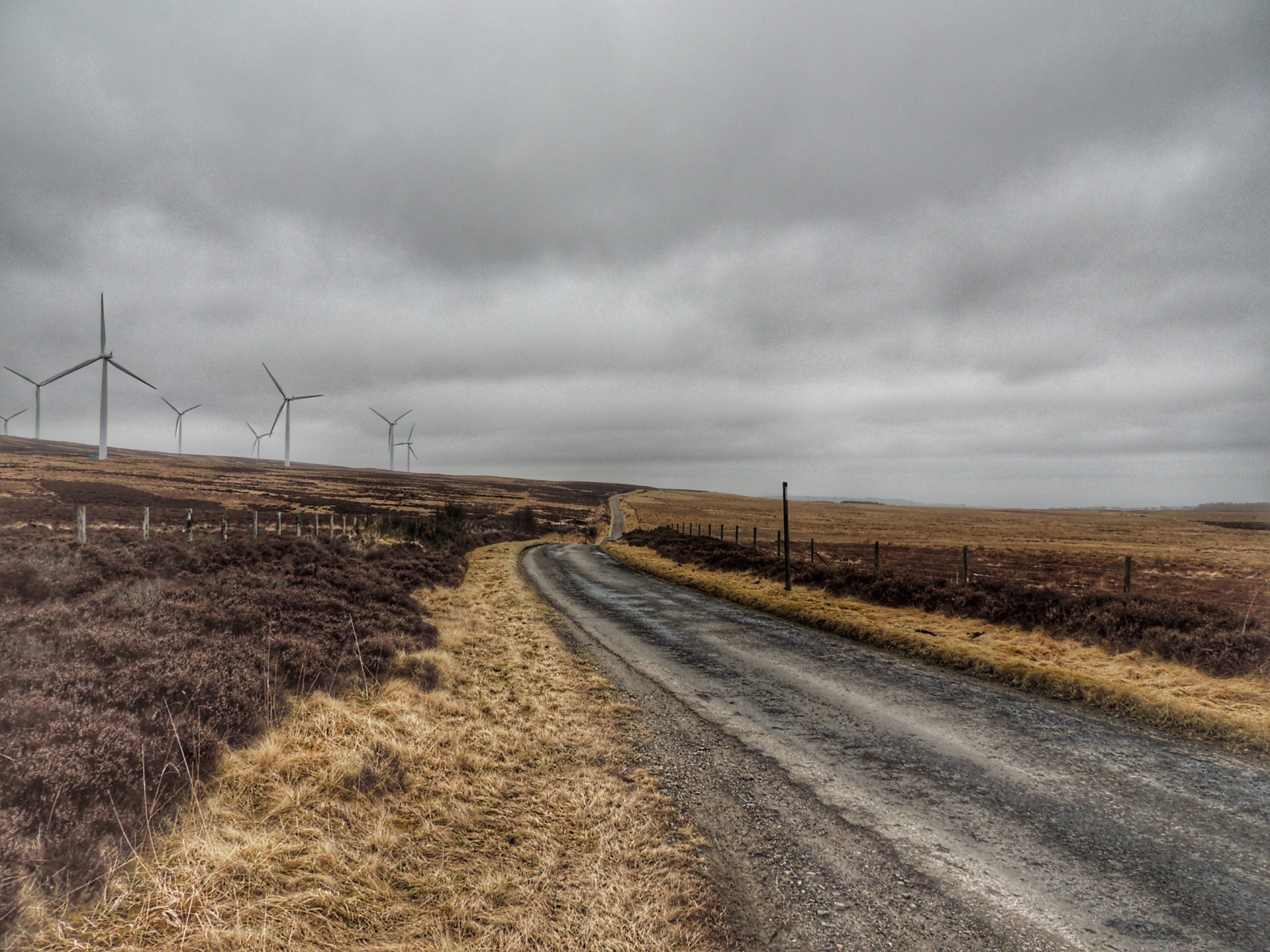
Moving on, we joined the A93 Glenshee road for a short while, before turning off left near a place called Bleaton. There was a great view from the bridge of a river cascading down the rocks. Stopping there gave us a wee breather before beginning a stiff climb that took us away from the valley, with a little easement in the gradient halfway, before the climbing continued all the way to about 1200 ft, bringing us out onto a windswept moor, covered in wind turbines. More like a type 2 climb, that one!

The installation of turbines was still ongoing, as we could see when we were stopped by traffic police and told to squeeze onto the verge. Shortly afterwards, two oversized lorries trundled past on the single track road, carrying massive pieces of a wind turbine construction kit.

At the end of our descent, we turned left through forest for a short while before coming back out into farmland. There was another short descent, followed by yet more climbing to take us back to Peel Farm, where we stopped for lunch. The soup was great, but there were some rumblings in the ranks about being given sliced white instead of homemade crusty bread with the soup. The place was really busy and they had run out. Ah well, we need to be faster next time!

A short half mile or so further on took us back to the cars and we were soon heading home, doing our best to follow the sometimes ambiguous instructions from the sat nav.

It had been a great couple of days cycling, despite the weather and my little mishap. The stay at the Airlie Arms was also a highlight, where the young staff were so friendly and helpful, and the food was spot on. That will surely be the last of the off-season Groupon deals for a while though, as summer will be along soon. Allegedly.


Posted in Uncategorized | 2 Comments

10 March 2018 – Fuerteventura adventure

In an attempt to escape the Scottish winter, Colette and I, along with four friends all booked a holiday for us and our bikes in the Algarve. Checking the weather forecast on the weeks running up to the holiday, it looked lovely and warm and sunny. However, it all went wrong just in time for our departure, due to the combined efforts of the Beast from the East and Storm Emma. We ended up with icy weather and snow in the UK, while Portugal had wind and rain. Not much better than home, but at least it would be a holiday, and there were some dry spells forecast to take advantage of.

Despite the snow, our flight was still scheduled to leave, so we all travelled to the airport during the red weather warning, got checked in and were about to board, when all flights were cancelled and we were sent home.

What a bummer, but maybe there was a silver lining, as we could now rebook a holiday to somewhere with a better forecast. Lynne took on the challenge that same evening, and we ended up with a week’s holiday in Fuerteventura (Costa Calma) leaving just a few days later.

Not knowing anything at all about the island (one of the Canaries), I looked at the map and found some nice wiggly roads near a place called Betancuria. That would be quite a long ride (60 miles) with lots of climbing, so I wasn’t certain that all would be in favour of attempting it.

Our hotel (Costa Calma Beach Resort) was all inclusive – the first time Colette and I had tried that. It didn’t have any specific bike facilities, but luckily the room was big enough to store our bike bags without tripping over them, while the bikes lived out on the balcony.

After a few days of exploring, we decided to take on the big ride on the Saturday of our stay. It was an early start, as we needed to be back by about 7pm when it would start to get dark. I reckoned on a 6.5mph average speed being necessary, including all stops. Not too taxing by the sound of it, so we wouldn’t need to rush up those hills.

So off we went, on a typically warm and sunny morning, heading north from our hotel and past the Hotel Rio Calma, with its distinctive spire, which marks the northern-most part of the town. From there, we descended to the next roundabout, taking the exit signposted for La Pared, where the road runs west under the busy FV-2 dual carriageway.

This road was fairly quiet, taking us gradually uphill towards the west side of the island, which is only a few miles wide at this point. The gradient then increased a bit, till we reached the top and had a great view of the west side of Fuerteventura, with mountains reaching down towards the sea and waves crashing onto the rocks at the edge of the land.

There was a quick descent towards the turnoff for La Pared, marked by a burnt-out car proclaiming the town to be “surf city”. We didn’t visit the town this time, but kept our momentum to help us up the short, steep climb on the other side.

After rounding the next corner, we were basically at the foot of the first mountain climb of the day, heading towards the Sicasumbre pass. The road undulated a bit to start, but gradually built into a steady climb, where the gradient got steeper as we went.

We had agreed that we would be sensible and stop to eat and drink every 5 miles or so, to keep the energy levels up and stay hydrated in the arid heat. After the first stop, Alison and Fiona decided to go carry on and not stop to the top of the climb up Sicasumbre, so we became quite spead apart on the road, each going at a pace that we found suitable.

That gave plenty of time to look around and take in the surroundings. The sandy landscape in which we started had given way to a more volcanic look, with the jagged summit of Montana del Cardon to our right making an impressive landmark. There was very little growing in this dry landscape, save a few low, scrubby plants. Ravens and the occasional vulture could be seen circling high above, giving the feeling of being way out in the desert, far from civilisation.

Nearing the final corner to Sicasumbre summit

The final push to the summit was the hardest part, with a final corner to be rounded before the top came into view. There was a car park and a walkway to the very summit, which apparently gives an incredible view. I was more concerned about snacking on my banana, which I had taken from breakfast, and replenishing my fluids.

After reassembling the group, we headed back down the other side, where the gradient was much more pronounced. There was also a swirling wind which caught me by surprise, so I took it easy on the descent. Keith wasn’t so easily put off, and shot past me, enjoying it to the full.

At the bottom, we ran into another climb; a mini-one compared to the previous one, but it still took some effort. From the top of that however, it was pretty much all downhill to the town of Pajara, where we were planning to stop for a coffee.

Flan!!!

After a couple of false starts, we found a cafe that did cake, and ordered coffee and eats. Colette was delighted to find some delicious flan (similar to creme caramel), and ended up with a massive portion, which she reluctantly shared with me. Others ordered cheesecake and chocolate cake, and were similarly impressed.

As Lynne (holder of the coffee kitty) was dealing with the bill, I went off and bought some water to top up our bottles. It turned out that 3 litres wasn’t quite enough, so my bottles only got topped up a wee bit. I wasn’t too worried, as the next stop, Betancuria, wasn’t far away, although there was a mountain to climb on the way.

Leaving Pajara, we found the gradient to be not too taxing. Coupled with the wind at our backs, it gave the impression of a fairly easy climb. With her upright riding position, Lynne got the most wind assistance, and couldn’t help herself from riding off ahead of the group with a little shout of joy!

As we progressed, we found ourselves riding round the inside of a huge bowl in the landscape, with fingers of rock lining the bowl, so that we were riding round the knuckles. Lynne kept disappearing from sight, then reappearing again as she rounded the next finger. We were glad that we were riding this road from south to north, as we got to hug the mountainside, rather than ride close to the drop on the other side of the road.

Feed me!

We stopped once we reached the top of the pass of Degallado de los Granadillos, where there was a large car park and various info boards, as well as a spectacular view of the surrounding mountains. Here, people were feeding the wildlife, with Barbary ground squirrels and ravens taking food from hands. Colette couldn’t resist, so I gave her part of the emergency sandwich that I was carrying. It should be pointed out that there were signs saying not to feed the wildlife, although they didn’t seem to complain about it!

Fiona outside the church

Next stop was Betancuria, so we headed downhill with thoughts of lunch. It wasn’t long before a village appeared, too soon to be Betancuria, but we paused for a short while when we spotted a very picturesque church (the Ermita de Nuestra Senora de la Pena). There was a wedding in progress, and as we stopped, we were treated to a rendition of Ave Maria sung by the priest drifting melodically from the church across to us at the other side of the village square.

Moving on, it was obvious that this area was much greener than the rest of the island, being higher and in the lee of mountains, it must get more rain. We even saw grass growing at the side of the road, as well as various wild flowers.

An undulating three miles or so took us as far as Betancuria, where we were on the lookout for a lunch place. The first to be seen was La Casa del Queso (the house of cheese), so we stopped and ordered bocadillas. In retrospect, maybe I should have ordered the fried cheese house speciality, but my filled baguette was perfectly good and I was well refuelled at the end of it. Colette had over ordered a bottle of water at lunch, so I used it to top up the supply on my bike. We all had enough now to see us to the afternoon coffee stop.

By this point, we were lagging a little behind our 6.5mph average speed target, so I suggested we get a move on. That saw us leaving the town and immediately embarking on the final mountain climb of the day. The Morro Velosa climb was only about two miles long, but it was steeper than the previous one. It also snaked around the contours of the mountain in such a way that much of the road was hidden from view at any one time. However, I did catch sight of a bus near the top of the mountain, driving up an impossibly steep gradient. That really made my heart sink, so I tried to put it from my mind and concentrated on the bit of road immediately in front.

Looking back on Betancuria from halfway up the climb

Before long, Betancuria was way below us, as we persevered towards the car park and viewpoint, stopping alongside some statues, where there were great views to either side of the pass. We had climbed to around 1900 ft, the highest point in our holiday, but we couldn’t help looking in horror towards the really steep part of the road to the east, apparently rising to the very top of the mountain. Worryingly, we couldn’t work out whether or not we needed to ride up that part.

View towards the north of Fuerteventura

There was only one way to find out, so I led the procession over the brow of the hill. After a short while, we were relieved to find that the steep climb to the top was optional, leading to a visitor centre, while our road continued on a downward trajectory all the way to the bottom. The road surface here was quite rough, possibly purposely so, to aid grip. All it did for us was cause discomfort, so I took it easy, while Keith forged ahead as usual. After some way, the surface returned to smooth asphalt, so I loosened my grip on the brakes and enjoyed the rest of the ride to the junction at the bottom.

At this point, we were just over halfway into the ride, with all the major climbs over, and now ready to head in a southwesterly direction, back to Costa Calma. We enjoyed a lovely long freewheel all the way into Antigua, which helped bring us back on target for our average speed. I was still keeping a close eye on that, which left me open to some good-hearted teasing from the others. At least I was confident that we had ample time for an afternoon coffee break, which we had planned for the next town of Tuineje.

Getting to Tuineje wasn’t all downhill however, and when we were presented with a stiff 13% climb, our already tired legs started to complain! There was also a strong side-wind to contend with, which made things occasionally quite scary, especially when it hit you during a fast descent.

When we arrived at Tuineje, we were horrified to find that the whole place was closed down, with not a single cafe open. Some of us had run out of water completely already, so there was a bit of sharing out of water between bottles so that we all had enough to see us to the next town, La Lajita, on the coast about 14 miles further on.

Although the road descends overall, there were still a number of significant undulations to deal with, along with the wind, but there were also some lovely descents to be enjoyed as well, despite the tiredness. When we arrived at the cactus roundabout leading to La Lajita, Alison asked whether we should just carry on, as our hotel with its unlimited refreshments was only a few miles away in Costa Calma. It seemed like a good idea, so on we went.

Unfortunately, we had no option other than ride on the main FV-2 for this part of the route. The road was busy, so we kept to the verge of the road, beyond the white line, taking care to avoid the cats eyes. We went past the animal park, after which the road rose steeply. There was a crawler lane on our side of the road, which meant that cars could give us a wide berth, but it seemed to be rush hour, so both lanes were busy with fast moving traffic, making it quite unpleasant.

The climb was mercifully short and once at the top, we stopped at the side of the road, waited for the traffic to clear, then ran across with our bikes to the other side, where we could join the old road beyond the crash barrier. The new FV-2 continued to Costa Calma as a dual carriageway, allowing us to take the old road with virtually no traffic, save the odd tourist checking out the Mirador de Sotavento viewpoint.

The familiar spire of the Rio Calma hotel could now be seen, meaning there were just a few undulations between us and a cold drink. Colette and I made up the rear, but the others were still waiting at the hotel entrance when we arrived, with high fives all round. A quick shower later, we all congregated on Lynne and Keith’s balcony for overdue drinks. That was the big one, and we’d all made it. Cheers to us!


Posted in Uncategorized | Leave a comment

20 February 2018 – The road to Kinloch Hourn

Several months ago, Colette spotted a great deal for dinner, bed & breakfast at Letterfinlay Lodge. The drawback was that it had to be taken off-season, so we booked for 20th February and kept our fingers crossed the weather would be ok. Well, we were in luck, as it was a clear, sunny day with no frost, a light westerly breeze and no rain in the forecast. That meant we were on for a full-on day of cycling, so I decided that we should tackle the road to Kinloch Hourn.

The road in question starts a few miles west of Invergarry, and is notable for being the longest cul-de-sac in Britain, at 22 miles each way. No clever circular routes for us today, it was going to be straight there, turn around and retrace our steps back.

I had envisaged it to be a deadly quiet road, where we were unlikely to see another soul, but I was proved wrong straight away, as two logging lorries rolled past just after we parked in the lay-by at the start of the road. We were joined by Lynne and Keith, who also liked the sound of the Letterfinlay deal and were looking forward to this excursion into the unknown.

We all set off down the single track road shortly after 11am, finding it a bit potholed to start with, which was a little worrying. However, it started looking a lot better after that, and in fact a lot less broken up than the roads at home. The surface was very grippy, with a texture reminiscent of rough sandpaper, which must help when there is ice and snow around. There was no sign of that thankfully, although there was still lots of snow on the mountains around us.

We cycled west along the shore of Loch Garry for a number of miles, then the road started to climb gradually. The bright, clear weather and beautiful scenery meant we had numerous photo stops as we made our way westwards.

After a few miles, we passed a semi-felled forest, with impressive tree-stripping machinery and banks of logs stacked up to the size of terraced houses. We didn’t have to worry about any more logging lorries after that, though there was still the odd estate vehicle and a fair few tourists, and while there’s no way it could be described as busy, it was more than I had expected.

Further on, we stopped at our first sight of deer close to the road. We came across quite a few groups of the beasts, all female at this point. We wondered where all the boys had gone.

Loch Quoich

Nearing Loch Quoich, we started climbing steadily, as we approached the dam wall. We passed on the right side of the dam, pausing for a while before climbing a little more to reach a car park and viewpoint looking west along the loch. It was such a wonderful view. One of the drivers offered to take a group photo of the four of us, declaring that we must be mad. Well yes, it was cold out and it was nice and warm inside her car, but we were well wrapped up and having a great time.

Speaking of time, it was getting on for lunch time and we still had quite a bit of ground to cover, so we came up with a cunning plan: Keith and I would crack on, then stop a few miles short of Kinloch Hourn and get the kettle on. In the meantime, Colette and Lynne would follow on, stopping for as many photos as they liked.

So Keith and I carried on along the loch, crossing a substantial metal bridge over an inlet of the loch, and stopping round the next corner when we ran into a group of stags. So this is where they were hanging out. I didn’t bother trying to take any photos, as I was sure that Colette and Lynne would be taking plenty when they got here.

Carrying on, we left the loch behind as the road became more steeply undulating. We were heading towards the highest part of the ride, and it was certainly looking like we were heading through a mountain pass. We started looking out for a good place to stop, choosing a spot with a nice big rock to shelter us from the now stiffening westerly breeze.

I got the spirit stove out, filled the kettle and started brewing up on a bed of damp sphagnum moss sheltered by the rock. Not being on solid ground, the whole kaboodle had a tendency to keel over, so I had to keep an eye on it for the whole process. Boiling took a long time, but not before Colette and Lynne rejoined us. We then were able to have our packed lunch with a nice hot cup of tea.

At this point, there was another decision to be made. In order to reach Kinloch Hourn, the map shows a steep descent to sea level, followed obviously by a steep ascent to get back over the pass. That sounded just a little too much for Colette and Lynne, so they decided to turn back at this stage, while Keith and I carried on towards the sea.

There was still a little bit of climbing to do before we got to the highest point. We paused there briefly and had a look. A couple of surveyors were there holding up poles, one close to us and another further down, a lot further down. The road fell away steeply as far as we could see, which was just as far as the next corner. Keith asked if I really wanted to do it. I said absolutely, and off we went…

Since the road was steep and quite twisty, with occasional potholes, we needed to lean on the brakes heavily. I was glad of my disk brakes. The descent just seemed to go on and on. I was reminded of the descent to Sa Calobra in Mallorca, where you descend over 2000 feet to the coastal village, from which the only way out is back up those 2000 feet. The trick is not to think of the ascent to follow and just enjoy the ride!

For the final part of the descent, the road runs alongside a fast-flowing river crashing down a rocky bed on the right, with beautiful Scots pines alongside the river and a steep rock face to the left. Then, all of a sudden, the road becomes completely flat, taking you into Kinloch Hourn.

We passed what looks like a new house being built on the left, then a sturdy stone-built steading on the right, which is used as a B&B and tea shop in the summer season. From there, the road ran a short distance further, past a car park overlooking the head of Loch Hourn.

The end of the road for us

Unfortunately for us, there was no loch to be seen, as it was low tide. There was just an expanse of sand and mud, with the river snaking its way through. We continued along the road to the next bend, which opened up the view just enough for us to glimpse the sea, as well as the end of the tarmac road, where it turns into a rough track. After that, I felt that we had gone as far as we should, then turned around, waving to the nice lady who took our photo earlier and was now in the car park.

Meanwhile, as we had been descending the mad road to the sea, Colette and Lynne were making good headway on the return journey. They were enjoying watching the red deer as they rode past, and stopped near a house to talk to some hinds that were close to the road. The deer ended up moving right in and took food out of their hands, which must have been amazing. The fun stopped when a dog walker let her dog off the lead and then chased the deer away.

Treats for the (not so) wildlife

At that point, a lady appeared from the house to give the dog walker a good telling off for not keeping her dog under control. This was lucky, as Colette was running low on water and the lady kindly topped up her bottles.

Back at Kinloch Hourn, Keith and I began the climb back away from the sea with some trepidation. The hill looked so steep, but we got down into lowest gears and gave it a go.

Keith coped a bit better with the climb than me, but even he had to get off and push when the gradient got brutal – as much as 30% in places, according to the Bikehike mapping app. Luckily there were only a couple of short stretches that steep, but even so, the progress was very slow.

Finally, we got up as far as the first surveyor, who said something like “It’s almost here” as I passed. It wasn’t until I felt the first few drops of rain that I realised what he was on about. That soon became a proper shower that persisted for the rest of the climb and for a mile or so down the other side.

Keith was now pulling away from me and I was having great trouble keeping up. What I didn’t realise was that he wasn’t wearing a waterproof, having believed the forecast that it would stay dry. He was feeling cold and wet, so that was why he was pushing extra hard up the hills, in order to generate more body heat to stay warm.

I wasn’t without my own problems too. Firstly, I was having trouble looking out of my rain-spattered specs, but more annoyingly, my back was sore, most probably from the heavy rucsack on my back. I was also feeling depleted of energy, so it was good to have a stop when we reached the Loch Quoich viewpoint again, where Keith fed me a good slab of Lynne’s home made flapjack.

The combination of the rain stopping, hitting some good downhill to rest my legs and the flapjack working its magic seemed to rejuvenate me somewhat. The westerly breeze was also helping us towards our destination, and the reappearance of some warming late afternoon sun was very much appreciated as we completed the final miles of our journey back to the car.

I kept thinking we might catch up with Colette and Lynne somewhere, but it wasn’t till we got back to the car that we saw them again, having arrived just a minute before us. Our cunning plans seemed to work out perfectly.

We were all tired, but in that satisfying way after completing a good challenging ride. It was only a short drive in the car till we arrived at Letterfinlay Lodge for our dinner, bed and breakfast. The staff were lovely and it was hard to find fault anywhere. We had the bonus the next day of the most magnificent view across Loch Lochy with the mist burning off in the morning sun.

Our final bonus was fitting in an extra ride along Loch Arkaig before our long drive home. Scotland at its finest – it’s hard to beat.


Posted in Uncategorized | Leave a comment

21 January 2018 – Ski Sunday

This January has seen us have to call off so many cycles, whether due to ice, snow or high winds. We only got a handful of rides in, so were spending a lot of time on the turbo trainer in the land of Zwift.

With snow thick on the ground for a week, Colette and I went out for a walk, deciding that it might be an idea to look out the kids’ old sledges and have a go down the hill as an alternative to cycling. Son Oliver and his partner Kirsty joined in and found it a lot of fun. Then Oliver decided to dig out his skis from the basement, last used when he did skiing with the high school. We made a date for the next day to try them out on a hill nearby.

The bike could stand up by itself in the snow!

I also got my mountain bike out and decided to join them on two wheels. It was actually quite safe to ride on the virgin snow, although further into the village where it had been flattened by cars and frozen into icy ruts, it was more tricky. Luckily we were heading away from that into fresh snow.

At the top of the hill, we tried out the sleds first. That gave an exhilirating, though bumpy and bruising ride to the bottom of the slope. The child-size sledges were not ideal, so we should remember to buy a bigger one for next year.

Oliver got himself into skis for the first time in maybe 12 years and set off down the hill, not really sure how it was going to turn out. But straight away it was clear that he hadn’t forgotten a thing – like riding a bike, and he sailed off gracefully down the hill; not straight down, but more diagonally, tracing a wide arc with his skis. With a shout of delight after coming to a halt on the plateau below the slope, he was instantly thinking about booking up a skiing holiday!

Colette looking the part, ready for action

The other three of us were novices, but still took a couple of turns each on the skis, just to try it out. My first run wasn’t great, ending up sliding down on my back, but on the next go, I managed to stay upright, just, and got as far as the flat ground, rapidly approaching an array of frozen mole hills sticking out of the snow. I managed to glide through miraculously without hitting any, then executed something resembling a turn before it all got too much and I fell over in a tangle of legs and skis. It was good fun, and if it wasn’t for the overwhelming feeling of being totally out of control, I would have gone for another try.

However, I had brought my bike with the intention of riding down the slope, so I trudged back up the hill to try that. Through drifting, the snow had got quite deep in places, where my front wheel had a tendency to get stuck. The answer was to sit back with my weight behind the (already lowered) saddle, to take as much weight as possible off the front wheel. Then it was a case of just letting yourself go and hoping for the best!

It was fast and great fun, though possibly I wasn’t a lot more in control than on skis. I had a couple of shots and would have done more, but that slog of dragging the bike back up the hill (there’s NO WAY I could have ridden up!!!) was taking its toll.

Heading home for coffee

Then it was a short way back to the house for some hot drinks. It had been an unexpectedly fun afternoon, but sadly not to be repeated as the snow melted the next day. We will be ready for the next time though…


Posted in Uncategorized | Leave a comment

22 December 2017 – Kings for the day

In between spells of snow and ice this December, we found ourselves with the rare prospect of usable day for a cycle. The question was where to go.

On the evening before, as we were driving in stop-start traffic just south of Gilmerton, we caught sight of a line of new street lights heading out to our left. That could only mean that the new cycle path to Shawfair had been completed. So we decided that would be the focus of our ride the next day – to search it out and ride along it.

We set out on quite a mild morning, meaning one or two less layers were required than recently. There wasn’t much in the way of wind either, but the sky was dark and dreary. I suppose you can’t have everythying this time of year.

We headed out of the village via Borthwick, as the A7 north was a no-go, due to the thick layer of mud deposited by NWH lorries leaving the Middleton quarry. From Borthwick, we headed to Gorebridge, and as we neared the houses, we found ourselves being chased by a Doberman. As always in these circumstances, I stopped and got off the bike to show I was a human. Weirdly, the guard dog didn’t bark but just stood its ground in the middle of the road and looked on menacingly. After a respectful wait, we then remounted and rode off very slowly so that it didn’t continue the chase and we escaped unmauled. Phew!

From Gorebridge, we rode on to Bonnyrigg and went straight through the town, towards Lasswade. After Lasswade bridge, we turned left onto the Church Road short cut. That involves a steep climb to the graveyard, which slowed us down a lot. Need more climbing practice!

After the shortcut, it was back into the traffic as far as Loanhead, where we cut through the car park and onto the cycle path at last. It was a relief to get away from the traffic, which was a lot busier than we usually encounter on our rides, but then again, we normally choose our routes to minimise traffic. Today’s ride was all about getting ourselves onto this particular cycle path, which now runs from Roslin, along the disused railway line, through Loanhead and onwards to Shawfair.

We pottered along, slowing for the occasional dog walker, passing under the city bypass till we reached the bridge over Lasswade road, where the path ended before. Now, a black carpet of brand new tarmac stretched before us. It can only have been open for a matter of days, so we felt priveliged to be one of the first to ride along it.

A few years ago, we did try cycling along the same route, through the gravel and undergrowth that was there previously. We got as far as the bridge where the A772 passes above, but had to turn around, as the underneath of the bridge was blocked with cut down trees. No such problem this time – we just sailed through. The path was very slightly downhill, so even without trying, we picked up a decent speed. What we didn’t realise was that there was already a Strava segment for this path, and that we had just become King and Queen of the mountain for our efforts!

At the end of the path, we found ourselves in Shawfair, which is like a new town under construction. The question was where to go from here. After checking the signs, we decided to head to Millerhill, which allowed us to use a roadside cycle path for part of the way. From there, we headed to Musselburgh, where we got ourselves onto cycle route 1, which we followed as far as Whitecraig.

At this point, Colette asked whether we were going to pass a coffee stop. The closest place I could think of was the Restoration Yard in Dalkeith Country Park, so we headed there, via the back entrance to the park.

We spotted a lucky white unicorn as we stopped at the Restoration Yard

After a cuppa and a slice of cake, I was ready for part two, presenting Colette with two choices of ways to go back home. However, she was feeling tired, so we just went for the most direct route instead – i.e. through Newtongrange and back home along the A7.

I was a little concerned how far back Colette was slipping as we made our way back up the main road. It wasn’t till we got home that we realized that her rear wheel had a puncture, courtesy of a tiny fragment of glass.

After uploading and checking our Strava, we were tickled to discover that we were king and queen of the mountain for the new stretch of cycle path. Our reign only lasted a day or so of course, before more people arrived to check out the new path.


Posted in Uncategorized | Leave a comment

08 November 2017 – The drop bar experiment

After a terrifying experience while trying out a drop-handlebarred road bike several years ago, Colette was very quickly convinced that this was not for her. She has been happily riding bikes with flat handlebars ever since, not really seeing any need to try again. However, recently a couple of things have made her think again about giving it another go…

Firstly, when we went to Mallorca on holiday last month, it was hard to find any decent flat barred bikes for hire. The flat barred options were generally heavy and slow, and the only place that had suitable bikes for hire was run by some really unpleasant characters who didn’t keep the bikes well maintained and would curse you in Spanish if you dared to complain. On the other hand, there are no end of suppliers of traditional road bikes for hire, so being able to ride one would make things so much easier when on holiday.

Secondly, after breaking her thumb a couple of months ago, Colette has been finding it sore to ride her usual bikes. The hand position for drop bar road bikes on the other hand is much more kind on the thumb.

We paid a visit to Decathlon and found a bike that Colette seemed to like while in the shop, though it was just a little too big. Unfortunately, the size small was out of stock and not coming back till early December. So that spurred me to build a drop barred bike for Colette to try out. There was an unused Kaffenback 2 frame in the basement, size small, so I decided to buy the parts necessary to build it up into a functioning bike, with the bars raised to a more comfortable position that the average road bike.

A couple of weeks later, after scouring the internet for bargain parts, we had the bike ready to try out. As this was going to be a little nerve-wracking for Colette, we decided to start with a short ride along a flat cycle path, starting at Innerleithen. It was a cold day with a frosty start, so we delayed our departure till the sun was well up. Still, it was only 2 degrees C as we set off, so we were both warmly wrapped up.

Although she was nervous, Colette found the position was perfectly comfortable, and she also quickly got the hang of changing gear with the unfamiliar shifters. However, braking was more of an issue. She found herself unable to generate much force with her fingers on the levers, but luckily we weren’t going fast or down any steep hills.

His and hers… and yes, that orange bar tape turned out to be more luminous than expected!

We reached Peebles and rode through the town before turning across the river and heading back in the direction of Innerleithen on the B7062. We had in mind to have a cafe stop at Cardrona on the way back, but as we passed the entrance to Kailzie Gardens, Colette suggested why not try their cafe. As we hadn’t visited that one before, it sounded like a great idea. Their soups were fantastic, and the coffee was great too, so we will add that to our list and will be back soon. Just a shame it doesn’t open on Mondays.

After lunch, we carried on, firstly going up some sustained uphill, which we all know means that a downhill would follow. That was what Colette was worrying about. Once we reached the top and started descending, I was on the lookout for Colette shooting past, if the brakes really weren’t working for her. However, she found enough oomph in her grip to slow the bike down to a trundle down the hill. The down side was that her hands were now sore, so it was a good thing that we were only a couple of miles away from the car.

At the end of the ride, Colette was pleased with herself for giving it a go, and she felt like a “real cyclist” on the bike. The braking is going to be the big issue to solve though. There are various tweaks that we can try, as well as just keeping on trying till it feels easier and more natural. If, after all of this, she ends up deciding that drop bars definitely are not for her, well at least we will have given it a good go, and I can always use the components from this bike to build up a new one for myself. So whatever happens, it will be a win-win!

Posted in Uncategorized | Leave a comment

12 October 2017 – On holiday in Mallorca

Last week Colette and I went to Mallorca to join a small group of friends for some cycling in the sun. One of the rides I had been looking forward to doing was the Orient circuit, passing through the village of the same name in the mountains. I’m sure Colette would have liked to try it too, but she had a small problem in the form of a broken thumb, which she picked up on a mountain biking outing a few weeks earlier.

In fact, the cast had just come off a few days before we left for the holiday and she was left wearing a removable splint. We weren’t even sure she’d be able to ride a bike at all when we arrived in Puerto Pollenca but we hired her a flat bar bike anyway and I moved the right hand shifter round a bit so that she could change down gear by pushing with the metal strip on the palm of her splint. That turned out to work but was quite uncomfortable, and so was braking with that hand, but at least she could change the front gear with her left hand OK, effectively giving her a range of 3 gears to choose from!

That wasn’t an ideal situation, as was the over 4 weeks of not cycling before the holiday, so we started with a few short and gentle rides. When it came round to the day to do the Orient, she felt that she wasn’t up to it, but thanks to Lynne and Keith, we came up with a cunning alternative plan…

The plan was for the whole group (numbering seven) to set out together, and to split up before the Orient climb, with Keith leading the main ride and Lynne taking Colette on a shorter and easier alternative.

So we set off bright and (relatively) early from the Duva hotel, heading roughly southwest from Puerto Pollenca on flat and fairly quiet back lanes. Quite soon, we passed a small group of road skiers, propelling themselves along by the power of their arms. This trip was the first time I’d seen this, and it was quite an amazing thing to watch, especially when they were going up the mountain roads.

After a short section on a more busy road, we turned off at the start of the Campanet valley. This next bit was undulating and quite fast, so some of us went off for a blast while Colette and Lynne took a more sedate pace and chatted to some other cyclists as they went.

Egrets, we saw a few

We then regrouped and went up a short climb to the outskirts of Campanet village, where we found a little shop. Every time we passed it, the shop was mobbed with cyclists stocking up on bottled water and sweet treats to keep the energy levels up.

The following section was lovely, as it was much quieter and the fields had a more rustic feel, with the mountains suddenly much closer. After that, we passed through Selva before stopping at Lloseta for a coffee. Time was marching on though, so we decided that this would be a good place for the Orient group to part company with Colette and Lynne, who had decided to head for Alaro.

Twin peaks guarding the entrance to the Orient

So after also heading initially towards Alaro, we turned off to the right and made towards the gap between two prominent mountains: Puig d’Alaro and Puig de s’Alcadena. It was a very impressive sight, followed soon after by the Orient climb. Alison went ahead, while I caught up with Keith after stopping to take a photo of the twin peaks, then stayed with him for the rest of the climb, which was steady but never too steep. Susan and Fiona followed a short way behind.

I have to admit that I don’t remember a lot about the scenery that surrounded us during the climb, apart from the fact that it was generally open and the sun was beating down on us as we made our way up. The general consensus afterwards was that it was nice, but not as spectacular as the climb from Caimari to Lluc which we did on another day.

We didn’t bother stopping at the top for photos next to the sticker-plastered “Coll d’Orient” sign, as there was nothing else there. Instead, we continued on the descent till we reached the tiny village of Orient itself. There, we found Alison had stopped and ordered a drink at the cafe/restaurant. We did likewise and then had a long wait in the baking sun for our drinks to arrive. That wasn’t ideal, as it was 2pm, and as we hadn’t finished with the climbing yet, we wanted to get that over with before having another stop for lunch.

Finally, we got underway again and after a short descent, came to the plateau before the second part of the climb. However, another stop was necessary when Susan’s bike developed a problem. The cable to the front derailleur had pulled loose, meaning she was stuck in her granny gear. After a bit of fiddling, I was able to secure it in place and gear shifting was resumed, as was our progress up the mountain.

The next climb was shorter but much more “hairpinny” than the previous one, and ran through the shade of pine woods. I thought it was lovely, but the others weren’t so keen, primarily because of the poorer road surface. More like home in fact! After reaching the top (Coll d’Honor), Keith went ahead for a fast descent, but was thwarted by a slow moving vehicle that he couldn’t pass. I definitely wanted to take it more sedately on the descent, partly after Keith’s warning that some of the corners were potentially dangerous, but mostly so that I could enjoy it more. And I certainly did! This was one of my highlights of the week, following the twists and turns of the road as it descended through beautiful scenery, with new views opening up on every corner, and catching glimpses of the convoluted road ahead allowing me time to anticipate the fun to come.

I continued to descend through the town of Bunyola, until I found Keith waiting at the square. A while later, we had all congregated and thoughts turned to lunch. Colette and Lynne had sent photos of their lunch to my phone, but here we were not yet halfway through the ride, and it was already 3pm! There was no option but to keep going if we were to get back to the hotel before dark.

We carried on for another 6 miles or so, till we reached Santa Maria del Cami. By this time, we had decided to stop at the first supermarket and grab a quick sandwich. Unfortunately, all the shops were shut for the afternoon, so we ended up having a brief ice cream stop in place of lunch. Not an ideal substitute, but delicious nonetheless.

Vineyard country

Keith had been in touch with Lynne to find the quickest way back, and after a short detour, we found the correct road out of town and began our return journey through vineyard country. The roads were flat, straight and well surfaced, which helped us keep up a good speed. In fact, we hardly stopped for long stretches, apart from a pause for some silly photos next to the sign for Buger.

Shortly after, we reached the town of Buger and were taken aback by the sudden reintroduction to steepness on our way up to the town centre. A fast exit from the town then followed, bringing us back to the Campanet valley, which we tried to power through. Susan found the pace a little fast, but after packing in six sweeties for energy, she was rejuvenated and we had to work hard to keep up with her all the way from Pollenca back to Puerto Pollenca.

Meanwhile… after splitting from the Orient crew, Lynne and Colette made for Alaro, with a small detour for a look at the twin peaks, without actually having to do the climb.

THAT pizza

They reached Alaro and decided to choose the cafe with the most people at it for lunch, on the assumption that the most popular would most likely be the best. After spying a delicious-looking pizza being delivered to another table, topped with loads of rocket and parmesan shavings, they just had to have the same thing, which they duly ordered, along with some cold beers. They took photos and sent them to us, and I must admit to feeling very envious at the time!

Another cyclist enjoying lunch in Alaro

From Alaro, they continued to Consell and from there, reached the same vineyard route as the group led by Keith, taking them back to the hotel via Buger, then the Campanet valley and various back lanes. The main difference was that they got back well ahead of the Orient crew, who returned around sunset with bike lights twinkling.

There was just time for some showering and getting changed before dinner, where we hit the buffet with a vengeance!


Posted in Uncategorized | Leave a comment

01 September 2017 – Carcant and Blackhope

This ride was my attempt to join up two off-road sections that I’ve fancied trying for a while but never got round to. Colette and I set off from Middleton on our mountain bikes and made our way, more slowly that usual, up to the Moorfoots, arriving at the big opening on the left just after leaving Midlothian behind and entering the Borders.

We often pause here to catch our breath and regroup on group runs before continuing on the road. This time however, we were taking the gravel track beyond the gate. The track gives access to several wind turbines, and that access is jealously guarded, with no fewer than five padlocks securing it shut.

Locked gates are no object, even with five padlocks!

We lifted our bikes over and rolled off down the hill, enjoying our priveliged access to this part of the countryside. Soon we were faced with a three-pronged fork in the road, and after consulting my map, we decided on the middle one. That took us down, past some surprised sheep, to a small bridge.

The bridge was in the process of being repaired by two workmen, with whom we exchanged pleasantries. I commented how the day had turned out nicely (full sunshine now, after a rainy start), but he was more concerned about the midges. Luckily, they hadn’t found us yet, so we carried on, through gates and some difficult loose gravel, back onto a good quality landrover track.

At this point, we found ourselves in a quiet, hidden valley. We stopped several times to admire the beautiful view that we were seeing for the first time. There was a small pond with a boat and fish rising at the surface. It would have been nice to go and pay a closer visit, but that might have taken too much time. I was unsure how good the path on the second off-road section was going to be, and I was concerned that we would need all the time we could get to traverse that part.

So on we went, downhill to a small collection of buildings at Carcant. We cycled through smartly, as we passed very close to the houses and didn’t want to disturb the locals. After that, a gravel road took us out onto tarmac again at the B709, where we turned right. A few miles later, we turned right again onto the B7007 and began the climb up past Garvald farm.

After a few minutes of climbing, we reached the turnoff for Blackhope Farm. At the road end there’s a signpost, signalling a path leading to Gladhouse Reservoir. I had plotted the path and uploaded it to Mapout on my phone, following the one shown on the OS map. In fact, this differed from the one actually signposted, so I stuck to the OS directions.

That way split off from the farm track a bit further down and climbed steeply up onto rough pasture, following what looked like a sheep track. It was hard going cycling on grass, and we ended up taking a few breathers along the way before we finally joined up with the signposted path just in front of a gate.

Colette went ahead and opened it; there didn’t seem to be any alternative at this point. I paused to check my map and we did indeed seem to be on the right track. The track was a double one, as if made by a quad bike or similar off-road vehicle. It ran steeply down the hillside here, where a wonderful panorama had opened up, with Gladhouse Reservoir nestling two or three miles ahead of us.

Looking over to Gladhouse Reservoir

I let myself go and freewheeled down the hillside in one of the grassy ruts. It certainly took a bit of concentration, which must have been why I managed to miss the turnoff onto the “proper” path, as shown on the OS map. I simply followed the most obvious one and didn’t even see the correct one.

Colette was a bit wary of the steepness and not being able to see where her wheel was going, so she pushed her bike down. By the time we joined up, it was clear that we had diverged from the intended path, but I was hopeful that they would reconnect further along, so we carried on. After all, the path was fairly well defined, and meaning it must be used pretty regularly, so it must take us out somewhere useful.

Bracken attack!

As well as the grass, we had big pathches of bracken to ride through. That was interesting, as it tended to grab at your leg as you rode through. There were also a few little dips here and there, some of them still a bit puddly after the morning rain.

While I was riding through one small puddle, it became clear that I’d made a mistake, as it was surprisingly deep, and swallowed up my front wheel completely, sending me comically over the handlebars onto a waiting bed of soft long grass. We had to laugh!

After that, we found a number of ditches to negotiate before coming back to rough pasture again. At that point, the one track split up into many, which all became less and less distinct, until we could barely work out where to go. The sight of a new deer fence between us and our destination also made me slightly nervous.

We spotted a gate in the fence, so we headed for that and went through into a newly planted plantation. Once we were in though, we worked out that the “proper” track lay on the other side of the fence at the far side of the plantation, so we decided to back track and chose a different way.

A bit further and one final ditch later, we got onto a farm track that took us past a small row of cottages to Mauldslie. There, we could see where the other end of the path exited onto the public road. It had been fun and not a little challenging to make it by our alternative route, but I was still left with a nagging feeling that we’d done it wrong.

The rest of the ride was easy, on familiar roads once more, which took us past the reservoir and swiftly back home. It had been a really enjoyable day out, and one that we will definitely repeat, if only so we can find that elusive path to Gladhouse.


Posted in Uncategorized | Leave a comment

09 August 2017 – Glen Cassley

The funeral of a family friend brought Colette, Damian and me back up north again. Colette and I decided to stay on an extra day and do some cycling while we were up there, and Damian had a hill to climb too. We managed to find a B&B in Bonar Bridge with a couple of rooms available due to a late cancellation, which was lucky as the rest of the highlands seemed to be fully booked. After a fine meal at the Crannag Bistro, a night’s sleep and a full cooked breakfast, we were ready for the adventure ahead.

Our circuit started at Lairg, about a 10 mile drive north from our lodgings. It was an overcast and cool start to the day, but there was no rain in the forecast at least.

As I got the bikes ready, a couple of other cyclists saw me with pump in hand and came over to ask for some air. I could describe them as a pair of beatniks, on a road trip to Scrabster, riding well-loaded vintage bikes. One of the guys was even wearing a beret. I was happy to help pumping up a couple of soft tyres and wished them well as they continued on their way north.

We went off the other way out of Lairg, but were only on our bikes for a few seconds before stopping for a photo of the wee white house on the island. After that, we took a right turn over the bridge in the direction of Ullapool.

The road out of Lairg rose gently through quite bleak-looking moorland. Low cloud was hanging on the hilltops ahead of us, and it wasn’t long before we felt a fine mist of rain, which turned into a committed drizzle, forcing us to stop and don waterproofs.

After about 5 miles, we started descending as we got nearer to Rosehall. Then, after a steep descent, he took a right turn onto the Glen Cassley road. The drizzle by this stage had stopped temporarily, but we had swapped that for a headwind. I can’t really complain, it wasn’t particularly strong, and it certainly wasn’t a battle against the elements as we pedalled up the glen.

Soon, we passed the Achness Hotel, which would have been the ideal place to stay for today’s ride, although it caters mainly for salmon anglers, fishing on River Cassley that runs through the glen. As we rode alongside the river, we could see that the pools were all individually named. The waters were very dark, coloured by peat, and in places gushed noisily down small waterfalls.

A castle, perhaps?

The single track road had a generally good surface, and a mile or so was even freshly tarmacked. That stretch ended at a bend in the road, where I spotted some castellations to the right. I was on the lookout for Glencassley Castle, so I stopped to investigate. In fact, it turned out to be a grand dog kennel, housing a number of small and initially noisy but very friendly dogs.

This was as much as we saw of Glencassley Castle

A short way further along, we caught a glimpse of the castle proper through the trees on our right. After that, we left the trees behind for a while, and in the open countryside, we endured a return to the rain for a final few minutes. We also caught a glimpse of a hen harrier, and heard its now familiar (to us) call.

Cow pats on the road indicated the presence of cattle, but we didn’t have any close run-ins. In the middle distance, we could see a large herd of red deer. They could see us too, and they seemed very nervous, which was a bit of an over-reaction seeing as we were separated by at least half a mile, with a river between us.

As we returned to the trees, Colette and I both stopped upon spying a pretty waterfall on a burn that feeds the main river. We went to have a closer look. This would have been a fine place to stop for our lunch, but it was just a bit too early, and just a bit too midgey. So we carried on…

The road began to undulate a little more steeply as we approached the top half of the valley, and now the shape of the mountain Ben More Assynt came to dominate the horizon ahead, especially as the low cloud was beginning to clear. Finally, the public road ended at the approach to Duchally Lodge. A gravelly landrover track took over, and led us down alongside the river.

River Cassley

On finding a nice spot, we stopped for lunch. I filled my kettle from the river and placed it on top of the Trangia spirit burner. The water started out a light brown colour, so there was no danger of ending up with a weak-looking brew! A few minutes later, we were drinking hot tea and eating lunch, and the sun even decided to make an appearance for the occasion.

Moving onwards, we came to some really steep inclines in the road. They were also lumpy, loose and hard to ride on, so we both got off and pushed. It occurred to me that the steep bits are always the most bumpy, and the best explanation I could come up with was the rain washing out the finer gravel on the steep slopes, leaving behind the larger stuff. There is no shortage of rain in this neck of the woods.

Ben More Assynt, with Duchally dam in the foreground

One prominent feature of the landscape was a large water pipe, which we followed all the way to a dam, where water cascaded out into a small reservoir. I think there is a small hydroelectric generator there, which would explain why the Hydro Board (now SSE) had built a tarmac road to access it. That was good for us, as we could get off the bumpy gravel road and onto the smooth stuff again.

The only problem was that we were now faced with a stiff climb to get over Maovally hill and link up with the public road on the other side. The gradient went up to about 15%, forcing me down to a crawl, whilst Colette chose to push on the steepest parts. The important thing was not to push too hard, so we could continue to enjoy every minute.

At the top, we could see a vast expanse of flow country to the right, and had our first view of Loch Shin (well, simce starting in Lairg anyway). After that, we had a fast 1000 ft descent, where we were glad that we had good disk brakes to slow us down.

View on the way down Maovally

At the bottom of the descent, after passing the huts of a clay pigeon shooting club, we circled round, till we reached a bridge over a river that links Loch a’ Ghriama like an appendix to Loch Shin. Following that, we went round a locked gate and reached the A838, which was to take us pretty much the whole length of Loch Shin.

Although we were a little tired, the sun was out, the road was fairly flat and the wind was at our backs, meaning we had a quick ride back. If I were to complain about anything, it would be that Loch Shin is fairly boring in terms of the view. It’s about 17 miles long, with the far bank a featureless expanse of green. Perhaps there were trees alongside the far bank in the past, but their remains would be underwater now, as the loch was dammed in the 1950s, raising the level by as much as 30 feet. Thanks to Wikipedia for that info!

After a while, we came to the Overscaig Hotel, with a sign outside saying they served coffee. Colette was keen for a stop and went down to the entrance before spotting the big “Closed” sign. Luckily, they have an outside tap, so she was able to top up her water bottles. Not as good as a coffee stop, but with her water supply nearly finished, it was just what she needed.

The rest of the ride was more of the same – a bit of a time trial, punctuated by slowing or pulling in to let cars past. Finally, Lairg came into view and we rolled back up to the car park. I packed away the bikes and Colette disappeared into a nearby shop, reappearing with Magnums. Yum!

We then drove the short way back to the B&B, where we caught up with Damian, and shared the tales of our adventures over another top meal at the Crannag. It was so good, we will have to go back and do more exploring soon…


Posted in Uncategorized | Leave a comment

02 Aug 2017 – Undulations of Glenisla


It has been a typical Scottish summer this year, with lots of showery days and only the odd one with a usable amount of dry weather. I’m forgetting about the long stretch of fine weather in May, as I was stuck with a broken arm during that.

As a result, I’ve been keeping a close eye on the weather forecast, and found that if we went up north of Perth on Wednesday, we’d get a full morning of dry weather, and part of the afternoon too if we were lucky. So we got up early and headed off at 7am, aiming for Blairgowrie as our start point.

It was a lovely sunny morning, with barely a breath of breeze as we set off on our bikes from a car park in the centre of town. It was slightly chilly, but the first hill soon sorted that out. It wasn’t long before we had stopped to remove arm warmers in the sunshine.

The first hill went on for a mile or two, taking us through pretty, rolling farmland. When we started going downhill, we soon arrived at the small town of Alyth. Somehow I managed to take us off course, but there was an alternative way out of town, past a couple of busy golf courses, that took us back onto my intended route.

From there, we headed east, with a nice gentle freewheel taking us all the way to a bridge over the River Isla, where we turned left. Suddenly we were climbing again, fairly sharply, with a deep river gorge to our right. After about 3/4 of a mile, we reached a sharp bend in the road, after which the climb became very gentle. We continued climbing on the “false flat” for a good while after that, until the climb finally ended with a sharp push to the top. That was followed by a long and fast freewheel down the other side, taking us in the direction of Kirriemuir.

In my original route plan, we were going to stop at Kirriemuir for coffee, but then I read about Peel Farm near Bridge of Craigisla, which looked like a nice spot for lunch, so we decided to miss out Kirriemuir altogether. Instead, we took a left and cycled through Kirkton of Kingoldrum. We were heading into an area of gradually increasing hilliness, between the rolling farmland of Angus to the south and the Cairngorm mountains further to the north. The undulations were mostly fairly gradual, with the odd steeper gradient thrown in, which slowed us down a bit. But it was all new to us, and lovely in the warm sunshine.

Loch of Lintrathen

The turnoff for Peel Farm took us past Loch of Lintrathen, where we paused for some pictures and I helped myself to some wild raspberries at the side of the road. There were there in abundance all throughout our route, although most were a little past their best. You could easily pick as much as you could carry. On the other hand, if that was too much trouble, we also passed many roadside stalls selling strawberries, raspberries and rhubarb. We were cycling in soft fruit heaven!

A little further on, we found Peel Farm and stopped, just as another pair of cyclists were arriving and another was leaving. The farm shop has a busy little cafe, and though it was sunny, we decided to eat inside. Due to our early start we had arrived before 11.30am, meaning we could still choose from the breakfast menu, so we ordered bacon rolls and drank plenty of tea. I had brought in the water bottles to get them topped up, but Colette said not to bother, as she thought we had plenty left.

Maybe it was the saltiness of the bacon, but not long after we got going again, Colette found that she needed to drink more, and her supplies started to look like they might not last the course. We knew that the Glenisla Hotel was coming up in Kirkton of Glenisla, so we decided to stop there for a cold drink and to top up the bottles. When we arrived however, we found that the place had shut down permanently just a week or two before. That upped the ante on Colette’s water anxiety, meaning she didn’t enjoy the next part as much as I did.

Forter Castle. According to Wikipedia, built in 1560, burned down in 1640 and rebuilt in early 1990s!

All this time, we had been following the River Isla upstream, now taking us past heather-clad hillsides with lots uf ups and downs as we stuck with the B951. Finally, we looped round and after pausing to take some pictures of a nice pond near Cray, we stuggled up a steep little climb to reach the A93.

The A93 north from this junction keeps on climbing all the way up Glenshee, but luckily we were going south, back down to Blairgowrie. Although the overall effect was going to be downhill, there were still quite a few significant undulations on the way, which Colette was finding difficult.

We discovered that there was  a lot more traffic on this road, compared to just the occasional vehicle on the route to this point. We also saw a lot more cyclists, by that I mean dozens, all happily waving to us as we passed in the opposite direction. By the magic of Strava, we were able to work out that they were on day 11 of an organised Lands End to John O’Groats cycle, and they were headed up that big Glenshee hill.

After a while, we reached Bridge of Cally, where we stopped for refreshments at the hotel. That did the trick for Colette, setting her back to normal for the remainder of the ride back into Blairgowrie. The wind was getting up as we returned, and as I got the bikes on the car, the sun disappeared behind clouds. Then, after getting onto the A9, the rain started exactly as forecast. It’s nice when things go to plan.


Posted in Uncategorized | Leave a comment