05 July 2017 – The Gaick Pass

Last year I intended to ride the Gaick Pass on my way up north, but changed my mind at the last minute because of poor weather conditions. In preparation to try again, I had planned out a route using the Drumochter Pass to complete the loop of around 50 miles. With a spell of settled weather on the cards, we decided to give it a go.

We drove up in the morning with very little in the way of traffic holdups, due to it being school holiday season. The only problem was in getting the car to the layby at the start of the ride, involving a tiny turnoff to the right from the dual carriageway with fast traffic up my rear. Not ideal and not to be recommended!

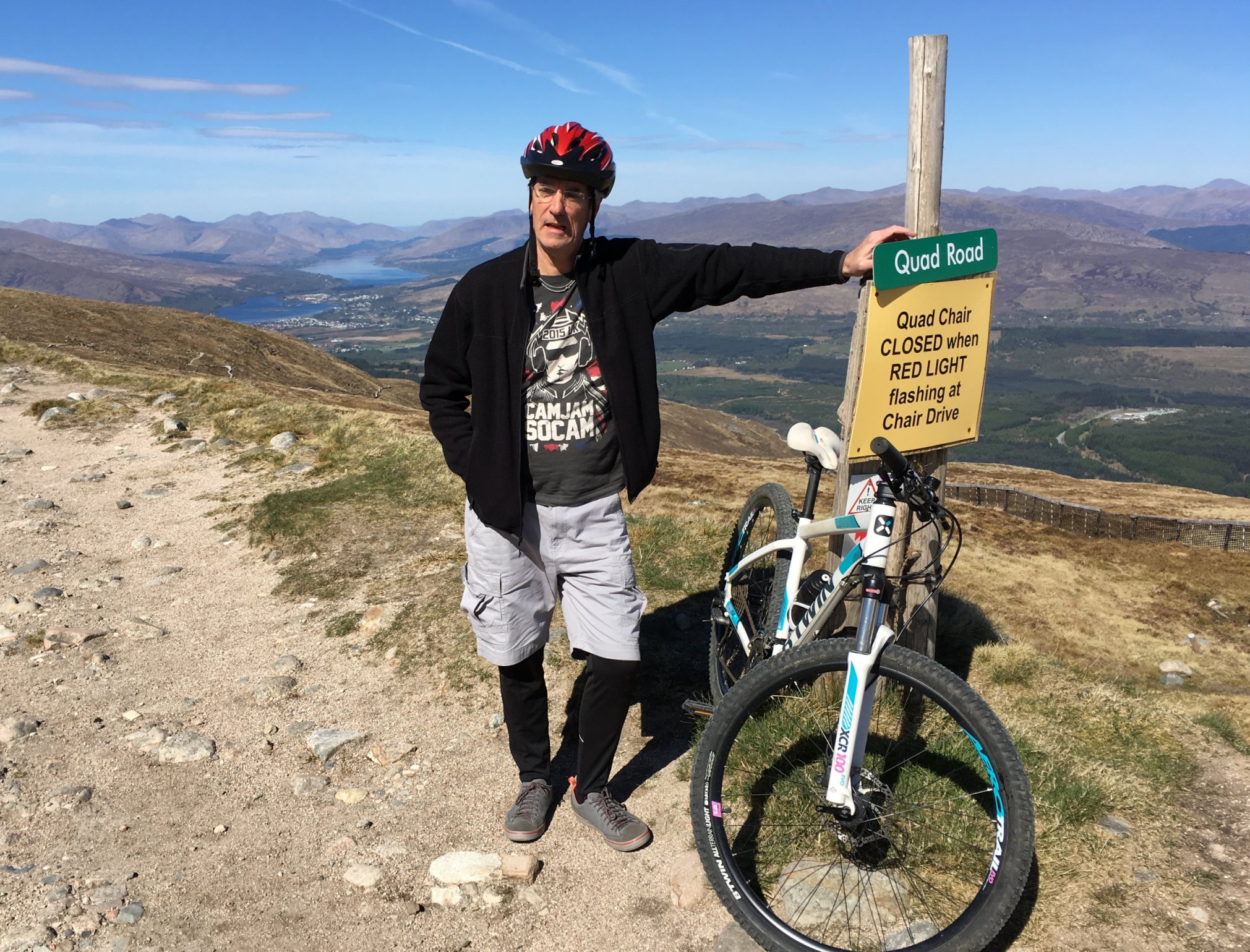
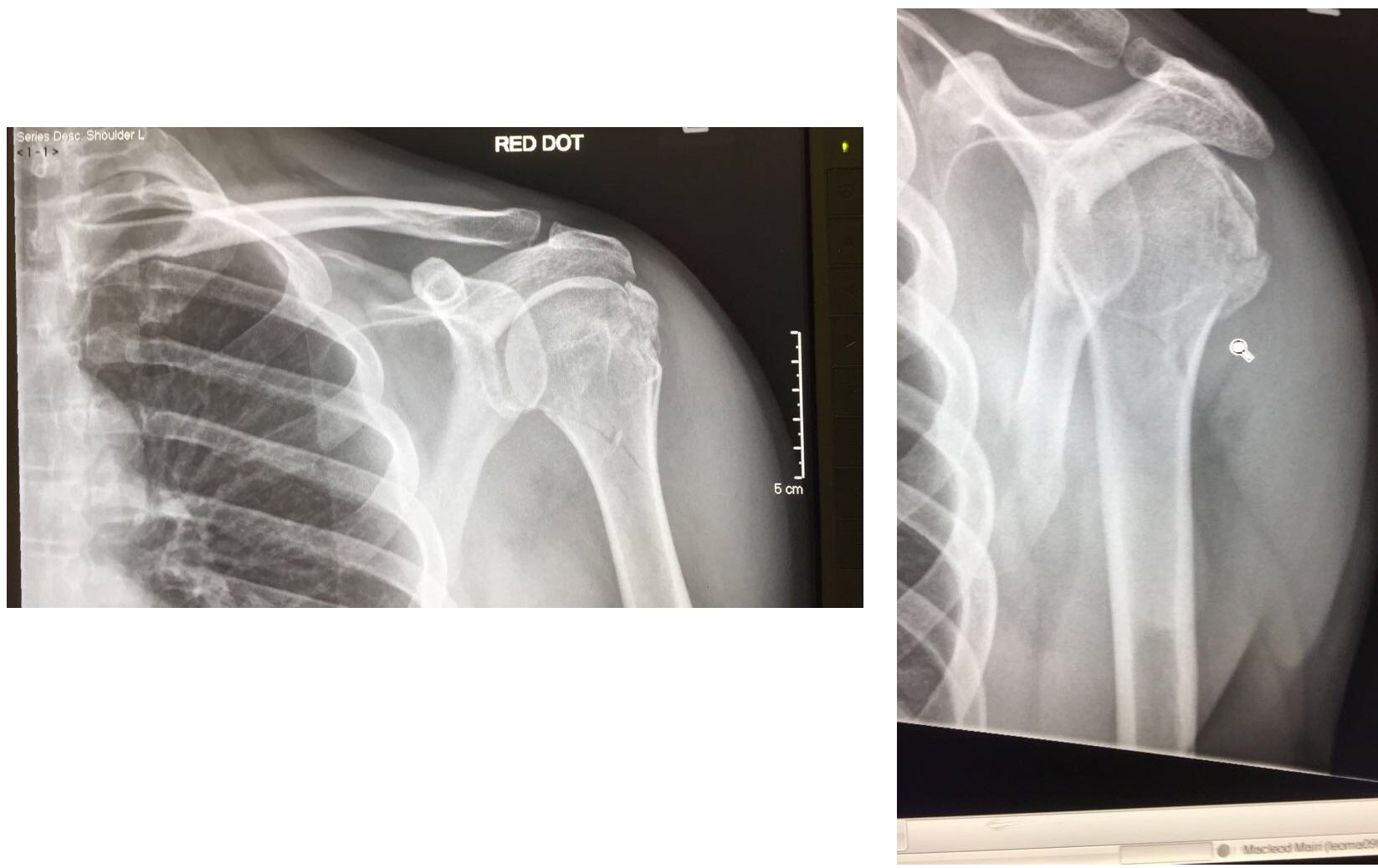
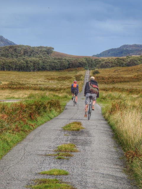
After that excitement, it was time to get the bikes off the back of the car, this being my first time back on a mountain bike since my accident at Nevis Range about 8 weeks earlier. We set off north up the landrover track that starts next to the layby, and is marked by a sign as the Gaick Pass path.

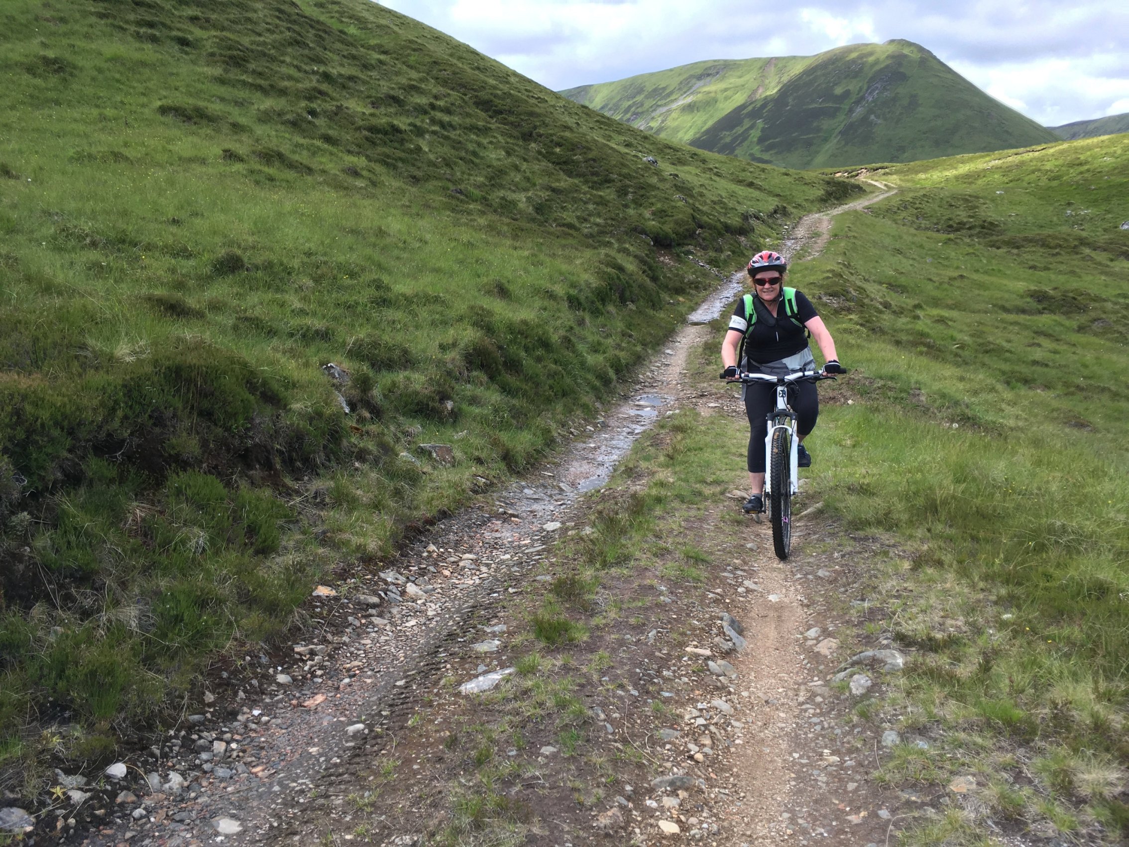
Since my crash, I have fitted a new front tyre with a lot more grip that the previous one, but it was a lot heavier too. That’s how I explained to myself the fact that Colette was so far ahead of me. It might also have been because was so excited to get going on this, our first off-road adventure for quite some time.

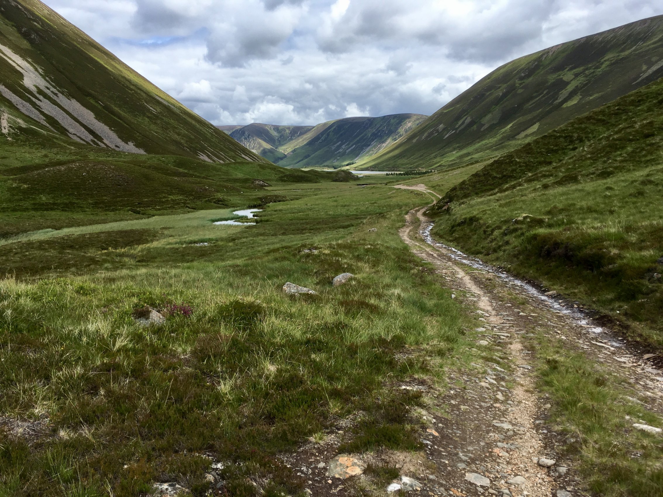
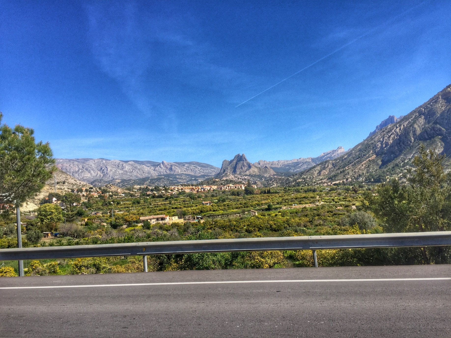
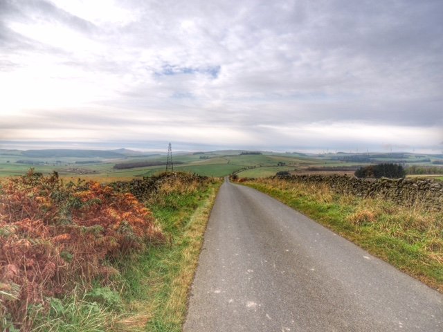
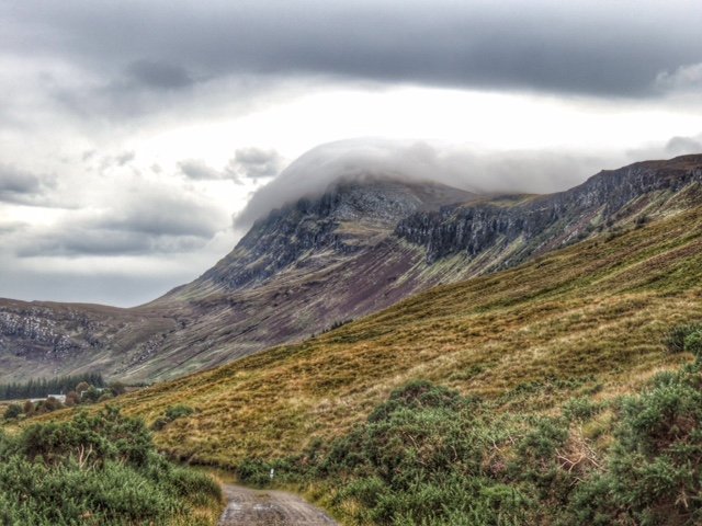
The track ran uphill through trees for a while before opening out onto a mountainous landscape, with our track ribboning its way through. We made our way along the east side of a small river valley, all the time heading towards the imposing shape of the steep-sided peak An Dun.

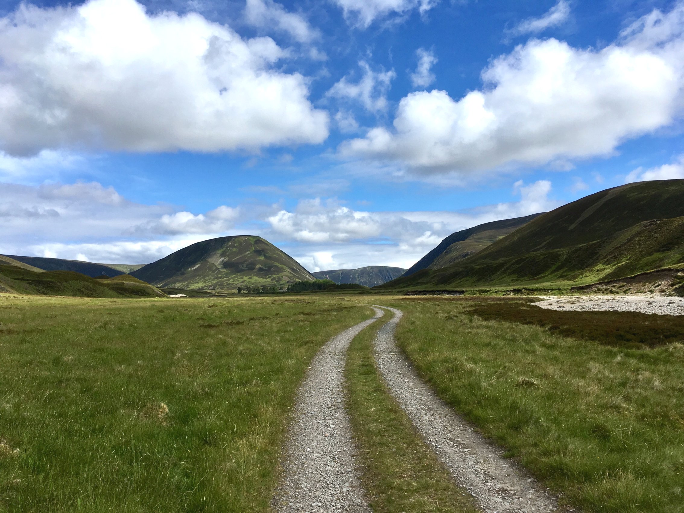
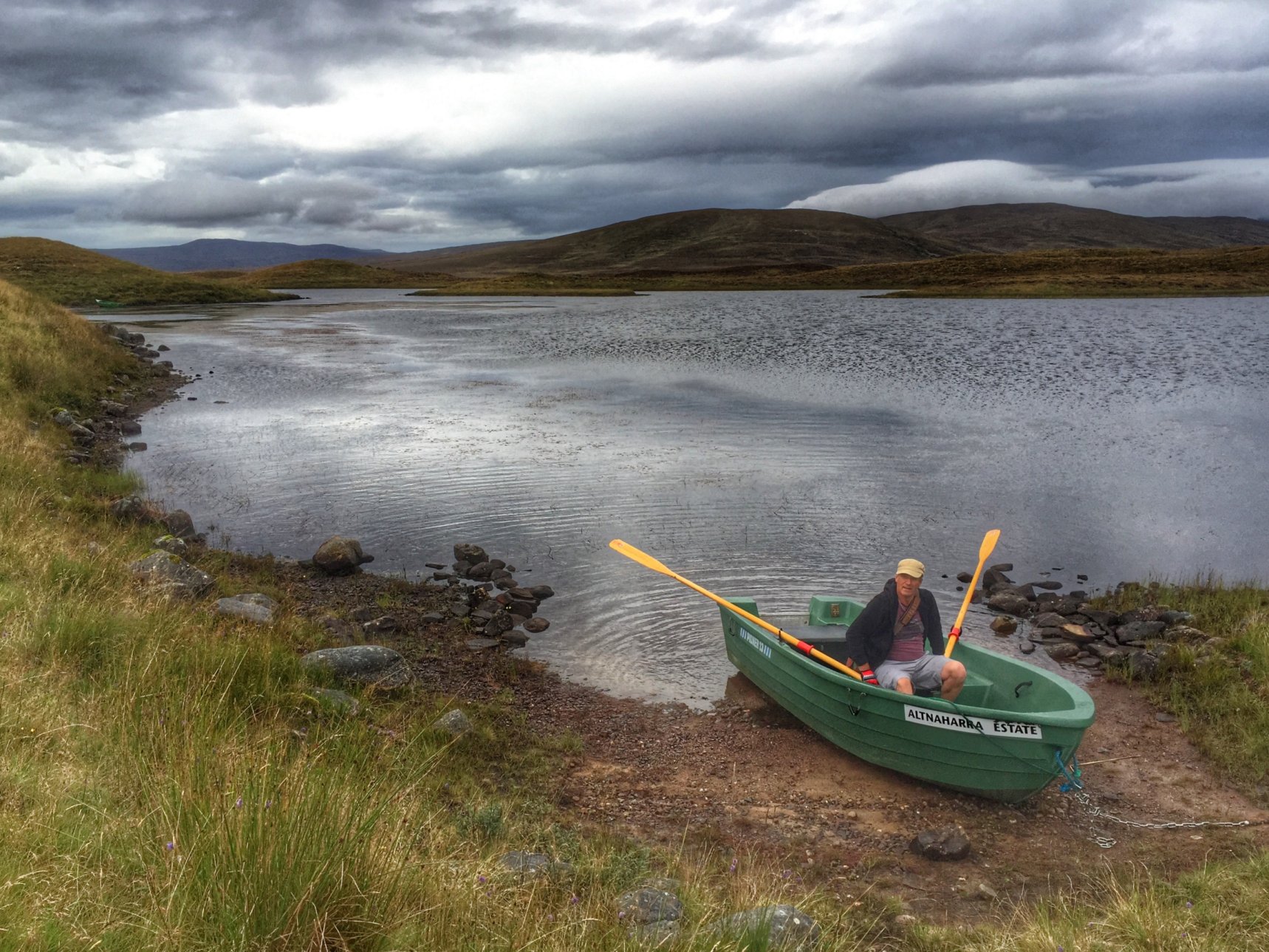
It was so quiet and peaceful on the track and felt a million miles away from the noisy A9 that we left behind. We did see one car – a Land Rover carrying some anglers, but that was it.

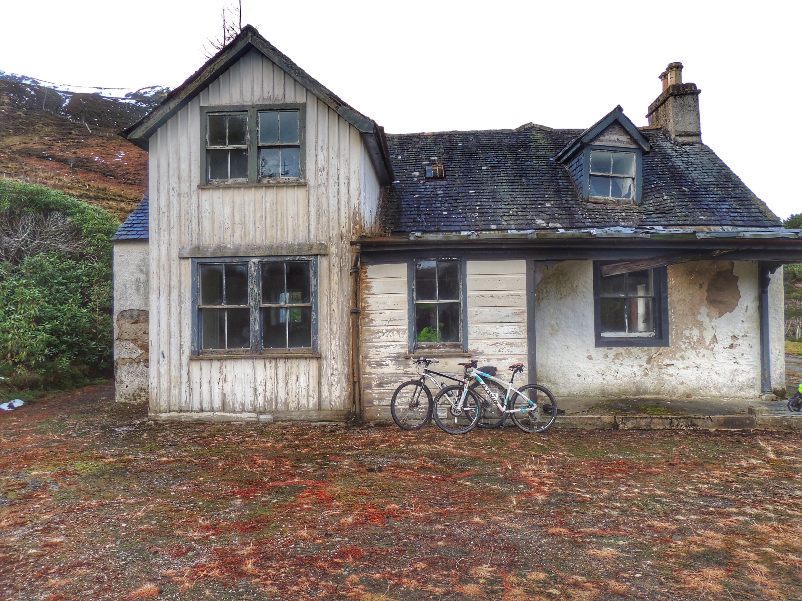
As we got nearer to An Dun, the track running alongside the river was re-routed in places due to erosion of the original road. After passing what looked like a recently abandoned farm, we came across the Land Rover we saw earlier parked at the “end of the road”.  The route I was following showed tracks continuing along both banks of the river, but in reality ours had vanished. We did find a narrow track of sorts running up a steep bank and decided that was the best way forward.

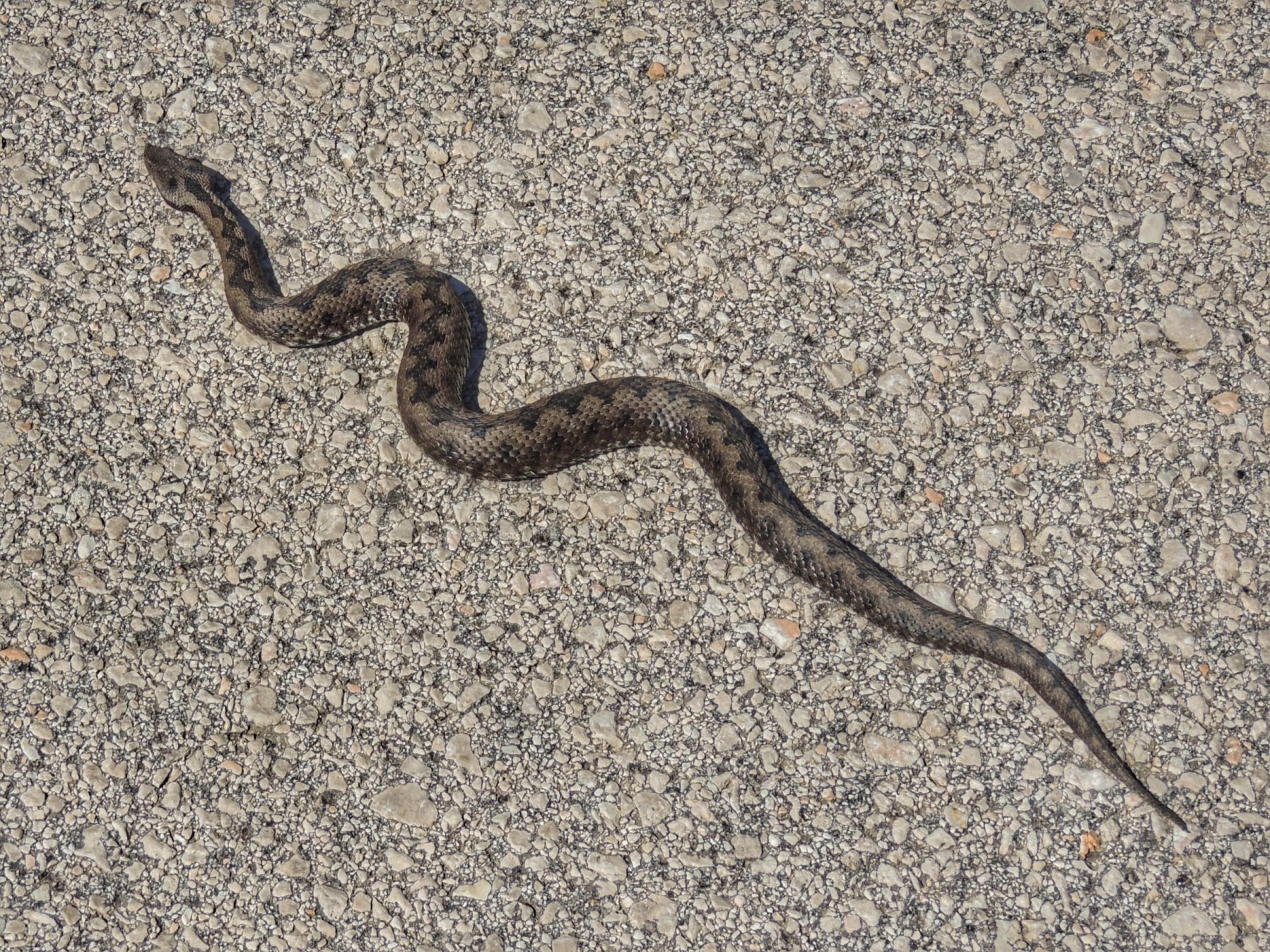
It was difficult heaving the bike up through the heather while trying to keep balance on the narrow path. Hearing a scream, I turned round to find Colette had taken a tumble off the path, with her bike resting on top of her. Luckily she didn’t fall far and the heather made it a soft landing. I got her back on her feet and we struggled on to the top, where we found ourselves at one end of a kind of marsh, with Loch An Duin at the other side, and no obvious path joining the two. We had to zig-zag our way along the tops of mini-canyons of heather with exposed waterlogged peat and spongy vegetation at the bottom, crossing from one to the other in a kind of maze. From time to time I checked our location on GPS to make sure we were on track to intercept the path further along. Having read about the Gaick Pass in advance, we were prepared for this obstacle, but we did get one pleasant surprise in the shape of a wee lizard who we stopped for a minute to watch flitting through the heather.

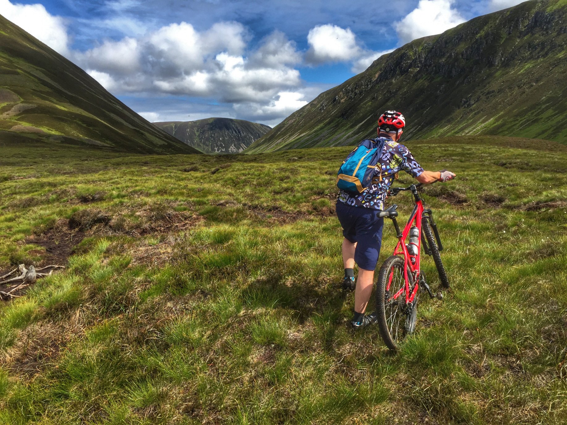
Picking a route across the bog

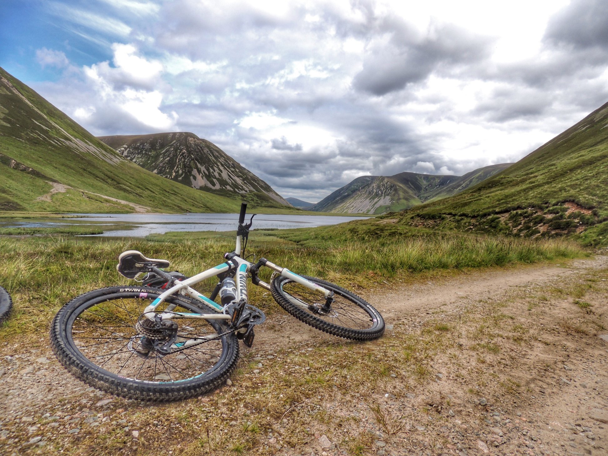
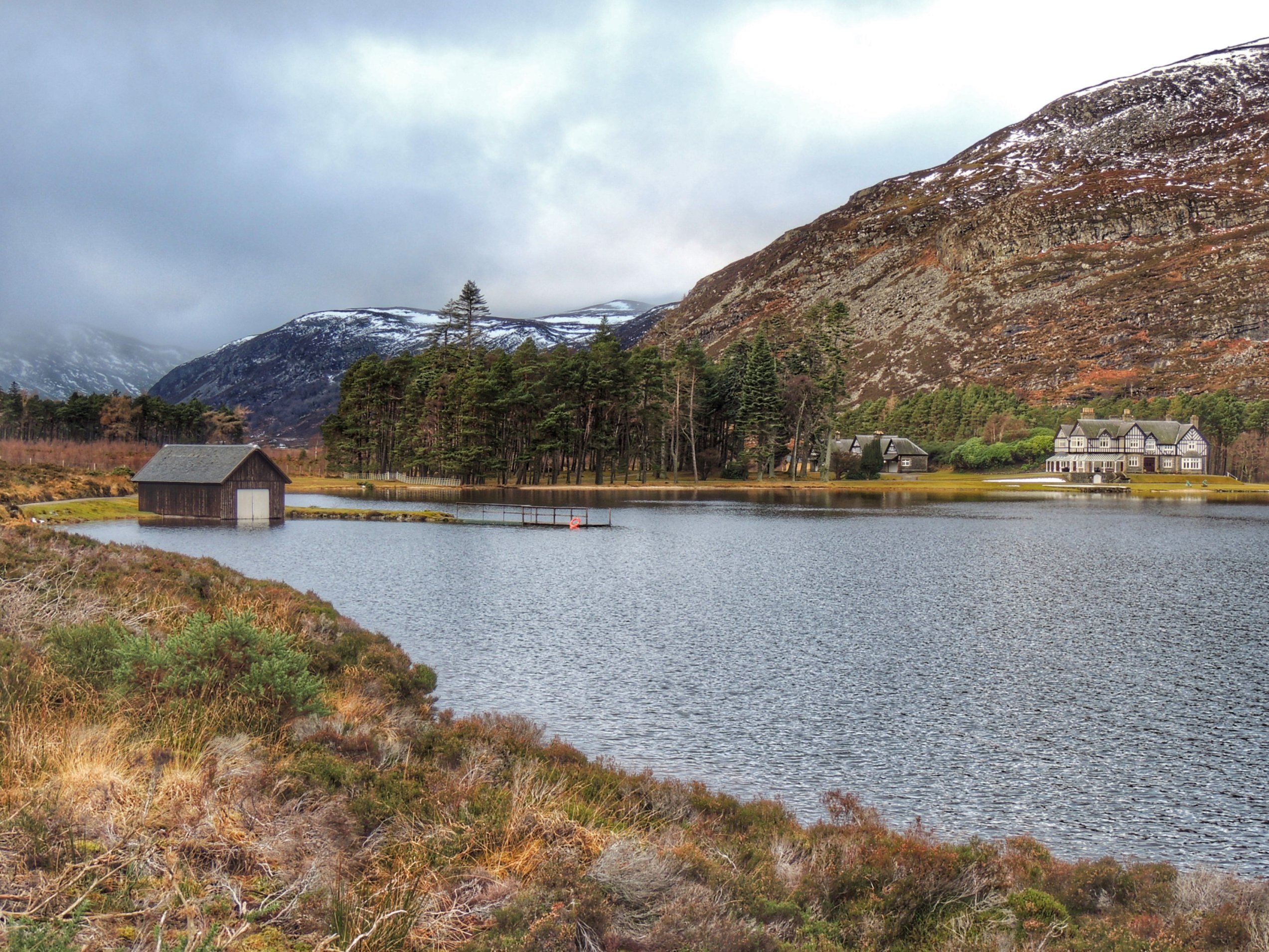
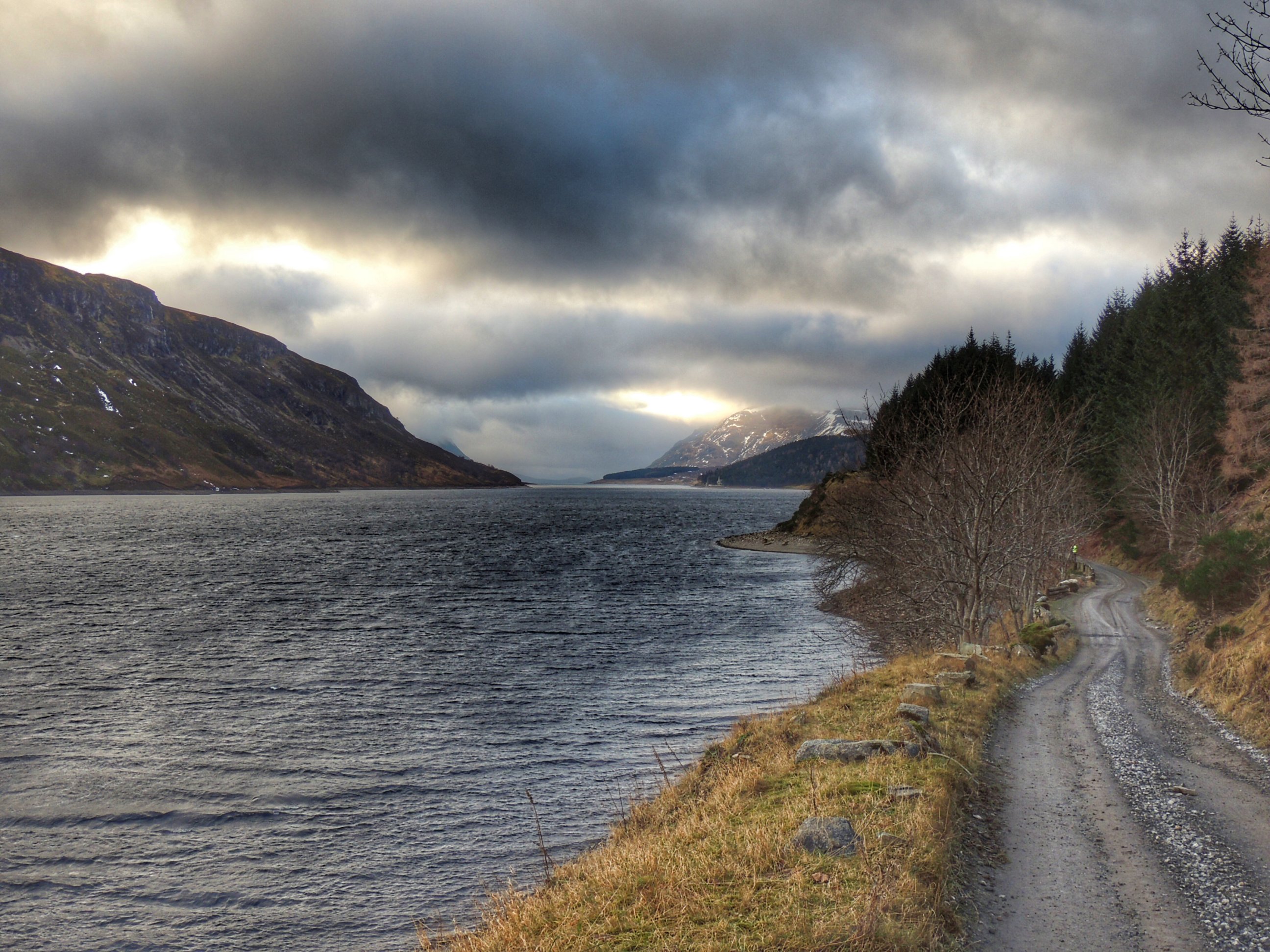
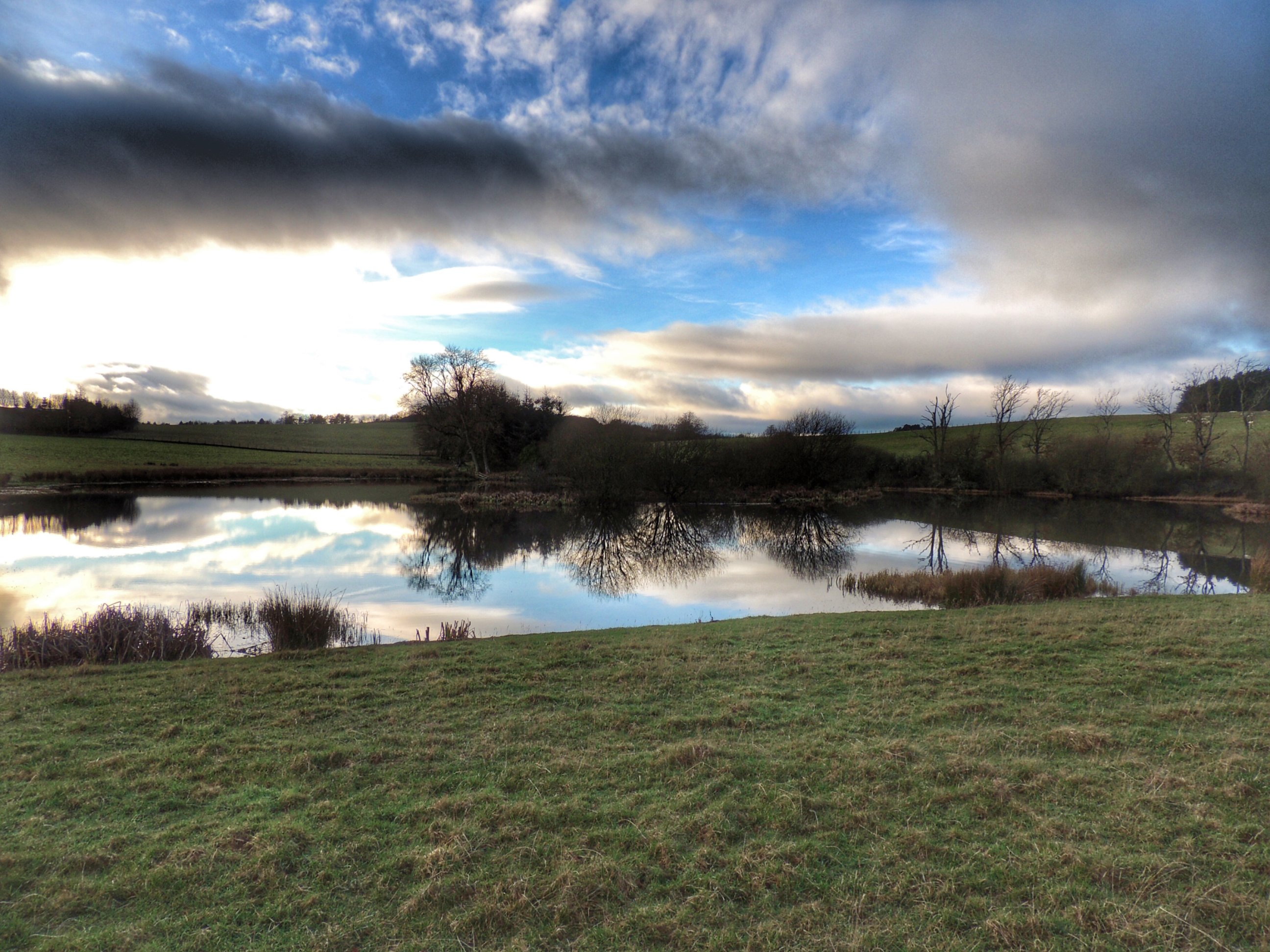
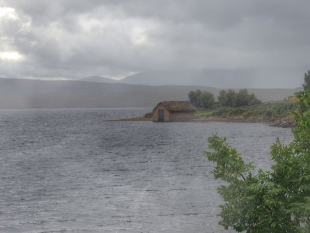
After a while, we came across a proper path cutting through the marsh, which make the job much easier, bringing us finally to the track running along the lower slopes on Au Dun, with the loch below us, where we could see the anglers casting their flies onto the dark waters.
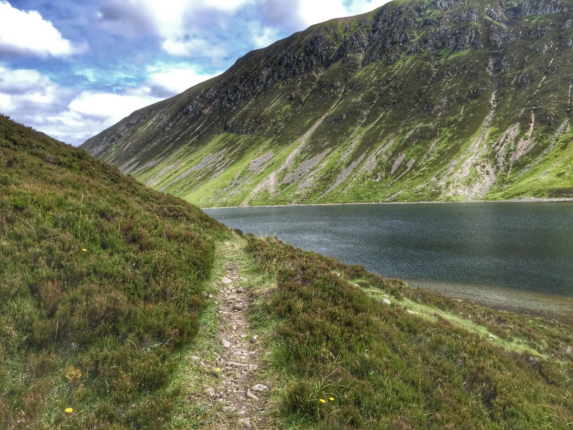
Loch An Duin

The track was very narrow, and although looking quite cyclable in parts, there were regular marshy bits or boulders that could stop you in your tracks. While that wouldn’t normally be a big deal, the steepness of the slope meant that you could only put your foot down on the left. If you tried that on the right, you would topple over and probably keep going till you reached the shore. It was too risky for us, so we continued to push our bikes the full length of the loch.

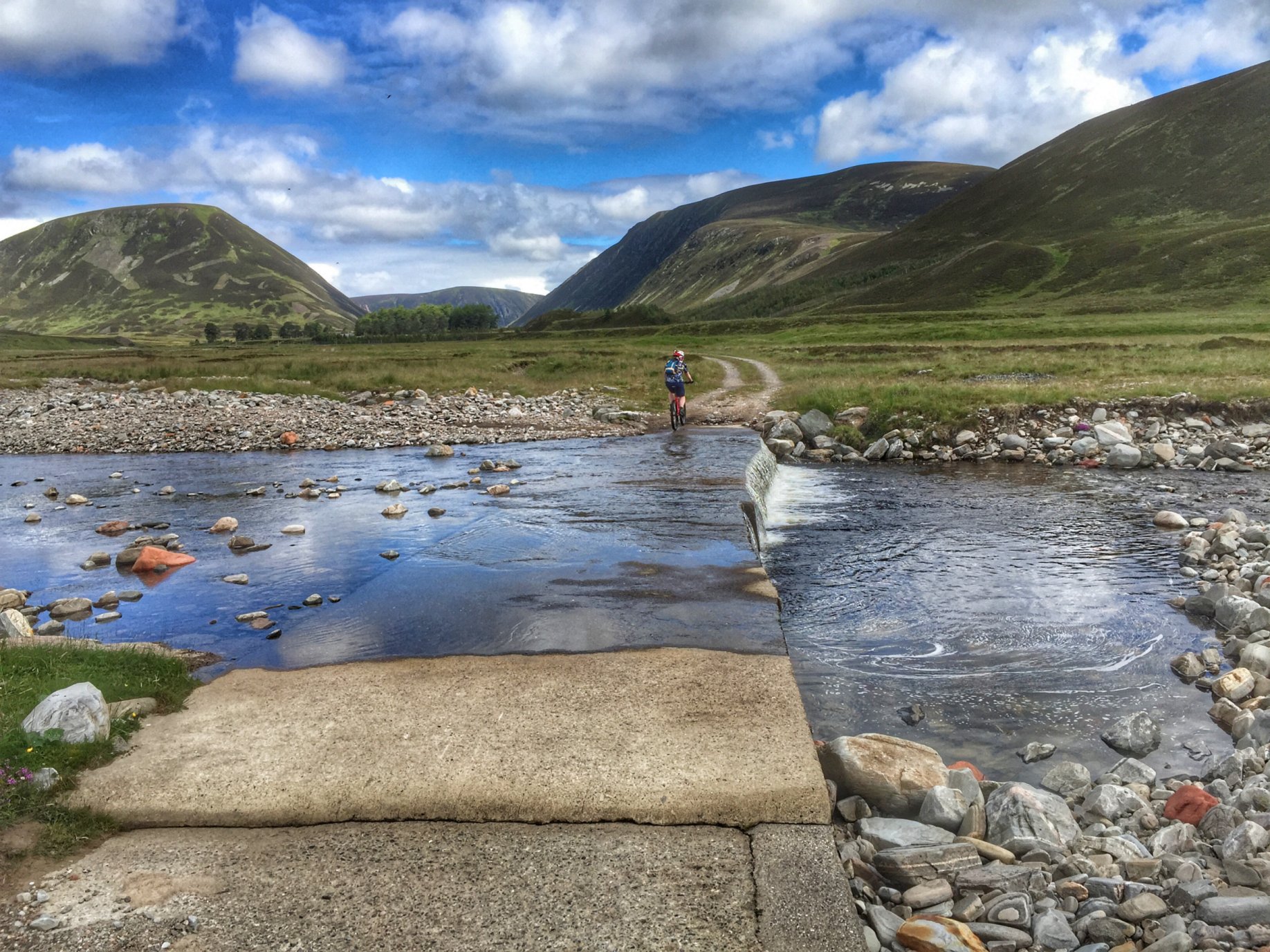
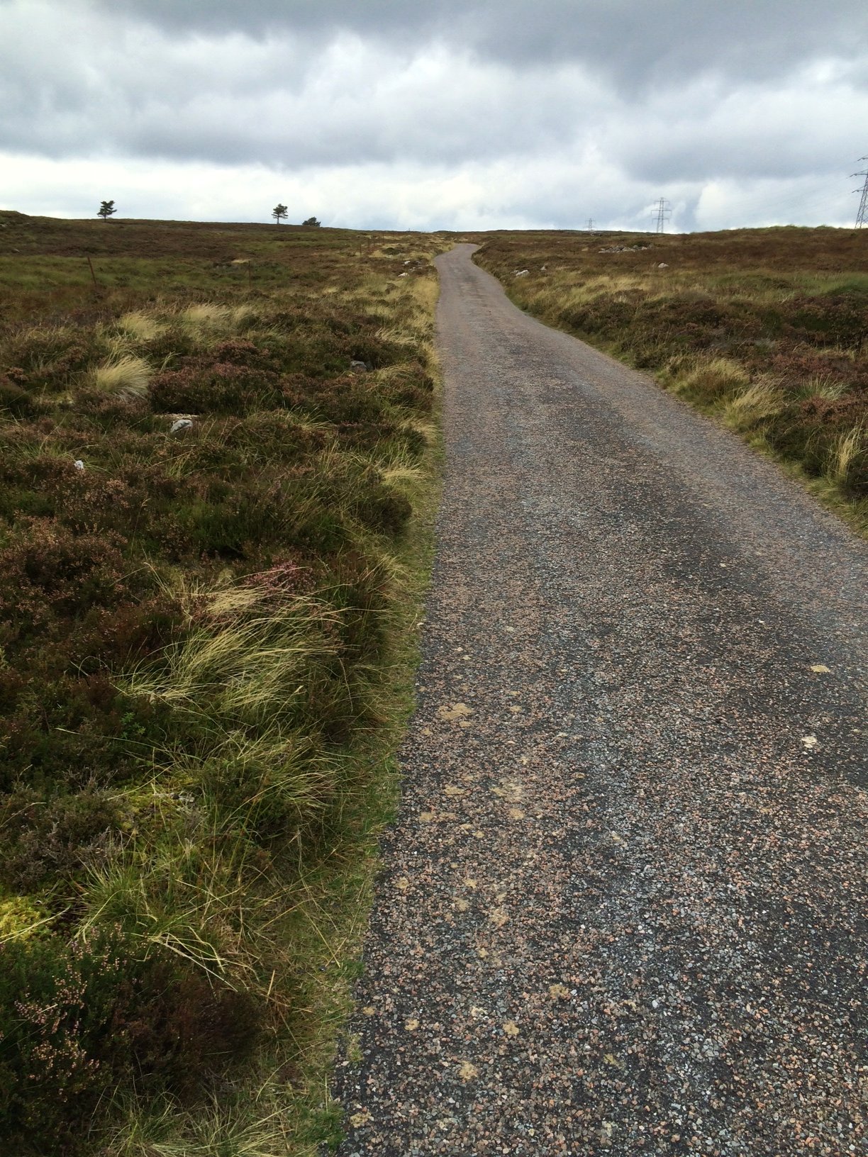
At the far end, the path reached flatter and grassier ground, where I was able to cycle for a bit till we got to a river crossing. This was just a shallow one that was easily ridden across. A short, steep climb took us back onto landrover track once more, which took us away from the steep-sided loch and along a wider, flat valley bottom.

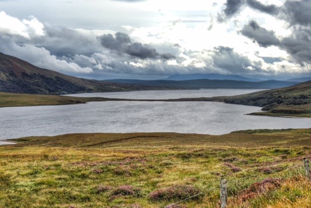
Picnic spot overlooking Loch Bhrodainn

With Loch Bhrodainn ahead of us, we stopped at a nice spot for our picnic lunch. When we realised that it was lunchtime and we had only travelled less that one fifth of our route, it was a little worrying, even taking into account that we had just done by far the hardest and slowest part. So we got back on the bikes and made reasonable progress round the loch till we came to a river called Abhainn Ghaig on the map.

Despite the river levels being relatively low, this was going to be a wading job. Again, this was something that reading up on the route had prepared me for. I had bought a pair of neoprene wading socks in anticipation of my first abortive attempt to do the route, and was still waiting to try them out a year later. Now was the chance! I took off my cycling shoes, then stopped before taking my cycling socks off and just put the wading socks on over the top. Makes sense, eh? Well no, as the wading socks turned out not to be waterproof at all! The padded, grippy bottoms worked a treat for the crossing, but I still ended up cycling with wet feet afterwards, which kind of defeated the object. I’ll know for next time. Colette on the other hand just waded though with her shoes on, as she had got her feet wet earlier on the crossing of the bog.

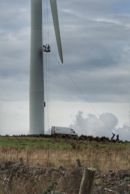
The track became quite undulating as we passed Loch an t’Sellich, until we came to the dam at the far end, after which we reached tarmac again – woohoo! And it went downhill too – wooohooo!!! On the way down we disturbed a hen harrier, who obligingly called out distinctively to aid our identification.

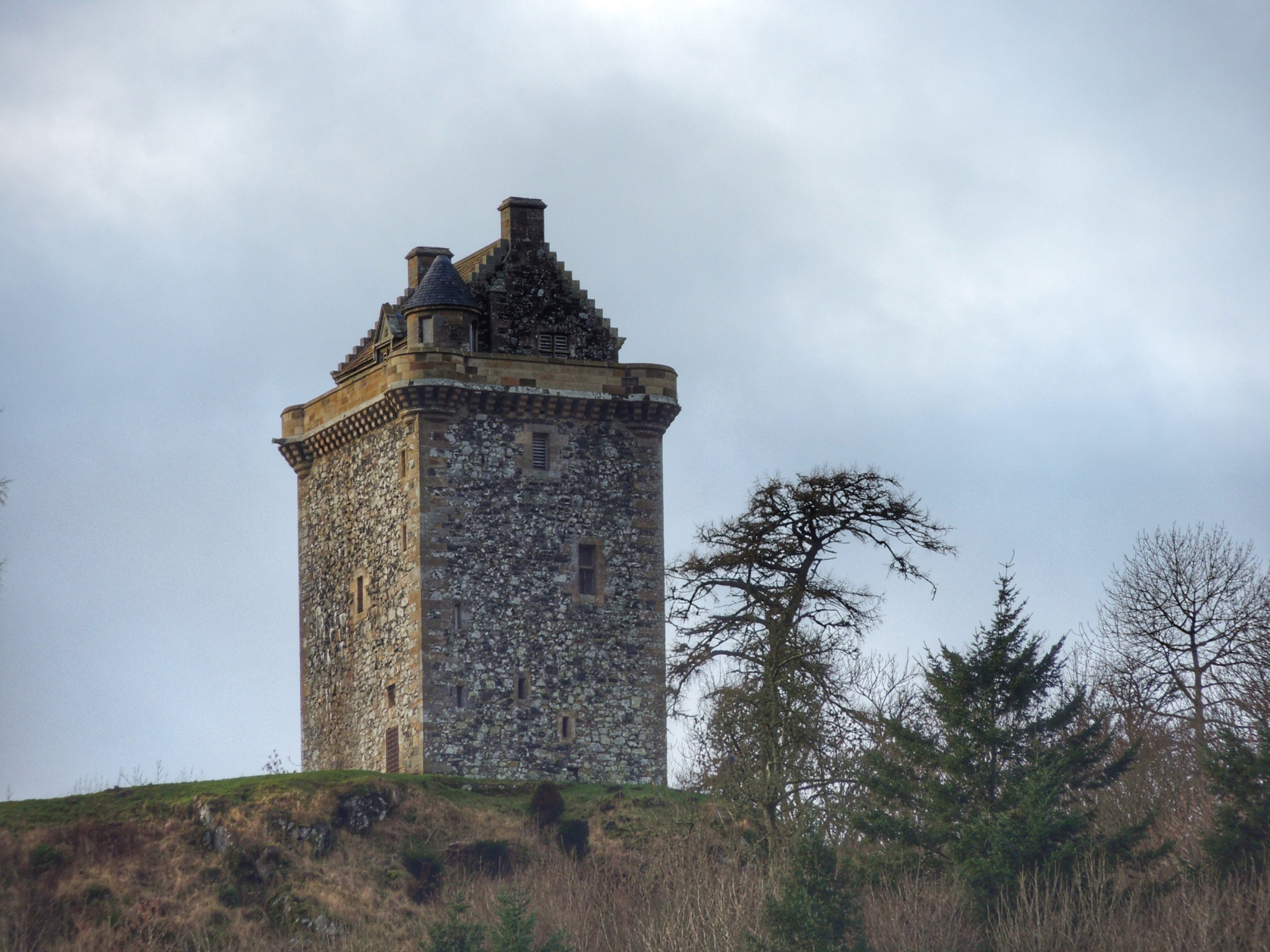
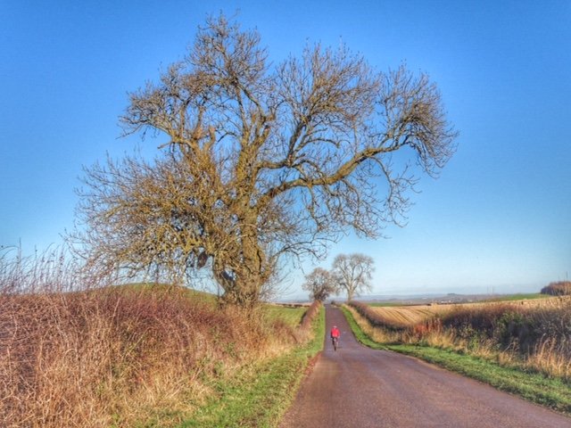
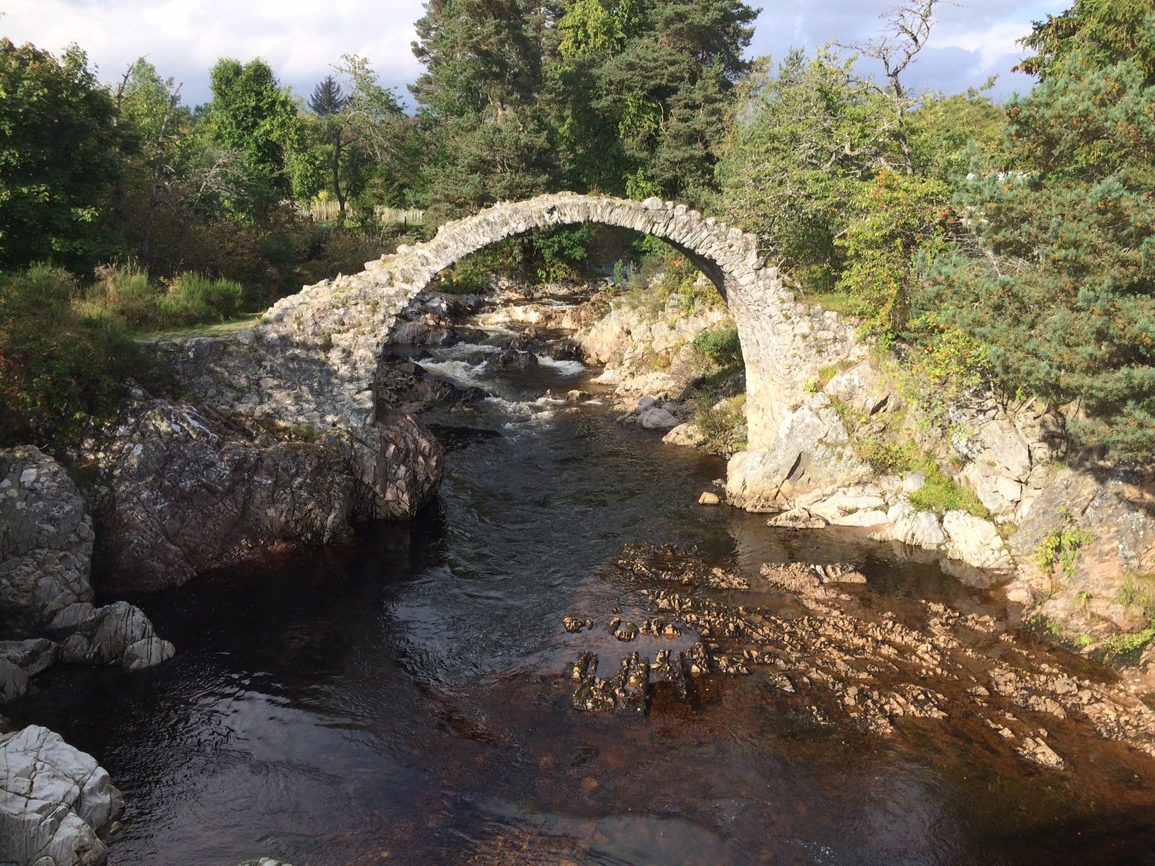
The next 8 miles or so sped past, taking us to the end of the private road and onto the public road network again, next to the bridge over River Tromie. We stopped briefly at the bridge to admire the falls before pressing on. We were keen to reach Kingussie as soon as possible for a cafe stop, so we only paused one more time for a quick photo of Ruthven Barracks as we passed by.

At the Sugarbowl Cafe in Kingussie, we had tea and cake and our long-awaited sit down. It was good to get a wee break but we were still only halfway round. In my mind, we just had to go down the Drumochter Pass to get back to the car, however I had conveniently forgot the part about getting up to the summit first.

It’s not that it was a steep climb or anything, it was just a sheer slog all the way back. It wasn’t such a pleasant ride as the Gaick Pass to start with, although much easier, but the scenery wasn’t half as nice, and the proximity of the A9 made it noisy and dreary. Add to that the fact that we were tired, the sun had gone in and were riding into a headwind all the way back, and it began to feel like it would never end. While I wasn’t enjoying this second half, I think Colette enjoyed it even less. I can tell that from her asking how far we had to go, and her disappointed, if not horrified tone in response to my answer.

Finally we reached the car and got eveything packed up. It felt like I’d just ridden 100 miles, not 50, but the slog of the second half was worth it for the sheer joy of the first.


Posted in Uncategorized | Leave a comment

06 May 2017 – The Red Giant

I hummed and hawed about writing up this ride, but as it will be the only one I can possibly do over the coming weeks (or maybe even months), here goes…

For quite a while, Colette’s brother, Damian, has expressed an interest in doing the Red Giant downhill mountain bike run at the Nevis Range centre near Fort William. It’s not as if Damian is a keen mountain biker or anything, it was more of a bucket list thing, like doing a bungee jump. So there was no way he was going to bother taking any lessons in advance – just give it a try and take it cautiously was the way forward.

We all found ourselves together in Fort William a few weeks ago, with mountain bikes at the ready, but there wasn’t enough time to try the Red Giant, so we tried the smaller and easier Blue Adder run instead, which is more suitable for novices. I did it with Colette first, who I thought might enjoy it. Unfortunately I was wrong – she was terrified!

When it was Damian’s turn to try it, on Colette’s mountain bike, I thought he might have had the same reaction, but no, it was more a case of: “That was fine, bring on the Red Giant!”

Fast forward then a few weeks to the 6th, and we were gathered at the gondola station at the official start of the 2017 mountain biking season. Colette was there in observing capacity only, while Damian and I bought gondola tickets and waited for our ride on a beautifully sunny spring morning. When our gondola arrived, we hung our bikes on the rack and jumped in.

On the way up…

The anticipation was high as we were elevated up the mountain. I tried to stay as calm as possible but it was difficult not to be intimidated by the sight of some of the steep, rocky track in the distance. We decided that we would definitely be walking our bikes down that part.

After disembarking, we got ourselves ready for the ride. I attached my helmet camera and pressed record, then off we went…

Damian with inspiring view, ready for the off

There was a short section of dirt track to start, with occasional rocks inset into it. Then the boardwalk began. It went on for simply ages, during which time you really had to concentrate hard on keeping the right line. Then there were the occasional rocks and drops and bits that shot you into the air. Getting airborne is not something that I’m used to, which added to the sense of being way out of my depth!

In contrast, Damian wasn’t at all worried by the boardwalk, although he didn’t like the rocks and step downs, so he stopped his bike to negotiate those.

So far, so good…

As soon as the first and biggest section of boardwalk was over, I took the chance to stop and feel terra firma again. Damian arrived feeling good, so on we went with the next part…

This section was mainly rocky path with the odd bit of boardwalk. To start with it was not too hard. There were some short drops which I decided to take on. The front end of the bike would lurch forward as the suspension compressed upon landing. I was trying to move my weight back as much as possible at the same time, but still did feel the shock moving me forward on landing. It was not enough to send me over the top but I did feel that I might have been riding my luck.

After that, we came to some seriously big slabs to climb over, which stopped us dead and we had to get off and push. I managed to get going again over the top and started following a series of red dots, which I presumed gave the best line. The last thing I can remember is launching myself over the final red dot, then the next thing I was aware of was lying flat on the ground. Something must have gone wrong inbetween…

What went wrong we will never know, as Damian was too far back to see clearly and the helmet cam wasn’t recording – I must have not pressed the button properly at the start. All I can be sure about was that I came down hard on my left side. My glasses were broken and they had embedded themselves above my left eye, cutting a loose flap of skin.

Damian helped me get over to a nearby puddle/pool to wash away some of the blood. We must both have been a little in shock to have chosen to do that rather than use our water bottles! Damian called Colette to let her know that we’d had a mishap and would be walking down the rest of the track.

We got going, slowly, when I found that my left arm was too sore to use, so I took my bike by my right hand and shuffled off downhill. After no more than a few minutes, we were joined by Dave, one of the Nevis Range staff. He got out his First Aid kit, which Damian took charge of, bandaging up my bonce to stem the flow of blood.

Dave took my bike, so I just had to concentrate on walking. That was good, as we had reached the really tricky rocky part. Another helper arrived, though I’m afraid I forgot his name. It took another 10 minutes or so to get as far down as an access road, where we waited for a truck to arrive while fearless guys on the World Cup descent were making big jumps right next to us.

Once delivered back down at Nevis Range HQ, I filled in an accident form to find out that I was the first casualty of the season, and then Colette drove me straight to the Belford hospital in Fort William. By this time, my limbs were starting to seize up, making the walk into A&E quite a slow affair. I got taken very quickly and the staff did a wonderful job of looking after me. It took six stitches and two steri-strips to close my eye wound, but that became the minor thing when an X-ray showed that I had broken my arm in two places. Damn, I thought it was just a “dead arm”.

Spot the fractures

Now I am wearing a sling full time and awaiting an appointment with the fracture clinic in Edinburgh next week. I’m guessing I will be out the game for at least 6-8 weeks, but I will have a better idea after going to the clinic.

For me, the most important thing is to learn something from the experience. Although I don’t know exactly how I managed to hit the deck, I do know that a full face helmet would have saved me from a nasty cut and needing to buy a new pair of glasses. Also, hip and shoulder protection would probably been useful as well. It makes sense, and explains why the vast majority of riders were wearing full helmets and body armour. Also, everyone else we saw were riding full suspension bikes, which soak up the bumps and are much less likely to kick you off over the handlebars. Before I do anything else like this, I will need to make sure I am better kitted out and better versed in the appropriate riding skills.

As for Damian, he is now cured of the need to do the Red Giant run. No need to come back and do the final bit – he can tick it off the bucket list and move onto the next thing!

But my last word must be to thank the guys at Nevis Range for helping me get down from the hill, and also the staff at the Belford hospital for dealing with my injuries. I’m really so grateful to you all.


Posted in Uncategorized | Leave a comment

31 March 2017 – Costa Blanca mountain loop

After the success of our 55 mile mountain ride a couple of days before, I thought Colette might be up for this longer route, as suggested by Ciclo Costa Blanca. “Isn’t that the one you said would be too hard?” she reminded me… That could have been a problem, but luckily it didn’t take too much persuading for her to give it a go.

We headed off nice and early towards Callosa as before. This morning was a little cooler, especially in the shade, but I resisted the urge to put on my arm warmers. At the central roundabout in Callosa, we took the CV-755 exit, heading for Guadalest.

We had been warned that the CV-755 was closed north of Callosa, due to a landslide in the January floods, which washed away most of the road surface. That means closed to cars, but bikes can usually slip past, even if it isn’t really encouraged. I had the idea of checking on Strava to see whether any cyclists had recently been able to get past. Sure enough, there were plenty of people completing the climb to Guadalest in the last week, meaning that there must be a way through.

So we ignored the road closed ahead sign and forged onwards. The sun was now shining warmly, the road was free of cars and we were enjoying the approach to the mountains. A mile or so further, we came to the museum of motorbiking, situated close to a fork in the road. To the left was the diversion to Guadalest, which is narrow, badly surfaced and very steep, while to the right lay the proper road, which winds its way gently up the hillside in a very picturesque way.

We cycled past the barriers and onwards towards Guadalest. There were some signs of minor flood damage, but nothing really significant until we came to the break in the road. In fact, we had tried this road earlier in the week on our first visit to Guadalest, and found it easy to carry the bikes over the rubble on the left side of the road at the point of the landslip. However, since then, there had obviously been some work carried out. A big excavator was sitting below us in the middle of the missing part of the road, and it had been used to completely remove the whole of the carriageway. The part of the road we crossed by before was now completely missing. Instead, there was an 8 foot “cliff” to get down to the level of the digger, with a ramp to climb out on the other side.

Looking back on the landslip

If I had been by myself, this would have been impossible to get past, but when Colette arrived, I lowered myself down and asked her to pass the bikes down to me. Then a couple of German cyclists pulled up too, whose bikes I took, and they helped lower Colette down to me. It was all a bit undignified and messy, but we made it.

Above us we could see two ends of an exposed blue pipe with water trickling from it, meaning we had to cross a muddy stream to get to the other side. It took a while to get the muddy concrete stuff off my shoes, and we were only just setting off again when several vehicles with road workers arrived on the scene. They looked at us with quite stern expressions, and I’m sure that if we had been a few minutes later, they would not have allowed us to come past. Phew!!!

Guadalest

When we arrived at Guadalest, it was time for some coffee and to get cleaned up a little. It occurred to me that the workers might have severed a mains pipe and came back up to Guadalest to turn off the water, giving us that short window to get past. Clearly, we were destined to do this route.

After Guadalest, we got ourselves onto the CV-70 headed towards Alcoy. We were climbing steadily but it seemed to take much less effort than similar roads in Scotland. Shortly we arrived in the village of Confidres. This far into the mountains, the villages are smaller and further between, so even though it was maybe a little early for lunch, we decided to stop.

I was originally attracted to a sign on the door of a restaurant saying “bocadillas hasta 12”, but the chap inside explained that meant bocadillas until 12, rather than after 12 as I’d hoped. As it was just after 12, we couldn’t have them. However, we were offered the “menu ciclista” instead, which turned out to be great – salad and a pasta dish, both delicious. Love the idea of a menu only for cyclists!

After lunch we re-applied the factor 50 and headed onwards and upwards. The road topped out at about 3,100 ft, after which we descended steadily for a few miles. We parted company with the Alcoy road, continuing downwards for a while, before hitting a quite tough 10% incline, which was about as hard as it got all day.

Penaguilla

There was a bit of a lull after that climb, then our route took us onto the CV-785 and a series of hairpin bends, very gently taking us uphill again. The climb was taking us up about 1,000 feet but it never got hard, and in fact was almost flat in places. We must have entered something of a bowl in the landscape, as in contrast to the majestic mountain views, the scenery here took on a more intimate feel, as we passed by tiny fields with tiny stone buildings, surrounded by low, wooded hillocks.

I had got ahead of Colette by this stage, who got a bit worried after not seeing me for a while, and phoned me to make sure she was still on the right road. So I nipped back and we finished the climb off together, finally reaching a plateau at around 3,200 ft.

We heard some unusual noises as we approached the Safari Aitana animal park. Colette called out to say she spotted a tiger, and sure enough we saw two, pacing around their compound, with a giraffe looking on from the distance. Not exactly their home habitat, but I get the feeling they would be happier there than in Scotland!

Soon, the mountain scenery opened up again as we took on the descent to Sella. This was a simply majestic, sweeping descent, with nobody else on the road but us for miles, with the sun shining warmly upon us and the road surface near perfect, meaning we could safely choose our line down the mountain. Just perfect!

We stopped in Sella for a coffee as we needed a break. There were still quite a few miles to go and we were starting to feel a bit tired. The descent continued for a few miles beyond Sella, after which we had some more climbing to do before we reached the town of Finestra.

The climbing continued for a while, but it wasn’t too taxing, till we reached a fast descent, taking us back towards the coast. Suddenly, we went from quiet country roads to heavy traffic in one go when we reached the CV-70 at a roundabout. We took the cycle path option here to stay off the busy road, then threaded our way through back streets towards L’Albir. That did involve getting onto the main N-332 for a while, which was quite a culture shock after the rest of the day.

After that, we headed for the beach, where the cycle path took us safely all the way to Altea. Rather than head directly for the hotel, we went via the Russian minimarket to stock up on refreshments, then straight back to base for a well-earned rest. It had been a big day in the mountains indeed. Yes, it was daunting at the outset,  but we were so glad that we’d done it.


Posted in Uncategorized | 2 Comments

29 March 2017 – Tarbena and Coll de Rates

As the exotic-sounding title suggests, we were not in our usual haunts for this ride, but on holiday in the Costa Blanca. Colette and I fancied some (almost) guaranteed sun for a cycling holiday after a long winter of taking our chances with the Scottish weather. We ended up in Altea at the Hotel Cap Negret, which is well set up for cyclists. We hired bikes through Ciclo Costa Blanca and took note of some of their suggested cycle routes.

To start with, we were slightly daunted by the amount of hills, but the first couple of short excursions we took showed that the roads were smooth and easy-rolling, and the gradients never got too hard, so we decided to try one of the recommended routes that headed up to Tarbena and beyond.

It has to be said that we found the flat cycling along the coast to be quite uninspiring, verging on the downright unpleasant, due to the amount of traffic. However, directly opposite the hotel is a lane which leads away from the hustle and bustle of the Costa, through agricultural back roads to the smaller town of Altea La Vella which lies on the CV-755 road. This road carries a more modest amount of traffic, often not much at all, and is mostly a steady climb, with a few downhill bits thrown in, leading up to the town of Callosa d’en Sarria.

Tufty knows how to cross the road safely

As we were following this road to Callosa, we noticed something red and small dart across the road in front of us – a red squirrel! That made it a bit of a red letter day for me, as I’d only ever seen a few during my visits to the Scottish highlands. We were even more surprised to spot another just a minute or so later. We had caught it in the act of crossing from one side of the road to the other, by a less risky but more complicated method than just running across the road. This squirrel had what seemed to be a well-worked out route, involving getting from a tree on the right onto a telephone wire that crossed above the road to the left hand side. It climbed down the far pole halfway, accessing another tree, then another couple of poles, wires and trees, culminating in an impressive leap before disappearing into the wood. After that entertaining interlude and plenty of scope for photos, we got back on our way to Callosa.

Callosa is a decidedly un-touristy town, at the centre of which is situated a small roundabout that we grew to know quite well. On this occasion, we took the first exit onto the CV-715, taking us back out of town and starting to head north. We passed the entrance to the Fonts de l’Algar (waterfalls of the Algar river), which we visited on our “easy” first day, but this time we carried on to Bollula. With every twist and turn in the road, we could see the mountains come closer, till by the time we reached the small village, we felt that we were well into proper mountain country.

From Bollula, we carried on to Tarbena, which was only a few miles away, but a good thousand feet further up the mountain. The ascent was one of the most lovely ever, especially as I was pedalling at a “touring pace” to preserve my energy and enjoy the scenery as I went. Colette took her own pace and we met up again at a layby just outside Tarbena.

Carrying on into the town, we found a cafe for strong black coffees and mineral water (to replenish the water bottles). The Spanish coffee did a great job of invigorating us for the efforts ahead.

Mountainous landscape north of Tarbena

Just outside Tarbena, we took a left turn, signposted for Castell de Castells. That required more climbing before we reached undulating terrain on a kind of plateau near the top of the mountains. Somewhere along this part of the road, Colette spotted a snake crosing the road, and stopped to check it out. She had to divert an oncoming car round the obstacle to keep it safe. I saw that something was going on, and backtracked just in time to see the snake (identified as an adder) slithering off into the undergrowth on the other side of the road.

Why did the snake cross the road?

As we got nearer to Castell de Castells, the road got very steep (in a downwards sense) and it was all we could do to keep the speed down to a manageable level. So we didn’t look out for any of the hoped-for castles. By the time we reached the village, we were just happy to have made it down safely – the castles can wait for another visit.

It was a bit too early for lunch, so we had a wee biscuit each and carried on, with the intention of stopping in Benigembla. The next section was unusually quite flat, with just a hint of a downhill slope that kept our speed up nicely. That meant it only took 20 minutes to cover the 6.5 miles to Benigembla, where we found a roadside cafe for lunch. Simple bocadillas (filled rolls) were just the job, and we had by then got the hang of asking for them and the desired fillings in Spanish.

After lunch, it was just a short ride to the outskirts of Parcent, where we took a right turn, heading away from the town and up the side of a mountain. This climb, to the Coll de Rates, is one of the better known climbs of the area, rising a total of 1,115 ft in 4.0 miles, with an average gradient of 5%. Since I knew it was coming up, I decided to give it a decent go without stopping till I got to the top. I kept up a decent tempo, sometimes needing to go into my lowest gear, but never really needing anything lower. The hire bike seemed well suited to the terrain.

Another view from our ride, though we can’t remember where it was taken!

I got to the top in just over 30 minutes (about twice as long as the pros take, which I was well satisfied with) and waited for Colette to arrive. She didn’t feel the same need to crack on, so had stopped to take some pictures on the way up. We then carried on to the bar situated at the top of the road. The “no entry to bikes” sign took us aback a little, so we parked them just outside the grounds. I suppose it must get very busy at times, and you can’t expect to park your bike alongside the table then. Anyway, the cafe has a wonderful panoramic view of the area, although we were more interested in just rehydrating at that point!

After that, we got onto the descent back to Tarbena. It was fast at times, but not too fast for comfort. A little more climbing was required, then we came back to the junction where we had turned left before for Castell de Castells, closing the loop section of the ride. From there, we passed through Tarbena once more and enjoyed the twisty descent to Bolulla.

By this time, we were beginning to get quite tired, but thankfully the rest of the ride was mostly downhill. I say mostly, as there were several little ups mixed in with the down. As I said to Colette, if you can’t see the hotel, then we’re not finished with the climbing yet.

But finish the climbing we did, and after parking our bikes in the hotel’s secure bike garage, it was back up to the room for showers, refreshments, dozing, dinner and bed.


Posted in Uncategorized | Leave a comment

16-18 January 2017 – Three days in a row!

Day 1: Glen Glass

Colette and I went off for a few days up north, with the hope of getting some cycling in. We managed three days in a row, which is pretty good going, considering the weather at this time of the year. The first was a trip up Glen Glass, which Colette really wanted to revisit on her mountain bike.

We parked just outside Evanton then headed towards Glen Glass on a mild but fairly dull morning. There had been quite a bit of snow a few days earlier, but the recent mild spell had melted most of it. There were a few remnants at the side of the singletrack road, as we headed up the glen.

After about 5 miles, we reached the closed gates of Eileanach Lodge. Through we went, to find the road on the other side properly covered in hard-packed snow. The tyres of my hybrid bike, although they are pretty good offroad, were no use at all on this, so I had to push my bike, while Colette rode across the snow without any problem on her proper mountain bike.

Luckily, the snow only lasted for a short while, after which we reached the track running towards Loch Glass. A few minutes later, we reached the lochside, with a bright pink house dominating the scene.

The Pink House

We paused to take a look at the pink house, which is something of a conundrum. The paint job looks quite fresh and the roof in pretty good condition, but the inside is completely empty, as if unfinished. We can’t decide if it is half-made or half-renovated. Whichever it is, there is a fantastic house in a fantastic location to be had with a bit more investment.

As we cycled along the sometimes muddy track, it was as if the whole hillside was awash with water. The snow-melt was rushing downwards, noisily filling up the burns and drains.

A little later, we came across a second abandoned house, but this time it was clear that it had been lived in and then deserted. The timbers were rotting and the roof looked ready to fall in. It’s a shame, as this house has such a beautiful view.

The head of Loch Glass with Wyvis Lodge on the right

Moving onwards, we reached the head of the loch with the impressive Wyvis Lodge on view in prime location at the top. A small number of other houses were dotted around. We decided to take a left here and carry on further up the glen.

The road began to climb a little more as we followed the river upstream, passing a fairly new building that I’m guessing held a smallish hydro-electric generator. There were signs of a buried pipe leading into it from further up the glen.

We carried on for a while, but decided to turn around when we got to about half a mile from where my map said the track ended. The alternative was to head up a steep track which promised to take us to a loch. The track was really very steep, but I managed to ride up it till we reached snow again. From there, it was trudging gradually uphill till we finally reached Loch Bealach Culaidh.

It was cold and bleak up there. The track appeared to continue round the loch, but we were happy to call a halt to our exploration there, and headed back down. After carefully negotiating the snowy part of the road, we fairly flew down the rest of the path till we reached the main track. We both commented on how it was suddenly feeling much warmer as we retraced our path all the way back to the car.


Day 2: Loch Ness and some fun with hairpins

This is a ride that I had been keen to do ever since finding out about the so-called Inverfarigaig corkscrew. Colette did it earlier this year, and luckily she was up for a return visit.

We started off from the car park of the Tesco store right at the south side of Inverness. Leaving the car park on the road to Dores, we were pretty much immediately into the countryside. At Scaniport, we left the “main road” (it wasn’t exactly busy) behind for a while, as we followed the recommended cycle route along an even quieter singletrack road. We then rejoined our original road just outside Dores.

Loch Ness

It’s traditional for Colette to stop next to the Dores Inn for a shot of Loch Ness from the beach. There’s a great view from there, all the way down the loch. After that, we got back on our bikes and pedalled along the lochside road, heading for Inverfarigaig.

Just before Inverfarigaig, there’s an improbably steep-looking bit of road which you can see from a distance, and seems to rear up in front of you. In fact, at first I didn’t believe my eyes, and thought that it must have been a grey-coloured cliff that stands alongside the road. Unfortunately, as I got closer, it definitely was real. After a struggle, I got to the top then paused for breath next to the “Welcome to Inverfarigaig” sign. Some welcome!

We went past the entrance to the corkscrew road for now, then took the next left, which runs up a deep gorge. There was a fast-flowing stream and native trees at the bottom of the gorge, whle the road running through was thankfully not too steep. We paused to look at the monument to the 19th century geologist James Bryce, who it appears had fallen to his death from the scary-looking cliff on the opposite side of the ravine.

We then carried on, taking the first right, heading towards Foyers. This quiet road ran through another steep-sided valley at a leg-friendly gradient, which we decided to take gently so as to enjoy the atmosphere. I was absolutely loving it!

Finally we came out near Foyers, which was eventually reached following a short but steep struggle. We then found the Waterfall Cafe, where tea and chocolate gateau was consumed, readying us for the second half of the ride.

Leaving Foyers was done at high speed, bringing us back to the shores of Loch Ness in no time. Shortly after that, Colette called to me that she had spotted Boleskine House. It was the first time she had caught sight of it, although I managed to miss it. It is known for tales of devil worship, celebrity ownership and a recent fire. Colette was keen to cycle up for a closer look, but the closed gate was quite uninviting, so we pressed on.

Soon we arrived at Inverfarigaig again and took the corkscrew road. This is a very narrow road and rarely used by vehicles, due to the very tight hairpin bends. It wasn’t long before we were going uphill and came to the first bend. In a very short distance, we negotiated a total of six hairpin bends, taking us high above the level of Loch Ness. It was great fun! The area is quite thickly wooded, meaning that it wasn’t possible to get a good photo of the hairpins stacked on top of each other, so we just carried on after passing them.

The climb continued post-corkscrew

The road after this point continued to rise, made more difficult by the tarmac being heavily eroded. For a good mile or two, the road is more like a farm track, and we certainly had an audience of interested cows as we cycled slowly past. After that, the road improved a bit, but it was quite a few more miles till we finally joined up with a more substantial road, just south of Loch Ceo Glais.

Travelling north, the road we joined was perfect, with lovely sweeping curves and a big hill rising steeply to the left as we passed the loch on our right. High above, we could see a golden eagle circling, adding to the special feel of the place.

Further along, we passed through Drumashie Moor, with its well-spaced Scots pine and juniper trees. There we also spotted a flock of waxwings, giving us another tick in the birdwatching box, although in terms of red squirrel watching we drew a blank, despite keeping our eyes peeled all day.

Next, Inverness and the Moray Firth came into view in the distance, and the road started heading downhill. We had quite a fast run back into Inverness, where the car was waiting, next to a very handily located hot food van.


Day 3: Exploring Loch Ericht

For our third ride, we stopped at Dalwhinnie on our drive back south to explore Loch Ericht: the loch that is visible from the A9 as you pass Dalwhinnie. The place has long held a fascination for Colette, and since the map shows a track running along one side of the loch, we thought why not…?

The first obstacle in our path was the railway, where we used a “private” level crossing to access the track to the loch. Pretty soon, the track became quite unpleasant to ride along. It was akin to riding into a building site, with dirty and quite loose gravel in the middle of the road, and claggy, almost gelatinous, light grey mud up to a centimetre deep on either side. It was all a little disappointing, so I tried to keep my eyes on the scenery ahead as much as possible.

Fairly soon, we reached a very impressive gatehouse, where the road was paved for a short distance. After that, it was back to the grime, with a little stop to admire the next building: another lovely lodge with bags of character.

The view up Loch Ericht

By the time we’d done three miles, I was thinking about packing it in, due to the unpleasant road, but by that time we could make out Ben Alder Lodge in the distance, so decided to carry on at least that far. The road undulated a fair bit in the mean time, but the surface didn’t get any better unfortunately.

Upon reaching the lodge complex, we found another lovely gatehouse, but with an electronic entry system to use if we were to continue along the lochside. The only alternative, apart from turning back, was to take the track leading up to the right through the woods. But joy of joys, the track to the right was devoid of grey goo, so off up we went.

After gaining a bit of height, we were able to look down onto Ben Alder Lodge on our left. It was made in that old-fashioned romantic style that is still quite irresistible to this day, full of unnecessary towers and castellations. I wonder who lives there…

Soon, we reached a gate, beyond which we left the woods behind and moved into open moorland. The landscape was deserted apart from a trio of horses close to a recently-filled hay feeder. They eyed us cautiously as we passed, but certainly didn’t seem at all disturbed by the sight of two cyclists slowly puffing their way up the hill.

With not unlimited amounts of time to play with, I had to think of the place where we’d turn back. Checking the map, it looked like we were heading towards a certain Loch Pattack. That was beyond the next rise, so we decided to make that our final destination before turning round again.

Arriving at Loch Pattack

We reached the loch and stopped for photos. It was an incredibly remote and tranquiul place. If I were the camping type, this would be irresistible, as long as it wasn’t midgie season of course! The track, still very cyclable, carried on round the next hillside and, according to the map, passed another lochan. It was tempting to go further, but we needed to get back and have some lunch, so that was as far as we went.

As Colette headed back towards Dalwhinnie, I stopped to pick up some rubbish – a discarded inner tube. I never understand why people ditch their burst inner tubes when they replace them. It certainly isn’t good advertising for cyclists, so I picked it up. The extra weight was minimal.

I caught her up in time to enjoy the next long downhill ride together, then it was back on the grey gunge for the final five miles. We passed a couple of tractors working on the road, spreading the gravel and ironically making it even harder to ride on. Let’s hope that the road is a work in progress and that it will improve by the summer. It certainly is a lovely place to explore.

Posted in Uncategorized | 1 Comment

07 January 2017 – Selkirk – Denholm loop

I’d planned for us to do this ride towards the end of Decamber, but we didn’t manage to get round to it until the new year. Going round and round the same old local roads was beginning to lose its appeal, so this day out in the Selkirk area was something to look forward to…

We arrived in Selkirk on a surprisingly mild and windless day, with light cloud cover and the odd sunny interval. Perfect weather for winter cycling in fact, though I still needed a full 4 layers, so “mild” is a relative term here.

Setting off from the car park of the newly reopened leisure centre, we headed to the centre of town, then took a way out that I hadn’t tried before. This took us up The Loan, which is a fairly relentless climb up to a crossroads where it meets the A7. After that, it was straight across and up a much less taxing climb out into the open countryside. After about 2.3 miles, the climbing was over and we were finally able to enjoy some coasting downhill. We turned right to pass through Midlem and then followed a more undulating route, though still with a general downhill theme.

A few miles before we reached Ancrum, the road became quite busy, but all the cars that passed us were soon stopping at the side of the road and people were getting out to look into the fields to our right, some carrying binoculars. We wondered if they might be twitchers, but then heard voices calling from the far end of the fields, as if trying to flush something out. So we ended up concluding that fox hunting was the most likely explanation. I was tempted to stop and ask, but part of me really didn’t want to know!

Once we reached Ancrum, we paused for a brief break to refuel, before setting off in a southwesterly direction on a minor road leading to Denholm. This road was mostly flat, which made a change, and as we cycled onwards, we were on the lookout for a castle on our right.

Fatlips Castle

The castle in question was Fatlips Castle, and with such a splendid name, we certainly didn’t want to miss it. As it turned out, the castle was located at the top of a rocky outcrop and was pretty much unmissable. Similarly prominent was Minto Hill, a large triangular hill, rising up from the plain. I knew that once we got near, we would be close to our lunch destination of Denholm.

Minto Hill

We had never visited Denholm before, so we didn’t know what to expect. We were pleasantly surprised to find a picturesque village / small town, with a large central green. I had done enough research in advance to know that there was a pub, so we should be able to get something to eat, but at one corner of the square, we also came across the Cream Puff cafe. As we generally prefer a cafe lunch to a pub lunch when cycling, we went in to investigate.

The cafe was quiet when we arrived, but soon after we ordered and sat down, it started to fill up. The food was excellent, definitely a cut above average, but we didn’t have room for any of the home baking. Next time hopefully.

One thing I overheard from one of the other groups of cafe-goers was “Dad’s got the keys to the castle”, which made me wonder whether they were talking about Fatlips Castle. Well, it turns out that you can actually borrow the keys if you fancy a visit to the castle, and then show yourself around. That sounds like a fun day out, so maybe we can arrange it the next time.

Leaving Denholm after lunch, there remained about 14 miles of cycling northwards till we got back to Selkirk. There was quite a lot of uphill crammed into those miles, but most of it was fairly gentle going, and with good weather and lovely surroundings, it was definitely not a chore. The only real steep part was a short section at Clerklands, followed by another mile or so of gradual uphill.

After that, we crossed the A7 once more and a final couple of undulating miles took us back to where we started. The car was packed up quickly and in a short 40 minutes we were back home again, just before dark, after a thoroughly enjoyable day out.


Posted in Uncategorized | Leave a comment

23 November 2016 – Ice cold in Kelso

This November has ended with a particularly cold snap, which has made getting out cycling problematic. Today’s forecast was for clear, sunny skies, but with the temperature here not likely to rise much above zero, it was a bit too dodgy to venture out on a bike. However, a look on the forecast website showed that Kelso was due to be basking in 4 degrees C, so we hastily planned an outing to take advantage of the better weather down south.

Arriving at Kelso around 10am, we found the temp to be still zero, whereas we were expecting 2 degrees, rising to 4 pretty quickly. So we headed for a coffee first to waste a bit of time, then went off to park near the river, hoping that it might have warmed a little in the meantime.

The path along the river looked a bit icy when we set off, so we took it very warily, but by the time we reached the bridge over the River Tweed, we found the path to be salted and began to feel a bit more relaxed.

We navigated our way to the Burnside road, which heads uphill and southeast from Kelso, where we found lots of ice on the road, though mostly slushy and melting. I felt glad that we were going uphill rather than down at this stage.

By the time we reached the top and turned left, we found ourselves on a well gritted road, with very little in the way of ice. The sun was shining on our backs, the sky was blue and the scenery very pleasant, which made the ice worries begin to gradually dissipate.

After a while, we reached a Northumberland sign, as we crossed the border into England. Later, we took a left turn signed for Cornhill, following a minor road with quite a lot of standing water on the road. It really did seem a little warmer now, and there was no sign of ice in the standing water.

Northumberland cycling, with none of that pesky Scottish ice!

Northumberland cycling, with none of that pesky Scottish ice!

In fact, when we reached the village of East Learmouth, we were confronted with something of a flood. I explored a farm entrance on the right to see if it was possible to find a route round it, but without any luck. I returned to find that Colette had gone ahead, so I hoped for the best and set off into flood water of unknown depth.

When it got deeper, there was no option other than to keep pedalling, even though my feet were going under the water. At least it didn’t get any deeper but by the time I was out the other side, my feet were feeling a little damp, which wasn’t ideal with quite a distance left to go in cold conditions. Colette on the other hand (so to speak) had dry feet, having taken a different route through the flood.

The famous Coldstream Bridge in November sunshine

The famous Coldstream Bridge in November sunshine

We pressed on and reached Cornhill, where we turned left onto the A698 and headed for Coldstream. Upon reaching the bridge over the Tweed, we paused for some photos, then we crossed back into Scotland and through the small but surprisingly busy town. On the other side, we turned right into Hirsel Country Park, where we planned to have lunch at the tea room.

As we progressed further along the estate road, the lack of gritting became clear. Once we reached an area that hadn’t seen the sun, the road became dangerously icy. We were also heading downhill at this point, and since pulling on the brakes could have had disasterous consequences, I decided to steer myself off the road and onto the grass verge. I told Colette to do the same, and we ended up pushing our bikes (very carefully) along the verge till we reached the tea shop.

Hirsel Lake was partly frozen

Hirsel Lake was partly frozen

Lunch at the Hirsel tea room was lovely – we both went for hot beef rolls, which were finished way too quickly. All of that ice-related panic must have given us an appetite! I also took the opportunity to let my feet dry off a little under the table with my shoes off, much to Colette’s disapproval! After lunch, we left the tea room and made our way out of the park by the west exit, which took a while, as we again had to push the bikes for a lot of the way.

Once back on proper roads, it seemed like we were in the clear. We went north along the A697 before turning right onto the designated cycle route back to Kelso. However, we hadn’t gone far before we realised this road was pretty well neglected in terms of gritting. Or if it had been gritted, it hadn’t had much effect. The ice was treacherous for quite a long stretch, though cars seemed to have no problem. Our bikes kept slipping from our grasp when walking them along the ice, so to ride them would have been foolhardy.

Eventually we reached tarmac that had been in full sunlight for some time and were able to get back on the bikes. After that, we decided to keep to main roads, so as soon as we reached the A698, we stuck with it all the way back to Kelso, rather than preferring the side-roads as originally planned.

So we made some reasonable progress for the last few miles of our ride and returned to the riverside car park without mishap. It was certainly good to get out in the sunshine and fresh air and get some real cycling in, but if we had known how dicey it was going to be, we wouldn’t have bothered. It was just too risky.


Posted in Uncategorized | Leave a comment

21 October 2016 – Exploring Lauderdale

We are back closer to home territory this time, with a short ride commencing in Lauder. We could have started off from home, but that would have added another 30 miles to the ride, and then we couldn’t do it in a morning, which was our plan.

Having parked and got ourselves ready, we set off south out of Lauder on the A68. Turning first left after leaving the town, we freewheeled downhill, past the grounds of Thirlestane Castle, feeling a little chilled in the cold, still morning air. Luckily, the road then turned uphill, giving us a chance to warm up.

Fairly soon, we were turning right onto the A697. There was a fair bit of traffic but we kept up a good speed on this section (must have been downhill!) so it wasn’t long before we were turning off onto a minor road, signposted for Legerwood.

If it wasn’t for the signpost, I would have sworn this was just a farm entrance, the road was so narrow. However, as we made our way up the moderate gradient, the road opened out a little, as did the view. The scenery on offer was quiet autumnal countryside. The early morning mist had lifted, save for the odd pocket, but a slight trace was left in the still air which muted the colours of the landscape. In other words, it wasn’t the best for taking photos…

We arrived at the crossroads at Legerwood to find a small hamlet, but it did seem quite busy, in contrast to the previous few miles of countryside. By busy, I mean we saw two vehicles driving off to the east and noticed some building work going on in one of the old farm buildings.

Our route took us west out of Legerwood, and after leaving it behind, the countryside fell silent again. It was almost an eerie silence, as if preparing for something momentous to happen. Even the crows were silent. Perhaps I’ve been watching too much Game of Thrones, but I couldn’t help thinking “Winter is coming!”.

After turning right at Birkhill and going past a lovely entrance gate, we began to get close to the busy A68, which we joined for all of about 100 feet, before taking the left turn for Blainslie.

If you were to drive north up the A68 from Earlston, you would notice a road to the left signposted to Blainslie. Drive a few miles further and you will find another one. Then a few miles more, and yet another appears. “All roads lead to Blainslie”, is what we always say, but we have never, until this day, gone to find out what all the fuss is about…

21oct16_02

It turns out that Blainslie is a collection of small places, all called Blainslie. We first came to South Blainslie, then Nether Blainslie (at least it’s called that on the map, though the sign just said Blainslie). This is the biggest Blainslie, a proper sized village in fact. Carrying on, New Blainslie was down to our right as we cycled northwards through Middle Blainslie. After that, we took a left turn and headed to Upper Blainslie, which was located, not surprisingly, up a hill.

Finally having sated our appetite for Blainslies, we carried on uphill. As our route took us past Longpark Wind Farm, the theme was going to be up, up and more up, but there was one great downhill section in there. The road on that section was pretty straight with a good surface, which meant we could let go and enjoy the ride!

Ready for some fun freewheeling action

Ready for some fun freewheeling action

When we reached the wind farm, we could see a team of workers doing some maintenance on the blade of one of the turbines. It was fascinating to watch how they manoevered the gondola with the aid of a hoist and a team of men on the ground with ropes. I had to drag Colette away, as I was hungrily looking forward to our planned cafe stop in Stow.

21oct16_03That was at the bottom of the hill that lay ahead of us. About 600 feet below with lots of 10%+ drops, it was important to keep on top of your speed. Scary, but at least it didn’t take long, so we soon found ourselves outside the Cloudhouse cafe.

It has been a while since we were there, and apparently it has changed hands in the meantime. The carrot cake was superb. We will definitely be back soon! The cake also served to fuel us on the final leg of the ride, which was going back up and over the hill to Lauder.

The hill out of Stow (on the B6362) is quite daunting-looking, with its 15% warning sign. Colette had avoided cycling up it till now, and though I’ve done it a few times, I remember it as hard. Well this time, for whatever reason, we both managed fine. I think it might be partly because I wasn’t giving it everything, just enough to keep moving and enjoy the ride. Colette managed to get all the way up and down the other side without stopping, which she was very chuffed about, so much so that she wants to do it again! There are so many interconnecting roads running through Lauderdale that we’ve got loads more possible routes to explore…


Posted in Uncategorized | Leave a comment

21 September 2016 – Making the join

This ride is the last in my short “tour” to Inverness, in which each day’s ride was a separate event, rather than a proper tour of sequential days of cycling, with overnights in B&Bs. It also formed the last link in the GPS trace linking my activities further south with an isolated island of activity in Inverness, Beauly and the surrounding area. That’s not to say it was just “box tixking”, I was really looking forward to exploring some new roads…

Leaving at 7am, I had to endure the start of the rush hour around Edinburgh and the tedium of the A9 before reaching Aviemore just after 10. I got parked up and was on the bike and going quite quickly.

There was a brisk southwesterly breeze that I thought might help me on my way, with a cloudy sky and the temperature on the cool side. I thought the best way to warm up would be to push quite hard for the first few miles, especially as I had decided to take the direct route as far as Carrbridge, with a fair amount of traffic on my tail.

Some roadworks before Carrbridge interrupted the flow for a few minutes, but by then the sun was showing its face occasionally, helping to see off the morning chill.

Carrbridge

Carrbridge

Arriving at Carrbridge, I was looking for national cycle route 7, which my planned route was going to follow for some miles. I found it, but there was a warning on the sign that it was rough track. Well, that made me stop and think, as I was riding my road bike. Luckily there is an alternative version of route 7 taking the road, so I followed that out of Carrbridge, after stopping to admire the fragile remains of the old bridge. I wonder how much longer that arch can remain standing, it looks so precarious.

The next stretch of road was taking me towards Slochd, gradually gaining elevation and now feeling the force of the wind coming from my left. The minor road ran quite close to the A9 at this point, but was thankfully almost devoid of cars. I rode past Slochd hostel then onwards to Slochd summit, with the railway on my left and the A9 on my right.

Findhorn Bridge

Findhorn Bridge

From there, I had a good long descent heading towards Tomatin, but the strong side-wind made me nervous, so I didn’t quite let fly. At the bottom of the descent, I stopped at the bridge over the River Findhorn. The bridge is a sturdy concrete construction, with pentagonal picture windows. The more I looked at it, the more I couldn’t make up my mind whether I liked it, or whether there was something not quite right about it. It was certainly worth stopping for a look.

On the other side of the river, now only a mile or so from Tomatin, there was a small road leading off to the left. This was my planned way to Inverness, leaving route 7 behind. I’m sure the route 7 way is lovely, but just yesterday I heard on the news that the final section of route 7 into Inverness was being described as dangerous due to extra traffic using it to escape roadworks elsewhere. That settled it for me – I was exploring the alternative…

So I headed southwest, following River Findhorn upstream, and into the teeth of a gale. Well, not quite a gale, but the wind was certainly quite strong and focussed in my direction by the river valley. There were a fair number of cottages, farms and other buildings along the road; their residents presumably united in supporting the “Save Strathdearn” campaign, which was advertised frequently along the way. This is an objection to the siting of a large electricity substation in the glen, and associated pylons.

The road continues for many miles up into Strathdearn glen, and by all accounts it is a beautiful place (for the time being anyway), but that is a dead end, and I was still aiming to get to Inverness. So I took a right turn at Garbole, signposted for Farr. This was the tiny joining road that I had noticed on the map, which looked so tempting when planning the route, and now was the time to try it for real…

The road rose gradually to start with, past a dark, meandering stream, then more steeply as it ran through woods, approaching two lazy switchbacks. It could have made for a lovely picture, but for the electricity pylons which dominated the scene. The price of progress…

Heading up onto the moor

Heading up onto the moor

Talking of progress, mine was very slow up the steepest section, which took me away from the trees and out onto open moorland. The road was so narrow that I had to pull right off the tarmac to let a couple of vehicles past. I wasn’t expecting to see any traffic up on such a remote and isolated road.

Juniper bush

Juniper bush

As the road began to flatten out at an elevation of around 1500 ft, I stopped to investigate an interesting bush at the side of the road. It looked like a juniper, and it certainly smelled like juniper, but it was small and stunted, not much higher than the surrounding heather. It’s one of Scotland’s native trees and apparently has been in decline, so I was pleased to see it here. After that, I spotted quite a few more, all just as small. Apparently this far north, they don’t grow into proper size trees.

The Farr road snaked across the moor in a very picturesque way, apart from the fact that the pylons would have spoiled any attempts at photos. Clanks of metal on metal occasionally broke the silence, coming from the direction of the pylons, suggesting that some maintenance work was taking place. I didn’t let that spoil my fun. It was a great road to ride, especially as it began to get faster on the downhill. You had to keep your wits about you through all the twists and turns, avoiding the gravel patches and imperfections in the road. The reward, an adrenalin rush!

When I reached Loch Farr, I knew it was just about over, so I stopped for a bite to eat, to keep my energy up, then continued the last wee way to the end of the road, where it ended in a T-juncton.

Farr was to the right, and would have been the direct route to Inverness, but I had decided to take a detour so that I could stick to more minor (and hopefully scenic) roads. So I went left, and after about a mile and a half, turned right onto another narrow single track road.

This meandered through farmland, moorland and woodland, with one particularly steep climb thrown in, where I got frightened by the sudden appearance of steepness and my chain fell off as I changed down. Chains can sense fear!

Inverness by the river

Inverness by the river

After that it was downhill all the way into the south side of Inverness. I made my way onto the riverside road and continued north at a fair lick. I had decided to stop the ride at the islands in the river and managed to sail past them at first. Then I had to work out where Colette was parked, as she was going to pick me up and drive me back to my car at Aviemore. We eventually managed to work out that she was parked on the other side of the river, but no problem, Inverness seems to have plenty of bridges.

Now that I’ve managed to join up the south of Scotland with the north, as far as Inverness, my next aim is to forge further north to Durness and then continue the red line right across the top of Scotland to John O’ Groats. That’s probably for next year though…


Posted in Uncategorized | Leave a comment

09 September 2016 – Circuit of Ben Hope and Ben Loyal

Last year, we didn’t do our annual cycle adventure with Colette’s brother Damian, so when he came up with a potential route for this year, we got it arranged ASAP, lest we miss the chance. Damian has been climbing various mountains up north, and on his way there and back, he realised that some of the quieter access roads would make for some very good cycling. The road he was most interested in was the Hope road, which leads west then north from Altnaharra, and runs past Ben Hope. From there, we would go east to Tongue on Scotland’s north coast, then head back southwards to Altnaharra on the A836, which goes past Ben Loyal. A circuit encompassing those two spectacular and inspirational-sounding mountains just had to be a winner.

We gathered in Beauly the day before and headed north on the appointed day, with the forecast for good weather just having taken a nose-dive. It was rainy to start with, but it was dry and much clearer with high cloud cover by the time we reached Bonar Bridge. However, as we closed in on Altnaharra, we ran into drizzle and then persistent rain. Damian wasn’t interested in doing the ride if it was wet and I don’t blame him, as the views would be obscured, and that was the main reason for going all that way after all.

As we arrived in Altnaharra there was a pulse of quite heavy rain. We sat in the car and thought about it for a couple of minutes. The rain then stopped suddenly and we got out – we agreed to just go for it and hope that the rain keeps off. Well, it did just that while we got set up, although it didn’t take long for the midges to find us, adding to the urgency of getting moving.

We then set off down the Hope Road, hoping above all for the weather to stay dry! The road is particularly narrow, even by Scottish single track standards, and almost completely lacking in passing places at the south end. This means that traffic tends to use other routes, leaving the road free for us to enjoy.

For the first few miles, we were riding through wide open moorland, with mountain ranges encircling us at a distance. Although it seemed flat, we were gradually gaining elevation, helped by a modest following wind. Suddenly a car appeared behind us, just as we were passing an opening to the left, so we were easily able to pull in and let him by.

09Sep16_01

Since we were stopped, we thought we might as well take some photos and investigate the lochan to our right. After some dinghy antics from Damian, we pressed onwards.

After a while, we started going downhill and picked up speed, bringing us ever closer to Ben Hope. We paused when we reached the remains of a 2000 year-old broch next to the road. The artists impression on the info board next to it shows that it would have been an impressively tall structure, with lots of room inside to escape the midges. The Strathmore River ran alongside here and Ben Hope now loomed large above us, with a white bonnet of cloud obscuring the very summit.

09Sep16_02

Ben Hope

The midges drove us back onto our bikes, though we paused round the corner at the car park for those about to climb the mountain, where we wished a couple good luck who were preparing for the ascent.

09Sep16_07After that, we reached Loch Hope, which lay to our left, as the road undulated alongside, occasionally passing through woods. Finally, we reached a small hamlet, the first non-derelict habitation we had come across on our ride, signifying that we were nearing “civilisation” once more. A short descent brought us out suddenly to a T-junction with the A838, which led left to Durness and right to Tongue.

We took the right turn and immediately began a taxing climb. The first half mile or so was hard going, before the gradient eased slightly to something more sustainable. I paused at the side of the road after a mile and waited for Colette and Damian to arrive. The first part of the climb had taken a toll on Damian’s knees, so he had to get off and walk every so often to stop them cramping up.

At the top of the climb, we got a great view south to Ben Hope, and also Ben Loyal where we were headed later. To the north, occasional vistas opened up, offering views of the North Atlantic with nothing bar water and ice between us and the North Pole. However, our next destination was Tongue, which was also visible in the not so far distance.

To reach Tongue, we had a fast descent (made a little scary by a strong cross-wind from the south) till we reached the Kyle of Tongue. This is an inlet from the sea, which is crossed by a causeseway. The sun was now shining warmly, giving the shallow sandy bottom of the Kyle a lovely azure glow. We couldn’t stay long to admire it, as we needed to get some food. Indeed, Colette shouted “Lunch!” and sped off in the direction of Tongue. I did my best to catch her up, while Damian followed with less urgency.

Ben Loyal from Kyle of Tongue

Ben Loyal from Kyle of Tongue

After a short discussion of the merits of various eateries in Tongue, we ended up stopping at the Spar, which had a small informal cafe. We had lunch there and discussed the way forward. Damian wasn’t confident about his knees holding up for the remainder of the cycle, and although he felt fit to walk with the bike, we had time constraints, including a booking for dinner at our next destination.

So following lunch and after getting ourselves onto the A836 heading south, Colette and I went off and left Damian behind. No, we weren’t abandoning him; how could we when Ben Loyal was the theme mountain of our return leg?! The idea was that we would go back to the car, while Damian continued at his own pace, then we would drive back to pick him up.

Loch Craggie (nearest) and Loch Loyal

Loch Craggie (nearest) and Loch Loyal

There were a few miles of climbing after Tongue before the road plateaued and we started descending again. The multiple peaks of Ben Loyal and its companions made their presence felt on our right as we descended to Loch Loyal, which ran for several miles on our left. Progress along the lochside was slower than expected, due to a significant headwind. We could also see rain in the distance, rapidly coming our way.

Loch Loyal boathouse with rain rapidly approaching

Loch Loyal boathouse with rain rapidly approaching

After passing the grass-roofed boathouse, the rain rapidly came on. At least it wasn’t particularly cold rain, and it certainly didn’t slow us down very much for the half hour or so it lasted. In fact, the sun immediately came back out again, in time to illuminate the next climb as a shining ribbon of wet road running up the hillside.

Initially, the climb was on new tarmac, which gave me a boost up it. The gradient was perfect for me to push on and make good progress, rather than be resigned to a long hard slog. There were several false summits, but when I was finally close to the actual top, I stopped to check on the map for sure, then went back for Colette.

Once we both reached the summit of the climb, we were only a few miles from the car, all downhill. Colette suggested that I went off by myself, so I covered the remaining ground as fast as I could under the circumstances (i.e. with quite a lot of traffic on the road). When Colette arrived, I locked our bikes to a fence and we headed back in the car.

When we reached Damian, he was walking along, pushing the bike with one hand and speaking into his phone with the other. He was halfway up the final climb, and would certainly have made it all the way had we not the time constraint to worry about.

Our next destination was Achiltibuie, with even more jaw dropping scenery on the way. That journey was by car, but we will be back by bike some day.

As far as today’s cycle was concerned, it really did live up to expectations, and true to its name, hope and loyalty played a big part. This day will live long in our memories.


Posted in Uncategorized | 4 Comments