
This ride is the last in my short “tour” to Inverness, in which each day’s ride was a separate event, rather than a proper tour of sequential days of cycling, with overnights in B&Bs. It also formed the last link in the GPS trace linking my activities further south with an isolated island of activity in Inverness, Beauly and the surrounding area. That’s not to say it was just “box tixking”, I was really looking forward to exploring some new roads…
Leaving at 7am, I had to endure the start of the rush hour around Edinburgh and the tedium of the A9 before reaching Aviemore just after 10. I got parked up and was on the bike and going quite quickly.
There was a brisk southwesterly breeze that I thought might help me on my way, with a cloudy sky and the temperature on the cool side. I thought the best way to warm up would be to push quite hard for the first few miles, especially as I had decided to take the direct route as far as Carrbridge, with a fair amount of traffic on my tail.
Some roadworks before Carrbridge interrupted the flow for a few minutes, but by then the sun was showing its face occasionally, helping to see off the morning chill.
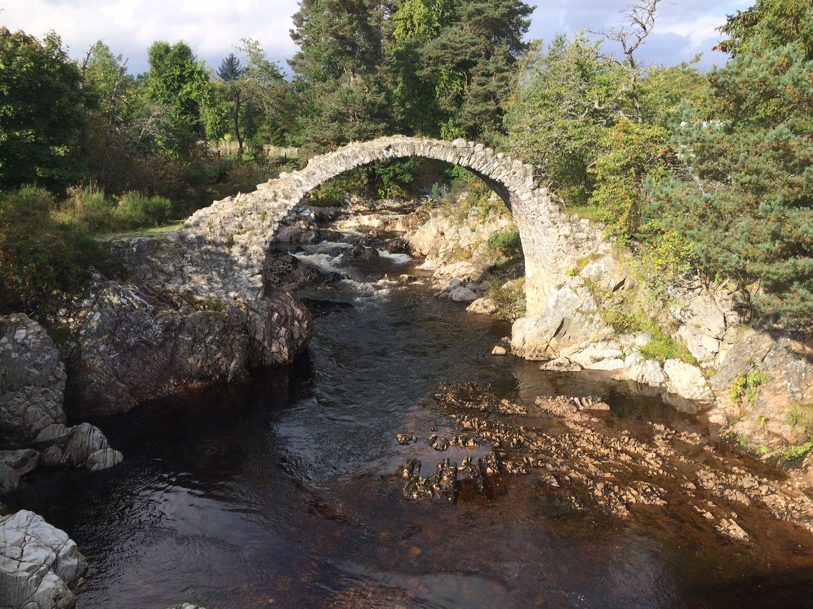
Carrbridge
Arriving at Carrbridge, I was looking for national cycle route 7, which my planned route was going to follow for some miles. I found it, but there was a warning on the sign that it was rough track. Well, that made me stop and think, as I was riding my road bike. Luckily there is an alternative version of route 7 taking the road, so I followed that out of Carrbridge, after stopping to admire the fragile remains of the old bridge. I wonder how much longer that arch can remain standing, it looks so precarious.
The next stretch of road was taking me towards Slochd, gradually gaining elevation and now feeling the force of the wind coming from my left. The minor road ran quite close to the A9 at this point, but was thankfully almost devoid of cars. I rode past Slochd hostel then onwards to Slochd summit, with the railway on my left and the A9 on my right.
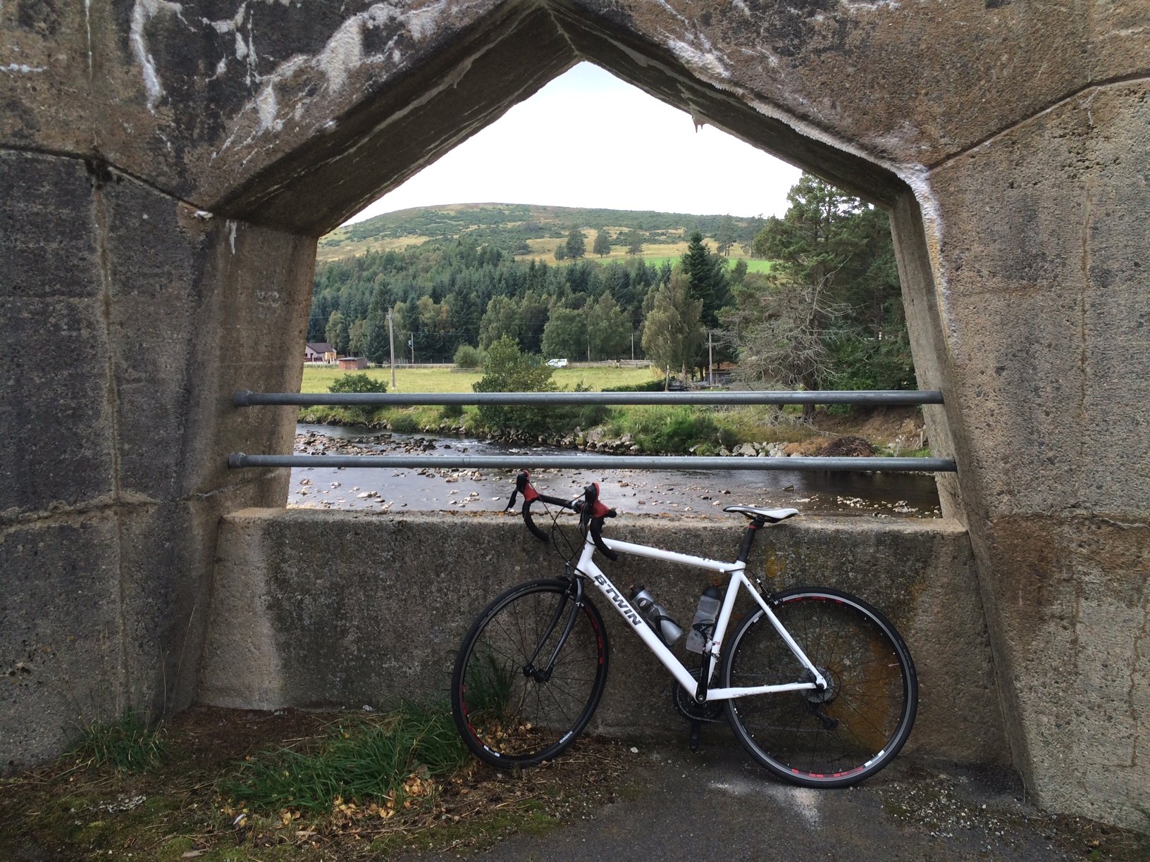
Findhorn Bridge
From there, I had a good long descent heading towards Tomatin, but the strong side-wind made me nervous, so I didn’t quite let fly. At the bottom of the descent, I stopped at the bridge over the River Findhorn. The bridge is a sturdy concrete construction, with pentagonal picture windows. The more I looked at it, the more I couldn’t make up my mind whether I liked it, or whether there was something not quite right about it. It was certainly worth stopping for a look.
On the other side of the river, now only a mile or so from Tomatin, there was a small road leading off to the left. This was my planned way to Inverness, leaving route 7 behind. I’m sure the route 7 way is lovely, but just yesterday I heard on the news that the final section of route 7 into Inverness was being described as dangerous due to extra traffic using it to escape roadworks elsewhere. That settled it for me – I was exploring the alternative…
So I headed southwest, following River Findhorn upstream, and into the teeth of a gale. Well, not quite a gale, but the wind was certainly quite strong and focussed in my direction by the river valley. There were a fair number of cottages, farms and other buildings along the road; their residents presumably united in supporting the “Save Strathdearn” campaign, which was advertised frequently along the way. This is an objection to the siting of a large electricity substation in the glen, and associated pylons.
The road continues for many miles up into Strathdearn glen, and by all accounts it is a beautiful place (for the time being anyway), but that is a dead end, and I was still aiming to get to Inverness. So I took a right turn at Garbole, signposted for Farr. This was the tiny joining road that I had noticed on the map, which looked so tempting when planning the route, and now was the time to try it for real…
The road rose gradually to start with, past a dark, meandering stream, then more steeply as it ran through woods, approaching two lazy switchbacks. It could have made for a lovely picture, but for the electricity pylons which dominated the scene. The price of progress…
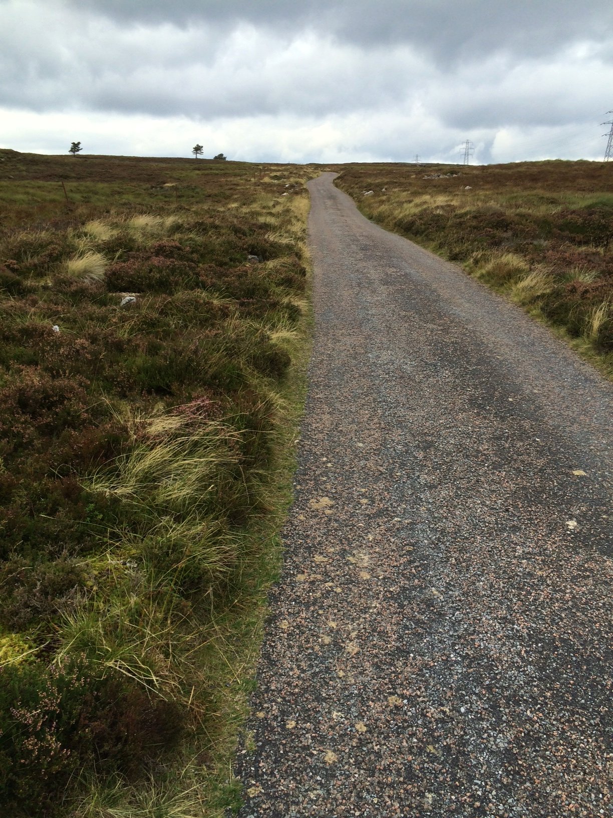
Heading up onto the moor
Talking of progress, mine was very slow up the steepest section, which took me away from the trees and out onto open moorland. The road was so narrow that I had to pull right off the tarmac to let a couple of vehicles past. I wasn’t expecting to see any traffic up on such a remote and isolated road.
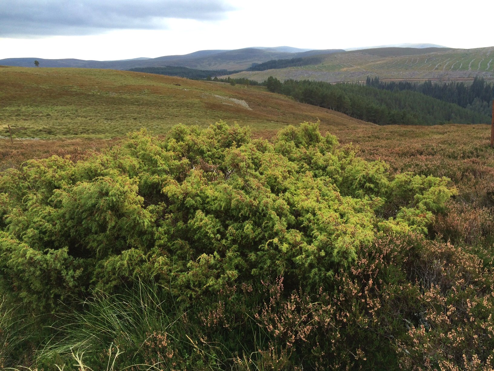
Juniper bush
As the road began to flatten out at an elevation of around 1500 ft, I stopped to investigate an interesting bush at the side of the road. It looked like a juniper, and it certainly smelled like juniper, but it was small and stunted, not much higher than the surrounding heather. It’s one of Scotland’s native trees and apparently has been in decline, so I was pleased to see it here. After that, I spotted quite a few more, all just as small. Apparently this far north, they don’t grow into proper size trees.
The Farr road snaked across the moor in a very picturesque way, apart from the fact that the pylons would have spoiled any attempts at photos. Clanks of metal on metal occasionally broke the silence, coming from the direction of the pylons, suggesting that some maintenance work was taking place. I didn’t let that spoil my fun. It was a great road to ride, especially as it began to get faster on the downhill. You had to keep your wits about you through all the twists and turns, avoiding the gravel patches and imperfections in the road. The reward, an adrenalin rush!
When I reached Loch Farr, I knew it was just about over, so I stopped for a bite to eat, to keep my energy up, then continued the last wee way to the end of the road, where it ended in a T-juncton.
Farr was to the right, and would have been the direct route to Inverness, but I had decided to take a detour so that I could stick to more minor (and hopefully scenic) roads. So I went left, and after about a mile and a half, turned right onto another narrow single track road.
This meandered through farmland, moorland and woodland, with one particularly steep climb thrown in, where I got frightened by the sudden appearance of steepness and my chain fell off as I changed down. Chains can sense fear!
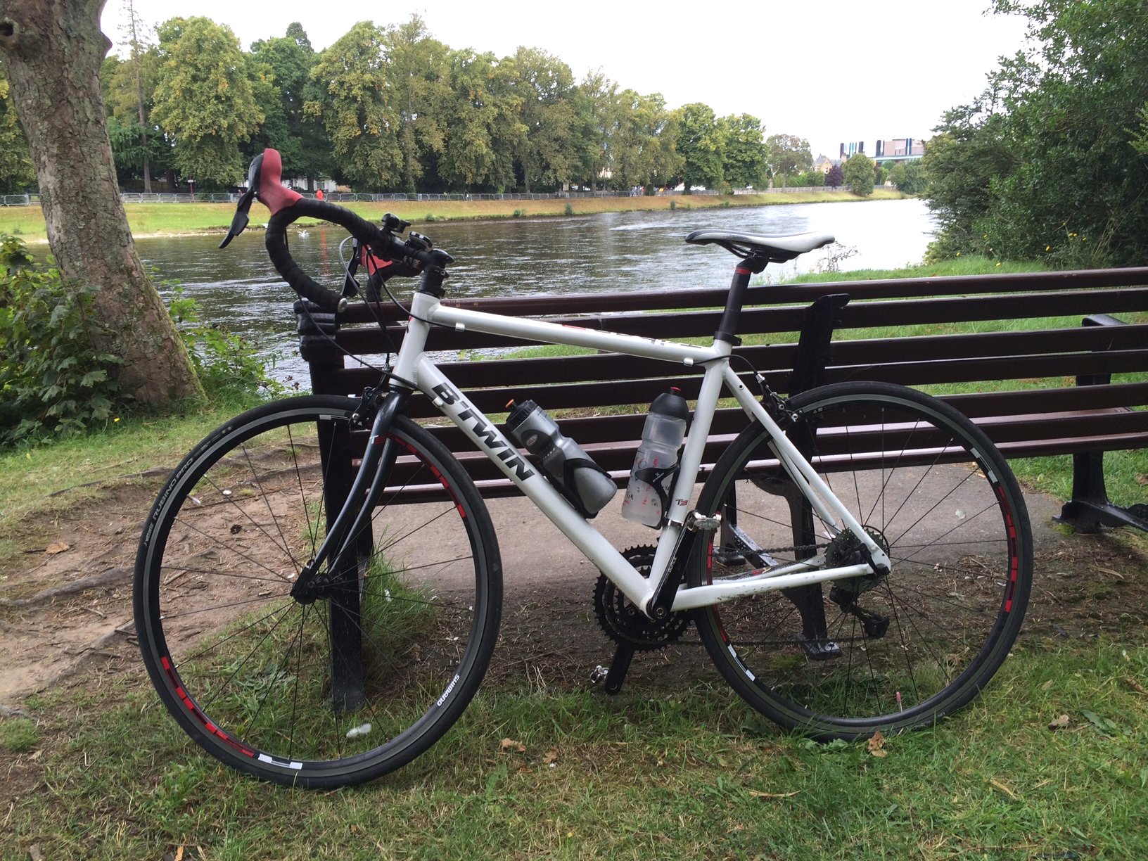
Inverness by the river
After that it was downhill all the way into the south side of Inverness. I made my way onto the riverside road and continued north at a fair lick. I had decided to stop the ride at the islands in the river and managed to sail past them at first. Then I had to work out where Colette was parked, as she was going to pick me up and drive me back to my car at Aviemore. We eventually managed to work out that she was parked on the other side of the river, but no problem, Inverness seems to have plenty of bridges.
Now that I’ve managed to join up the south of Scotland with the north, as far as Inverness, my next aim is to forge further north to Durness and then continue the red line right across the top of Scotland to John O’ Groats. That’s probably for next year though…