08 April 2019 – Spring comes to Oban

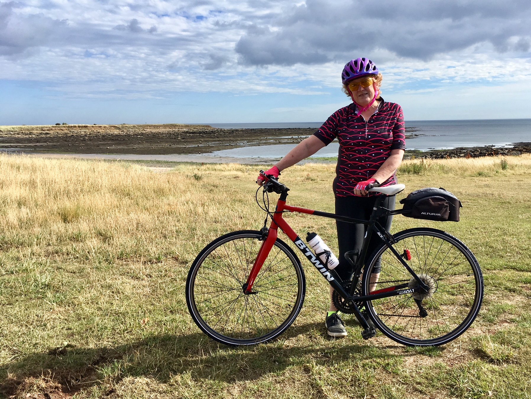
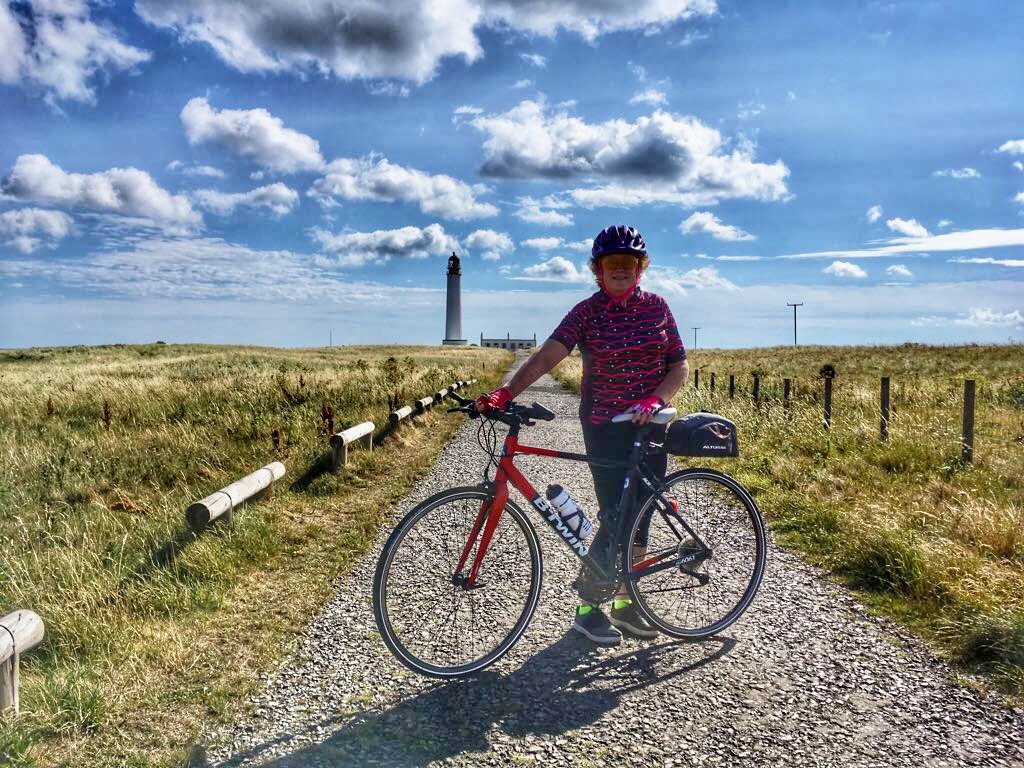
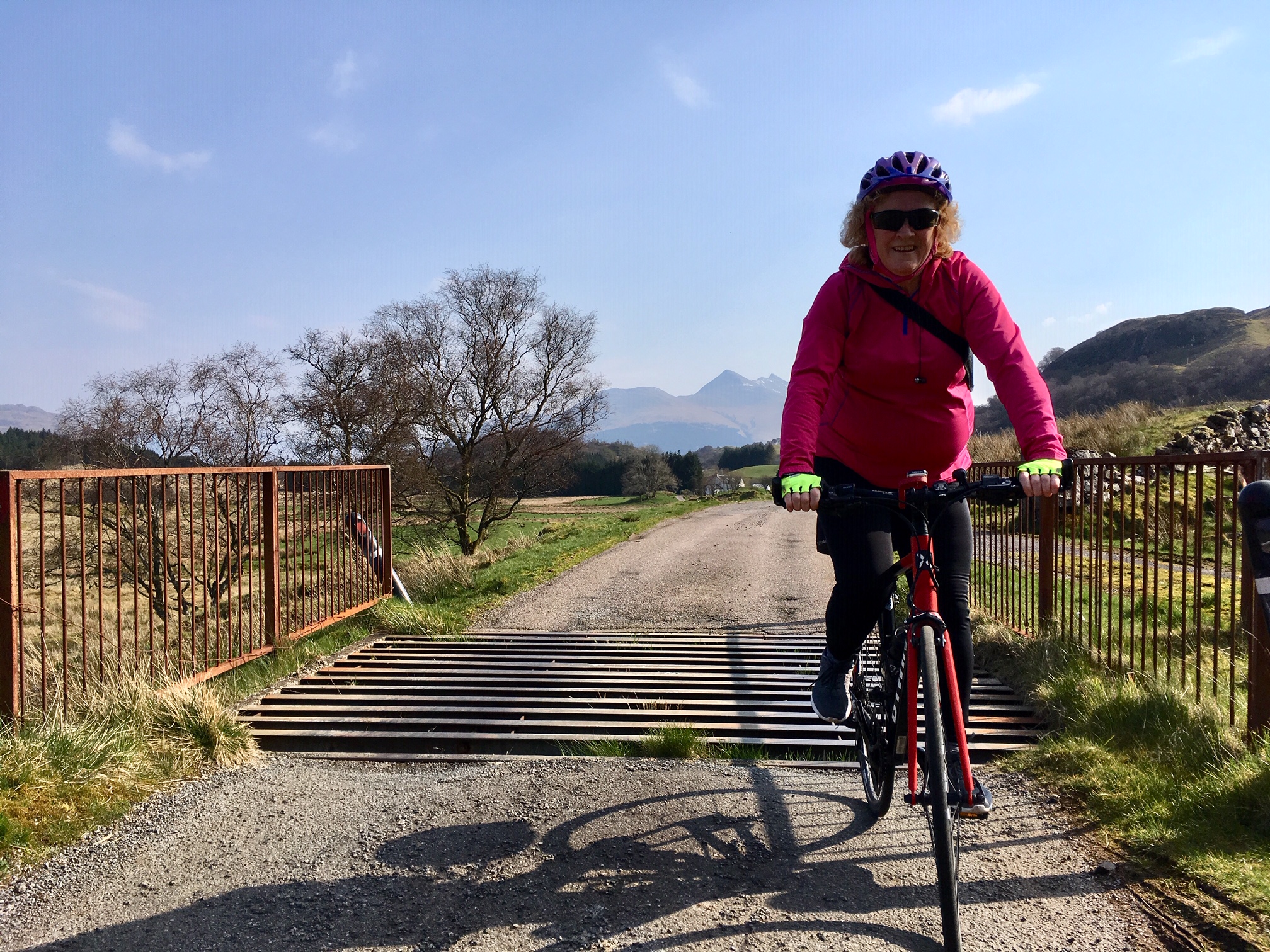
We were contemplating heading out into the cold east wind on this particular day, when we noticed that out in the west, the forecast was for 16 degrees C and sunshine all day. It wasn’t long before we said “what the heck” and got the car packed up. Off we went, in the general direction of Oban, making up a plan on the way.

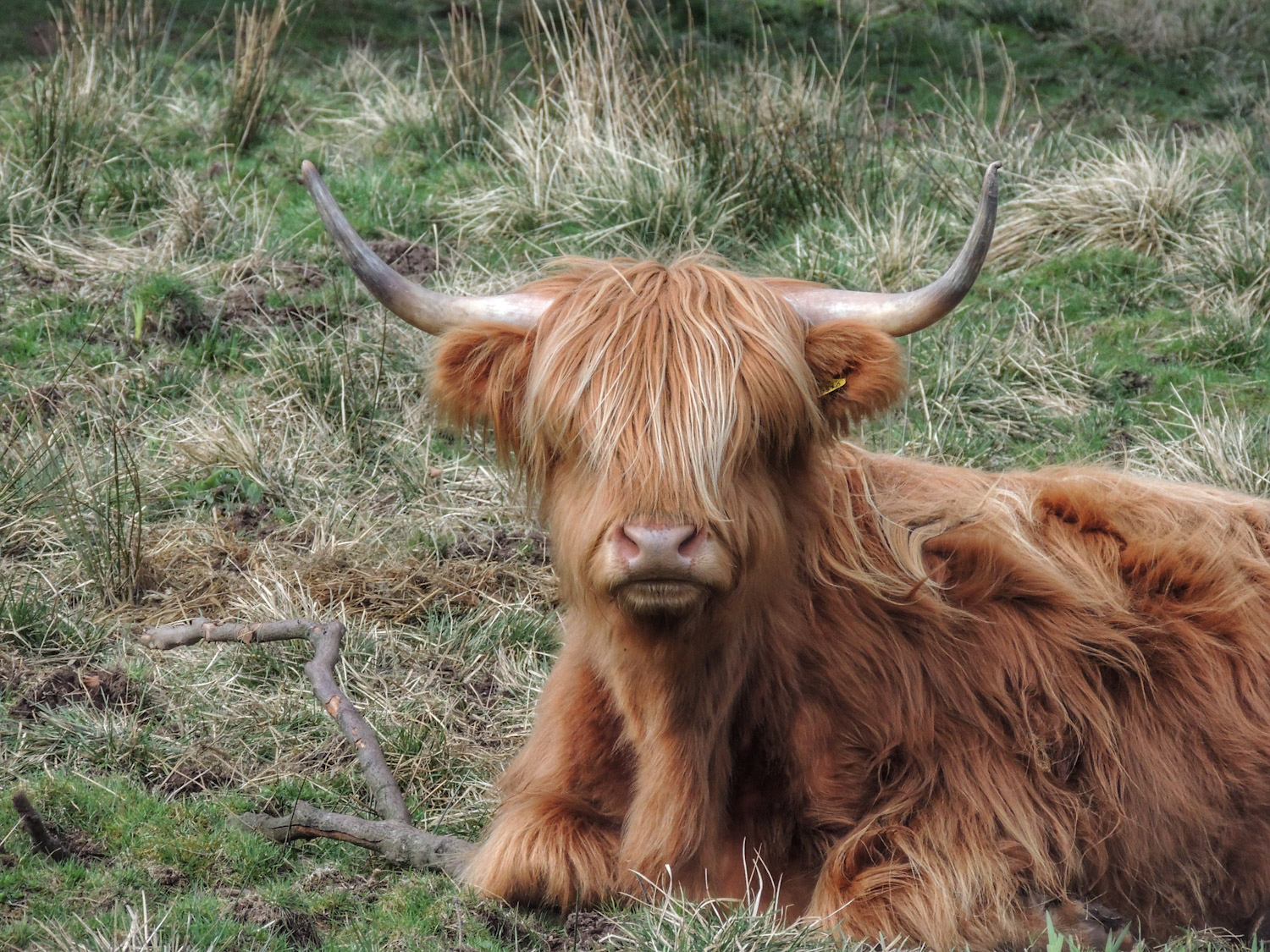
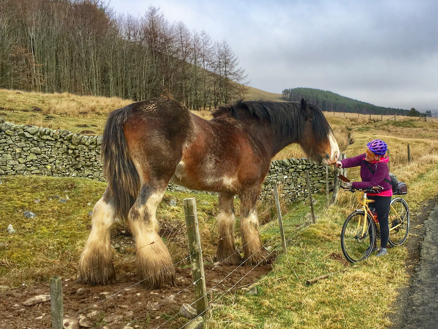
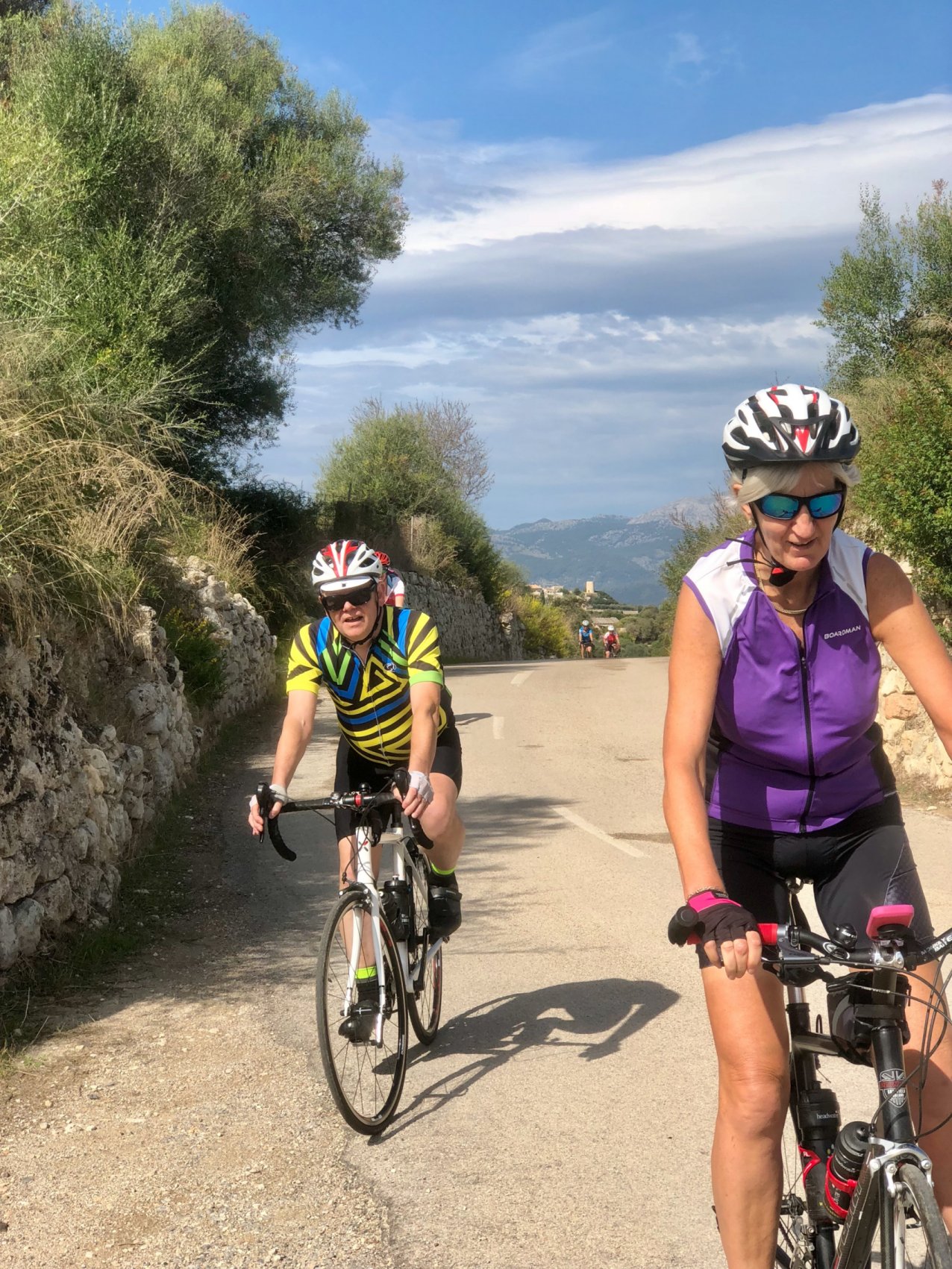
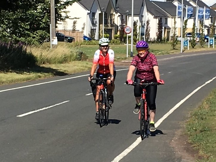
After a nice drive, we arrived at the village of Taynuilt, about 10 miles short of Oban. We headed out SW from the village along National Cycle Route 78. The route took us uphill for a while before opening out onto rolling countryside with a backdrop of mountains. This was rugged hill farming country, with occasional Highland cattle to prove the point.

The road was not best quality though, with potholes and deposits of gravel keeping us constantly looking for the best line, a bit like mountain biking. After about 5 miles, the road improved a bit, allowing us to take in more of the beautiful countryside as we rode along. A few more short sharp climbs and one last fast downhill brought us out at the centre of Oban.

This was a bit of a culture shock, where we sat at a junction for several minutes before we could get out into the traffic on the main road through town. We had only gone about 10 miles, but due to starting out a bit late, it was already lunch time.

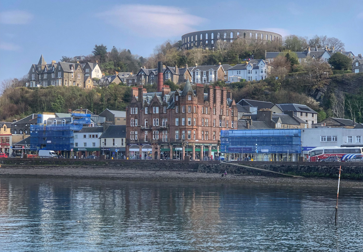
We investigated the harbour area. There were some tempting seafood shacks, but nowhere to sit down. We chose to patronise the cavernous Weatherspoons instead, where we had a tasty lunch at a very reasonable price.

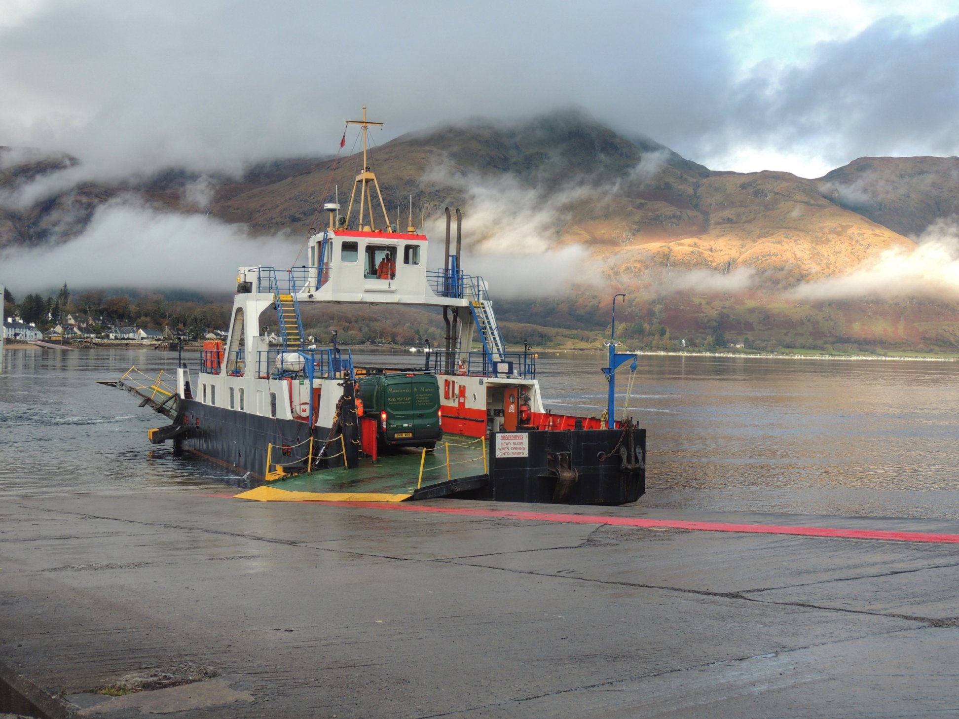
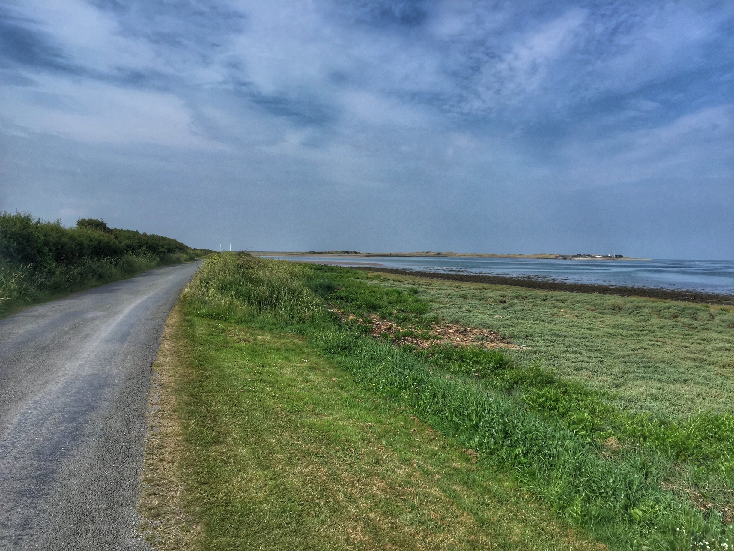
At the dockside, we watched ferries coming and going and soaked up a few warming rays before getting back on the bikes. Route 78 took us north out of town, along the shoreline. There were some impressive houses there, with great views out to sea across Oban’s natural protected harbour.

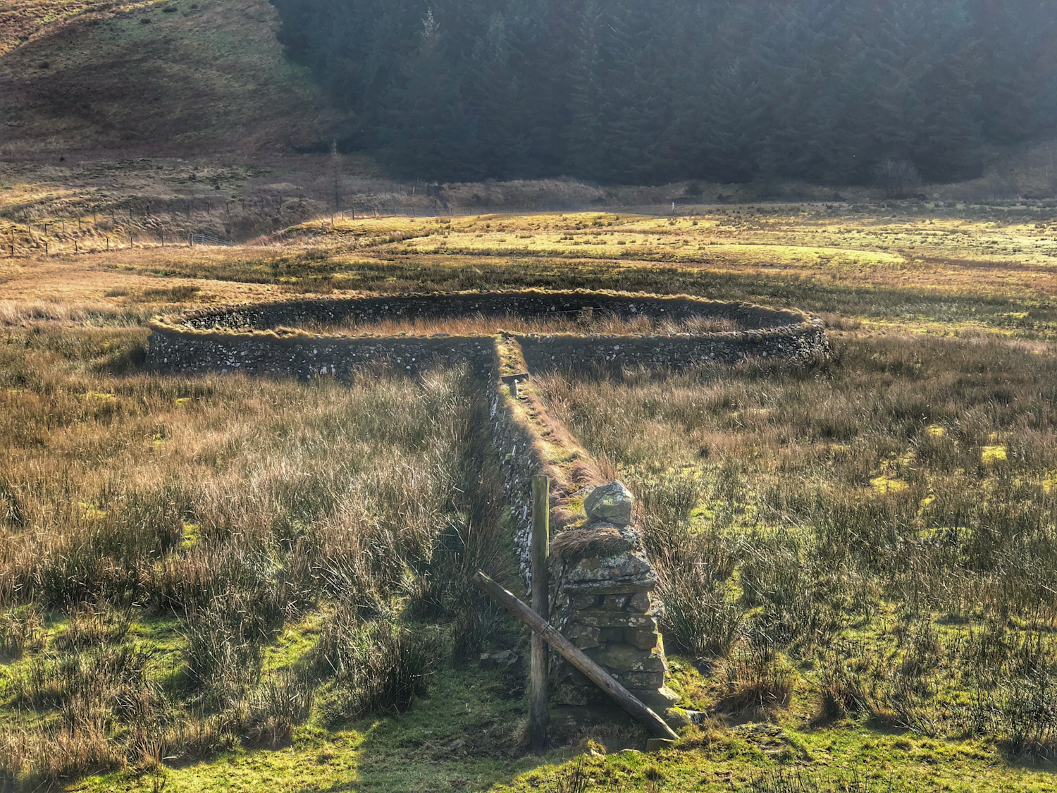
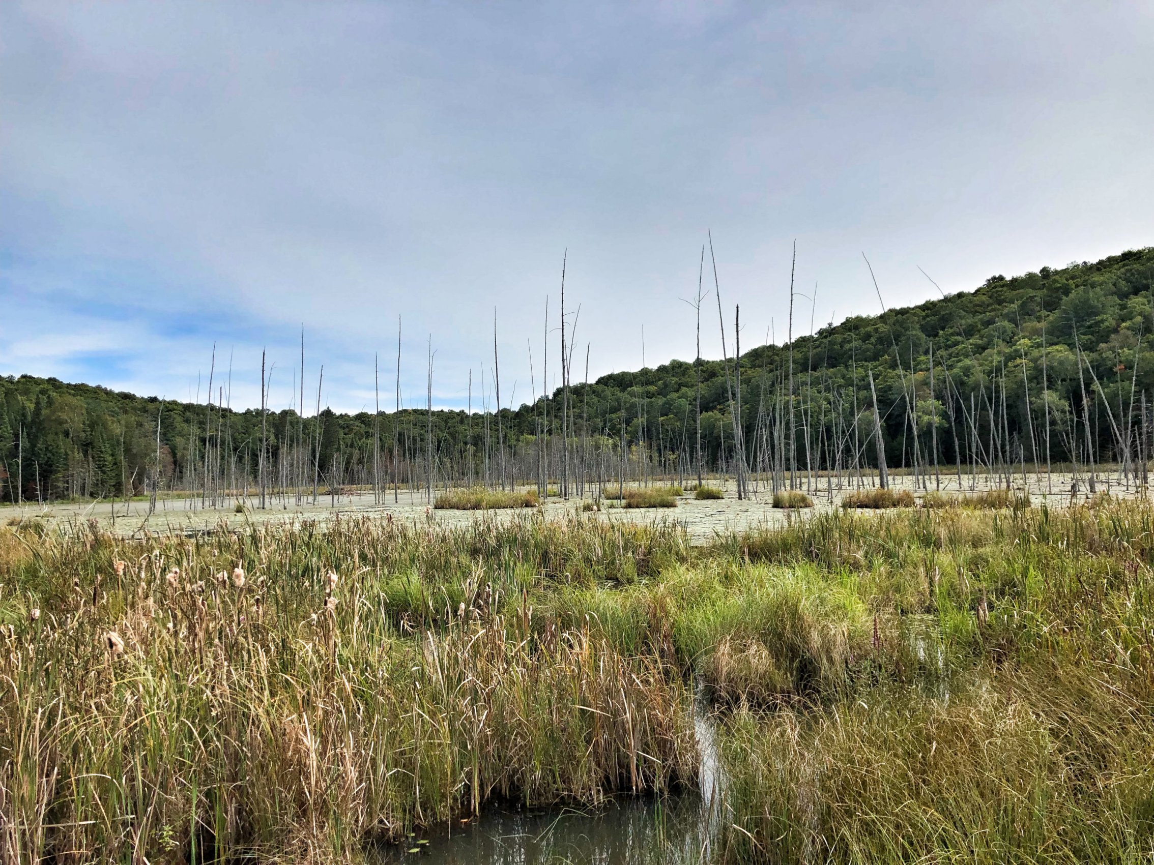
Leaving the town behind, we were loving the scenery. This was the first time that either Colette or I had come this way. There was an impressive sea stack, followed by Dunollie Castle, with the sound of bagpipes drifting from the ramparts and out to sea.

A mile or two beyond, the road ended at a seaside car park. However, the cycle path continued across country, with signs warning of steep gradients ahead. Steep yes, but very short, so no real obstacle to progress.

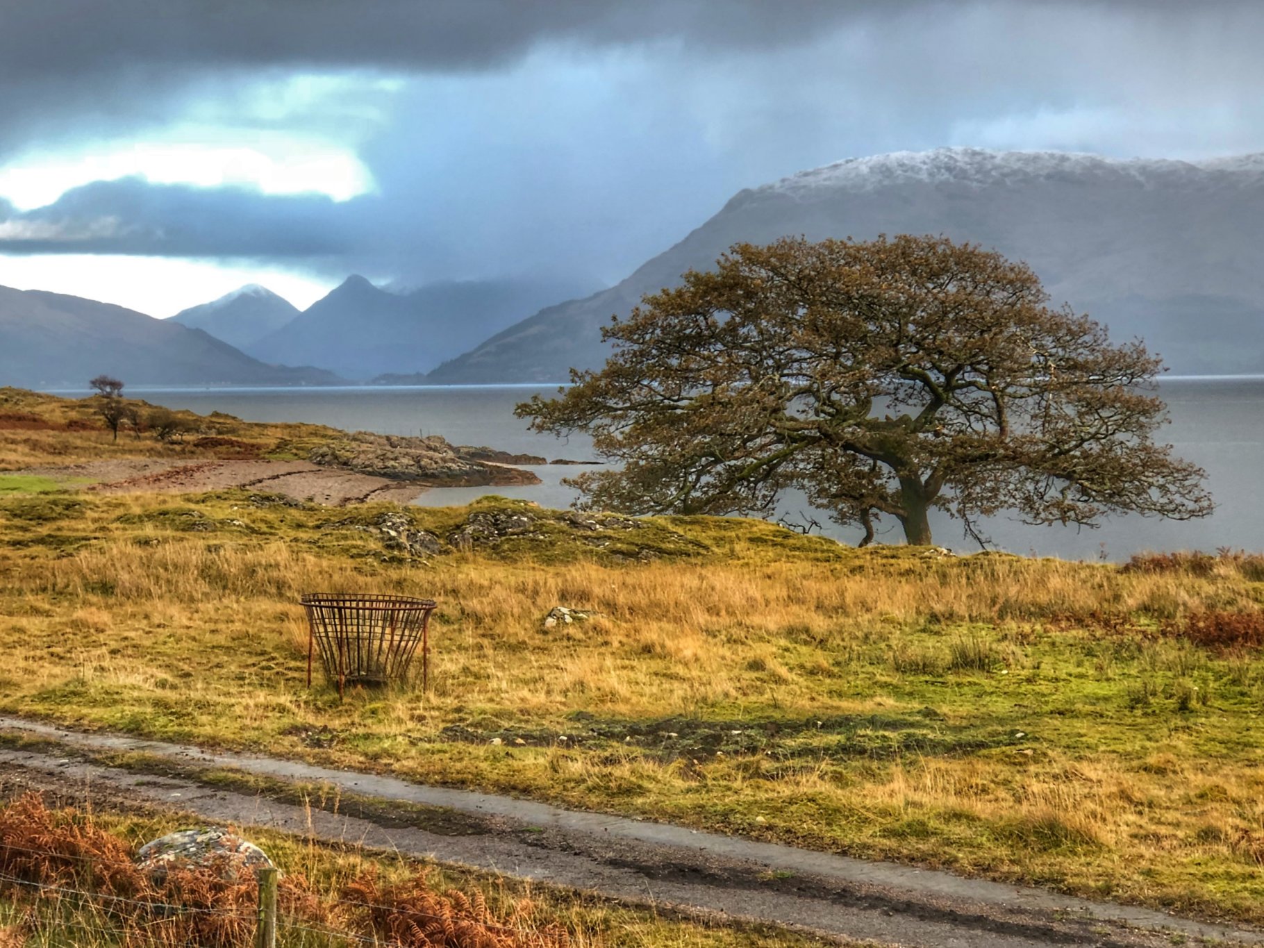
We followed this wee path till it came out at Dunbeg, then it dumped us back out on the main A85, which we cycled along for a couple of miles. There is a small car park with a view of Connel bridge, so we stopped there for a view of the Falls of Lora. This is the narrow opening where Loch Etive opens out to the sea proper. It was about halfway through the ebb tide, so the water was running strongly, creating impressive eddies and whirlpools.

Our next objective was to cross this maelstrom via the Connel Bridge. The problem here is that the crossing is a single carriageway, controlled by traffic lights. Unfortunately, cycles inevitably cause a tailback in the traffic, so the bus behind us had to wait till we were fully over before it could get past.

We followed the bus as it turned off into North Connel, then continued northwards on the route 78 cycle path. This took us past Oban’s tiny airport, where we waved to our bus driver again, who had arrived at his next stop via the main road.

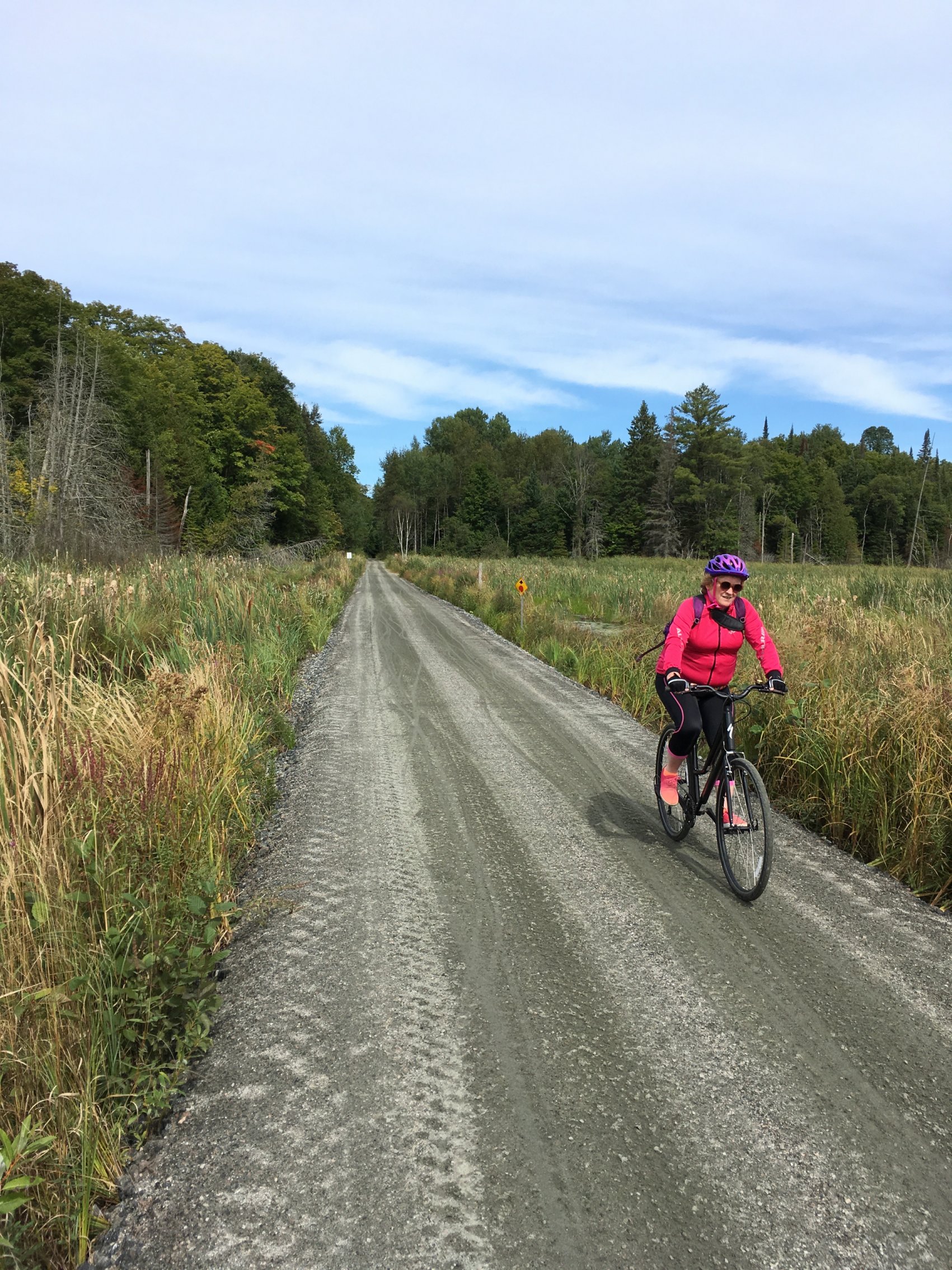
My map seems to be out of date, as I was expecting to have to do the next part on the main road, but the route 78 cycle path had been recently extended northwards from here. We gladly followed it north, passing through a large campsite and onward to Benderloch. Here, we went looking for a shop to replenish water and snack rations before continuing on route 78.

At times we were routed alongside the A828, but thankfully not along it. The route then crossed the main road to the east side towards the village of Barcaldine. Here, we parted company with route 78 and turned right, in the direction of Bonawe.

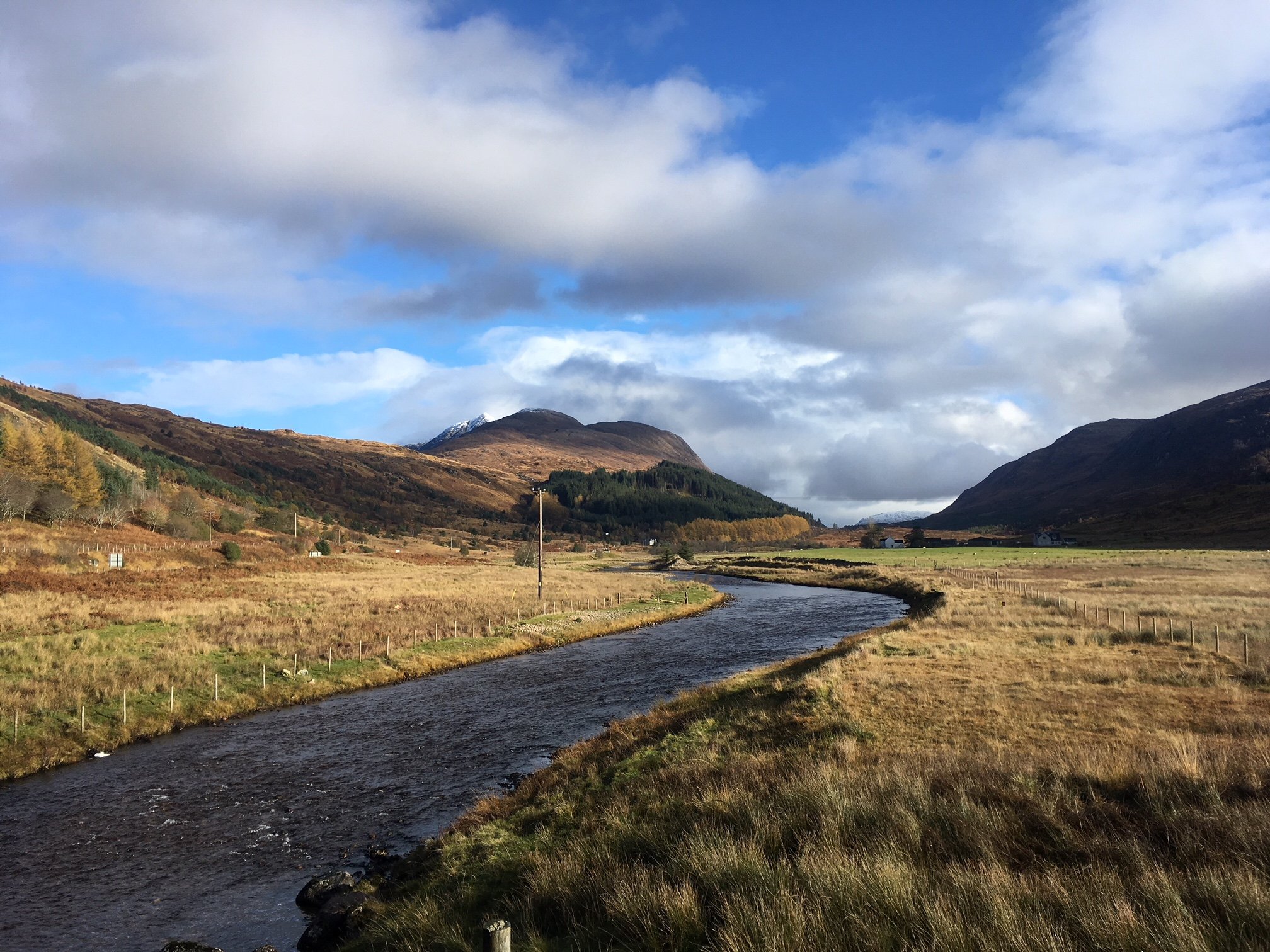
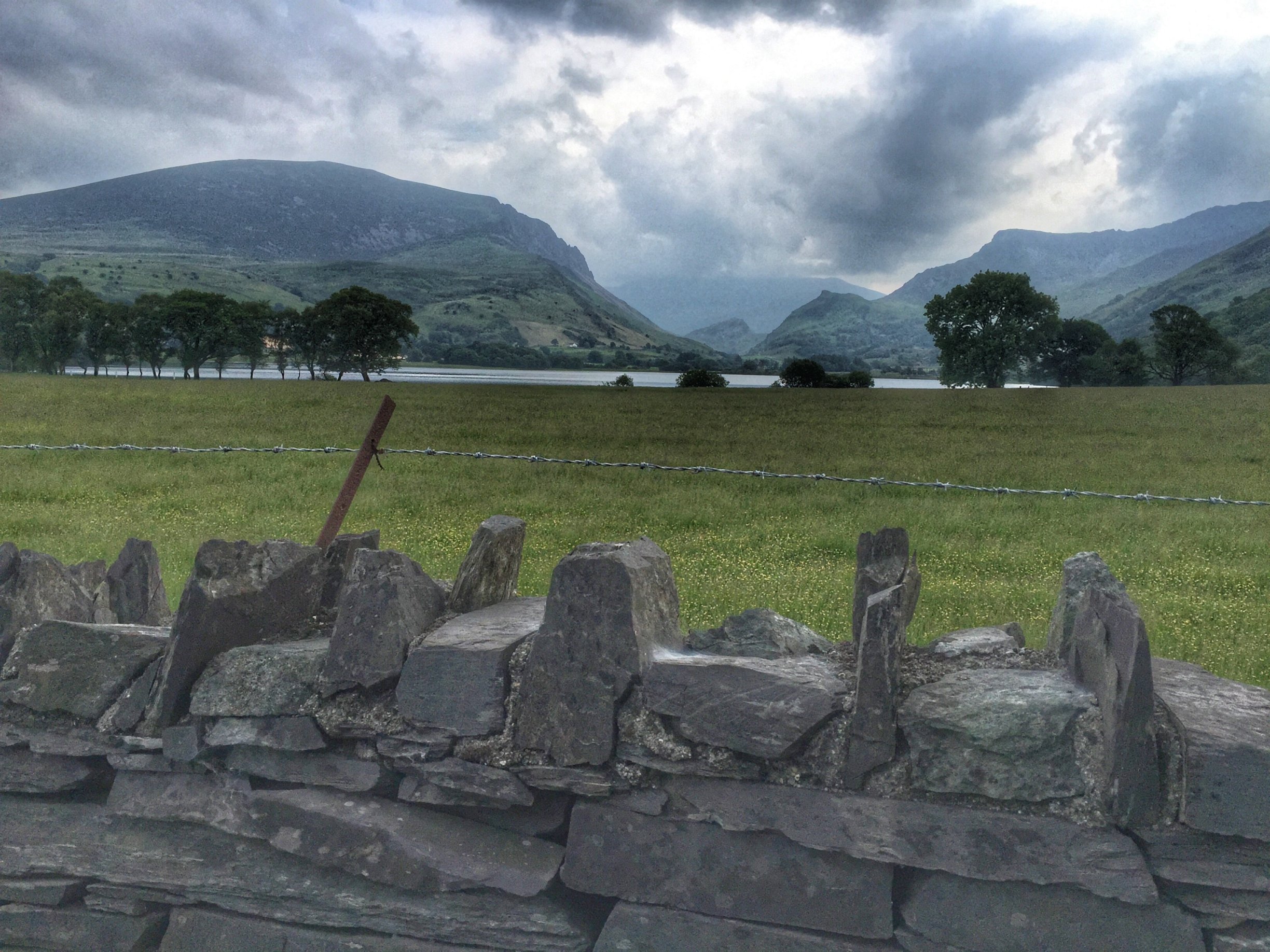
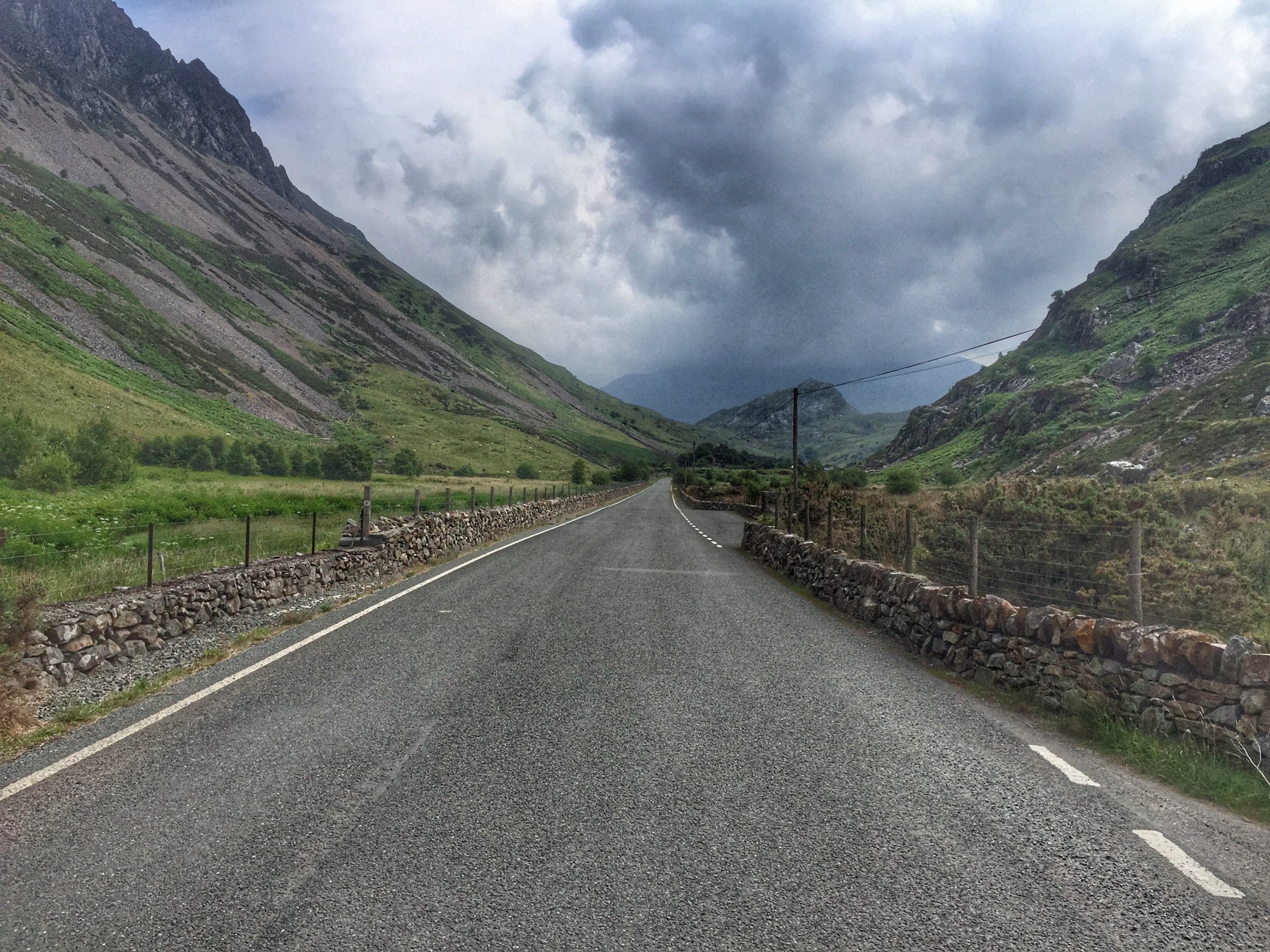
Straight away, we started a climb that went on for several miles through forest. We weren’t in any hurry though, so we had the odd stop on the way. At the top of the climb, we left the trees behind and the view opened up, revealing Loch Etive in all its glory below us.

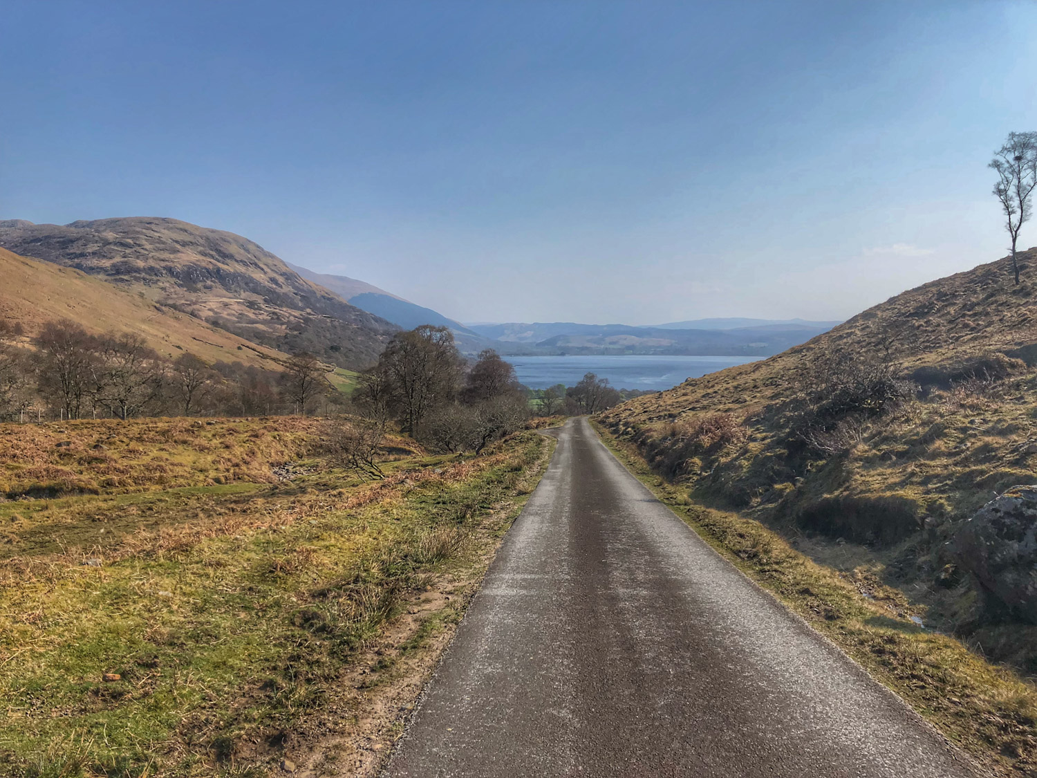
There was then a fast downhill section, where I was glad not to meet any cars coming up the opposite direction! At the bottom, we came to a kind of T-junction, where the road continued either left to Bonawe or right to North Connel, and a crow would have the option of flying straight forward about a couple of miles to Taynuilt.

Originally, I had thought of cycling as far as the dead end at Bonawe, then turning back. However, that would have added at least 4 miles so we shelved it for another time, and turned right to cycle along the shore of Loch Etive.

This was by and large a flat ride along a quiet and scenic lochside road. There were a couple of undulations though, including the one bringing us back to the Connel bridge. Again, I had to wave apologetically to the oncoming traffic, who were waiting impatiently with their light at green. I wondered if we should have cycled along the footpath, but there was no indication that I saw of it being a shared use path.

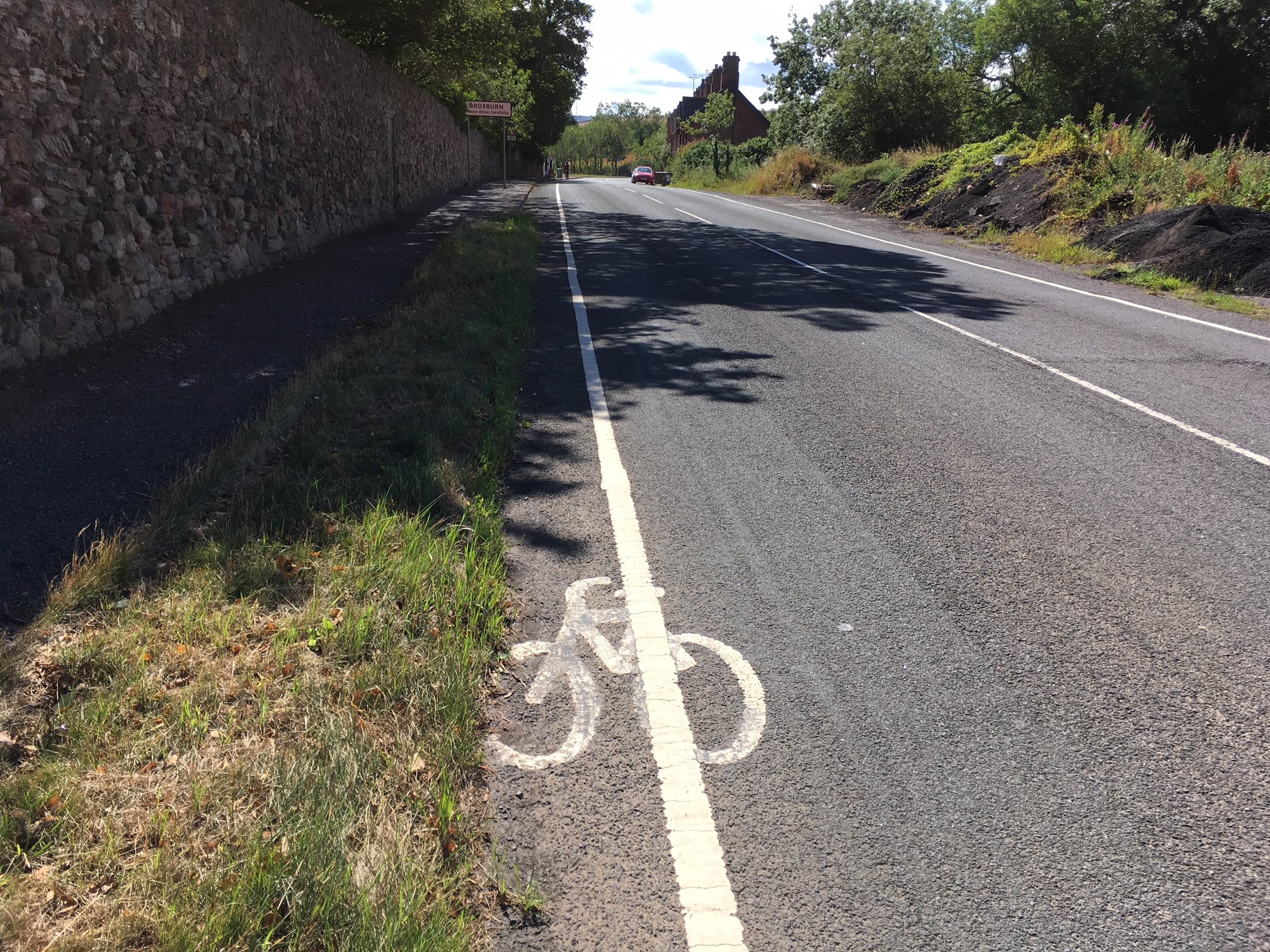
After that, we had the least pleasant part of the day, which was the 7 miles or so that we had to cycle east along the A85 to close the loop in Taynuilt. The scenery was still nice and the traffic polite, but there was quite a bit of it and we were conscious of causing a bit of a tailback at times. Ah well, it had to be done, and the sun was still shining warmly as we rolled up to the car at the end of the ride.

It was a superb day out, and we can’t wait for the next opportunity to head west and explore more of route 78…

Posted in Uncategorized | Leave a comment

26 March 2019 – Cycling in the Algarve

We were persuaded to take an extra cycling holiday this year (didn’t take much arm twisting) to try out a new location to us, the Algarve. We did try to visit last year, but our flight was cancelled amidst the Beast from the East, so I guess this is take 2. The Portugal exploration team comprised Colette and me, along with Alison, Janette, Fiona and Sheryl.

After one day of getting our bearings, day 2 was an assault on Foia, the highest point in the Algarve. We headed away from our hotel at Praia do Vau in the direction of Alvor, but as we reached the skydive centre, everything ground to a halt in a traffic jam. There were roadworks, which held us up for maybe 10 minutes. It might have been less, but the traffic from the other direction kept on coming when the light was green for us.

As we passed through the roadworks, Sheryl rode through a sharp hole in the road, and she was lucky not to come a cropper. Luckily she was riding a gravel bike with wide tyres to absorb the hit.

After the roadworks, the line of oncoming traffic was stationary for at least half a mile, explaining their impatience. On the narrow road, that made it impossible for the bolus of cars behind us to overtake, so we had to pull over and let them pass, which also gave a chance for a good check of Sheryl’s bike.

We then had to negotiate a triple roundabout to get us onto the N125, heading west. Although a busy road, there were wide verges on either side, which made for safe cycle lanes. At the first roundabout, we left the N125 and joined the EM532, heading north towards the hills.

This new road was quieter, allowing us to feel relaxed for the first time, although the odd car did have to squeeze past, and our experience already has shown us that the drivers in Portugal are not nearly as considerate as those in the Spanish places we’ve visited. In fact, they are no better than British drivers!

One of the potential drawbacks of the route I’d drawn up was that we didn’t pass through any towns or large villages, so we weren’t guaranteed a coffee stop until the cafe at the top of the mountain. So when we spotted a roadside cafe after only 9 miles in, we decided to stop, as we might regret it later.

The coffee was strong and bitter, needing extra sugar, but at only 70 cents a cup, it was hard to complain!

Suitably caffeinated, we got going again and took the left turn onto the CM1057 a bit further on. As we progressed, we got further and further from traffic and began to really enjoy the quiet country roads. We were passing through an area dotted with low, pyramid-shaped hills, the origin of which Fiona (our resident Geography teacher) was able to explain. But I’m glad there wasn’t a test!

Pretty flower – Cistus or rock rose

One striking thing about the hills was that they were carpeted in a type of shrub with large white flowers. Very pretty. The nature of the terrain meant the road became quite undulating here, but nothing particularly steep. It was all just the kind of thing I’d been hoping for. Slightly incongruously, we occasionally heard the noise of speeding motorbikes here, although we didn’t actually meet any on the road.

We rejoined the EM532 at Montes de Cima, where there was a decent-looking coffee shop, which we might have stopped at had we not gone for the previous one. Mental note made…

Everywhere there were reminders of recent forest fires in this region

This also marked the end of the low hills and an entry to the mountainous region. There was about a mile of quite tough climbing with gradients of 8-10% that slowed us down a bit. Not Janette though, who sailed off ahead, getting practice in for Mont Ventoux later in the year.

With the hard bit over, we regrouped then turned left at Casais, which put us onto another mile or so climb at a more enjoyable gradient. I was amused to see what looked like peas growing along the side of the road. I picked a pod as I was going and found little pea-like things inside, although I didn’t eat them, much to Sheryl’s relief. There were other wild flowers growing in abundance, including yellow lupins. It’s a botanist’s dream this place.

As we got higher and the view opened out, we could see a large race track down below, which explained the loud motorbike noises we heard earlier.

We regrouped again where a single track road led off to the right. It was marked Foia, and I had chosen to go this way up the mountain, as it was likely to be fairly free of traffic. It did look quite steep to start with, which I hoped was just some introductory steepness that would soon level off. Unfortunately, that was a vain hope. It was quite a struggle to get to the first easement of gradient, where we all gathered to get our breath back.

The real steepness begins

Hard going in places, but a lovely quiet road.

It was a lovely road, winding its way up the mountain through a forest of eucalyptus trees. But it did keep hitting us with these difficult ramps of 15%+ gradient. This section was less than 3 miles long but it seemed to take an age to complete, ending where we met the N266-3 road.

Right next to the junction, there is a layby with picnic benches, and across the road is a font where fresh spring water issues from the mountainside. It tasted good, and nearly empty water bottles were replenished.

Next, we just had to ride another mile or so to the top of the mountain, which was a doddle since the gradient was now in single figures. As we completed the final part, the trees vanished, to be replaced by a rock garden of heather. The road corkscrewed round the top of the hill, coming out at a visitor centre and radar station.

I made my way to the viewpoint area just as a squall descended and the view disappeared. A chair flew across the road from in front of the cafe and didn’t stop till it hit a rock on the other side. It was hard to stand, and then the rain started!

As the others arrived, we had to take shelter from what felt like sleet but was more probably hail that was starting to melt. More chairs took off and smashed into the bike rack – luckily missing any bikes. Alison sensibly decided to hide hers round a corner out of the wind.

We then retreated into the cafe and had lunch. As we ate, the rain stopped and it started to clear a bit but the wind was still howling. I was the only one who didn’t bring any extra layers or even arm warmers, so I was feeling cold during lunch in my damp short sleeved jersey. It didn’t help remembering the fact that you always feel colder after lunch. So before we left the cafe, I grabbed a handful of paper towels from the toilet and stuffed them up my jersey.

Standing shivering outside, I couldn’t wait for the others to get ready and just launched straight into the descent. As the road unwound round the mountain, the wind went from behind me to a full on side wind. That was pretty scary, forcing me to slow right down. I was also shivering intensely with the cold. That had a strange effect on the steering, making it feel quite wobbly. Under normal circumstances, this should have been a great fun descent, but I was just keen to get it over with.

Once we reached the eucalyptus forest, there was a bit of shelter from the wind, and despite still feeling cold, I was now enjoying myself. The road was littered with debris blown from the trees but nothing dangerous. Soon, we had arrived in Monchique, where we paused at the side of the road.

Fiona arrived also shaking with the cold, in an almost hysterical state. Alison was also shivering, and had felt the same odd effect on the steering. She even stopped a couple of times on the descent, thinking there was something wrong with her wheels. Sheryl told us how to shake our arms to get the blood flowing again, which really made a difference. It was warm in Monchique, so we got back to normal quickly and were then ready to continue the descent on the N266.

Our Jet2 rep had recommended that we visit the village of Caldas de Monchique, so we detoured through there as we passed. It was akin to a small version of Port Meirion, except that the buildings were larger and not arranged quite as photogenically. I wasn’t happy with any of my photos anyway.

We didn’t stay long as we needed to get back on the road. I had originally planned to take the N266 all the way into Portimao, but cycling through the town was a bit of a nightmare the previous day and we were keen to avoid a repeat. So a few miles further down the road, we detoured right, using a smaller and quieter road heading towards Moinho da Rocha. Immediately, we were in peaceful cycling territory again. The fact that we had a few undulations to deal with was fine by us.

Finally, we reached the EM532 again, and reversed part of the road that we had taken in the morning. We again spent a short time on the N125 before approaching the area of the roadworks. In order to avoid that, I devised a cunning plan to negotiate a maze of back roads through the suburbs. Two small problems with that though: 1) some REALLY steep undulations were involved and 2) I kept getting lost! On top of that, the wee roads were so busy with people in a hurry that I began to wish I was waiting in a traffic jam instead!

Finally, we made our way to Avenue Henry Cotton, which took us past golf courses to a roundabout where we could see our hotel. Phew, we had made it back at last.

The day was a success in that we had made it to the top of the Algarve and back as planned and found some great roads worthy of repeating. Also, we had found some less good roads that we know to avoid in the future. The Algarve definitely has good potential for cycling: it’s all about choosing the right route…

Posted in Uncategorized | 1 Comment

24 February 2019: Ettrick Valley

Having left the country last month for some warmer winter cycling, February sprung a welcome surprise in the form of a brief spell of mild, sunny and calm weather. We took advantage of this to venture for the first time to the dead end at the head of Ettrick Valley. With no cafe that we knew of out there in the wilderness, we set out prepared with a picnic to have at the halfway point. What a thought – it’s still only February and we’re planning a picnic! 

Our trip started out in Selkirk, aiming to pretty much follow the Ettrick Water upstream as far as the public road will allow, which was a full 25 miles. Despite the forecast showing warm, sunny weather for mid-day, it was quite chilly and overcast when we set off, so a full four layers were required.

We left Selkirk on the A708, passing the Waterwheel Cafe before turning off left onto the B7039, crossing Yarrow Water. A couple of miles later, we joined the B7009 and met up with Ettrick Water again. 

As we closed in on Ettrickbridge, the route became a bit more undulating, at which point some de-layering was required. We stopped at the bridge, where Colette removed her top layer and squashed it into her saddlebag. By the time we’d reached the top of the climb through the village, Colette realised she’d left her camera on the ground next to the bridge and forgot to pick it up again after the luggage reorganisation. Luckily I was there to sail down and bring it back, while she waited.

A few more miles further up the valley, the view opened out and the cloud began to lift as the sun burned off the morning mist. We were on the lookout for one particular horse, which Colette always likes to stop for, to say hello. It’s a Clydesdale or similar type of heavy horse which you don’t tend to see very often, and a very impressive beast it is too.

Carrying on past the yurts, we arrived at a junction where we would normally go right, heading towards Innerleithen. Today we were going to head straight on for the first time, but before that, we paused for a quick cup of coffee from our flasks and a wee snackette to keep us going.

A bit further on, Colette called out from behind “Is that a pub?”. We had just gone past the Tushielaw Inn, but I had only just clocked a white building, no more. Rather than stop and go back, I suggested we investigate on the return leg.

Ignoring the next left turn, which would have taken us in the direction of Hawick, we carried on following the Ettrick Water. In places, the road had the feel of a proper highland glen, with damp, moss-covered ground between the trees, which were draped with lichen.

By this time the sun was shining warm and bright, illuminating us and the hills to our right in a golden light, while the mist hung on above the wooded hills to our left, making them look dark and cold.

We passed through Ettrick and quite a large caravan site with a shop (good to remember that), after which habitation became pretty sparse. The road was freshly resurfaced towards the head of the valley, which was a bonus. 

Towards the end of the road, the flat-floored valley became less wide until it formed a simple steep-sided V-shape with the river, now just a burn, running along the bottom. The public road then stopped at a turning place, though a gravel track continued beyond. I had read that there is a bothy maybe half a mile further on. I had imagined that we might continue that far and have our picnic there if the track seemed suitable and/or the bothy looked to be in a picturesque position. However, the bothy appeared to be situated next to a quarry, so we just stopped and broke out our sandwiches at the turning place. 

The sun was beating down surprisingly strongly, forcing me to strip down to two layers during our lunch stop. It was lovely and warm and peaceful, and the M&S best sarnies (that we picked up in Gala on our way to Selkirk) were pretty good too. After lunch, the layers went back on for the downhill, bringing us back to Ettrick in no time.

We paused for a look at Ettrick Kirk then pushed on as far as Tushielaw Inn once more. On close inspection, it turned out that the inn was open, so we popped in for a coffee. For a moment, I thought it might make a good lunch stop for our Monday rides, but sadly it is only open Thursday – Sunday, at this time of year anyway.

After that, we retraced our steps fairly uneventfully all the way back to Selkirk. The sun stayed out for the return trip but it was starting to get chilly again by the time we returned. We can’t really complain, as the weather was a real bonus and we were delighted at the day’s ride, discovering a lovely new road that we will surely revisit soon.


Posted in Uncategorized | Leave a comment

23 January 2019: El Campello and Relleu

After last winter, we planned a getaway to the sun for this January, opting to visit the Costa Blanca again. Lynne and Keith were joining us this time, and they persuaded us to do an 11 day stay rather than a week, in case we lose any days to bad weather. The average temp for the time of year is 17 C, although last year it was mid-20s. That sounded just great. So good, that we were joined by another friend, Alison to take the numbers up to 5.

We were staying at Hotel Albir Plaza in L’Albir, about 4 or 5 miles up the coast from Benidorm. It’s a quiet resort compared to Benidorm, but that’s how we like it. We also chose this hotel partly because it has secure bike parking in the basement.

Our first ride to Guadalest was great, but on our second day we were faced with a forecast for a strong westerly wind. So we decided to take the tram west to El Campello, then ride back, hopefully with some wind assistance. That was the plan anyway.

The day started with us celebrating Lynne’s birthday with a restrained half glass of Cava, which the hotel lays on at breakfast time. Then it was off to Benidorm to catch the tram. We could have picked it up at Albir, but then we would need to change at Benidorm, so we just decided to cycle to the tram station in Benidorm and cut out the wait.

My planned route into Benidorm worked OK until one of the roads turned out to be a no entry, so Alison took it on from there, as her Garmin could re-route us to pick up my route further on. The resort city was busy with traffic and wasn’t a lot of fun to cycle through. After a while, we picked up the cycle path I was aiming for, which took us along pavement busy with pedestrians as far as the tram station.

Although we had a good 15 minutes to spare, the queue for tickets was not moving very fast, with some complicated discussions going on at the front. Alison went off to buy our tickets from an automated machine, but it didn’t like her type of credit card. I was beginning to get tense but we got served at last and pushed the bikes onto the busy L1 tram with a couple of minutes to spare.

It was a squeeze getting the bikes on, splitting up between both ends of the tram. A guard came on just before we departed and told us that the maximum number of bikes is 4. He didn’t kick one of us off, but seemed keen that we didn’t do it again!

The trip lasted about 50 minutes, standing next to the bikes all the time, but after a few people left at various stops, there at least was enough room to get our bikes out of the way and into the bike spaces. We jumped off at El Campello, leaving the tram to continue all the way to Alicante.

From El Campello, I had let the online route planner decide the best way out of town. However, it was going to take us on the main road, so Lynne and Alison came up with a quieter alternative. We then used a couple of roundabouts to cross over the N-332 and AP-7 to get us onto the CV-775 road to Relleu. The blustery wind made its presence felt as we crossed the roundabouts, nearly blowing us off our bikes.

We then left the traffic behind as we began a gentle climb into the mountains. It was sunny but not exactly warm, so we had to stay fairly well wrapped up. Still, much better weather than virtually anywhere else in Europe, so we couldn’t complain.

By the time we reached the village of Aigues, we had done over 1000ft of climbing and it was definitely time for a coffee, so we stopped at a bakery / coffee shop. There were a number of interesting looking baked goods on offer, and I chose one to share with Colette as we drank our coffees. It looked like an apple turnover, but sadly it was just sugar coated puff pastry with a hollow centre. Bad choice! I wished I’d gone for a sausage roll or pastie instead. Next time…

After leaving Aigues, we had a bit of relief for the legs with some downhill. Soon, we were being passed by some very fast cyclists, whose colours we recognised at the CCC pro cycling team. They very quickly disappeared into the distance, but were visible for a while longer, rounding some of the bends up ahead.

We reached those switchbacks after a while, and what a joy they were, especially with the occasional bit of wind assistance to make them seem easier. The view of the surrounding jagged-topped mountains was spectacular.

I decided to stop at the top of the climb for regrouping, and there in the layby was the CCC team car. A young, tall and skinny rider was standing there, holding his bike minus its back wheel, looking very cheesed off. A mechanic was finishing pumping up his tyre, and I presume he had just finished repairing a puncture, as they were not carrying any spare wheels. I asked if Greg van Avermat (the Olympic road race champion and CCC rider) was training with them today, but was told he was in Belgium, and this was the youth development team. The mechanic fitted the wheel, put the bike on the roof rack and the boy in the back. Then they all raced off to catch up the main group.

It did cross my mind to ask if they had any spare bidons that I could have as a souvenir, but I chickened out. Coincidentally, a few days later while we were waiting for a tram at Calpe, an Astana mechanic arrived to catch the tram home and happened to be carrying a bag of bidons from that day’s training ride, from which he kindly offered us one each. Astana are now one of our fave teams!!!

Anyway, after regrouping, it was mostly downhill to Relleu. I let gravity take control and got up a good amount of speed at one point, when a sudden strong gust pushed me right across the white line onto the other side of the road. Needless to say, after that I kept the speed down to a manageable level.

We arrived at Relleu on the lookout for a lunch stop, gathering on the main street to discuss where we might go. The wind was funnelling between the buildings at great force. Alison’s weather forecast said to expect wind gusts to 76 kph, and it felt every bit of that. We went into the Balcon de Relleu and ordered simple bocadillos for lunch.

After Relleu, there was a lot of descending till we met the CV-770 at a right turn. We had to do that very carefully, as the swirling wind could catch you by surprise at any time. Though mostly, the sight of madly thrashing bushes just ahead was enough warning to kill the speed a little and be prepared.

We turned left onto the CV-758 after a short while, taking us steeply down then steeply up before the slope moderated on the run-in to Finestrat. Another coffee stop was called for there, before the last proper climb of the day out of Finestrat. The wind might well have helped us here, as I remember feeling that it was quite easy.

Wanty-Groupe Gobert sped past as we were having coffee in Finestrat

After that, we descended safely to meet the busy CV-70 at a roundabout. Making use of a bit of cycle path then side roads, we managed to get back to Albir without coming across much traffic at all. The only traffic problem came as we tried to pass under a bridge in Albir, where the traffic goes from driving on the right to driving on the left as you pass under, then back to the right again. God only knows why they chose to do that, but it was the cause of much beeping of horns.

Soon after, we had parked the bikes safely in the underground car park and were planning our trip to an Indian restaurant for Lynne’s birthday. It had been a great sunny day of cycling that might have been perfect if it weren’t for the wind, and perhaps a slightly less stressful tram journey would have helped.

To give the tram its dues, we went the opposite direction to Calpe and found the L9 tram line a bit less busy and better suited to carrying bikes. With five of us, the tram was always going to be potentially problematic, but for a couple it would be ideal, as the tram opens up so much more area for cycling. Otherwise, you might run out of routes after a week.

With the 11 days in the sun over, we arrived back in Edinburgh to snow. It isn’t going to be easy to get motivated to cycle in the cold again…

Posted in Uncategorized | Leave a comment

06 December 2018 – Turbo time again…

As winter bites and the chances to get out for a good bike ride are few and far between, a lot of us dust off the old turbo trainer again. To make it a bit more bearable, we have had the likes of Zwift to help keep us motivated as we pedal away in front of the telly. I’ve been using Zwift for a few years now (see December 2015) and still find it useful.

As described in the original post, I started off with a BTwin trainer and an old Macbook. I then progressed to a PC (bought a 2nd hand one which I dedicated to Zwift) and upgraded my trainer to Tacx Satori Smart. By the time the PC broke down, Zwift had become available on Apple TV, so I got one of those, as it was cheaper than buying a new computer. Now I am very happy with my Zwift experience, though I might yet be tempted to upgrade my monitor from 720p to full HD or even 4K.

While I’m a big Zwift fan, Colette finds it a bit too “cartoony” to hold her interest. Some of my friends have been looking into alternatives to Zwift recently (prompted mostly by the 60% price hike in subscription charge) so I decided to check them out too, in case Colette might prefer them to Zwift. In particular, I am looking at options that show real life videos of cycle routes where you can move along at a speed determined by your own power.

In total, I’ve compared 3 options: Fulgaz, Rouvy and BigRingVR. The former is on Apple TV, while the two others I got working on my PC (yes, I eventually got my PC working again after replacing the dying hard drive).

Rouvy (https://rouvy.com/en/)

Free trial: 14 days

Cost (monthly): $7.99 – $12 (standard vs premium)

Platform: PC, Android, iOS

Rouvy has lots of video rides available, and even more without video, but I’m not really interested in them. The routes are from all over, which is good, as I like to alternate between rides I know and those that are completely new to me, as well as ones that I would like to try in the future. The highest quality rides are HD, and include about a dozen or so Augmented Rides, with animated riders and features that pop up to give you extra info. A bit gimmicky maybe, and slightly reminiscent of 1980’s Doctor Who special effects. If you can ignore that, I found the video quality was excellent, and even when I was going slowly up a steep climb, the video stayed very smooth.

The Augmented Rides I tried were downloaded before riding, which is just as well, because my internet is not capable of streaming HD video. There are also 30-odd premium routes, including many classic climbs, but they are streaming only. Predictably, I wasn’t able to get any of these to work. Also, the premium rides are only available on the premium subscription.

The remainder of the videos are of variable quality, some of which were too wobbly for me to use at all without feeling seasick. The Trek Factory Racing ride from Lluc to Orient in Mallorca was not best quality, but I enjoyed it as I remembered the roads from my hols. Colette wasn’t quite so impressed.

At the end of a session, I like to save my workout, so that I can keep tabs on how much I’ve been doing. I prefer not to save turbo rides to Strava, keeping that just for real life rides, so I save to my MapMyRide account. Rouvy doesn’t do this automatically at the end of a ride, but does offer a 1 click upload. That seemed to transfer the route, distance and time OK, but somehow I ended up with a 55mph average speed! This may be more a problem with MMR than Rouvy.

BigRingVR (https://www.bigringvr.com/)

Free trial: 7 days

Cost (monthly): $10

Platform: PC, Mac

I found this one not quite so intuitive to use at first, but soon got the hang of it. There are about 250 videos to choose from here, but the number of countries is more limited than Rouvy, with none from the UK for example. Lots of the classic rides from the Alps are available, along with some Mallorca and Costa Blanca routes that I am familiar with.

The makers of this package have made sure that only high quality videos are used, and these can be downloaded in advance if you have a less than perfect internet connection. Only 2 downloads are allowed at any one time during the free trial, so you need to plan ahead.

I tried out the Sa Calobra ride. This was the second time I’d done it; the first being a few years ago in real life. It was just as hard, and there were no stops for photos or at the cafe near the top either, unlike last time. On the plus side, I did complete it quicker. The video quality was great throughout, though by the tine I was halfway up I really couldn’t care any more! One weird thing: I didn’t see a single bike in the video. Maybe it was midsummer and far too hot, and could explain why the video was taken from a car.

I would have loved to show one of the screenshots from my workout, but for some reason they failed to show any of the video.

BigRing downloads a .TCX file containing your workout into a folder on your PC after every ride. It was easy to upload this to MapMyRide and it transferred all the info perfectly.

FulGaz (https://fulgaz.com/)

Free trial: 14 days

Cost (monthly): £7.49

Platform: Apple TV, iOS

This is the only competitor to Zwift on the Apple TV platform, focusing on high quality video rather than the multiplayer game-like experience that Zwift provides. After an initial test that seemed to go OK, I read in the FulGaz FAQ that the software doesn’t support my Satori Smart trainer. Well, after finding that out, I had a hell of a time trying to get it to connect again.

FulGaz on the road to Orient. Photo taken on a 26″, 720p TV

After a lot of trial and error, I think I might have found a method that works… Firstly I start up Zwift and make sure it recognises the trainer at the pairing screen, then I quit Zwift (or pull the plug and restart Apple TV), open up FulGaz and (sometimes) the trainer is recognised. After that, it’s all good. I think it’s all about getting the trainer in the right “mood” for pairing. Maybe this will improve with a future update to the app, but equally, it might stop working altogether.

There is a big range of videos to choose from, and like BigRingVR, only good quality ones have been selected. The usual suspects are here, including Mallorca rides, but not much from Costa Blanca. There are a good number of UK routes, which was very welcome. We found a ride up Glen Nevis (confusingly titled “Arbroath Smokie”). Colette loved riding up the glen that she knows so well from her early years, and it held her attention all the way to the end.

One plus point for having the app on Apple TV is that it handles 4K video. Many of the FulGaz videos are shot in 4K, so with a suitable telly you will get the best lifelike experience possible.

As for saving workouts to MapMyRide, that was possible using the .fit files that are emailed after every ride. You need to save the file then upload to MMR. I did this, but MMR didn’t recognise any of the route data, only the ride summary. I think this is a MMR problem, as I got the same .fit file to upload fine to Garmin Connect.

End of round 1

At this stage, we need to say goodbye to one of the contestants. All do a really good job, and they have their unique plus points. In the end, although I like lots of things about Rouvy, the fact that the number of high quality videos is limited and only available for streaming, means we can rule it out at this stage. Thanks Rouvy, great effort!

The grand finale

How to pick between FulGaz and BigRingVR??? A head to head was the only way to decide. For this, I downloaded the Cap Formentor ride on both platforms and asked Colette to test ride them one after the other. I also borrowed a full HD TV from the living room for the best experience.

BigRingVR looking great on a big TV, at the start of the climb from Puerto Pollensa.

We started with BigRingVR, running on the PC, which looked clear and smooth in HD. You almost felt like you were really there. So far, so good.

Then I tried to get FulGaz running on the Apple TV. I tried all of my tricks but to no avail: it wasn’t for starting this time. So Colette went back to BigRingVR on the PC, which allowed her to restart her ride from where she left off – a great feature.

So there you have it. After a technical KO, it looks like BigRingVR wins the day. We’re definitely going to sign up for the next few months at least, while we need the turbo the most. With so many routes to explore, let it snow, let it snow, let it snow!

Posted in Uncategorized | Leave a comment

01 November 2018 – Ardgour and Strontian

Booking a night’s B&B at Ballachulish allowed Colette and me, along with Lynne and Keith, to have a couple of days away cycling up north. On the first day we headed for Port Appin with the intention of taking the ferry over to Lismore. However, the weather closed in so we just headed back to Ballachulish with heavy rain at the finish. This is getting to be a familiar scenario, as is my Garmin running out of battery before the end of the ride.

A good shower and meal, followed by a night’s sleep and a hearty breakfast recharged our batteries, and all the time my Garmin was plugged into the wall, doing the same.

Next day we headed to Corran to get the ferry over to Ardgour. It was easiest just to drive there and park at the ferry before getting on our bikes. However, I did feel a little uncomfortable leapfrogging the large queue of cars and lorries waiting for the ferry. We took up the final two places in the small car park at the end on the left and got ready for our ride.

Less than half of the queue of vehicles made it onto the ferry before it was full up, but that didn’t prevent bikes or foot passengers walking straight on. What’s more, it was free for us!

It was quite exciting making the short crossing, thinking about the day ahead. We had a crisp, bright start and the scenery up and down Loch Linnhe looked fantastic.

Once off the ferry, we headed south, following the coastline on a good quality road. There were quite a few photo stops and lots of lovely scenery to soak up as we rode along.

After about 6 miles of pretty flat riding, we noticed a small road running steeply uphill to our left. Surely that wasn’t ours? But yes it was! I hadn’t paid that much attention to the elevation in planning the first part of the ride, assuming we were hugging the coast in a flattish way. So we had a tough little climb, taking us away from the coast temporarily.

Any dissent in the ranks was soon forgotten once the next view opened up, revealing a lochan nestling in a bowl in the brown autumn landscape with our road snaking its way through. After that, we descended back to the shore, with the loch close by on our left and snow-dusted mountains to the right.

As we rode onwards, light rain began to set in. We rounded a corner at a bay and could see the settlement of Kingairloch ahead of us. As we closed in on the village, we discovered that it was situated down a dead end, while our road carried on above, requiring a short climb.

At the end of that climb, we stopped and broke out our Thermos flasks for a warming cups of coffee/tea. The rain held off for our wee break, but set in again after we continued. We were now steadily climbing northwest, away from Loch Linnhe. After we had been going for a while, the hills ahead of us were bathed in sunshine and we emerged from the rain. Looking back, Loch Linnhe looked dark and forboding with the rain clouds still lingering over the water.

The road flattened out and even went downhill briefly till we reached a junction. Our route took us north towards Strontian, and involved just over a mile of further climbing. After that however, it was two miles of steep downhill. Luckily there wasn’t anything coming up, so we had license to let go of the brakes if we liked, though I tried to keep the speed under 40 mph as the road was still wet. It wasn’t till we reached sea level again at the shores of Loch Sunart that we needed to slow for an oncoming car. Everyone was pleased that I’d routed us down that hill rather than doing the loop the other way round!

Looking east up the Carnoch River from the head of Loch Sunart

After regrouping, we had a short wait at roadworks before being ushered onto a stretch of brand new tarmac to ease our ride round to the head of the loch. Once we reached the main road from Ardgour again, it was just a short ride into Strontian.

We pulled up at the Strontian Hotel, where we could see tables set for dinner inside. Sadly, they didn’t open for lunch. Before we could panic about not getting lunch, a passing local told us that there was a cafe open further into the village.

The cafe was a welcome sight, and had a pretty big menu. I had a burger and the others mac & cheese. It was good warm, wholesome food, setting us up for the trip back to Ardgour. Sadly however, the rain started hammering down just as we got up out of our seats to get back on the bikes.

Once we got going, the rain moderated a bit, but stayed with us along the flat out of Strontian and all the way up the following hill. Then, as Loch Linnhe came back into view, it dried up again, so we could enjoy that last long descent.

By this time, my Garmin was beeping low battery at me again. I was hoping for it to last at least to the 40 mile mark, but it gave up the ghost again at 39.94. Maybe it’s a coincidence, but all the times my Garmin has died on me, and that’s 3 times in the last month alone, it had been raining. I’m going to have to go back to recording my rides on the phone like before.

Anyway, forget about the silly Garmin, we were still fully enjoying our ride and the scenery, stopping for yet more photos before it sadly came to an end at the ferry. It had been a terrific ride. The showers really didn’t spoil it at all, and in fact, the ever-changing cloudscape really enhances the views. It surely wouldn’t be as atmospheric with blue skies all the way… but I’d be willing to give it a try, all the same!

Posted in Uncategorized | Leave a comment

09 October 2018 – Riders on the storm

This year’s Mallorca trip with our cycling buddies was one that we were looking forward to for a while. Colette was now mended from her accident earlier in the year and we were going to make up for missing that great spell of weather during the summer.

However, the weather forecast for Mallorca wasn’t looking the best for our chosen week. We were keeping our fingers crossed though, as we arrived in Palma around noon, where it was warm and dry. It stayed like that as we drove towards Puerto Pollensa and I thought we might be able to build the bikes and get a wee ride in on day 1. However, just as the coach approached our hotel, the rain started falling. It progressed to torrential for the rest of the day, so we had to wait until the next day for our first ride…

The forecast for the day 2 was looking better, with the chance of a shower late afternoon. Lynne came up with a plan for an easy first day’s riding, with a small group of us heading out to Muro and looping back via Campanet, where we could have lunch.

It was a pleasant ride out through the back lanes, with the little streams looking fuller and faster than I had seen them in previous years. The rain had also washed out some gravel and debris from the fields, so we had to be careful in some places.

Even though it was easy riding, I was glad to stop and have a break for coffee by the time we reached Muro. And it goes without saying that we all had cake as well!

Leaving Muro through the maze of streets and alleyways, we got split up into two groups for a while. It is easily done, but we regrouped and carried on, passing to the north of Santa Margalida.

After a while, Colette thought she might have a puncture. Well, the back tyre was looking decidedly flat. I gave it a pump up, hoping that it might be a very slow one. That lasted a few miles until it needed attention again. By this time, we were only half a mile away from Campanet, where we were going to stop for lunch, so I pumped it up again good and hard and we carried on to the square in the centre of town.

When we got there, we found another group of our cycling friends already installed at a table, having just ordered some drinks. We joined them at the next table and ordered our lunch.

Service was quite slow, so I contemplated fixing Colette’s puncture. By the time drinks had arrived, the tyre was flat again. I took the wheel off in preparation to change the tube after lunch, but the dishes came out in dribs and drabs. Eventually, I gave up waiting and got a new tube installed and the bike back together before my lunch had arrived.

My lomo (pork loin) finally arrived at the table, and I was starving for it by then. It was lovely and tender though it had a slight hint of fish about it. Then one of us went into the bar and discovered that the kitchen was a single gas burner and a skillet. No wonder they took so long!

By now, we were well behind schedule and the sky had clouded over. It was going to be a bit of a race back against the rain.

We reached the far end of Campanet valley when the rain started. It wasn’t too hard at first. I put on my bright orange rain jacket and those of us with lights turned them on too, as it was getting really quite dark. Thunder was echoing through the valleys and as we got nearer Puerto Pollensa, the thunder and lightning got more intense.

It appeared to be coming in from the east, but the jaggy hilltops above our destination were still clear of it. I mentioned to Fiona that we might escape the heavy rain. Of course that was tempting fate, and the clouds burst onto us round the next corner. There was forked lightning and deafening thunder all around us to accompany the torrents, which continued for the last couple of miles back to the hotel.

We arrived completely drenched and I couldn’t help thinking that without the delay at lunch, we would have been able to make it back to the hotel in the dry and would be feeling very smug right now. Then I looked at Colette. She had a great big grin on her face. “That was amazing!” she said. Well, it certainly was an experience we won’t forget.

It wasn’t till the following morning that news started to filter through of the havoc the rain caused on the east of the island with ten people dying in flash floods. Such a shocking, terrible tragedy, it put our own experience into perspective.

Posted in Uncategorized | Leave a comment

09 September 2018 – Haliburton rail trail

We haven’t done much cycling  this month for various reasons; one of which was travelling to Canada to visit Colette’s brother and his husband, who live in downtown Toronto. After doing the touristy thing at Niagara falls, we all went north to spend some time in their lakeside cottage near Haliburton. On the Sunday, Colette and I decided to try hiring some bikes and exploring the rail trail that starts at Haliburton. The weather had turned a little cool and it was going to be dull and cloudy but luckily we had brought suitable clothing with us.

We turned up at Algonquin Outfitters shortly after they opened at 11am (due to it being a Sunday) and asked to hire bikes. We had the choice of mountain bikes and somewhat lighter looking cruiser type bikes with more limited gearing. We opted for the latter and were handed bikes that looked pretty much brand new.

The bike hire cost about $105 CAD after taxes, which was quite pricey for a day’s hire, especially as they wanted them back by 3pm. However, we were on our holidays and when were we going to be back again? So we didn’t quibble about the price.

I was more concerned that the bikes were hired out without a spare inner tube or pump and asked what I was supposed to do if I had a puncture. I got a very vague reply, and only later did I realise that I should have used the word “flat” instead of “puncture”! If I had looked a bit more closely at the wheels, then I would have found out that these Specialized Alibi bikes were running solid tyres and that a puncture would be impossible!

We headed off from the centre of town towards the start of the rail trail, marked prominently by a jet plane and steam locomotive parked up on the grass. The trail runs 35km to Kinmount along the line of a disused railway. It has been made into a trail for walking/cycling and ATV/motorbikes during the summer and ski-doos during the winter. Our start was a little faltering though, as I had to keep getting the Allen keys out of my backpack to adjust the seat heights till we got them just right.

The trail itself ran through trees, with little to see for most of the time, but they thinned out occasionally to give views of Gelert Road, running alongside, or sometimes swampy areas. I was on the lookout for turtles in the swamps, or wildlife of any kind, but there was not much to see unfortunately.

The compacted gravel surface was ok for riding most of the time, but some spots became more sandy and we struggled a bit. In retrospect, maybe we should have gone for the mountain bikes. On the other hand, the ride was pretty flat.

Prior to the ride, I was on the lookout for any cafe stops that we might be able to make on the way. The only thing I could find was the Little Tart shop in Donald, which should be able to furnish tarts, but we weren’t certain about the availability of coffee. We breezed right through Donald without noticing on the way out and carried on for another few miles before we stopped to reassess our route.

First of all, we didn’t have enough time to go all the way to Kinmount and back, so we would need to turn back before that. Secondly, Colette wasn’t a fan of the soft surface of the rail trail, so we decided to take a diversion back via Ritchie Falls Road to Gelert Road and head back on tarmac (or whatever solid surface that roads are made of in Canada).

Unfortunately, this detour took us up a hill. Maybe only about 5% gradient, but our bikes ran out of gears and it was hard going. However, we persevered and made it back to Gelert Road, which was much better, though still a bit broken up in places.

After a few miles on Gelert, we came to Donald, signposted from this road, and made for the Little Tart. The shop wasn’t a cafe, as I suspected, and sold only tarts. But what a selection there was! That Canadian speciality, the butter tart was to the fore, alongside a range of other mouthwatering varieties. We were due a break and a bit of a snack by now, so we decided to share a butter tart and a coconut cream tart.

I went into my bag to look for my wallet but came up with a blank. I was sure that I had been keeping it in the same pocket as the Allen keys, but there was no sign of it. It wasn’t in my jacket pocket either. I searched everywhere three times before coming to the conclusion that I didn’t have it any more and that it was likely lying on the trail somewhere.

That was going to be a problem, as we couldn’t pay for the tarts and Colette wasn’t carrying any Canadian cash. The kind man behind the counter told us to just take the tarts and go off and retrace our steps to find the wallet. Somehow I managed to put the wallet panic out of my head for a moment of calm to savour the delicious coconut cream tart before entering search mode and heading off towards Ritchie Falls, leaving Colette to enjoy her butter tart and then head in the opposite direction in search of the errant wallet.

The situation put a spring in my step, as I zoomed onwards, on the lookout for a wallet that might have fallen from my back pocket or backpack at any point, or most likely at the places where we stopped to adjust our seatposts. I was trying to postpone thoughts of all the hassle of cancelling the cards and the problems that would cause us on our holiday, deciding to believe that the wallet wasn’t properly lost until I’d searched every bit of track that we had visited earlier.

Just as I reached Ritchie Falls and stopped for a natural break, my phone went off. It was Colette. The signal wasn’t great, but I heard her say she’d found the wallet. Relief to the power of two! Now I just had to get back to Haliburton for 3pm to hand back the bike, hopefully catching up with Colette on the way.

So I turned around and headed back up the now familiar stretch of rail trail. After a while, an oncoming ATV driver signalled me to stop. He explained that Colette had stopped him earlier to ask him to be on the lookout for a cyclist of my description and to tell him that she’d found the wallet. That was very nice of him. And his wife added that she was headed to Haliburton to hit the shops!

I finally ran into Colette a couple of miles short of Haliburton, and I was so glad to see her. It turned out that she found my wallet in her own bag. I think I must have handed it to her when I had my hands full after paying for the bike hire and manhandling the bikes out of the shop. What’s more, she found out just after I headed off from the tart shop but I didn’t get the message for ages, despite her repeatedly phoning and sending messages, due to the poor mobile coverage. And then she had returned to the tart shop to pay for the tarts but the nice man had refused to take her money. Aren’t Canadian people lovely?!

So finally we reached the hire shop and handed the bikes in without any hassle at five past three. All in all, quite a memorable day’s cycling, but not for the reasons we expected!

Posted in Uncategorized | Leave a comment

30 July 2018 – Colette gets back on the bike

This is Colette’s first ride for over 5 weeks, since she fell off on 22nd June. On that fateful day, a group of us were setting off from Tweedbank for a day’s cycling in the borders. We had been going less than a minute when I heard a strange clattering and a shout of “oh no!” (or similar). Then we came across Colette lying on the ground with her bike on top of her.

Nobody actually saw what happened, but it was a clear, flat, straight road with a decent surface and no real reason to give any problems. Our best guess is that Colette was turning to look behind when she lost control and just hit the deck.

The force was distributed between her head, right shoulder and back. She was unconscious for a few minutes before slowly coming to. In the meantime, an ambulance had been called and arrived 20 minutes later (though it felt like hours!). It was clear she was in a lot of pain, and X-rays at Borders General confirmed a broken collarbone and five broken ribs. At least there was no head injury thanks to her helmet (which had a big crack in it).

After three nights in ITU, she was transferred to a normal ward before being released home with a supply of strong painkillers. Since then it has been a story of very gradual improvement until, after a little more than 5 weeks since the accident, Colette decided that she wanted to get back on the bike.

We were looking for somewhere flat and traffic-free, such as the Innerleithen to Peebles railway cycle track. Unfortunately, on the chosen day it was forecast to rain there and pretty much everywhere else, apart from Dunbar. Remembering the flat, quiet roads to the east of Dunbar, we decided to head for Skateraw and set out from there.

Nervous at Skateraw

Setting off from the car park, Colette was nervous, so she rode slowly and carefully to begin with. Turning right at the next junction and heading towards Dunbar, she said she was feeling good, with only a small amount of pain.

As we approached the cement works, I realised that I hadn’t been down that way for a while. The old road leading to Barn Ness was there no longer, but there was a cycle path that ran up to and alongside the railway. We followed that path, which was very smoothly paved, but with some very large weeds encroaching from both sides in places.

So far, so good. However, after skirting round the cement works, the cycle path became a rough track with loose gravel in places. Colette wasn’t particularly happy with this development, as it had the potential to get quite painful, but she coped well. Thankfully it didn’t last long and we came out at a roundabout, where we turned onto the road to Dunbar.

After a short while, we came to a right turn onto a single-track road to Barns Ness with a cycle track running alongside for part of the way. There was a caravan / camping site there on the left, replacing the one that used to be at Barns Ness. We followed this road along to the end at the lighthouse.

Happy at Barns Ness

Colette was really enjoying being back out on the bike, so after retracing our steps back to the main road, we continued to Dunbar and had tea and cream scones at the Garden Path cafe. It was beginning to feel like we were getting back to normal, but while we were sitting in the cafe, Colette’s painkillers started to wear off, so we had to call it a day and started heading back to the car.

Colette with lucky charm

On our way back out of Dunbar, riding nice and slowly, we were overtaken by a much faster cyclist, then another came up behind and said “Hello” in a familiar voice. This turned out to be our friend Alison, who was about 30 miles into a 240 mile journey to York with Stewart (who had zoomed past us earlier). Alison had been with us when Colette had her accident back in June, so Colette called Alison her lucky charm. Alison wasn’t sure what kind of luck she was referring to, but it certainly was a coincidence.

Really???

The other two had a long day ahead of them, so after a brief chat, we let them go on their way and we pootled back to the car. Despite the pain, Colette was delighted to have passed this milestone of getting back on the bike. Let’s hope for more gradual improvements until the pain is just a memory and we are back to normal again.


Posted in Uncategorized | Leave a comment

08 June 2018 – The Brailsford Way

We grabbed the chance of a wee extra holiday in Anglesey this month, giving us a chance to cycle somewhere new to us. The Welsh mountains are well known as great cycling territory, and on Googling possible routes, came across the Brailsford Way. This was launched in 2016, named after Dave Brailsford of Team Sky fame, bringing together some of the best bits of Welsh mountain road that he cycled in his youth.

There is a medium and big version of the route, but we chose the medium; at 50 miles and over 3000ft of climbing, that would be plenty for us!

Unfortunately, the official link to the GPS coordinates of the route wasn’t working, but I managed to find an unofficial version of the ride online and loaded that into my Garmin instead. Then we headed for Caernarfon Castle for the start of the ride.

Caernarfon Castle

It was a beautifully sunny, warm and still day as we set off from the castle car park. A footbridge led off to our left across the Afon Seiont river, which might have made for a cheeky shortcut if bikes had been allowed, but instead, we made a circuit of the castle and followed the Brailsford Way route signs out of town, ignoring the inviting-looking cycle path.

Pretty soon we arrived at a roundabout with the A487 road. We joined it briefly then turned right onto a quiet back road on the other side of the river from where we started. After a while, we reached the far side of the footbridge and had a final look at the castle before carrying on along the coastline.

The road here was flat, with great views over to Anglesey on our right, and Snowdonia looking hazy in the distance on our left. It was a nice, easy start to the day, so we just pottered along, enjoying the warmth of the day, until after a few miles the road turned inland.

We continued to follow the Brailsford Way markers until my Garmin beeped at me, saying we were off course. Was the GPS route wrong, or had someone fiddled with the way marker? I decided to stick with the route already on my Garmin, as it would save me from being hassled about being off-course. That introduced us to some undulations until we reached the A487 again. There was no Brailsford Way marker there, so it was clear that my Garmin route was wrong. Rather than double back, we continued to follow the wrong route, which after a few miles brought us to a town called Groeslon.

From there, we were relieved to see the Brailsford Way markers again, although we were a little disappointed when we were directed onto the A487 once more. That was just for half a mile though, after which we took a more minor road to Penygroes. The traffic had thinned out a lot by that time, and on leaving the village, we could see the mountains ahead much more clearly, despite it turning cloudy.

Snowdonia

The route led us into a flat, wide valley, with a body of water named Llyn Nantlle Uchaf to our right. We stopped there, right at the entrance to Snowdonia National Park, to admire the view of the lake and mountains beyond, including Snowdon itself, whose peak was the only one actually obscured by cloud.

Carrying on through Nantlle, we came across a van that was putting out “Warning Cyclists” signs for a cycle event due to happen soon. We leapfrogged them several times as we made our way along the road, until we were slowed by a steep climb and we saw them no more.

We were now well into the hills, with steep-sided valleys and rugged, rocky hillsides. Once at the top of the first real climb, we realised we had been going for long enough to have earned a stop, so we decided to have a break at the next cafe.

At the bottom of the descent that followed, we turned sharp right, to find ourselves in the village of Rhyd-Ddu, outside the Cwellyn Arms. Not a cafe exactly, but we took a look inside, and yes, they could do us a pot of tea and some scones. That was ideal! The scones were lovely and buttery, and came with clotted cream and strawberry jam. What a treat!

When we headed off again and found a tea room about 50 yards up the road, we weren’t in the least disappointed, as they would have done well to better the Cwellyn’s delicious scones.

Beddgelert

After a short while, we got into a long and fast descent that took us all the way to Beddgelert. This looked like a delightful little town, but we were just passing through and only stopped briefly to admire the charming bridge and the stream and the unusual black butterflies.

One other notable thing about Beddgelert is that the Brailsford Way diverges here, with the big route going right over the bridge towards Blaenau Ffestiniog, while the 50 mile route runs left for a shorter and easier option.

Our option did seem easy enough at that point, as the road ran pretty flat for a number of miles, passing a couple of lakes. After the second one (Llyn Dinas) however, we could see the road begin to rise. More alarmingly, we could see the road further ahead rise incredibly steeply. It took a while before we realised that the steep road was actually a minor road running from the bottom of the valley, while ours made a more steady climb. It was the biggest climb of the day, but the gradient was kind enough to allow us to make a gradual ascent without too much huffing and puffing.

At the top, I reached a junction where I paused a minue or two for Colette to catch up. That was the point where the medium and big routes meet again, then continue uphill for another mile or so to Pen-Y-Pass. Once we reached Pen-Y-Pass, we went into the cafe attached to the youth hostel there to ask about lunch. However, it was too early in the season for them to offer lunch (must be a short season!). That wasn’t as bad as it seemed, as there were lots of lunch options in Llanberis at the bottom of the descent that followed.

And what a descent it was! I enjoyed it a lot, but took care on the blind corners, as I didn’t know how twisty they were, and what might be lurking beyond. Like sheep, for example. Six of them decided to hop over a wall into my path, making me brake sharply before they hopped over the wall on the other side. After that, I was content to glide down the rest of the descent at a leisurely pace.

As soon as we spotted a cafe, we pulled in. We had arrived at the small railway station at the bottom of the Snowdon Mountain Railway that runs all the way to the summit. We couldn’t see from there whether the summit had cleared of cloud by now, but it was nice and sunny in Llanberis for sure. We stoked our own boilers there and took on water to see us through to the end of the ride.

It felt like we had descended to the bottom of the hills and that it should be flat for the rest of the way, but we were wrong. We should have known better by now! In fact, there was a short but steep climb in store leading to the village of Ceunant that seemed much harder than the mountain climb. Or maybe we were just getting tired.

At least we were now getting glimpses of Caernarfon in the distance, so not too far to go. After a few more fast descents, we had to mix it with some fast traffic for a while, till we reached the outskirts of Caernarfon once more and were soon back at the castle.

It had been a brilliant day out on a brilliant route, fully deserving of the hype. Well, almost. I wasn’t so keen on the bits on the main road, but then again, maybe there would have been less of that if I’d managed to follow the proper route. So let that be a warning to anyone trying to use our route as a guide – contact Visit Snowdonia and ask them to make their GPX files on Mapometer public instead of private!


Posted in Uncategorized | Leave a comment