
I have fancied having a cycle around the Duns area for a while, but it is just a bit too far to ride there and back comfortably in a day. So we decided to start our investigations of the roads around Duns by first driving there by car. In fact, we enlisted our neighbours Lynne and Keith into the venture and even got a lift there in their car, which can accommodate up to 6 bikes! On a lovely sunny but slightly chilly morning, we drove out to Duns and got parked at the side of the road on Newtown Street. We got the bikes unloaded and were eager to get started on the day’s adventure.
As for the route, the nice people at the Scottish Borders website have detailed a number of circular rides starting from Duns, which can be navigated by following different coloured markers. The yellow and blue routes to the south and east of Duns are short and fairly flat routes, while the red and green routes to the north and west are longer and hillier. I decided to join them all up to make a composite route of about 35 miles (or so I thought), which started from the town centre and initially headed out southwest towards the high school.
After the school, we turned left and straight onto quiet country roads. We hadn’t been going long before we got a bit of a shock on turning a corner and heading straight down into Langton Burn. Beneath the surface of the water was a cobbled ford. There was no going back, so we just ploughed through regardless. Our road bikes were perhaps not the best choice for fording a stream, but we all got through dry and unscathed and after that, we were ready for anything.
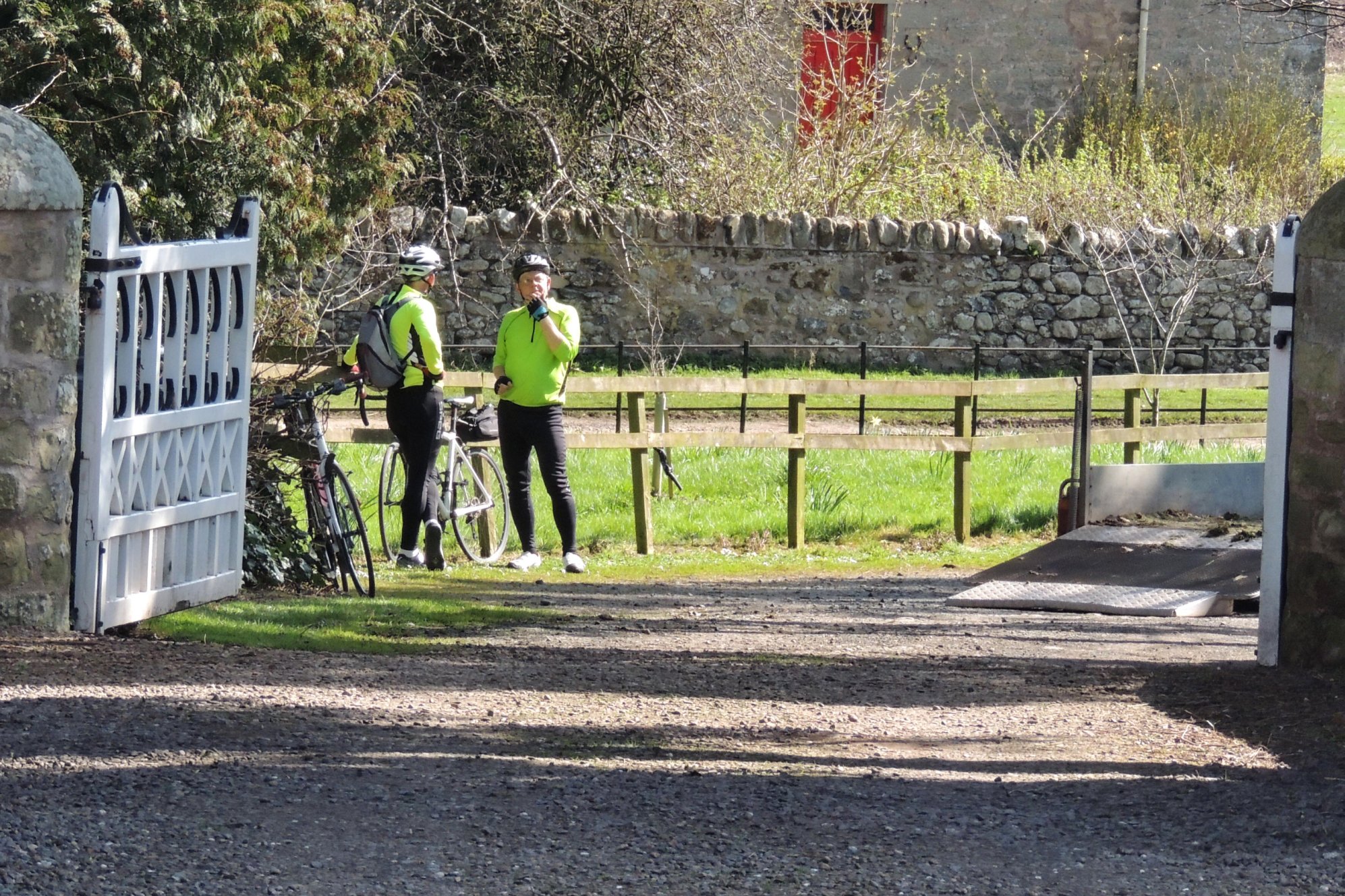
The route I’d picked out took us past the outer gates of Wedderburn Castle, but neither of the gates we passed afforded any kind of view of the stately home within. So that was a photo opportunity lost for Colette and Lynne, but there was plenty to focus on later into the ride.
Further on, we passed over the Blackadder Water via a couple of nice old bridges then headed north where we met the A6015. Luckily we were only on the road for a few hundred yards, before picking up the red route markers and turning right onto a minor road that passed through Edrom. We came close by the picturesque Edrom Parish Church, where we made a brief photo diversion.
Paused at Edrom
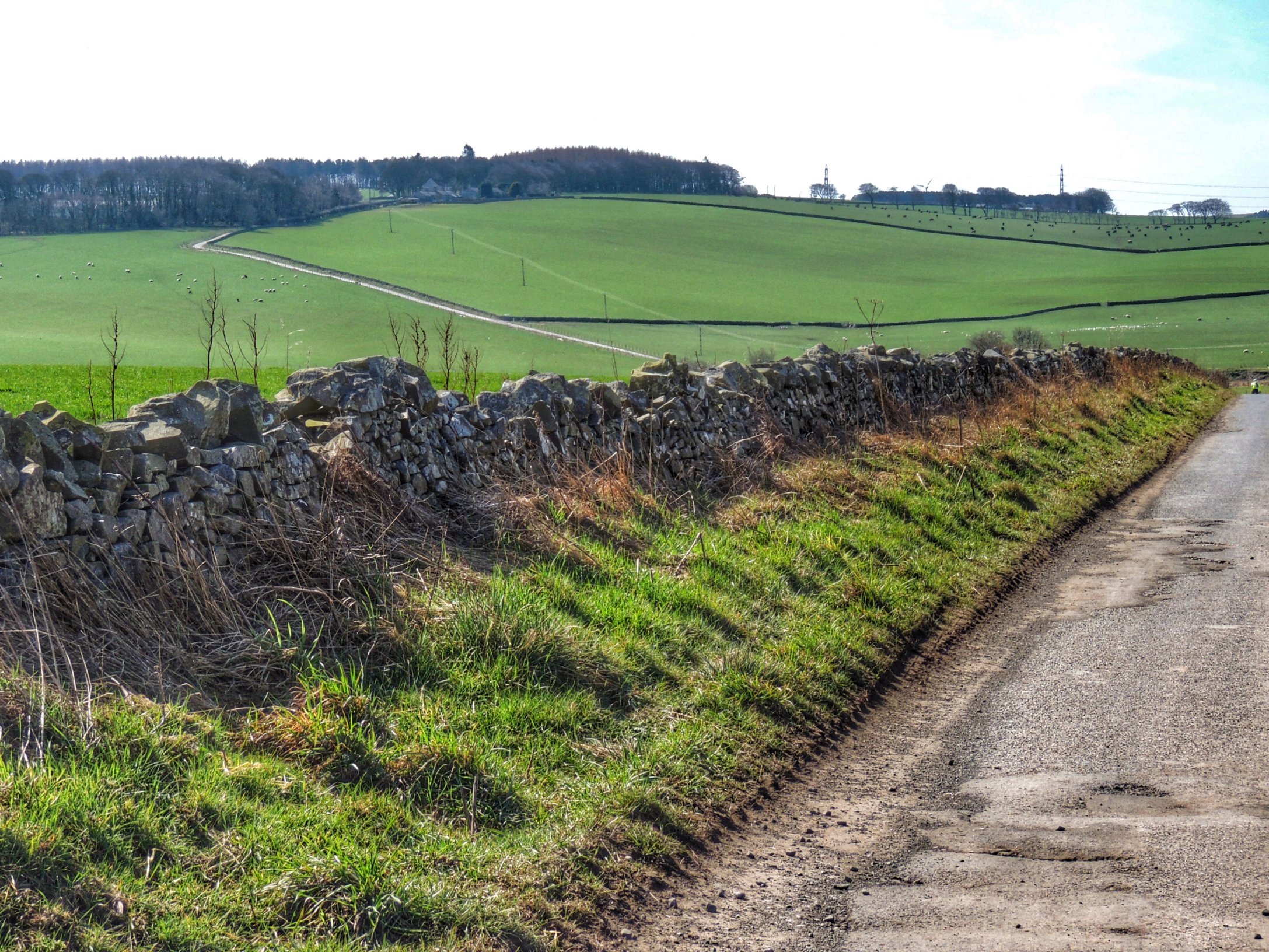
Moving on from there, we passed over the Whiteadder Water and started climbing as our route continued northwards. We reassembled and took a rest at the crossroads with the B6438 before tackling a really quite steep incline. Once at the top of that section and looking round the corner, we could see the road carry on upwards for a long long way, but thankfully at not quite as steep a gradient. It was very satisfying to finally reach the top and look out over the countryside stretching out below us. The view was quite hazy, so not the best for landscape photos, but the sun was certainly shining on us and the sky was blue, with wispy cirrus clouds.
Next we had a good long spell of downhill freewheeling which took us to meet the A6112. Despite now being on an A road, there weren’t any cars to be seen, and the road swept beautifully downhill till we were close to the village of Grantshouse. We could see the rail line ahead, with the A1 just beyond it, running noisily through the village, and beyond that in the distance lay the North Sea. Luckily, our route didn’t mess with the A1 but instead took a left turn away from the coast and into hilly farming country again.
First sighting of Oh No Hill
The road rose gently at first, until we came over a rise and Colette and Lynne both shouted out “Oh no!” in unison. They had become acutely alarmed by the angle at which the road ahead ran up the next hill. Well, it certainly slowed us down, but only for a few minutes after which we took a breather and started thinking about lunch. It wasn’t too far now.
Once we had stopped climbing, we began to descend toward woods and came out in a delightful narrow valley. The slopes on either side were topped by woods, while the valley floor was grassy meadow with the Whiteadder Water snaking its way sinuously through. Soon we reached a sign for Abbey St Bathans and went past a large farm. We turned left looking for our intended lunch stop, the Riverside restaurant.
In fact, we had turned in too soon and this was the Old Kirk. I left the others behind to explore while I went off in search of the Riverside, a sign for which I found about half a mile further down the road. Turning off the road it wasn’t immediately obvious where the restaurant was, but I only needed to follow my nose to find out which of the buildings was producing those enticing cooking aromas. I popped my head round the door and told them to expect 4 hungry cyclists soon, then went off to marshall the troops.
The point at which Lynne realised I wasn’t kidding about the two mile climb after lunch!
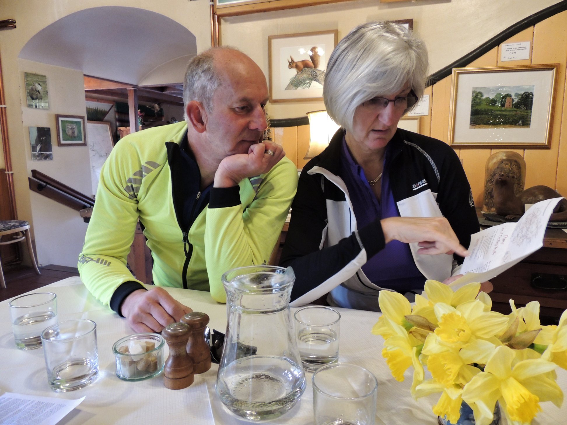
Soon we were sitting down inside the quaint little restaurant, which doubles as a gallery, full of paintings of all sizes and styles. Being so isolated and with sporadic passing trade, the restaurant doesn’t offer a wide menu. There weren’t snacks or sandwiches, so we went for fish and chips, and burger and chips. Cooked from fresh, they took a wee while to arrive, but the wait was well worth it. My haddock was cooked to perfection with wonderfully light and crispy batter. No room for pudding, we left feeling pleasantly full and delighted to have discovered such a hidden gem of a lunch stop.
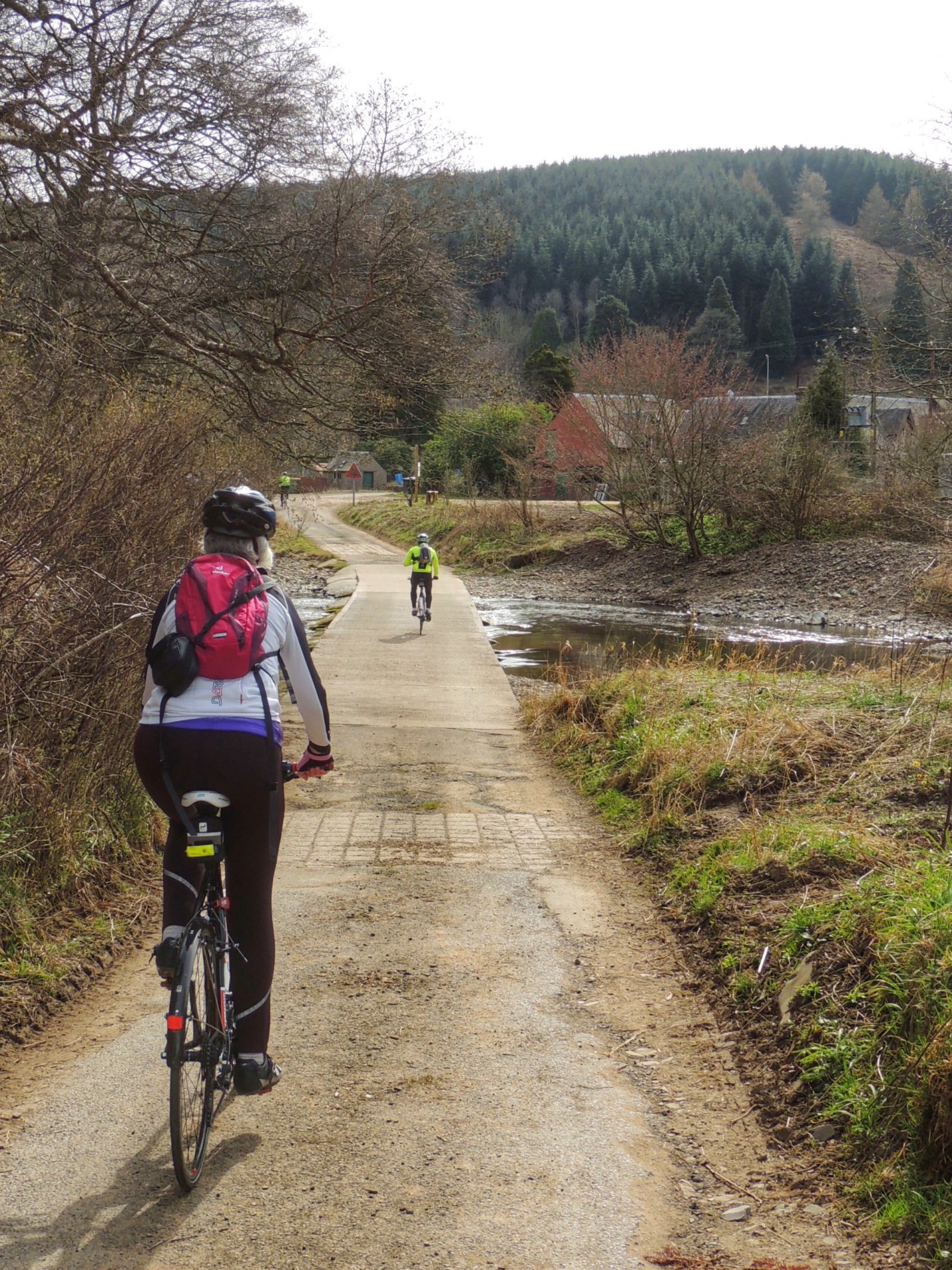
Exploring at Abbey St Bathans. The Southern Upland Way comes past here.
We took a while to explore the ford and area surrounding the restaurant before getting back to our intended route. I had made the mistake of reading out the description of the red route while waiting for lunch, so we were all aware of the two mile climb that lay ahead. That took us away from the valley, out through the woods and back into open country. The climb actually wasn’t all that steep but did continue on for a while. Once we had reached the top, we were soon into a very rapid 17% descent. It was a bit of a white knuckle ride taking us all the way down to a T-junction with the B6355.
Here, we had intended to turn tight, picking up the green route going to Longformacus before turning back to Duns. However, our long lunch had set us quite far behind time so we decided to cut it short here, and followed the shorter red route back to Duns. Although shorter, this still presented a few miles of undulations to negotiate, ending in a fast downhill into the town of Duns.
We found the car quickly and got the bikes secured in what seemed much warmer sunshine than when we had arrived. Perhaps some of that was the warm glow of satisfaction from spending such a perfect day out in the countryside. And having missed out the green route gives us the perfect excuse for going back again. Soon!
Fabulous blog about a fantastic day out