
This foray into Loch Ard forest was our first, though it was our second attempt this year. On the first attempt, I’d planned a loop round Loch Katrine, returning through the off-road tracks in Loch Ard forest, rather than the road. That was called off soon after the start, when Colette managed to cut the back of her leg quite spectacularly when her pedal slipped.
On this occasion, inspired by a video on the Rusty Rides Gravel channel, I decided to focus the ride entirely on the forest tracks, using the longest of the three way-marked Gravelfoyle trails: the Lomond loop. As this seems a little short at only 18 miles, I added a wee detour for extra value that should take us to the shore of Loch Ard and bring the total distance to over 20 miles.
We arrived at Aberfoyle and parked the car after passing through rain on our way, which abated to a mild drizzle by the time we arrived. That wasn’t enough to put us off, so we got the bikes ready and pedalled onward, passing over the river Forth then turning right, away from the road and into the forest.
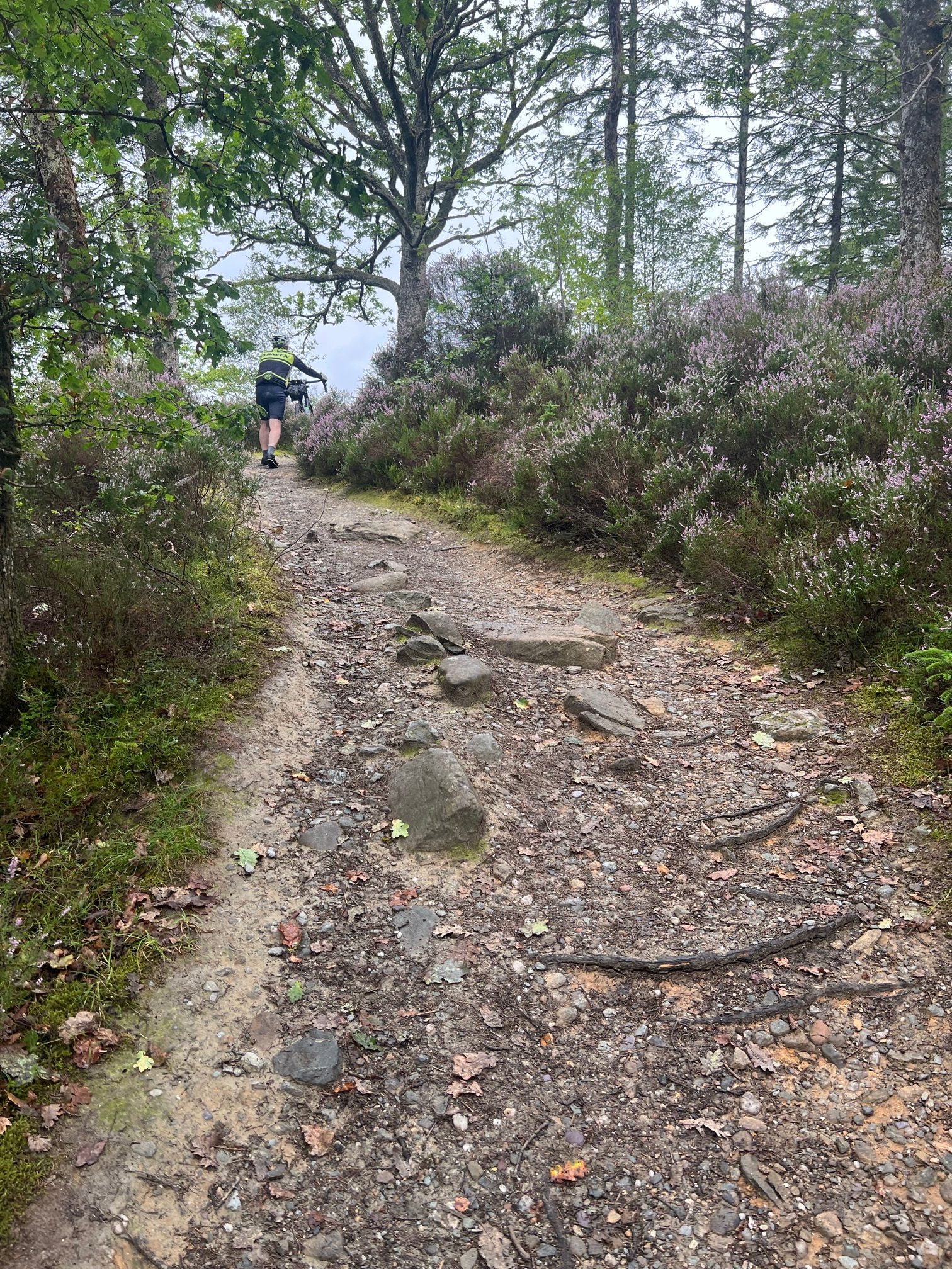
Soon we picked up the markers for the various Gravelfoyle routes, taking us onto some gravel that looked newly laid and somewhat loose. However, that didn’t last long, after which the forest tracks were more well compacted. As expected, the lower reaches of the loop passed through forest that didn’t afford much in the way of views, however there were enough ups and downs and turns to keep us interested.
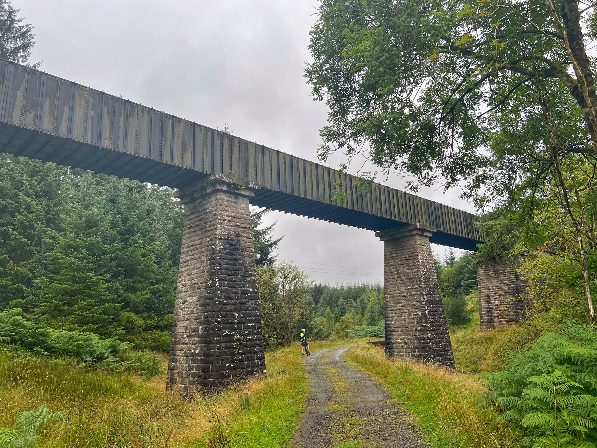
After a while, a fast descent brought us to an aqueduct, where we could hear the slooshing of water overhead. This piece of Victorian engineering was built to carry water from Loch Katrine to Glasgow, and by the sound of it, it still works.
Not long after, we reached a sign telling us we were already a quarter of the way through the loop, but there was quite a bit of climbing ahead before we could reach the 50% mark. It was a little steep in places and slowed me right down, but we managed to grind our way to the top. The reward was better views, especially where the forest to our left had been cleared. We could see over to picturesque islands of pines in the middle distance, atop small hillocks. Beyond that, we imagined majestic mountains could be seen, including Ben Lomond, I believe. However, low cloud and murk was about all we could see today.
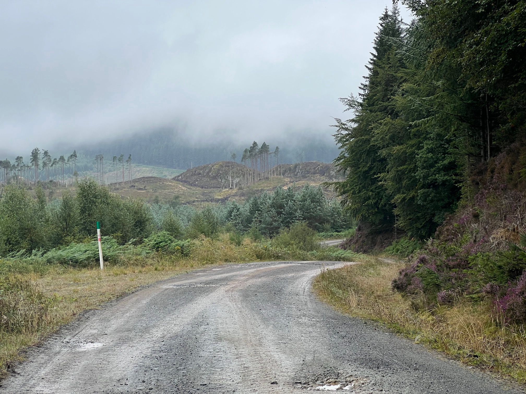
Moody scenery
When I thought about it, this is one of the wettest parts of Scotland, so to see it on a sunny day would be unrepresentative; we were seeing it today as it is meant to be seen!
A little further along, we caught our first glimpse of Loch Ard, lying quite a way below. We stopped and had a wee sandwich break, then got into some swift descending. Then we reached the point where my planned route diverted from the Lomond loop.
That took us steeply downwards, prompting Colette to ask whether we would need to climb all the way back up again to continue the loop. I basically said don’t worry about that just now!
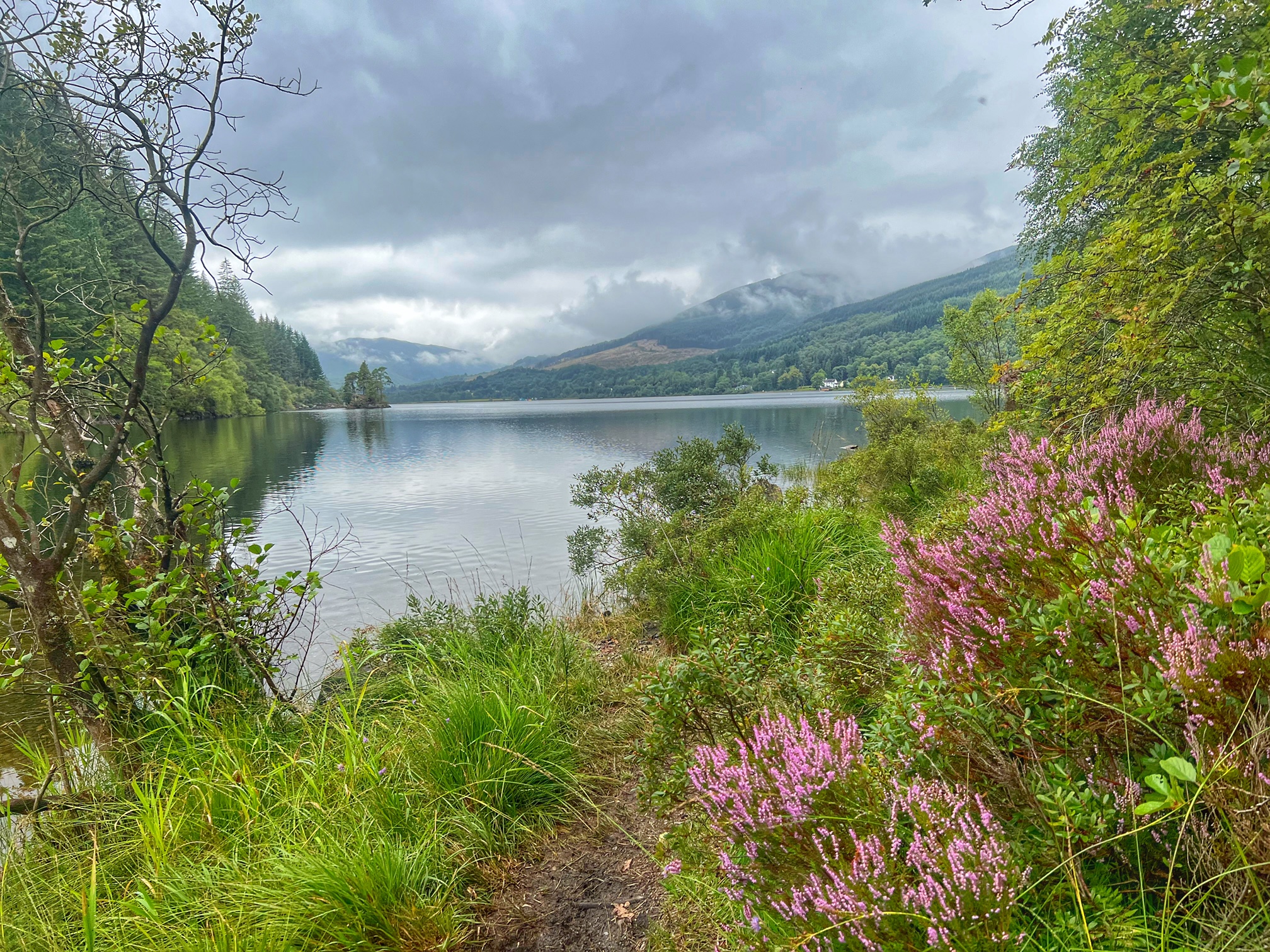
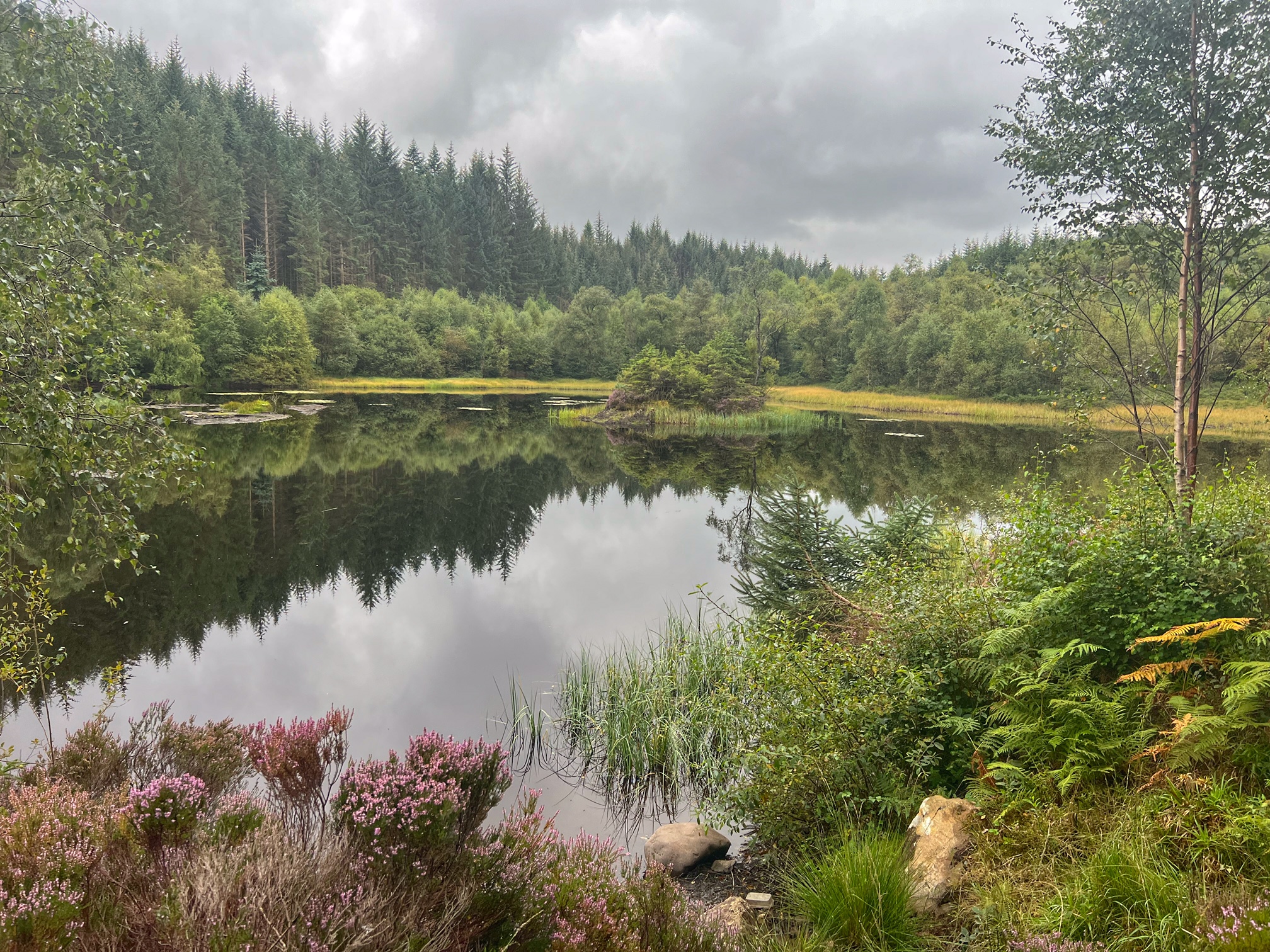
Loch Ard
We got down to water level, then took a left onto a narrower track. This ran out after a while, depositing us onto singletrack. This wound its way through some natural-looking woodland in a very pleasing manner, and wasn’t overly technical at this stage. However, Colette isn’t too confident on narrow tracks, so she pushed.
Soon, we arrived at a clearing by the waterside, where one or two of the larger trees had been felled to open up what seemed to be a popular place to hang out, judging by the remains of camp fires. There wasn’t a scrap of rubbish to be seen though, which was good.
Loch Ard is quite narrow here, and also very still and tranquil. Colette went off to take some photos, while I went in search of Rob Roy’s cave, which I saw on the Strava mapping app when I put the route together. Sadly, there was no signal here, so I wasn’t able to pinpoint an exact location. I wandered around looking for clues or hopefully a sign, but found nothing except for blueberries, which were out in abundance. I picked a handful and scoffed them, although Colette thought they weren’t sweet enough for her taste.
Moving on, the trail got more technical, and I had to push up a couple of short steep inclines. Colette did the same, and also needed me to push her bike down one steep drop. I felt a little more confident, and enjoyed the ride, though perhaps I should have been more circumspect, as I wasn’t riding a mountain bike, and getting a pinch puncture on one of the many rocks in the trail was a distinct possibility.
The singletrack ended and we reached a more typical forestry track, just as a family was heading down in the direction we’d just come from. They were looking for Rob Roy’s cave as well. I couldn’t help, but wished them luck.
We then headed east for a wee while, then made a sharp right uphill on a track that I’d plotted for our return to pick up the Lomond loop. I wasn’t entirely certain that the track would be rideable though, since Strava heatmaps showed that hardly anyone goes along there. Well, I was relieved when it turned out to be quite a wide forestry track rather than the overgrown singletrack that I’d feared. It did however rise quite steeply and we were surprised to find it busy with walkers, all coming downhill towards us. That meant that when Colette ground to a halt on the steep gradient and fell over when she tried to put her foot down, she had an audience!
Luckily there were no injuries, so I walked with her till the gradient eased enough for me to get back on again, and carried on. Soon, the uphill turned into downhill and I sped along for a wee while till I heard the phone ring. It was Colette, but the signal was so poor that I couldn’t hear her properly. So I turned around and retraced my steps, hoping she hadn’t had another fall. Thankfully, it turned out the she’d just dropped her chain and needed me to put it back on.
We carried on together and soon regained the Lomond loop where we left it earlier. Here we met a couple of walkers consulting maps, who asked if Rob Roy’s cave was down where we’d come from. We replied yes, and wished them luck finding it. At least with printed maps, they wouldn’t be subject to the vagaries of mobile reception.
Lochan a’ Ghleannain
The ride from here was predominantly downhill, speeding us past a couple of lochans, then into a car park, from where the trail continued as an easy singletrack for a short while. We emerged back at familiar gravel track that we’d ridden along at the beginning of the ride, signalling a turn back towards Aberfoyle.
It wasn’t long before we were going back over the Forth at the wee bridge, then turning right back into the car park. We were ready for a wee snack from the van in the car park, but that was cash only. Our alternative was the Station Cafe, which worked out just fine. But it’s worth trying to remember to bring some quids if you fancy an ice cream from the van at the end of your ride.
Overall, another enjoyable day out, but just average marks for the scenery, due to the poor visibility. We need to visit again on a sunny day…