02 December 2015 – Witless in Watopia

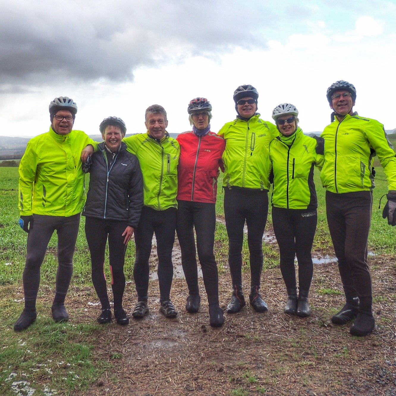
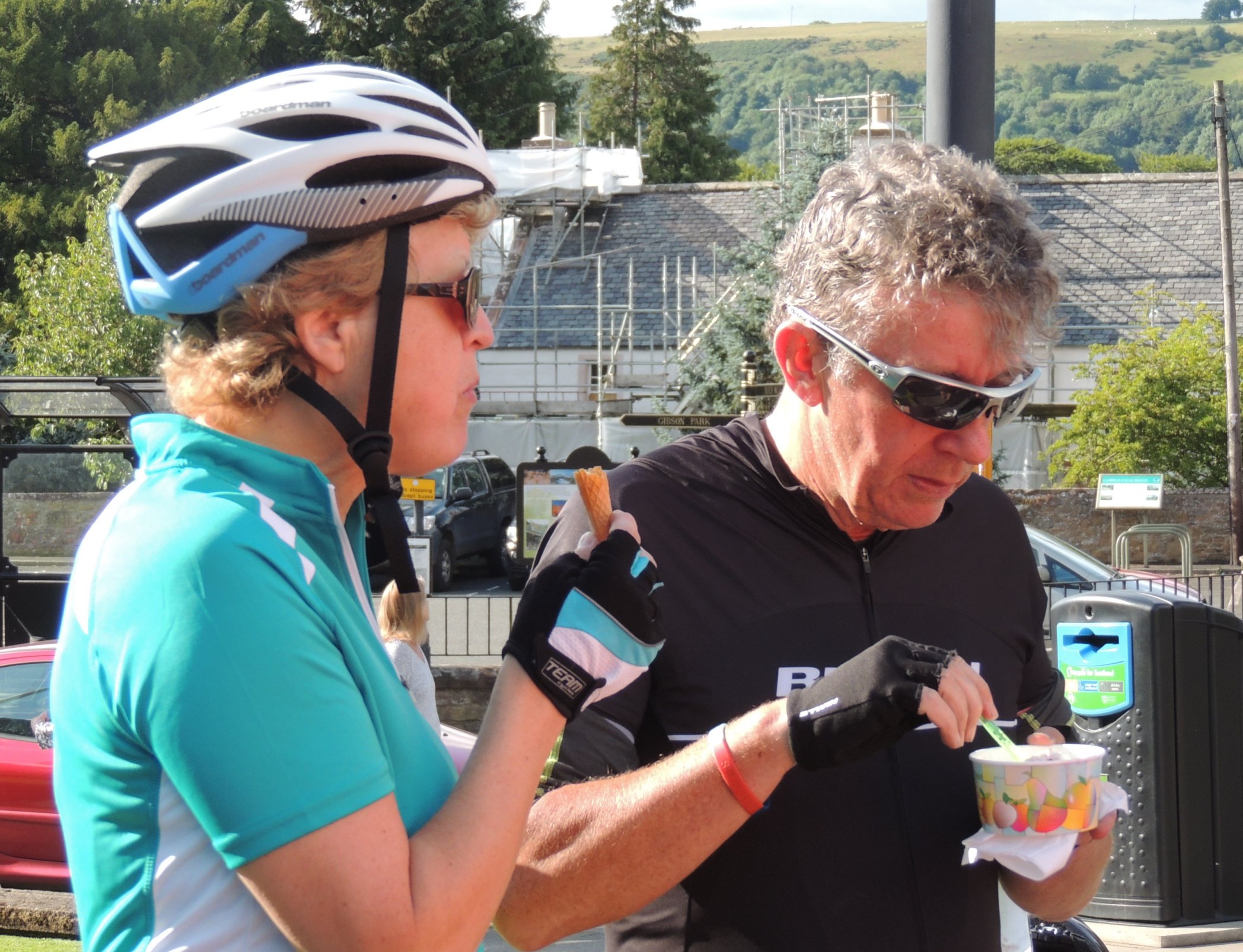
On Wednesday evening, I joined some of the Lothian Cyclists for a wee outing, but this time it was a little different… doing laps of a 5-mile circuit on the tiny island of Watopia in the South Pacific, lying somewhere between the Solomon Islands and Fiji! We didn’t need to get our passports out though, as this was “virtual cycling” done from the “comfort” of our own homes. We had put our bikes on static trainers with a speed sensor on the rear wheel linked to a computer program called Zwift, which allowed us to cycle round a virtual world (albeit modelled on a real island) alongside hundreds of others.

I got logged in a little early and cycled up and down the flat section close to the starting point to warm up a bit and to carry on trying to get the hang of the software. At one point, I saw a huge crowd of cyclists go past, all huddled together in close formation. This was a group ride featuring pro cyclist Jens Voigt, who clearly attracted a big following. Our group was a lot smaller, just Phil, Alan and myself, and luckily we managed to find each other and get started as planned, despite the island being so busy.

The idea was to start with a fairly gentle pace for the first lap, with the main aim being to just stay in sight of each other. Phil was giving out regular messages, but I was finding it hard to reply using my ipad, as the tablet holder that I’d bought only works in landscape orientation and the Zwift mobile app uses portrait, so I had to crane my neck through 90 degrees and type while pedalling hard at the same time. Not easy!

02Dec15_01

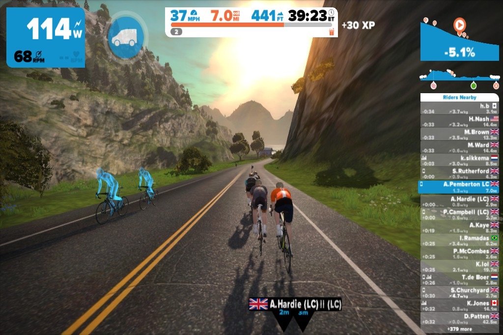
As we hit the big hill, our apparent speed went right down to about 2mph. I think I might do better than that in reality, but probably not by much! However, over the other side, we picked up speed on the downhill, and I was soon hitting 40mph. At the end of the first lap, Alan pulled out as his trainer was making him work a lot harder than Phil’s or mine for the same apparent “virtual” speed. Phil and I carried on for another lap, going a bit quicker this time, and we both gave a bit extra when we reached the sprint sections.

That's me in front, Phil with the orange top, then Alan closest to the camera

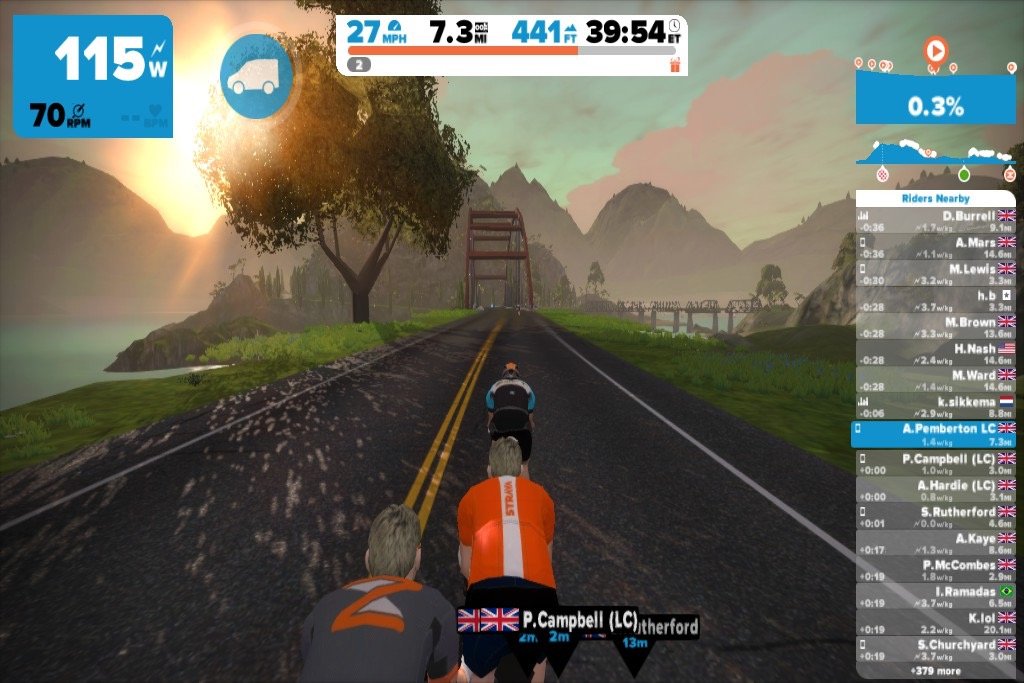
That’s me in front, Phil with the orange top, then Alan closest to the camera

All in all, it was good fun, and a much more engaging way to spend an hour on the turbo trainer than watching the telly or listening to music. With good cycling weather days few and far between at the moment, entering the Zwift world instead sounds like a very acceptable alternative.

NERDY SECTION WARNING!!!

I thought it might be useful to document some of the challenges in getting everything set up for Zwift, including my dalliance with the murky world of power curves…

You need several things to make this all work: a bike, a turbo trainer, an ANT+ speed sensor, an ANT+ dongle for your computer, and of course a computer. I had all except the sensor and dongle, but these are easily available online, so no need to go into details there.

I already had a turbo trainer (more on that later), so that just left the computer. The minimum requirements are a 64-bit computer running Windows 7 or up, or Mac OS X 10.7 or up, with 4 GB of RAM and a graphics card with at least 1 GB RAM. This was my main stumbling block, and I almost gave up before I started. The best thing I can advise is to download the program and try it out on your own computer before investing in anything else. My first attempts ended in failure, as I tried it out on 32-bit Windows 7, and the computer said “Whoa!”: 64-bits really is a deal-breaker.

Next, I located my daughter’s previous laptop (64-bit, yeah!) and fired it up, only to be met with a flashing caps lock indicator, telling me that the CPU was dead. The last chance was a 6-year old Macbook running OS X 10.6.8. Although I tried, the software wouldn’t run on this due to the outdated operating system, but maybe I could update it…? Yes I could, and it was a free download too! The only drawback was that it took about a day to download and install. Then I tried it out…

With Zwift, it’s possible to log in without having the ANT+ dongle and just watch the action from the sidelines. There’s a free trial too, so you don’t have to shell out any cash to just test the system. Well, it loaded up fine and allowed me in, despite my Macbook only having half of the minimum RAM and a quarter of the minimum video RAM. The downside to this was watching in the lowest possible resolution and with a very low frame rate (maybe 4 fps?). Despite this, it seemed quite usable, so having come this far, I went ahead and bought the sensor and dongle, as by this time, I really wanted to join in!

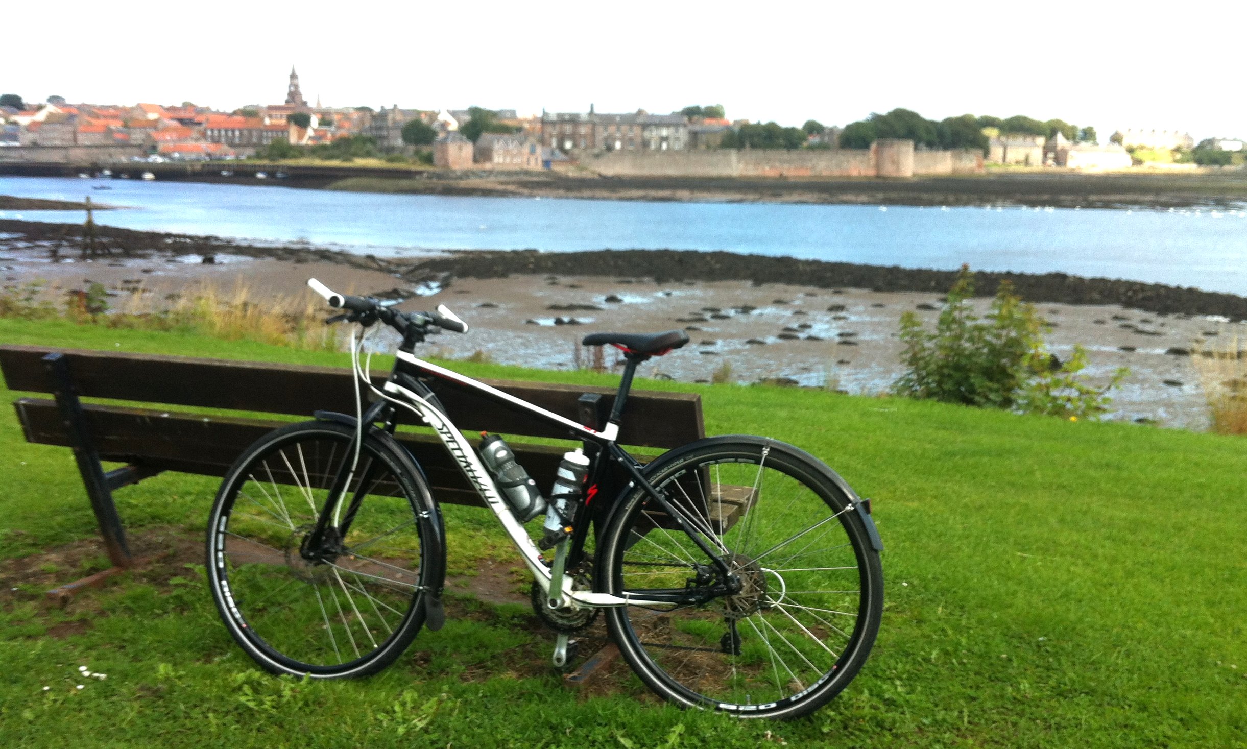
Now it’s time to go back to the matter of my turbo trainer. It’s a BTWIN In’Ride 300 model from Decathlon. Unfortunately, this model isn’t one of the supported trainers, and I very much doubt it ever will be. This means that you can use it but your exertion on the machine (measured as speed) isn’t realistically calibrated to an estimated power output (in watts). The supported models have all been calibrated using a power meter to give a power curve, realistically linking speed with power; Zwift call this zPower.

If you don’t have a supported trainer, you are encouraged to select the “unlisted trainer” option, which gives you a default power curve that at least allows you to join in, but is unlikely to be anything near accurate. Having done this, it was quite dispiriting on my first trial run to find that I had to pedal really hard just to do 11 or 12 mph on the flat. The power curve was clearly way off what it should be for my trainer.

That encouraged me to look into power curves in more detail, and luckily came across this website: powercurvesensor.com. The curves for lots of common models are published there (though sadly, not my BTWIN trainer). It is quite clear that the curves vary a lot between model, and the shape of the curve is very different between magnetic and wind and fluid-type trainers. So for Zwift to have one power curve to cope with all manner of different trainers is not really going to work. It would be much better to at least have a generic curve for each of magnetic, wind and fluid, in my opinion anyway.

Since I had invested in a speed and cadence sensor, I was able to build up a graph for the default power curve by noting down the power output stated in Zwift when pedalling at a constant cadence in each of my gear combinations. The latter was converted to speed using the calculator on the Sheldon Brown website. Speed vs power is shown in the graph below.

02Dec15_03

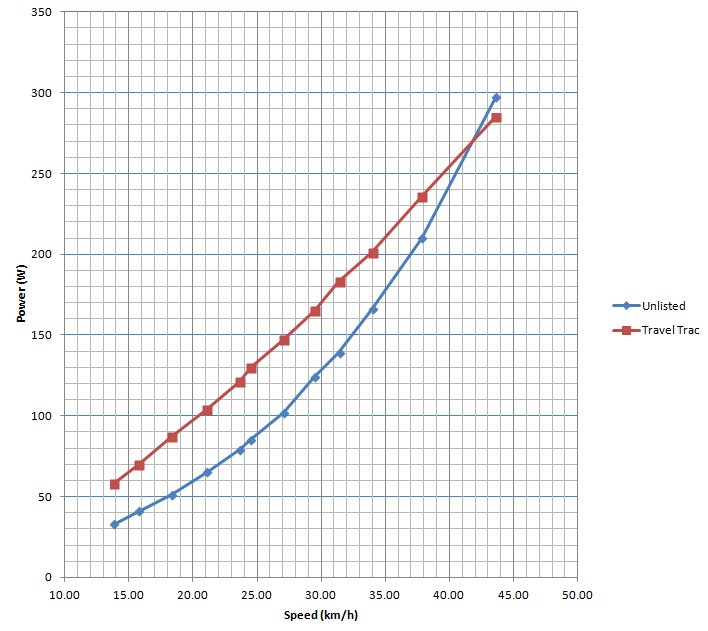
What I also did is change to the Travel Trac Mag+ trainer option and do another power curve estimation. This gives a more linear response, which appears to be more typical of magnetic trainers. What does this show? Well, if you are pedalling at say 20 km/h using Zwift’s unlisted trainer option then you would be credited with a 60 watt output, compared with about 95-100 watts if you had selected the Travel Trac Mag+ option. That’s a big difference. However, by the time you are giving it 40-45 km/h, then the difference becomes minimal. Sadly, I don’t cruise at 250W!

For me, it made sense to stick with the Travel Trac Mag+ option, as it makes the response of my virtual cyclist seem much more realistic. I would certainly recommend it as a starting point if you have an unlisted magnetic trainer. This model is quite a low powered trainer, with a limit around 400 watts, so you won’t risk flying round the track at high speed if you get it wrong. However, if you selected one of the more high powered trainers when in reality you had a bog standard low end model, that really would be cheating!!!

One final thing that probably is worth mentioning is how to change between trainer models. After making the selection for the first time, there doesn’t seem any way to get the trainer menu back up again, at least with the Mac software. So you need to seek out the “prefs.xml” file and delete the line starting with <LASTTRAINERDEVICE>*. When you load up Zwift again, you will be able to select the one you want. *Of course you do this at your own risk.

Although the way I have Zwift now feels realistic, I am under no illusion that the power output that I’m seeing is particularly accurate. Hopefully it isn’t way off, and besides, if I stick with it and keep the trainer setup identical from ride to ride, then I should be able to track any improvement (or otherwise) in my fitness over the time I use Zwift. So long as I don’t stray into the top half of the scoreboard, surely nobody is going to feel cheated.

END OF NERDY BIT!!!


Posted in Uncategorized | 5 Comments

22 November 2015 – Kelso

One of the great things about cycling in the Borders is that in addition to loads of lovely roads to explore, the Borders council website has a set of very good suggested routes starting in all of the major towns, and those routes are also signposted at the key junctions to keep you on track. Kelso is no exception to this rule, so I joined up some of these routes to make a hybrid tour of about 25 miles, with a lunch stop just over halfway. The only quibble I would have with the website is that the suggested starting point, Mayfield car park, close to the River Tweed, is a little hard to find. However, sat nav came to the rescue and all of us managed to make our way to the start location without a hitch.

Colette’s friend Dotty, who lives in Kelso and loves getting about by bike, joined us for this ride. Since the bike is her only form of transport, she hasn’t been able to join in with any of our usual group rides, so we came up with the idea for this ride to give her a taste for what we do, in the company of a small subset of the Lothian Cyclists regulars.

We gathered by the river on a cold but calm and bright November morning, and made our way east along the river. The cycle track then continued via the bridge over the river, till we were able to cut away from the main road on a side path, leading back under the bridge (yes, it was a little complicated…) until we suddenly found ourselves on a small country lane with zero traffic.

What a handsome fellow you are!

What a handsome fellow you are!

The lane did lead uphill fairly incessantly, which caused some murmuring in the ranks, but finally came to a stop at a T-junction next to a field of turkeys, who came running to meet us. Cue a photo stop for Colette and Lynne!

From there, we headed roughly southwest, following the “red route”. Well, trying to follow it – I managed to take us the wrong way at one point, but luckily there are plenty of interconnecting roads, so the detour was no more than a quarter of a mile. While I checked our route, we were hit by a wintery shower that was thankfully very brief and didn’t dampen our spirits at all, since there was a good expanse of blue sky to the north that was coming our way.

Back on track, Dotty commented that we were heading towards her favourite gate. We certainly couldn’t miss that, so when we reached Bowmont Forest sawmill, we turned left off the main road and up the forest road for a short way. The favourite gate was easy to spot, being an opening with a view roughly north towards the Eildons, and featuring the Marquis of Lothian’s magnificent tower (I think that’s what Dotty said…). We all huggled close at the gate for group photos, where a passer-by kindly took some of the shots to get us all in.

A happy bunch at a favourite gate!

A happy bunch at a favourite gate!

After that, it was back downhill and back on track, where we picked up the green route and followed it to a T-junction. There, some of the more hungry cyclists had spotted a smoke house / cafe a little further up the road, and there was some talk of whether to stop there for an early lunch. But was it any good? Luckily we had some local knowledge in the form of Dotty, and she advised we give it a miss. That was good enough for me, and besides, I was looking forward to our original planned lunch stop, even though it was a few miles further on.

River Teviot looking peaceful (but cold!)

River Teviot looking peaceful (but cold!)

So we turned right then left, bringing us to a lovely “weak” bridge over the River Teviot. As we admired the bridge and the river, we had to make way for a car wanting to cross. It hadn’t crossed my mind that this was anything other than a footbridge, but clearly it was a roadway and the car got over without incident.

22Nov15_04

Our route took us along the river, then turned east, ending at a T-junction in a wooded area. As we waited at the junction for me to double check which way to turn, Willie spotted a strange weather phenomenon, where it was raining to the left, with the rain ending abruptly less than 50 yards away, but where we stood it was perfectly dry. Sadly, I had to break the news that we were going left, but luckily the rain was again just short-lived.

We carried on through Nisbet to another junction where there was a sign for our lunch eatery, showing us that it wasn’t far off. Just a few minutes more cycling took us to the Woodside Garden Centre, which we had visited earlier in the year and were very impressed. The garden centre itself seemed pretty deserted but the cafe was busy. We were lucky enough to get a table – a big kitchen table that could seat all eight of us. I think we were all very satisfied with our choices, I certainly was, and I won’t forget that delicious huge slice of ginger and lemon cake in a hurry! Yum!

After lunch we very quickly arrived at a steep little hill. It didn’t last long but it definitely warmed us up! The road took us around a wooded hill, which is crowned with the Waterloo Tower monument. The balcony at the top looks like it would give a wonderful view of the surrounding countryside.

Turning right further on, we started heading northeast, back in the direction of Kelso. Much of this was open countryside, so we could properly feel the force of the northerly breeze for the first time. It was only mid-afternoon, but it was starting to get dark too, which further added to the downward trend in the perceived temperature. It was a good time to be heading back.

The final couple of miles back into town were on the A699, the only busy road of the day, so it was an unfortunate time for Willie to have a puncture. Keith went off to help him sort it out while the rest of us hung around in a nearby driveway to stay off the road (the verge there being almost non-existent). At this point, we parted company with Dotty, who needed to get back in time for her boys coming home. The rest of us hung around until the puncture was repaired then we covered the final ground quickly till we reached Kelso. As soon as we crossed the bridge over the Tweed, we diverted right onto the riverside path and ended up back where we started.

I think we all had a great time, cycling along quiet roads through beautiful countryside with good friends. I’m sure it won’t be long before we’re back…


Posted in Uncategorized | Leave a comment

08 October 2015 – Mennock Pass and Lowther Hill

Recent coverage in the news of a particularly challenging cycling “sportive” brought my attention to Lowther Hill in the Scottish southern uplands. This cycle event for ultra-fit participants involves 100 miles of riding through hilly country, finishing with an ascent of Lowther Hill from Wanlockhead, Scotland’s highest village. At the top of the climb is a golf ball-like radar tracking station, which is why the road is tarmacked all the way to the top. I thought it would be fun to try the climb as part of a much less ambitous 40 mile loop.

The day started at the car park in Abington, about an hour’s drive from home. It was bright and sunny but a little chilly, so we got ourselves warmly wrapped up for the departure, heading towards the junction with the M74.

After a couple of roundabouts, we were clear of the roar of the motorway and onto a cycle path at the side of the old A74. We followed this for a short while, then turned left, heading away from the main road and into hilly farmland. The road followed the contours of the hillside in an arc, bringing us to the village of Crawfordjohn. We turned left there and made our way up through a valley into moorland. I used to regard this part of the world as bleak and desolate, but in the sunshine it all looked very scenic. I think cycling has allowed me to appreciate this kind of landscape much better. In addition, the road was mostly in good condition and very quiet, adding to our enjoyment.

Over the highest point, we began to descend towards Sanquhar, whereupon the moor gave way to enclosed fields once more, and trees reappeared. Then we stopped abruptly for a set of traffic lights at a T-junction with the A76. Here, we turned left and headed into the town of Sanquhar. Although far from the prettiest town in the world, it did appear to have its charms. As we cycled through, we were on the lookout for a decent-looking cafe and a bakers. Well, Colette was looking for the former and I was looking for the latter, where I thought we might be able to get something to supplement our picnic. We paused at the far end of the town, opposite the ruins of Sanquhar castle, having failed to spot the cafe. Colette reported having seen the baker, but I decided against doubling back as I was keen to press on.

The A76 was intermittently quiet then busy, possibly something to do with the traffic lights further back. However, we didn’t have to stay on it for long, as we took the left turn at Mennock. Here was the start of the Mennock Pass, which leads up to Wanlockhead. The road to start was a little steep, then it levelled off for a while, running through a wood with a fast babbling stream alongside.

Before long, we came to a nicely-situated bench overlooking the burn. That looked like a good place to stop for lunch. It’s nice to have a proper seat for a picnic, so thanks to Granny Jean Scott (1927-2005), in whose memory the bench was placed there. The tuna sandwiches were good, but perhaps not quite enough fuel given the hard climb ahead. A bun or two from the bakers might have been a good idea after all.

The Mennock Pass

The Mennock Pass

After lunch we set off again, following the road through an impressive valley with steeply-sided hills on either side. It reminded me a lot of the Granites near Innerleithen.

From this point, the gradient started to increase, but was still easily manageable for us at a gentle pace. There were plenty of stops to remove glove liners, neck warmers, etc., as the climb warmed us up, then finally at the top of a steep rise, we could see Wanlockhead below us in a dip.

Made it to Wanlockhead, but there was more to come...

Made it to Wanlockhead, but there was more to come…

We stopped at the sign for some photos, then carried on through the village. The road climbed again for a while, then we came to the junction with the Lowther Hill road. It is signed as a private road and has a gate that may be closed and locked at any time. However, neither of these is any impediment to bike riders, so after checking with Colette that she really wanted to go ahead with this, off we went up Lowther Hill.

When it comes to climbing steep hills, it’s important to keep to your own pace. On the other hand, I wanted us to do the climb together, so whenever I got to the top of a steep bit, I stopped and waited for Colette to catch up. Stopping before the end of a steep bit is a no-no, as it’s hard to get started again!

The only way is up!

The only way is up!

After the first steep, winding section, the road levelled off for a while before going steeply up again. Colette was progressing a bit slower than me, and I admit to feeling guilty about dragging her up the hill. However she was adamant that she wanted to do it, and she was definitely enjoying it. So that was great! Onwards and upwards then…

Wanlockhead in the distance, and a glimpse of the road that brought us up here.

Wanlockhead in the distance, and a glimpse of the road that brought us up here.

The rest of the climb followed this pattern, taking one section at a time. As we progressed, the view opened out and it was amazing how small and far away Wanlockhead looked below us.

Success!

Success!

Finally we reached the top of the hill, where the golf ball was partly shrouded in mist for most of the time. Or to be more accurate, cloud level started right there at the summit. It was a bit chilly and there wasn’t anything to hang around for, so after taking a few photos, we hopped back on the bikes ready to head downhill again.

This was the part that really worried me: not the climb, but the descent. I was really hoping my brakes were good enough! As it happened, I had no problems, but I made sure to take it slow and brake heavily for the initial winding, steep drop, then eased off as the road got straighter and less vertical. Even with a stop halfway down to admire the view, it was amazing how quickly we got all the way to the bottom. The worst part was a drainage channel across the road right at the bottom which both of us managed to hit too quickly, getting some jarred bones but thankfully no punctures as a result.

Now, I had claimed that it would be downhill all the way after this, but a steep little hill still loomed ahead of us as we rejoined the road from Wanlockhead to Leadhills. Luckily, that didn’t go any further than it looked, and over the other side we were into a downhill. We couldn’t go very fast though, as the left side of the road here was an absolute bone shaker. It gradually improved by the time we reached Leadhills though.

The village of Leadhills looked old and quaint and characterful, which wasn’t what I was expecting from a defunct mining village. It actually has various tourist attractions, such as the mining museum and narrow gauge railway. However, it was out of season, so there was nothing to stop for and so we rode on through.

From there back to Abington the road was predominantly downhill, meaning we made good pace and by the time we got back to the car, our average speed was not too bad, considering the speed we went up the big hill! If you measure it from the start of Mennock Pass, the overall climb to the top of Lowther Hill was about 2000 feet, making it our biggest so far. Admittedly we are among the very slowest cyclists ever to do this climb, but I like to look at it this way: we’re fairly ambitious for cyclists of our limited ability!


Posted in Uncategorized | Leave a comment

30 September 2015 – Across the Lammermuirs (twice)

The weather at the end of September gave a brief glimpse of what summer should have been like – warm, blue skies and barely a breath of wind. We weren’t going to waste it by not cycling, but the question was where? Coincidentally, I had been playing around with a new mapping app and discovered a new mountain bike route, the Capital Trail. Part of this trail runs across the Lammermuirs so we decided to check it out, starting from Gifford.

So we drove to Gifford and unpacked the bikes: Colette’s hybrid and also her mountain bike, which I built up for her but she didn’t like, so I am now using it instead. The sky was blue but it was still a bit chilly and positively cold as we passed through the shade of the trees.

Moo!!!

Moo!!!

We headed up to Longyester junction, where we took the road signed as a dead end. It ran up towards the hills, with fields on either side. It was getting a little steep, so when Colette said she wanted to stop for a photo, I wasn’t complaining. She was trying to persuade a bull to look her way for a picture, but all of her coaxing only attracted the attention of bulls in the opposite field, who came our way, bellowing. Then the bulls on our side started calling back. Pretty soon the previously quiet contryside was resounding to a shouting competition between maybe a dozen bulls. With that, it was time to go, before we caused any more aggro!

The tarmac soon disappeared, to be replaced by rough gravel. A fell runner who had parked next to the gate at the end of the public road and was getting ready, kindly opened the gate to let us through. We continued but very slowly up the steep and rough landrover track. It wasn’t long before the runner (who looked to be mid-60s or maybe 70) overtook us and disappeared into the distance. After cycling as far as I could before stopping, I then had to join Colette in pushing the bike up the path, as it was pretty much impossible to get started again. The track kept going up and up, and our progress was very slow but we didn’t mind. It gave us a great opportunity to enjoy the scenery, as we made our way past Lammer Law in the warm sunshine.

Sometimes pushing is the best option. Sometime it's the ONLY option!

Sometimes pushing is the best option. Sometime it’s the ONLY option!

Finally, we were able to get on our bikes once more, riding along a flatter plateau section with the whole expanse of the Lammermuirs opened up around us. We even picked up a bit of speed on some downhill parts, but it was important not to get carried away, as some of the bumps and deep gravel patches could have been tricky at high speed!

The reward...

The reward…

Soon, the trail took us away from the main track onto a minor one that ran away to the left. That took us downhill, then suddenly dipped very steeply with a couple of hairpin bends taking us into a little hidden glen. A small cabin has been built in this delightful and remote spot – a wonderful place to get away from it all. To progress through the glen, we had to ford the same stream twice, then push up a really steep hill on the other side. I didn’t even bother attempting to cycle up it!

The hidden glen

The hidden glen

Fording fun! Select a low gear, pedal like hell and don't stop!

Fording fun! Select a low gear, pedal like hell and don’t stop!

Once at the top, the track became an easier, slight downhill slope so we finally started to cover the ground at a decent speed. After a while, we took a right turn, following the line of pylons leading away from the windfarm. This was fast and fun and straight, apart from a wee wiggle with a short, sharp climb lying in wait to take us by surprise.

After that, we took a left onto a lesser track. Pretty soon we arrived at a steep, loose drop, which we took very carefully, then there was a meander through dense fernage leading to another new-looking cabin. I stopped to take a look, and it was a bothy: Bunny’s Bothy to be precise. It was an ideal place to sit down and eat our sandwiches.

Following our brief break, we continued, following a muddy path down a valley through sheep farming contry. Lots of mud and puddles and sheep poo were ridden through, making me very mud-splattered. Colette was much less so, due to having mudguards (that reminds me, I’ve not washed those bikes yet!).

Finally we reached civilisation (i.e. some farmhouses) and were met by proper tarmac once more. We followed it for a mile or so, eventually reaching the A697 at a place called Cleekhimin. There we turned right (parting company with the Capital Trail) and cycled for a few minutes along the road till we reached the Carfraemill hotel. We sat outside at the hotel to enjoy some well-earned tea and scones. I also washed the mud off my water bottles and got a refill with iced water – great!

Now we needed to go back over the hills to return to Gifford. So to start, we followed the single track road running north from the hotel. This was easy going for a mile or two, running mostly along the valley floor, but our route suddenly went from flat to very steep, up the hill to the farmhouse at Tollishill. Luckily the road was still paved for this climb, so I was able to slowly amble my way up at minimum speed. The iced water from the hotel was still cool by the time we reached the top and at that point was very welcome indeed!

From the farmhouse onwards, the road continued as a landrover track but mercifully the gradient was much easier. After a while, we met up with the Capital Trail again, coming from the other direction this time. We stayed on the same path for maybe a mile before taking a right leading towards Hopes Reservoir.

Easy does it, it's a long way down...

Easy does it, it’s a long way down…

Before reaching the reservoir, we had a long, steep downhill section to negotiate. It was slightly scary, but I managed to get myself down without the brakes giving up on me before the bottom. They were red hot at the end of it though!

The rest of the ride to the reservoir and past it to the proper road on the other side was much easier. I was still enjoying every minute and had a blast on the final downhill to the cattle grid.

From there, it was tarmac all the way to Gifford, and somehow odd to be going at “proper” cycling speed for once. So it took very little time to complete our journey, returning to the car in the late afternoon sun. Then just a short car journey lay between us and much needed showers, giving us time to reflect on a fantastic day out.


Posted in Uncategorized | Leave a comment

03 – 05 September 2015 – Mull of Galloway

Day 1: Home to Dumfries

This is where things start to get serious in my four corners of Scotland challenge, with me heading to the soutwest corner: the Mull of Galloway. I planned out a 3 day trip, meaning that I would need to carry everything I needed for the trip in panniers: proper touring in fact.

The bike and all the luggage etc totalled about 22-23 kg; quite heavy but still manageable. One last-minute thing I did was to swap the flat pedals on the bike for clip-in “SPD” type pedals, to use with proper cycling shoes. The reason for doing that was because I have been having sore feet after riding long distances on flat pedals recently, possibly down to using soft soled trainers.

So with everything packed, I left the house at about 8.15am on a quite cold and overcast morning. I headed south into the Borders over the Granites and through Innerleithen, then continued south past Traquair. The climb that followed, the oddly-named “Paddy Slacks”, was long and slow. I stopped at the top to take off my jacket – I was definitely heading towards some better weather.

At the bottom of the next downhill, I turned right at the Gordon Arms. The burnt-out shell was busy with scaffolding being erected. I spoke to one of the workmen and found out that they were starting to put on a new roof, so with a bit of luck it might be ready for next summer.

At the moment, the Glen Cafe at St. Mary’s Loch about 6 miles away is the only nearby alternative. It was useful then, that I was heading in that direction. I stopped there for a cup of tea and a bacon roll, with about 34 miles already under my belt, almost halfway there already.

Steep valley - fun descent!

Steep valley – fun descent!

Carrying on from the cafe, I was cycling on “new ground” for me. After a while I left Borders region behind and entered Dumfries and Galloway. I also entered an impressive steep-sided valley, with an exhilirating fast paced descent on the windy road. I stopped halfway for a photo though, then caught a glimpse of the Grey Mare’s Tail waterfall as I sped on past.

After that, the terrain was quite undulating all the way to Moffat, which I reached just before noon. I thought it too early to stop for lunch and decided to get some way down the A701 first. So I went through Moffat without stopping and made use of a cycle path part of the way, but it wasn’t too long before it went off in the wrong direction and I was onto the A701 proper and experiencing significant traffic for the first time.

The road went up consistently from Moffat, which slowed me down a lot. My left knee also started to ache, which was worrying. Getting a bad knee might be enough to scupper my plans, so I had to take it seriously. Passing a suitable layby, I decided it was time to stop for lunch and rest the knee. There was a path leading away from the layby to a more secluded spot, so I pushed the bike down and broke out my packed lunch. I drank an energy drink and popped a couple of ibuprofen to help with the knee.

After lunch, the knee didn’t get any worse thankfully, but I couldn’t help thinking that changing my pedals before the big trip wasn’t the best idea and might be the root cause. The traffic had eased down considerably by this time and I was able to enjoy the ride, especially as the sun was now shining.

It wasn’t long after 2pm when I arrived at the outskirts of Dumfries. I passed my B&B on the way into town, but I was too early to check in. So I decided to do a little wandering, and was specifically on the lookout for the place where I lived in Dumfries when I was a toddler. It was directly opposite the Crichton Royal hospital (now Crichton Campus) so I just followed the signs till I found the right road. I was sure the bends in the road were familiar, leading up to the opening on the right where the bungalows were situated. Now however, there is only a vacant plot, looking smaller than I would have expected, with the houses having been bulldozed flat some time ago. Just the odd brick and bit of pipework poking up from the ground are left to hint at what was left behind 48 years ago when my family moved on.

Where I used to live. doesn't look like much now.

Where I used to live. Doesn’t look like much now.

Putting it behind me once more, I left and made my way to Burnett House B&B, taking in a quick visit to the riverside on the way. The owners were very helpful, geting my bike locked up out of the way and suggesting a few places to eat out. I had a shower and rested for a while before heading out in search of some pub grub.

Dumfries town centre on a sunny afternoon.

Dumfries town centre on a sunny afternoon.

First stop was the Hole in the Wall pub, which had a decent-looking menu outside, but unfortunately had neither real ale nor food (they stop serving at 2pm). I had a quick pint of 80/- and packet of crisps before moving on just as the police arrived. I didn’t hang around to find out why!

The Robert the Bruce pub was my next stop: a Wetherspoons in a beautiful building with cheap real ale and food. Just what I needed really. A pint of Green Jack Waxwing and some scampi and chips just hit the spot.

After that, it was back to my room, a wee bit of TV then an early night…


Day 2: Dumfries to Wigtown

After a decent night’s sleep in a very comfortable room, I went down for breakfast. Fresh fruit and museli, tea and toast and a full cooked breakfast all got packed away. I needed to wait a while before I was fit to get on a bike after that!

Back on the road, I headed south over the bridge then out of Dumfries, looking for cycle route 7, which was to be my friend for almost the whole day to come. From Dumfries, the route follows an old military road to Castle Douglas. It climbed steadily to start, and almost immediately the knee problem started again, but this time it was a bit more than just a twinge. I tried changing position on the saddle and found that perching on the front lessened the pain. After a while, I stopped and moved the saddle forwards a little, and also popped a couple of ibuprofen again for good measure. Well, that did the trick, and the pain gradually subsided over the next hour or so, not to come back. Phew!!!

Arriving at Castle Douglas, I paid a visit to Tesco for a sandwich and a banana, which would do for lunch later. I didn’t need very much after that whopping great breakfast. Then after passing through the town and once more into farmland on the other side, I was treated to the sight of five red kites all wheeling round in the sky above me. They were so close, but all my attempts at wildlife photography ended in failure.

Sunny day in Kirkcudbright

Sunny day in Kirkcudbright

Next up was Kirkcudbright, which is a lovely little town on the mouth of the River Dee. I stopped for a photo and thought about maybe having lunch in one of the cafes, but the sun was shining and I had my picnic, so I decided to keep moving and stop a bit further on.

A nice spot to stop for lunch

A nice spot to stop for lunch

After Kirkcudbright, I had intended going on the A755 for a bit which is more direct than cycle route 7, but I was enjoying the cycle route too much. It was an easy trade: a few more miles and a bit more climbing for a much more peaceful journey, and after all, I had all day. So I followed the cycle route along the coast, looking for a nice place to stop, eventually pulling over at the side of the road where there was a great view out to sea. Perched on a rock there, I ate my picnic and plastered myself in factor 50, as the mid-day sun was feeling very strong.

Getting back on the bike, I found that round the next corner was a proper picnic place, with lots of available tables and even toilets. Typical!

The road turned away from the sea for a while before returning a few miles later. The terrain was a little more rugged than the typical rolling green farmland of Dumfries and Galloway, but most of all, it was just so peaceful. I was so glad that I chose to stick with route 7.

Eventually, the road turned north again, making its way closer and closer to the dreaded A75, which I was making a point of avoiding at all costs. The cycle route then made a sudden change away from paved road and onto woodland track. Following the signs, it took me under the A75, through Fleet Forest and suddenly Gatehouse of Fleet appeared much sooner than I expected.

Time for a cuppa, I thought. There were quite a few places to choose from, all deserted. On a beautiful sunny afternoon like this, it was hard to fathom. I chose the deli, situated on a corner right opposite the clock tower, and ordered a cuppa and a slice of carrot cake which I took on the table outside. It seemed like everything had stopped there mid-afternoon, and in the sunshine, it was idyllic.

Up on the moor, about 5 miles from Creetown

Up on the moor, about 5 miles from Creetown

After getting my bearings, I continued out of town, still following route 7. I was leaving the gradual undulations behind and getting into more hilly country with more steady climbing. I passed through some wooded sections before coming out on moorland. Heading more or less westwards, there was a bit of a headwind, slowing progress a little. Finally, I got onto a long gradual descent that took me to Creetown.

Now, the part of route 7 between Creetown and Newton Stewart is the only bit that I know, and what I know is that there are some really steep bits. Even so, I decided to continue on the cycle path rather than go on the totally flat A75.

I had to push the bike up the first of the really steep parts, but cycling up the hill at the edge of Kirroughtree Forest was possible, but only at a very slow speed. It was like the sting in the tail of route 7!

During the final few miles of cycling towards Minigaff / Newton Stewart, the clouds started rolling in and the headwind got stronger. As I entered the town, there were a few spots of rain in the wind.

I had originally planned to stop for the night at Newton Stewart, but all the hotels and B&Bs were booked up on this night. So I had booked a B&B in Wigtown instead, meaning leaving route 7 behind and doing an extra 6 or 7 miles cycling. My legs were telling me that I had done enough already, the main road to Wigtown was quite busy with traffic and to cap it all, it started raining steadily.

What I didn’t realise was that there was a cycle route from Newton Stewart to Wigtown, but after a mile or so of my cycling along the A714, it came alongside the main road and I was able to transfer. The road was flat but it was all a bit miserable, due to the rain primarily. I needed cheering up, so I stopped and ate a Stroopwaffel, a type of Belgian waffle biscuit to which I’m addicted. My mood suddenly got a lot better, and the rain even ceased at that moment too.

More flat road followed until I could see Wigtown perched on a hill, so one final bit of climbing, terribly slowly, got me to my destination: the Glaisnock Guest House. For some reason I couldn’t remember the name, being replaced in my head by “Glasnost”. Close enough though!

After showering, it was time to look for a bite to eat. The Ploughman’s provided that in the form of a posh burger and chips, washed down with a couple of pints. Then back to the room, some TV and then sleep…


Day 3: Wigtown to Mull of Galloway

Another day, another big breakfast. This time: cereal, tea & toast and full Wigtown breakfast! The cooked breakfast part was even tastier than yesterday’s, including a slice of haggis too, but in retrospect, I could have done without the beans, and the tomato, and the potato scone. But I ate it all up and had to lie down for a while, just like yesterday, before I was fit to get moving. Stoking the boilers is all very well, but I think it is possible to overdo it.

As I left, Wigtown was preparing for the Saturday market in the square, right opposite the guest house. The sun was shining, the wind had dropped and it looked like being another great day for cycling.

My aim, initially at least, was to get to Ardwell for 1pm. That is where I had planned to meet Colette, who was driving down from home. The plan was to meet there, have lunch and cycle together to the Mull of Galloway. Leaving at about 9.15am, I reckoned I had plenty of time and could take it easy.

Torhouse stones

Torhouse stone circle

The idea was to take cycle route 73 west, which I followed (or so I thought) out of town. In fact I was following a completely different cycle route, but a very nice one nonetheless. I paused at Torhouse stone circle to admire the ancient stones before continuing through the lovely rolling countryside in bright sunshine.

It wasn’t till after I had passed Kirkcowan and was faced with a choice of roads that I decided to check my map. It came as something of a surprise that I was nowhere near where I expected to be! At least I was going roughly in the right direction, and one of the roads I was looking at would get me back on track. There was still plenty of time to get to Ardwell for 1pm if I didn’t make any unscheduled stops, and the way I saw it, the extra 5 or 10 miles was an unexpected bonus, as I was loving every single mile!

The scenery changed to moorland for a while and with the wind behind, I was flying along. I then passed some rough grazing where I saw the only Belted Galloway cows of my trip, but thought it best not to stop for a photo. I then went past a lovely loch on the right before finally getting back to cycle route 73.

First sight of teh Mull of Galloway - see if you can spot it!

First sight of the Mull of Galloway – see if you can spot it!

Another few miles brought me to the coast once more, this time looking out over Luce Bay. This also afforded the first glimpse of the Mull of Galloway, looking incredibly far away. How on earth was I going to be able to cycle all the way there? For the first time, I felt a sense of urgency creep in, but tried to keep it under control by just cycling steadily and invoking the power of the full Wigtown breakfast to fuel me onwards.

There was quite a lot of up and down as I progressed to the top of the bay and came to the A75. To avoid needless extra miles, I had to ride along the main road for about half a mile before taking a left turn. The A75 was wide at this point, and the traffic light, so no problem there. The turnoff was signposted for Portpatrick and Drummore, making me feel that I was finally closing in on my destination.

Colette called from Newton Stewart asking for directions. I told her to look out for the Portpatrick / Drummore turnoff, to keep heading for Drummore after taking it and look out for Ardwell, where we were to meet.

If Colette was at Newton Stewart, she was already ahead of time, so I went as fast as I could along the flatlands at the top of Luce Bay, past fields of what looked like corn on the cob. I reached Sandhead where the road split up – one going left to Sandhead village, one right to Portpatrick, and an unmarked road carrying straight on. I checked my map just to be sure that the middle road was the right one, when Colette turned up. She had misheard me and was ready to take the turnoff for Portpatrick, so it was a very opportune place to meet her and avoid the potential upset of getting hopelessly lost.

So off she went to Ardwell to get herself ready while I completed the final couple of miles to meet her at the car park. Once there, I took the opportunity to offload my panniers into the car, then we had a picnic lunch before setting off for the Mull. With the wind behind us, we made good time as far as Drummore, where we came to a stiff climb. After that, we were very close to our destination, with one final short climb to get us to the lighthouse.

Success, made it to the Mull of Galloway!

Success, made it to the Mull of Galloway!

We had a good look around from this prime vantage point at the bottom of Scotland. We could see Ireland clearly in the distance (about 20 miles away I think), and a ferry heading over there from Stranraer. Further to the east, we could see the Isle of Man too, though a bit fainter in the distance. It was a spectacular location, and very much more popular than when I last visited over 10 years ago. A cafe has now been built here, with wonderful views from the windows. It was just too hot inside for us, so we had tea at an outside table.

05Sept15_04

After having our fill of the Mull Of Galloway, we headed back to Ardwell. The final part was quite arduous, as we were cycling into the face of a strong headwind, as well as doing a bit of climbing into the bargain. But finally we got back to the car and journey’s end for me. All that remained was a 4 hour drive back home, including a tiresome traffic jam at roadworks in Dumfries.

So with the 2nd of 4 corners ticked off, it’s time to take stock. I survived all the cycling quite well, and certainly did enjoy it. I’m now pretty sure I could cope with the remaining leg to the north of Scotland, though it’s probably not going to be till next year. Things I have learned, in no particular order: 1) Route 7 is my friend, 2) taking the quieter road is well worth it, 3) don’t overdo the cooked breakfast, and 4) don’t go making big changes to your bike the day before a tour.


Posted in Uncategorized | Leave a comment

19 August 2015 – Berwick upon Tweed

A little while ago, having now done the 100 miles in one day challenge, I was pondering what cycling challenge to try next. Well, one thing I’ve not really got into is cycle touring. Lots of people view Lands End to John O’Groats as the ultimate cycling challenge. I think that’s maybe a little too much for me to start with. Yes, it can be done at an easy pace, but that could take as much as 3 weeks and involve a lot of expensive accommodation, not to mention me being away from home for all that time. So I came up with something a bit more manageable that is still a significant challenge: to cycle to the four corners of Scotland.

By that I mean the Scottish mainland, the corners being Berwick upon Tweed (Southeast), Mull of Galloway (Southwest), Cape Wrath (Northwest) and John O’Groats (Northeast). That will be split up as follows:

1. Home to Berwick, just a single day trip to tick one off and get the ball rolling

2. Home to Mull of Galloway, a 3 day trip to get the touring feel, then if I survive that and enjoy it of course…

3. Home to Cape Wrath and John O’Groats, involving about 9 or 10 nights away and some challenging terrain (and probably weather as well!).

You might notice that these are not return journeys, i.e. I am only intending to cycle one way. To go there and back would cost twice as much, take twice as long, and going back home is never as much fun as the first half. That means persuading Colette to come and pick me up from my destinations!

So today was the first part of the challenge, heading to Berwick. I had concocted a plan where Colette would drive to Berwick soon after I got underway, and once there, she would have her own cycle trip (following National Cycle Route 1 to Holy Island and back seemed like a good idea), then we would meet up in Berwick and have something to eat before driving back.

My day started with me leaving the house at about 8.30am on a sunny August morning. Being a single day trip, I could get everything I needed into a small backpack so this was going to be the fastest of the trips, which I started by heading south down the A7.

The traffic was light and by and large courteous, with the exception of one random horn blaster (there’s always one), making it a pleasant ride down to Stow. I turned off there and headed for Lauder on the back road. I passed a local just before the steep 15% bit began and she wished me luck! This time I was focussing on slow and steady, which got me to the top without too much effort. I stopped for a quick drink and snack, and to take in the view. It was a bit hazy so not worth a photo. The haze was at least stopping the sun from being too strong, which was useful as I had forgot to put on any sunscreen before I left.

The downhill to Lauder was effortless, freewheeling at over 40mph at one point. Next it was right, through Lauder, then left at the other end. At this point I was following the route to Duns that I did earlier in the year so didn’t need to stop and check on directions yet.

Quick break at Westruther

Quick break at Westruther

At about 25 miles in, I got to the pretty village of Westruther, where I stopped at a bench beside an impressive floral display for more food and water (little and often seems to work well). Soon I was back on track, heading across moorland for a good number of miles before the road started going downhill. I joined the main road heading towards Duns and continued downhill at a good rate until reaching a sharp bend, where I took the tricky turnoff for Gavinton.

In Gavinton I found another bench, where I stopped and ate the first of my sandwiches. Colette meantime had texted to let me know that she had reached Spittal on the south side of Berwick and was about to head off for Holy Island. The plan was working sweetly so far.

After Gavinton, I was following a route criss-crossing through various minor roads on the south side of Duns. This involved an occasional stop to check the route using Viewranger on my phone, to reassure myself that I’d not taken any wrong turns. The roads undulated gently, then as I progressed, they seemed to get flatter and faster. I didn’t seem to have to go lower than my top 3 gears for a good number of miles. In fact, the profile shows that these roads were consistently very slightly downhill, explaining why it felt so easy. I was enjoying zooming along and tried to keep it going as long as possible, knowing that since my destination was not too far away now, I could safely tire myself out.

Made it all the way to England!

Made it all the way to England!

When I turned left onto Paxton Road, I knew that Berwick was not far away. The Tweed came into view on my right and then I came to a sign telling me that I was now in Northumberland. That was worth stopping for a photo.

At that point I also saw a text from Colette saying that the cycle path was awful – just a field. I hadn’t expected that, and now felt guilty for sending her off there without checking properly first. However, there was nothing I could do now but keep going on my way…

It wasn’t long before I came to the A1. Here I followed the blue route 1 signs that took me on a pavement alongside the dual carriageway, across the main road then along the other side before diverting away from the A1. The path at this point was overgrown with dog roses and other jaggy bushes which grabbed onto me as I passed, trying to pull me off the bike. Clearly nobody uses this path any more, but I wasn’t sure where the alternative was.

At the other end, I got onto a farm track that became a proper road as I approached the outskirts of Berwick. There was no sign saying “Berwick upon Tweed” on this road, otherwise I would have paused for a commemorative photo. I just carried on, joining up with the main road into town, which I followed into the centre in a line of traffic.

It was my intention to explore the town a little and get photos of the bike and/or me at various locations. I had even given some thought to cycling out to the actual Scotland-England border, time permitting.

To digress a little, it could be said that the Southeast corner is technically where the Scotland-England border crosses the coast. That is a couple of miles north of Berwick at Marshall Meadows. To get there would involve cycling up to A1 for a mile or so, turning right across the dual carriageway and going down to a caravan site. Then I would need to push the bike for a further half a mile or more through a field to reach the border, which might only be recognisable by use of GPS. I was still pondering the possibility of trying this while I was coming into town, although to my mind, Berwick being situated on the north bank of the Tweed is the natural, historic and symbolic SE corner of Scotland, seeing as the Tweed marks the actual border for so much of its length.

So, getting back to the point, I stopped in the middle of Berwick next to a bustling street market, to stop Strava and take some photos. When I looked at my phone though, I saw some texts from Colette saying that she was lost. I phoned her and she seemed very unsure of where she was, so I told her not to worry as she could always backtrack, and I was on my way to meet her.

Very blurry photo of my bike looking over the Tweed to Berwick.

Very blurry photo of my bike looking over the Tweed to Berwick. Where is Colette when you need her?

The exploration of Berwick went by the wayside as I had more important things to do, so I got myself onto the old single track bridge and crossed over to the south side of the river. A little further on, I passed a great viewpoint looking back over the river and decided to stop for one quick photo to mark the end of part 1 of the 4 corners challenge before getting back to the search for my lost wife!

I had chanced onto route 1 again, so followed it into Spittal and out the other side, where it turned into a rough track. I stopped to call Colette again and by this time she had got herself to a place called Beal where she had found a cafe to stop and have a drink. She was feeling a bit better having done this, but she still didn’t know where she was. I couldn’t help, but luckily a passer by was able to explain where Beal was, and that she must have taken the wrong turn as she approached the causeway to Holy Island. Oh well, I had come this far, I was going to continue towards Beal and hopefully meet up with her.

Continuing down the track, it went from an acceptable potholed path to just simply a grassy field, with muddy ruts worn into the grass. It was incredible to think that this was actually a national cycle route, and the sparse signage had me questioning whether I’d taken a wrong turn somehow.

Luckily the field came to an end and route 1 continued along a minor road right at the coast, where many cars had parked for a day out by the seaside, and there was even an ice cream van. That was noted for the way back!

The route continued to vary in quality as it went, as well as crossing over the main east coast railway. It crossed back over the rail line at Goswick golf course but the barriers were closed when I arrived. This was a cue for me to get my other sandwich out, and I was nearly finished by the time the barriers opened again. I finished it off as I rode, spilling little bits of coleslaw onto the road as I went.

I stopped to check my phone for more texts (I just can’t hear them coming in when I’m riding) and found that Colette had worked it out and had now made her way onto the island. I was glad that she hadn’t had to give up before reaching her destination.

Crossing more rough ground, the sun was now beating down, I was being bombarded by clouds of tiny flies and my water supplies were just about exhaused. In fact, I might have been exhausted if I let myself be, but I had to keep going. When I finally reached the causeway, I found out that Colette was already on it, coming back across to the mainland. So I was able to have a wee rest till she arrived. What a relief it was to see her!

From her account, Holy Island was a bit of a let down, at least in terms of photo ops. It was also unbelievably busy so she was glad to get away. Maybe this is a place to investigate well away from English school holiday season.

What Colette saw on the island... Lindisfarne Castle

What Colette saw on the island… Lindisfarne Castle

As we rode away from the coast, we came across a signpost that was at the root of all Colette’s problems. The post clearly showed route 1 going right (towards Beal), whereas the pointer showing the extension of route 1 left onto Holy Island had been snapped off and was missing. Since I’d told Colette to follow route 1, she went off to Beal instead. Let’s hope that gets mended soon!

We now retraced our steps feeling hot and tired. At last we came to the ice cream van, where we had a 99 each, and I downed a can of diet Fanta in short order. A couple of miles later, we had reached the car, which we loaded with our bikes and headed back into Berwick.

Neither of us were up to anything more adventurous than MacDonalds, and while Colette was standing in the queue, I went to the toilets for a wash. I’m sure I got some funny looks when after my hands and arms, I washed my face, and then my hair. But it felt a lot better afterwards! I made sure to order a maxi size diet cola with my meal and took it in the car to help me rehydrate on the drive back home.

So that was part 1 of the challenge, amounting to about 51 miles of cycling, plus an unplanned 20 mile extension… and that was supposed to be the easy part!


Posted in Uncategorized | Leave a comment

14 August 2015 – Glen Strathfarrar

On a visit to Colette’s mum in Beauly, we were looking for a chance to get away for a nice wee cycle ride. On the Friday, it was Colette’s mum’s weekly outing for physio and other pampering, with her return due about 3pm. So off we went, heading for Glen Strathfarrar with some decent weather (mostly cloudy and a little cool, but at least it was dry!).

We headed west up the A831, past Aigas on the road to Glen Affric. But before the turnoff for Glen Strathfarrar, we were on the lookout for a particular set of gates on the right, as Colette wanted to investigate something there.

After a good few miles, we reached the attractive white painted gates, which have an early 1900s vibe (to my eye, but what do I know about these things?!!). Colette has admired the gates in the past but she has since been told that it was worth going through and seeing what lay beyond. So we did. On the other side, there was a path that spiralled round and up a small hillock. At the top we came out next to a large ewe tree overlooking a small graveyard with impressively decorated headstones. Beneath these lay deceased members of the Chisholm clan, who are the ancestral custodians of Glen Affric and the surrouding area that we were about to explore.

Resting place of the Chisholms

Resting place of the Chisholms

Carrying on, we reached the right turn for Glen Strathfarrar. Fairly soon we came to a locked gate, which is used to regulate vehicular access to the glen. There are strict opening hours and a limit to the number of cars per day allowed onto the single track road up the glen. You need to ask at the adjoining cottage to get let through. However, for walkers and cyclists, all you need to do is squeeze through a narrow gap alongside the gate. It occurred to me that anyone riding a trike would be effectively limited to the normal vehicular opening hours.

The other thing I noticed was a sign saying “Beware Potholes!”. That is definitely to be recommended as you progress along this route.

The road follows the River Farrar most of the way up the glen, running through woods for the first few miles. It is pretty easy riding with only very gentle undulations for the most part, but most of all the lack of other traffic made it very quiet and peaceful. After a while, the woods were replaced by more open countryside and we got more of an impression of the surrounding hills.

Loch a'Mhuilliadh

Loch a’Mhuilliadh

We passed a couple of lochs, stopping at the second one to refuel on sausage rolls that we picked up from Gows in Beauly earlier and which were still quite warm. On the second loch we could see a heavily wooded island in the middle, which is apparently a rare remnant of the Caledonian Forest that at one time covered much of the land in this area. We pondered the proper use of this land: whether it should be allowed to regenerate as natural forest or whether “natural” now means maintaining it as heather moorland for the sport of shooting.  Discuss…

As we continued, we gradually started climbing a bit more noticeably. We stopped a cyclist coming towards us and asked how far to the top of the glen. He said it was another half hour’s ride, which was going to put us in danger of getting back home too late. Well it was if we were still going to fit in a cafe stop on the way back! As a compromise, we went on for another mile or so to a point where we could see the road going right up to the dam at the head of the glen. I remembered driving up there a few years ago, and the scenery was spectacular. However, that would have to be for another time.

Ever get the feeling you're being watched?

Ever get the feeling you’re being watched?

We turned back and made very fast progress downhill till Colette stopped at the side of the road and got out her camera. There was a large herd of red deer to our left. That’s why she hadn’t seen any deer yet – they were all hanging out together in a big herd rather than scattered in small groups. They seemed quite interested in us, or at least concerned by our presence, so after a few snaps we left them in peace and continued on our way.

After leaving the glen behind, it wasn’t long before we reached the Cnoc Hotel, which had a sign advertising cream teas. The place seemed deserted, but we had no trouble in getting our tea and fruit scones, which we piled high with well-deserved cream and jam. Great scones, and just what we needed to power us back to Beauly.

As it happened, we got back with over half an hour to spare, so maybe we should have carried all the way up to the dam earlier. But that leaves us with a great reason for going back and doing it “properly” next time…

Posted in Uncategorized | Leave a comment

10 August 2015 – Soutra Aisle

A very similar route to this one was featured in the blog a year or so ago (see here), but this time we did it with the Lothian Cyclists and it was, well, a bit more eventful!

We started off from North Middleton with our full quota of 14 cyclists and headed to Borthwick, with a steep climb waiting at the far side to take us over the Borders Railway (which is about to open very soon). The route took us to Newlandrigg, where we came out at the Vogrie road, turning right. The road is very rough and potholed at the moment, but the sight of spray painted markings outlining the worst of the potholes makes me hopeful that some patching might occur soon. A proper resurfacing would be even more welcome though.

At the end of the road, we turned right onto the A68 for a minute before turning left and back into the peace and tranquility of the side roads. We then wound our way through the countryside, enjoying the warm sunshine till we reached Peaston where we stopped to wait for the back markers. Then it was onwards again heading towards Humbie, with me leading the way.

Pretty soon, we reached the steep drop to Keith Water and the equally steep climb at the other side. Scott was well aware of the terrain and zoomed past as he attacked the hill. Lesley then came alongside and we chatted as we made our way upwards, keeping Scott in our sights. We three paused at the top of the rise to wait for the others. Keith arrived, feeling a little aggrieved that a wasp had singled him out for a sting on the neck, and as the next few arrived they brought with them the news that Fiona had fallen off her bike.

That was worrying, especially as she had only just started cycling again after a hip replacement. However, they said it looked like a low speed tumble so she had only skinned her knee, and she was on her way, pushing her bike up the hill.

It’s never easy to tell how a fall is going to affect you, so I wasn’t sure whether Fiona was going to be fit to continue all the way or turn back. We waited what felt like ten minutes or more but there was no sign of Fiona or the others, so I thought I’d better go back down and check. I got all the way to the bottom of the hill and didn’t see anyone, so I wondered if they had backtracked and gone back up the way we came. I tried phoning but only got voicemail so I cycled on for another half mile or so before giving up and heading back to the waiting group, wondering what on earth had happened to the missing cyclists.

Then, as I got close to the top of the hill again, there they were! They had left the road and gone into a field for Fiona to sit down with Colette and Norah, to get her wound cleaned up and plaster attached. That gave her time to get over the initial shock and decide how she was really feeling. Thankfully she was feeling good and up for continuing, so off we went.

Poor Fiona, being tended to by Norah

Poor wounded Fiona, being tended to by Norah

But not so fast, Norah’s bike now had a brake problem. Her hydraulic disk brake was permanently slightly on, which had been slowing her down. After a bit of faffing, Scott came up with the solution and we were finally back on the road.

The sun had gone in by this time and there were spits and spots of rain in the air. Some of group donned their waterproofs and off we went, with just a few miles to go before lunch at the House of Soutra cafe.

We arrived at the cafe without any more rain, and in fact it was quite warm so we decided to eat outside. In the past we have found the inside to get oppressively hot and it was quite busy anyway, so eating outside seemed like a good decision. Halfway through lunchtime though, it started to rain steadily and we reluctantly picked up our plates and headed indoors. Luckily, a number of tables had freed up by this time, so we could all be accommodated.

Thumbs up for the sandwiches from Angus. I immediately regretted opting for the soup.

Thumbs up for the sandwiches from Angus. I immediately regretted opting for the soup.

Colette and I had managed to get served first and were finished well before the others, so any ideas of skipping cake had to be put aside. We filled the time and our tummies with some lovely home baking and after a nice relaxing break we were all ready to head up the hill to Soutra Aisle.

After a brief dalliance with the A68 again, we made our way onto the Soutra Aisle road and up the initial stiff climb that takes you to the historic site. There was a medieval hospital at this location, and the recently renewed information boards explained all we needed to know about the history and geography.

Susan and Norah arriving at teh top of the Soutra climb. What a view!

Susan and Norah arriving at the top of the Soutra climb.

We all had a good look around then got back on the bikes for the downhill “reward” after the climb. Unfortunately, after rounding the next corner we ran straight into a strong headwind, so we had to pedal hard to make a decent speed even going downhill. The scenery was still magnificent, keeping the spirits up. That was important when the heavens opened up and we were suddenly cycling into stinging rain.

The rain had stopped by the time we reached the A7, but Norah wasn’t having a good day and at that point she and Colette decided to cycle directly back to the start point along the A7, while the rest of us we going to go a longer and hillier route via Heriot.

I always feel a bit unsure when talking about Heriot, as it consists of two separate groups of houses. There is one near the A7 and another about a mile away, including the school, with the village hall all by itself inbetween. The rerouting of the roads associated with the Borders Railway project has effectively made the part of the village by the A7 into a dead end so we no longer go through that part, but still go past the school part. The sun was again shining brightly as we made our way through and out of that part of Heriot, past the entrance to Borthwick Hall (which to further confuse matters is nowhere near the Borthwick that we passed through earlier) and crossed over Heriot Water. Shortly after that, we came face to face with one of the strongest headwinds that I’d ever encountered, even stronger than earlier.

The wind was channelled right down the valley that we were cycling up, making progress terribly slow. We all made it eventually, and having gathered together, we now faced a two mile climb up to the highest point of our ride. Normally that would be quite a prospect at this stage in a ride, but the wind was now at our backs, positively blowing us uphill. We couldn’t believe how easy it was. What’s more, the wind was still at our backs for the two mile downhill that followed and there were quite a few of us reporting record speeds as we rocketed downhill!

It wasn’t long before we reached North Middleton again, at which point Lynne invited us back for coffee, cake and chat, allowing us to prolong the fun for another couple of hours. In some ways it had been the perfect day out (apart from Norah, sorry), mixing some great cycling country with a bit of adversity, some extremes of weather and loads of fun!


Posted in Uncategorized | Leave a comment

14 July 2015 – The four abbeys

This time we went down to the borders for a classic day ride, linking four of the historic abbeys of the area. We were cycling with our Lothian Cyclists pals, so we gathered together at Melrose close to abbey no 1 on a cloudy but calm summer’s morning.

Alison, our leader for the day, was ready to provide some key facts at each abbey, so I can report that Melrose Abbey was founded in 1136 and is reputedly the burial place of Robert the Bruce’s heart.

Melrose Abbey

Melrose Abbey

We set off on our route, which is occasionally marked at the roadside by blue signs with a [4] on them. To start with, we left Melrose, crossed the main road and skirted our way round the Eildons. These are the three pointy hills next to Melrose which make an unmistakeable landmark, and after which the Roman fort in the area was named “Trimontium”.

The road took us through Newton St Boswells, after which we crossed the A68 and continued northeast along a quiet single track road, crossing the River Tweed on a footbridge before arriving at Dryburgh Abbey. The abbey wasn’t visible from outside the grounds, so I led a detour round the path on the left to try to catch a look. After that failed, Colette went up to the ticket office and explained that she was a Historic Scotland member but had forgotten her card. The man in charge was kind enough to let her in to take some photos of abbey no 2. Did you know that Sir Walter Scott is buried there? Well you do now.

Dryburgh Abbey

Dryburgh Abbey

Our next abbey was in Kelso, which took us further east. After doing our best to miss a turning, the front group were set back on track and we continued along some peaceful and gently rolling country roads. These came out at the A6089 just before Kelso and we arrived in the town just as the drizzle started. We split up into two groups to get a cafe stop. I followed Jill who was making off purposefully towards one particular cafe, The Meringue Place.

I felt a bacon roll coming on, so didn’t order a cake, though my tea came with a small meringue on the side. Stephen ordered a slice of lemon meringue pie, which turned out to be enormous and looked amazing. I know what I’m having next time!

14July15_03

Is that a cake, or… ???

Colette wondered if her friend Dotty who lives in Kelso might be somewhere nearby, so gave her a call. She was, as it turned out, and popped over on her lovely retro style shopping bike to say hello before we got back on the road.

Kelso Abbey

Kelso Abbey

We stopped at Kelso Abbey on our way out of town, with the rain apparently petering out. There we learned that the abbey was laid to ruin under the orders of Henry VIII. Its location so close to the border with England must have made it a prime target when Henry was going through his abbey destroying phase. It makes you wonder how different the world would be if things had worked out better with his first wife…

Back on our bikes, we left Kelso en route for Jedburgh. The rain started again and threatened to become a bit of a problem, but thankfully only lasted about 10 minutes. We paused at a junction for the raincoated ones to remove their outer garments and let the steam out. Where we had stopped there was the option of a short cut missing out Jedburgh, but we stuck to the recommended route, which took us over the River Teviot and into more undulating countryside.

Cessford Castle

Cessford Castle

At the top of one of the undulations was Cessford Castle, where we stopped for a couple of minutes to soak in the history and take on some food and drink. It was well into lunchtime and with a fair few miles left to Jedburgh, we needed to keep fueled up. The next few miles included a fairly long downhill section followed by a longer climb, though with no really steep gradients. Finally, we came onto a fast descent into Jedburgh, where the impressive abbey came immediately into view in its dominant position.

Jedburgh Abbey

Jedburgh Abbey

It was time for lunch, so we chanced out arm at the first place we could find, the Abbey Bridge Tollhouse. We had arrived about 15 minutes before they stopped serving lunch, and with nobody else in the cafe, I think we caused them a few problems. The soup was delivered in large cyclist-sized portions though Colette’s was a bit cold for her liking, even after being sent back to be warmed up. I enjoyed my haggis and cheese baked potato; basic fare but tasty and filling and just what I needed. The waitress coped very well with the unexpected crowd, even though she seemed less than enthusiastic about our sudden arrival just before the end of her shift!

The sun was shining as we left the abbey behind, which incidentally was established in 1138 by the Augustininan order. We followed a slightly strange detour through a park, alongside the Jed Water with impressive cliffs on the far side. The detour was strange in that it left us with a tricky crossing of the A68 to make, but once we got over, we were into quiet contry roads again. At first, the road ran through a dark and humid gorge and presented us with the steepest climb of the day. However it was just a brief one, and as it flattened off, we emerged into warm sunshine again and benign gradients then followed for quite a while.

We passed through the pleasant village of Ancrum. Being summer holidays, there were kids out playing, and I noticed one boy hop onto his scooter and make haste after spying an ice cream van entering the village. I remember the excitement well myself!

As we pressed on, we were all aware of one more significant climb before getting back to Melrose. I had done this ride before but couldn’t remember when it started. But after we crossed over a crossroads and paused at the layby just beyond, it all came back. It was a good memory though, as it was a long, gentle climb. I hung back with Colette, who wanted to take it slowly, and also Stephen who was taking it gently due to a gearing problem. It was a lovely climb and came out close to a picturesque pond surrounded by woods, which we would probably have investigated had we not seen the others waiting for us up ahead.

The group all gathered together at the top of the climb, with the Eildons suddenly coming back into view surprisingly close to our right. From there it was a case of hang on tight as we descended quickly right back into the middle of Melrose.

At this point, we had ice cream on our minds, as we knew there was a shop on the corner opposite the abbey. We headed there and put in our orders. There was a family there who had seen us go past in Ancrum and were impressed we’d made it to Melrose so quickly. The kids were also getting ice cream and I wonder if they’d missed the ice cream van earlier, or maybe they just preferred the stuff you can get in Melrose. After trying mine, I’m convinced it must be the latter! Delicious!!! Our renowned ice cream lover Willie couldn’t resist the maximum three scoop offering, and in recognition of this, shall henceforth be known as “Tri-scoopium”.

Enjoying the reward after a great day's cycling

Enjoying the reward after a great day’s cycling

After the ice cream was finished, we said our goodbyes and went our separate ways, all of us delighted at a great day’s cycling. It’s no wonder this route is so popular.

Posted in Uncategorized | 1 Comment

03 June 2015 – East Lothian 100 miler

The day for the big 100 mile challenge had arrived…

Back in January during a lunch stop on one of our regular Monday rides, the subject came up of what challenges we might be attempting this year. After completing the 10 miles a day challenge last year, I suggested attempting a 100 mile ride sometime in 2015. I wasn’t all that sure whether it would be physically possible for me, but after several of us agreed to try it together, Willie (who had already passed that milestone) offered words of encouragement and agreed to take charge of the organisation and training.

The original plan was to build up through the spring to 50-60 mile rides, which most of us had experienced before, then do a 75 mile training run before the big day in July. However, when Fiona, one of the original instigators of the challenge, found that she would be out of action in July due to a hip replacement, the date was quickly moved forward to the start of June. That meant that our planned training ride was now going to be after the event, and that was why I did the 75 mile Duns circuit by myself last month.

I learned quite a lot from that ride. I needed to be more careful about pacing (I fitted a cycle computer to the bike so I could monitor my average speed) and about feeding (I packed plenty of snacks to be eaten at regular intervals and concocted an isotonic energy drink to keep me from flagging later into the ride). Everything was as ready as it could be. All we needed now was good weather…

Nine of us gathered together at Musselburgh railway station car park for the ungodly start time of 8am (it takes quite a long time to cycle 100 miles!). The route for the day was one concocted last year by Alan Hardie of Lothian Cyclists for the faster “sportive” riders in the cycle group. It consists of two loops reaching out into East Lothian. The first loop returns to Musselburgh after 60-odd miles (100 km) allowing those with less lofty ambitions, or who might be struggling, to pull out early. Then a second loop of 40-odd miles carries on, ending back at the start point with exactly 100 miles elapsed.

We all set off from the car park and followed the route 1 signage through a residential area, where we somehow managed to lose the back half of the group. Willie scooted off to round them up before we were eventually back on track heading along the cycle path to Whitecraig on a sunny but quite chilly morning. Both Colette and I had dressed for temperatures in the low teens so we were feeling the cold early on, but only until just after Whitecraig, where we hit our first hill.

On the few days prior to the ride, we had all been anxiously looking at the weather forecast, as high winds were expected. On the day, they were still quite strong but blowing from the west, the wind was actually in our favour to start with. I’m sure that helped us with the climbing that continued to East Saltoun, where we stopped for Susan to buy some essential water after forgetting to pack her water bottles. It was a good opportunity to drink and have a snack.

We found lots of good luck at East Saltoun!

We found lots of good luck at East Saltoun!

From there it was on to Gifford, where I crammed in another snack before heading out on the Haddington road. There was a flyer of a downhill there, before we turned right off the main road and went past the tiny village of Morham. The route took us past Traprain Law on our left, looking splendid in the sunshine. With the wind at our backs, we were speeding along nicely. After a good number of easy miles, we took a right turn and were into a fairly steep hill climb, which I took very gently in low gear, trying to conserve as much energy as possible.

"You're not seriously going to take a photo of this are you?"

“You’re not seriously going to take a photo of this are you?”

We regrouped at Pitcox crossroads before enjoying another good freewheel going down towards the outskirts of Dunbar at the eastmost point of the loop. Great fun, but tempered by the thought that we were just about to turn into the face of the wind. Well, the wind certainly didn’t help but it wasn’t exactly stopping us in our tracks either. We turned away from Dunbar and followed the old A1 westwards. We were actually riding on the road, whereas any time I’d gone along there before I’d used the dual-use pavement on the other side of the road. So when the road was clear, I hopped across for a slightly less stressful ride, and joined up with the others when we took the right turn for Tyninghame.

Our morning cafe stop was close by – the old Tyninghame Smithy. We arrived and grabbed a few of the small tables between us in the coutyard. Buildings on three sides sheltered us from the wind, allowing us to bask in the sunshine. The blueberry scones were great, keeping up our energy levels, and the ladies behind the counter very helpfully refilled all our water bottles.

Lovely blueberry scones at Tyninghame

Lovely blueberry scones at Tyninghame

From there it was mostly uphill towards North Berwick, which had the effect of stretching the group into a very long line, depending on our ability or desire to cycle quickly uphill. We gathered together at Auldhame, where the view out to sea was perfect, with the distant Isle of May being clearly visible in the sunshine beyond Bass Rock.

Bass Rock and Tantallon Castle with Isle of May inbetween in the distance

Bass Rock and Tantallon Castle with Isle of May inbetween in the distance

We cycled through the outskirts of North Berwick taking the roads running closest to Berwick Law, almost completely circling the imposing conical volcanic remnant before being slung back out into the countryside. Despite the slingshot analogy, Colette and I found ourselves a bit off the pace, struggling against the wind as far as Kingston. From there however, we had a slight downwards slope to help us along going past West Fenton and reaching the coast again at Aberlady.

From there, we kept to the coast road all the way to Cockenzie, and despite going into the wind, various features, such as the walls of Gosford Park, helped to protect us from the full force. Before long we had arrived at Cockenzie House, where we were going to have lunch in the tea room recently taken over by Falco Konditormeister.

Post-lunch coffee at Cockenzie

Post-lunch coffee at Cockenzie

It was about 1.30pm and we had arrived at the tail end of an unusually busy lunch time. There wasn’t much space available, apart from the tables outside. I suppose it was a bit nippy in the wind, but we were still feeling warmed up from our ride thus far, and the inside felt oppressively hot. The brunch menu had been severely depleted by the preceding rush, but the cake selection was still very impressive. All of us found something that we liked and we enjoyed a lovely lunch out in the sun, after which Willie asked for a show of hands for carrying on to the full hundred miles. It was about half for and half against, with Colette in the latter category. Her neck problem meant that she had to call it a day after the first loop. Sheryl also joined us here, planning to just do the smaller second loop.

So the two groups parted company and I followed the rest of the would-be 100 milers uphill again, heading for Tranent. I was very conscious of not wanting to tire myself out, but thankfully that wasn’t an issue for long, as after Tranent we gradually descended towards Pencaitland and after that we were wind powered past the southern outskirts of Haddington, past Hailes Castle and on to East Linton. In fact, it didn’t feel like long till we reached our afternoon cafe stop. This was at Tyninghame again, reached from the opposite side compared to our morning visit. Time had marched on however, as we arrived shortly after 4pm. Luckily the place stays open to 4.30!

At 75 miles, this was a good time to take stock of how we were feeling. The general concensus was good, and I was in agreement with that, though I was beginning to feel a bit weary. Well, we had been on the go since 8am after all. This was where I was hoping my home-made energy drink was going to play a part in keeping me going. I moved it to the front bottle holder and once we got on the road again, took regular sips.

The road going north past Binning Wood has a sting in its tail, with a very steep finish. My ascent felt very slow, much slower than normal for sure, so the miles were beginning to tell in my legs but at least I was still going and still had some energy left. After a little more uphill, we went down towards East Fortune before more steady climbing through Athelstaneford towards the Garleton Hills. The wind had helpfully moderated noticeably by this time, and I found I was still really enjoying the ride, along pleasant, quiet country roads with the scenery looking glorious in the late afternoon sunshine.

The idyllic theme continued on the downhill and carried on till we crossed the level crossing at St Germains, close to Seton Collegiate Church. That took us out at a dual carriageway busy with rush hour traffic. We decided to cross and use the footpath on the other side, heading west. That was a good idea to start with, but then we came to a roundabout where it seemed to take about 10 minutes to get us all across to the pavement on the other side. In retrospect it would have been easier just to ride on the road.

Sticking to the pavement, we found it getting very bumpy in places, and at one point we all had to crunch through a massive patch of broken glass. It was a miracle that nobody got a puncture! Eventually we took the hint and got back on the road, making our way closer and closer to Musselburgh.

We cycled past the racecourse and through the town till we reached the cycle path alongside the River Esk. It was now seriously close to the finish line and I was beginning to feel euphoric. We stopped at the footbridge to check our cycle computers. We all had 99.something – we were so close!

The intrepid 100 milers: (l-r) Susan, me, Fiona, Janette, Willie

The intrepid 100 milers: (l-r) Susan, me, Fiona, Janette, Willie.  Thanks to Susan for the photo and Sheryl for taking it.

My computer went over 100 and I gave a wee cheer. It wasn’t long till we reached the car park, where I checked my phone and found that Strava put the distance at 99.9 miles. Darn. So I did a few laps of the car park till Strava said 100.5 miles, when I felt it was safe to stop the recording and call it a day. With high fives all round, we gathered together and posed for a picture, with Fiona taking pride of place for managing the feat on her dodgy hip. As for me, I was exhaused, a bit unsteady on my feet and dying for a pee, but most of all, I had a whopping big 100 mile grin on my face.


Posted in Uncategorized | 1 Comment