14 January 2022 – Whiteadder, Watch Water and the Land of the Giants

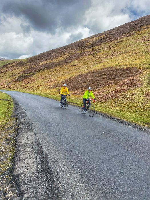
I made a resolution at New Year to try and get out for more adventurous cycles this year, like we did when we started out cycling; mixing road with bits of off-road cycling and exploring places we’d never been before. I had vaguely planned out a route that would take in Watch Water reservoir, where I’d been before, and explore deeper into the Lammermuirs on tracks that would be new to us, looping back via the Herring Road. All we needed was a spot of decent weather…

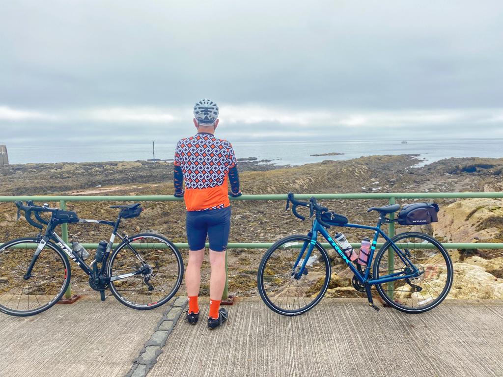
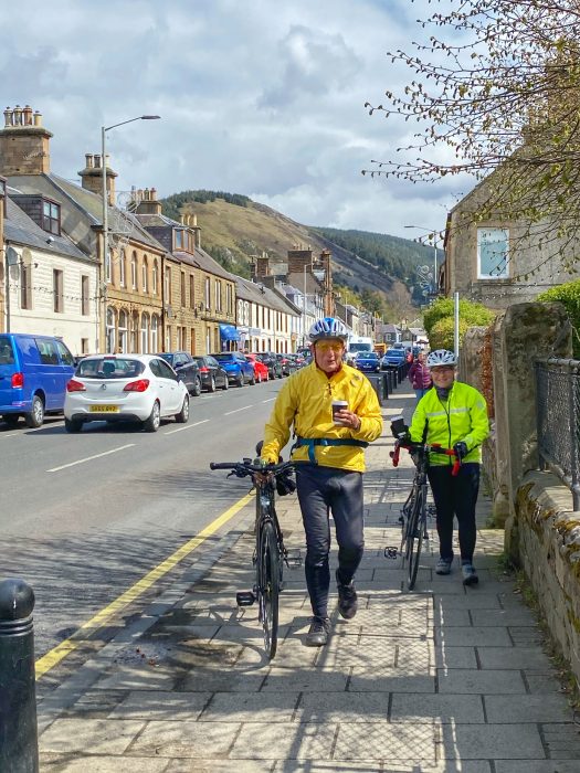
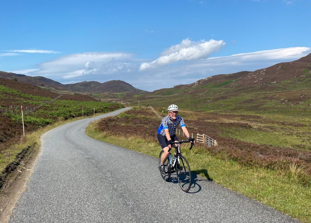
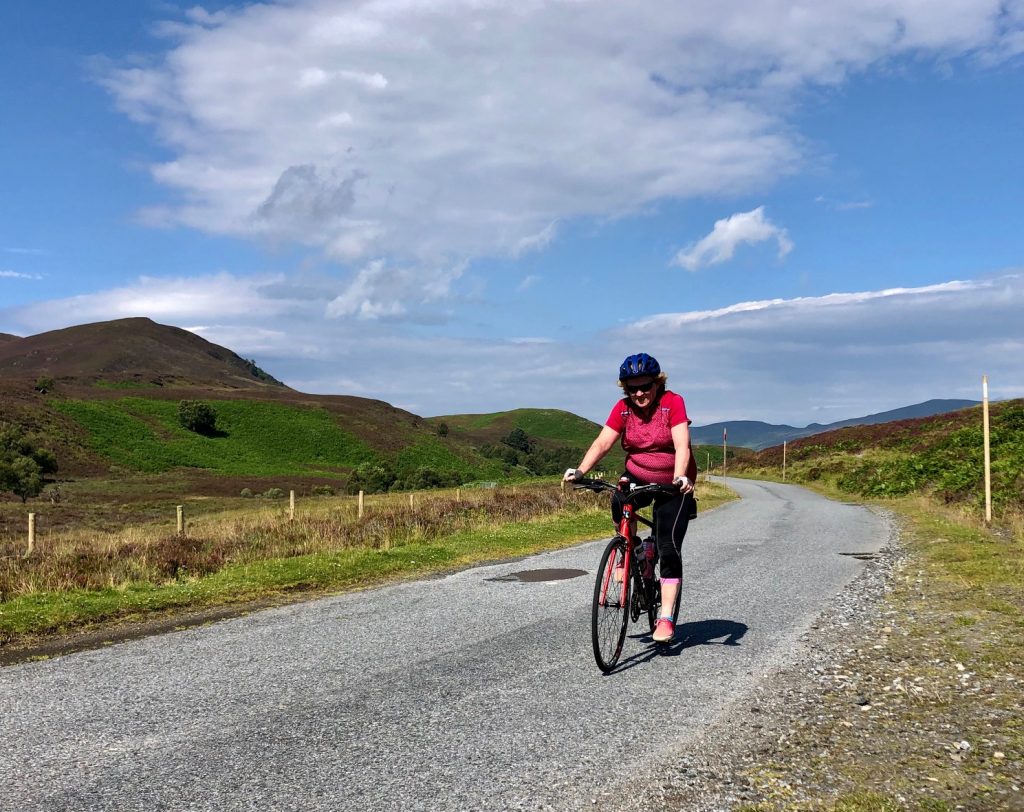
The forecast for the 14th looked great – full sun, barely any wind and temperatures safely above freezing. So we set off in the car and parked at the west end of Whiteadder reservoir. We unpacked Colette’s gravel bike – ideal for this route, and my old hybrid – again ideal, if a little on the heavy side. 

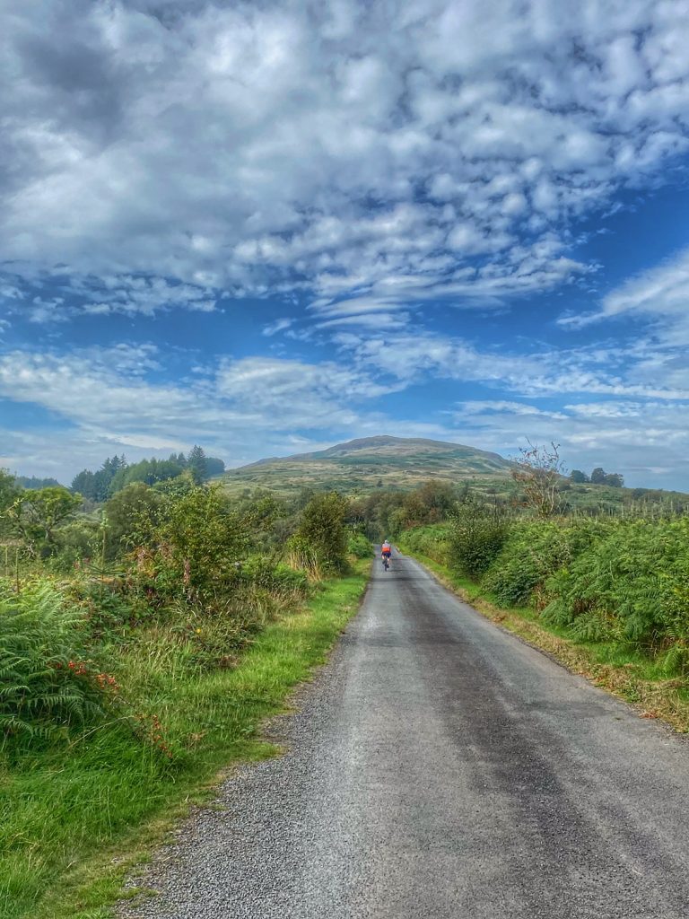
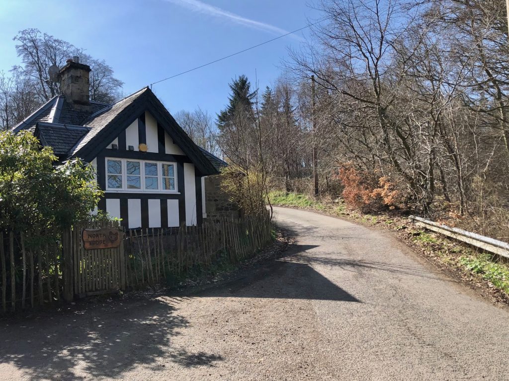
We set off with the low winter sun barely risen above the horizon, but I could swear that I felt a faint warm glow from it.  Fairly soon, we hit the steep slopes of the Hungry Snout climb, and I was certainly feeling a warm glow after that exertion. Then there was a super fast descent that sent us on our way towards the tiny hamlet of Cranstoun, where we stopped for a wee photo of the church.

I was then on the lookout for a right turn to take us to Longformacus. Somehow I’ve never cycled along that joining road before, so had to stop to check the map on my phone a couple of times to reassure myself that we hadn’t somehow missed it. I have the route on my Wahoo but remembered late on that I didn’t have a suitable mount on my hybrid, so I put on Colette’s retired old Garmin at the last minute, hoping that the battery would last and I would just ride with the route in my memory rather than on the handlebars.

Colette reached the turnoff first, and it was pretty much unmissable as it turned out, where we started up quite a steep climb past an orchestra of chainsaws and a very large bonfire. There was a scene of devastation in the woods that we cycled past, where I’d estimate that around 50% of the trees were down. Alongside the road, their now vertical roots were lifting the wire fence to our left high into the air, and the fence posts were dangling like washing on a line. To the right were piles of chopped up logs and telephone poles left over from the work to clear the road. The recovery work is clearly going to take a long time, but at least the locals won’t need to worry about buying firewood for years to come.

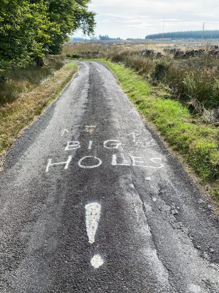
After topping out near Whitchester House, there was some nice descent on our way to Longformacus. We were in and out of the village in no time, taking a left turn on the road to Watch Water reservoir. The bumpy, potholed road ran through a wooded valley to start with, where the trees seemed to have fared a lot better that the more exposed woods we passed earlier.

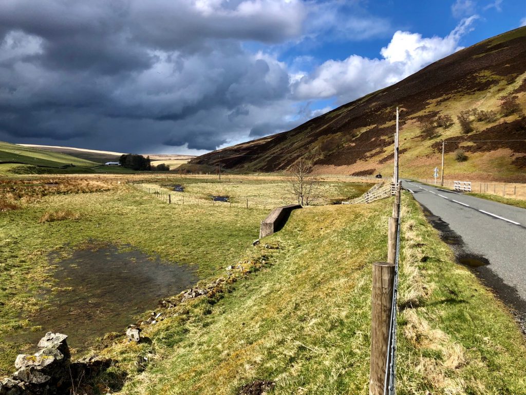
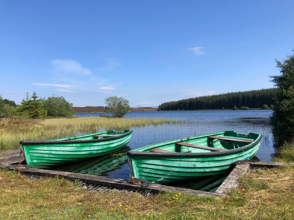
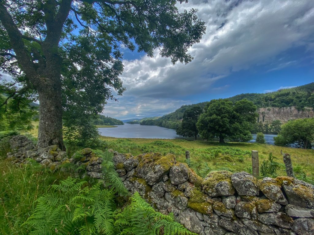
Watch Water reservoir comes into view

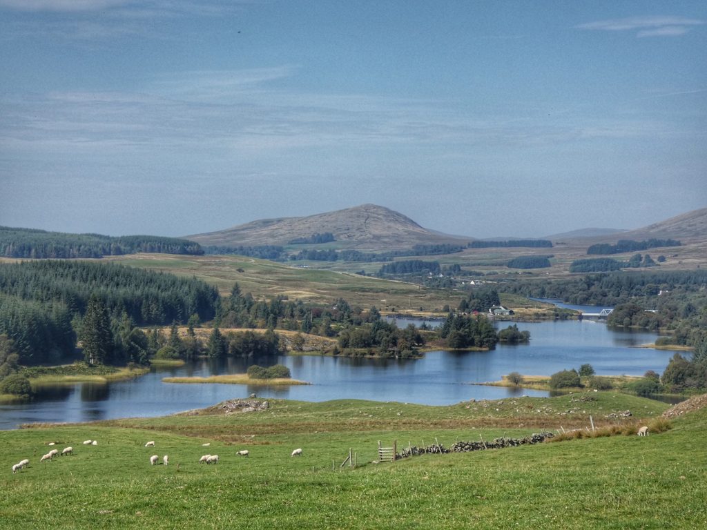
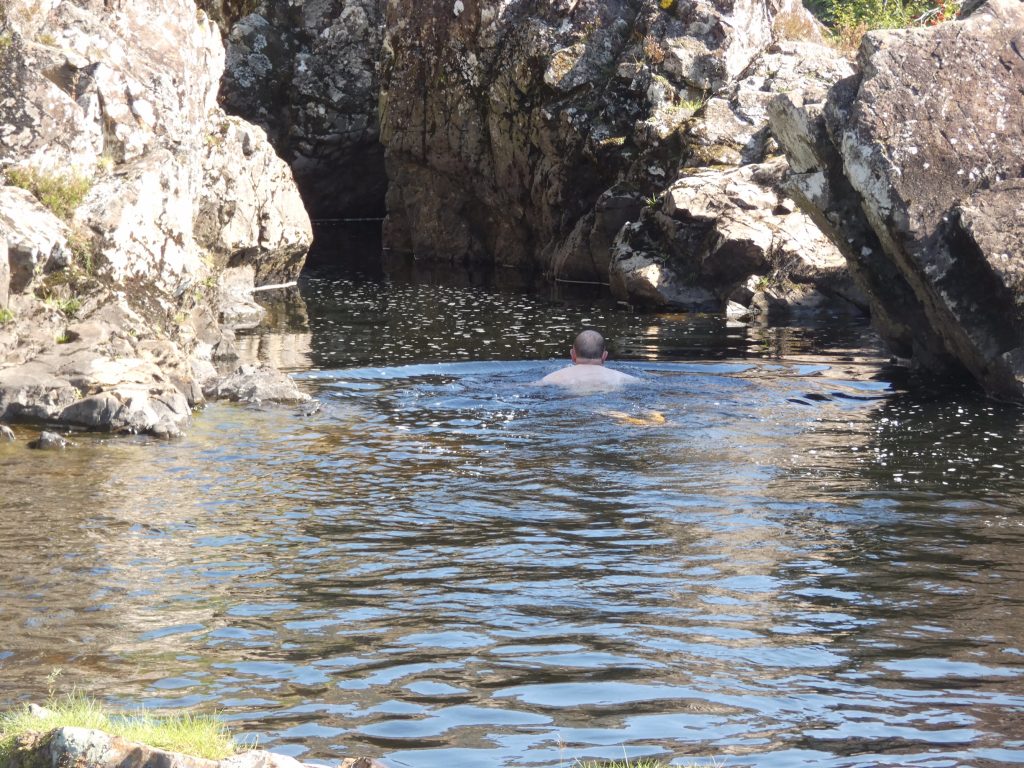
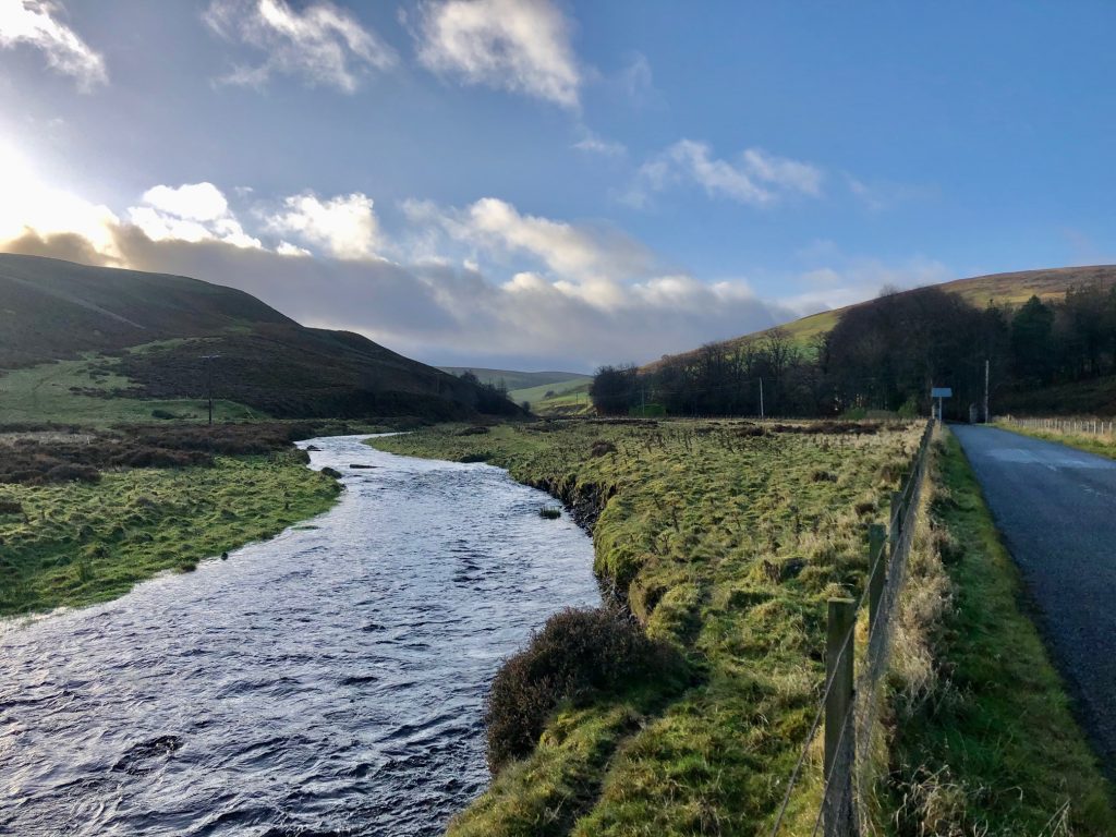
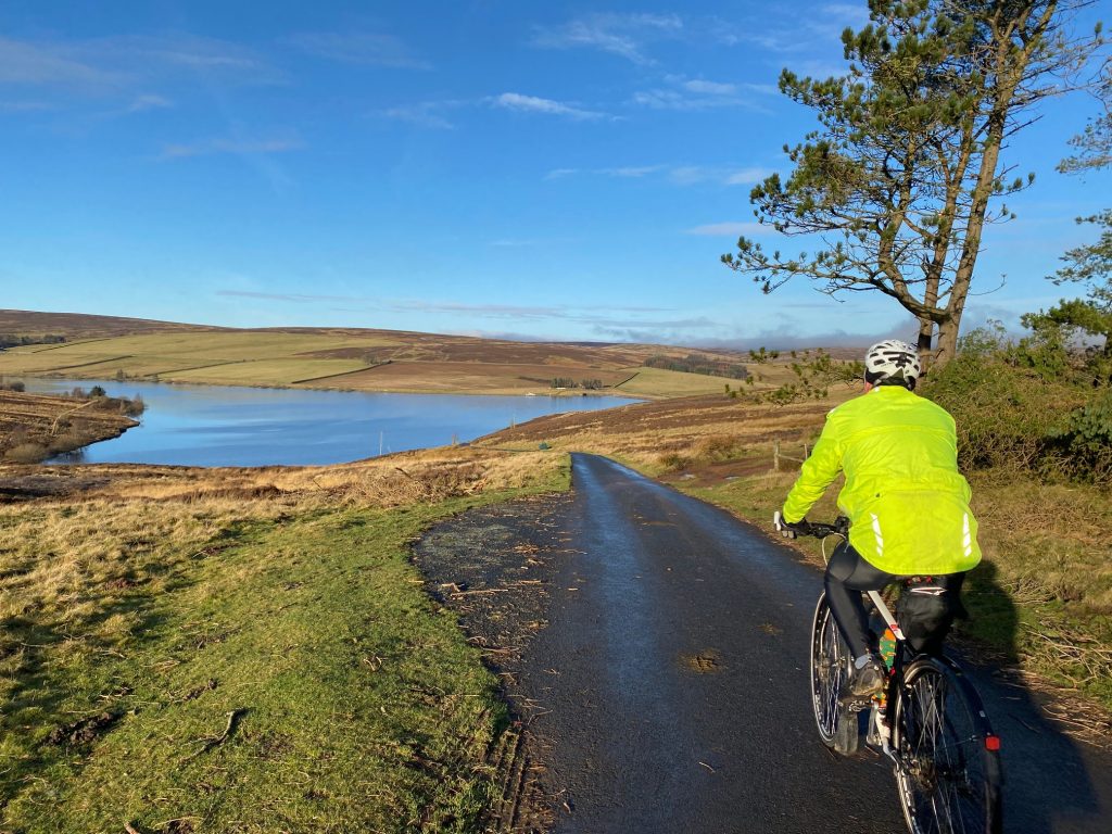
We then entered more open countryside, and after passing through a farm, it felt like we were out on the moors proper. The road curved to the right, round the contours of a small hill, after which Watch Water reservoir came into view. A quick descent took us to the dam, where there was a curious sign warning of adders. That was the first time I’ve seen a snake warning sign, but being the middle of winter, I’m sure we had very little chance of coming across any adders.

Low sun over Watch Water

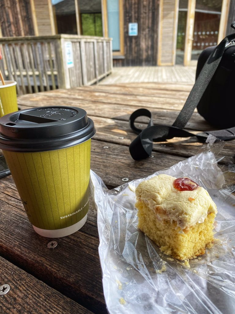
At the far end of the dam was the anglers’ clubhouse. Colette noticed that outside, there was a picnic table, so we headed there to eat our sandwiches and crack open the flask of coffee. I was feeling some warmth from the sun, so I took off my outer layer. This was definitely not typical mid-January weather!

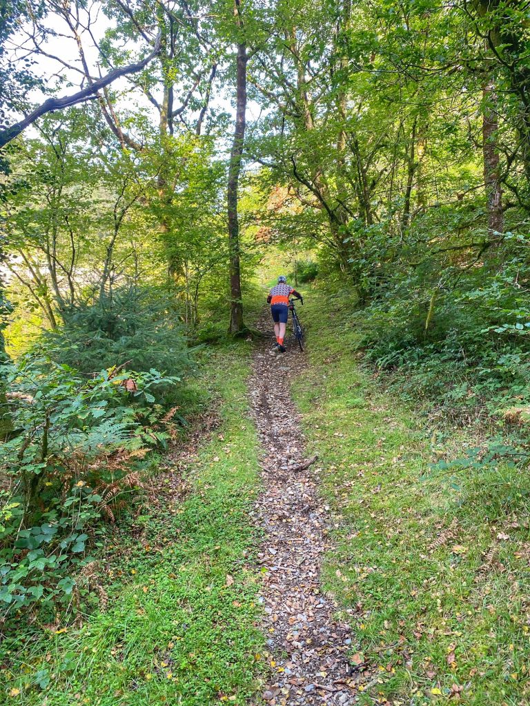
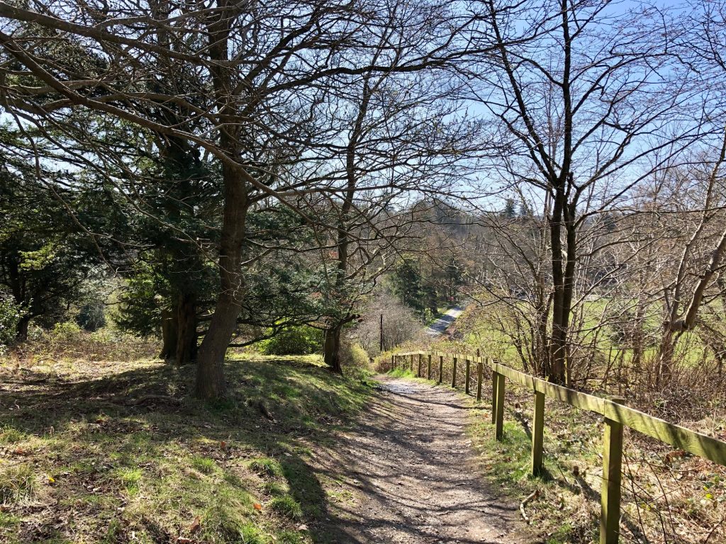
Moving on after our early lunch, we followed the road to a farm house, where the tarmac ended and we negotiated a short bumpy drop down to a splash though a small burn, then up onto a typical landrover track. At last we were properly off-road!

The track intercepted a more major one at a T-junction, with a very steep climb to the left and a more gradual one to the right. Colette was relieved to hear we were going right. The surface was very hard-packed fine gravel. It was so smooth and hard, it looked like a tarmac road. I wouldn’t think twice about riding a road bike on skinny tyres along this one, as it was better than many of the main roads we cycle along.

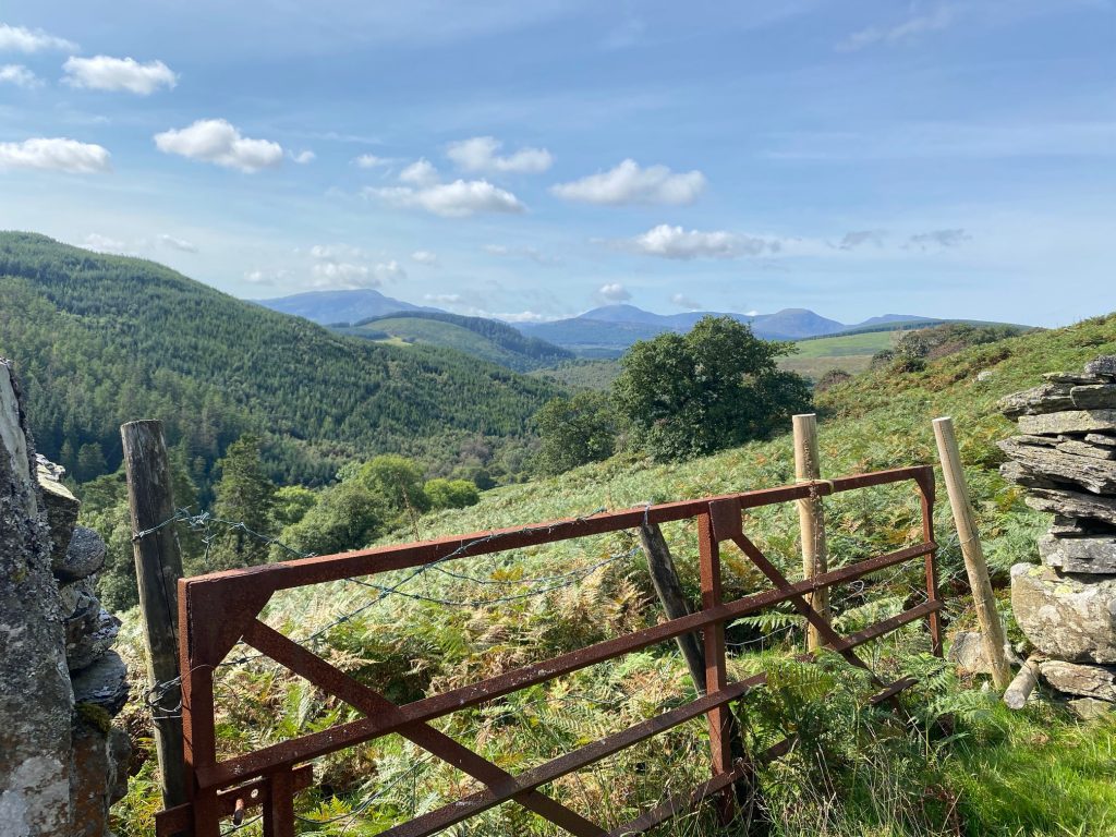
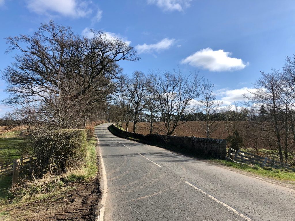
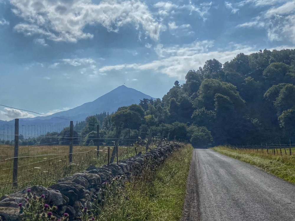
Over the top, I was happy to let go of the brakes for a 30+mph descent. Soon, we reached a bridge which connected us with a tarmac road leading into the heart of the Lammermuirs alongside Dye Water. I was surprised to see quite a number of houses and farms as we cycled up the valley, in what I previously thought was an utter wilderness.

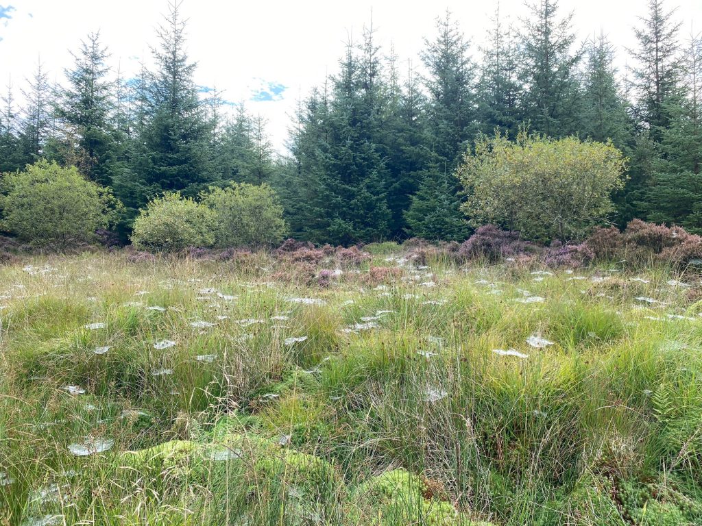
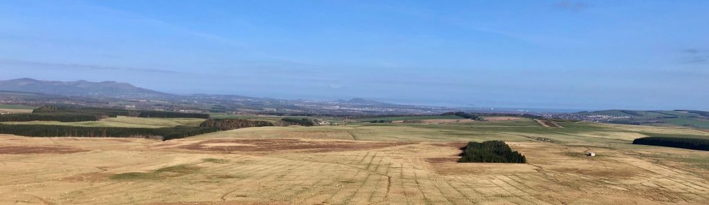
The tarmac ran out after a while, but the track continued as another well-surfaced gravel road beyond that, although it was out of bounds to cars. We carried on, gradually gaining altitude as we progressed deeper into the moors. The tops of the flattened hills were shrouded in mist / low cloud, from which we could begin to make out the looming giant forms of wind turbines. They were moving almost imperceptibly in the light breeze.   

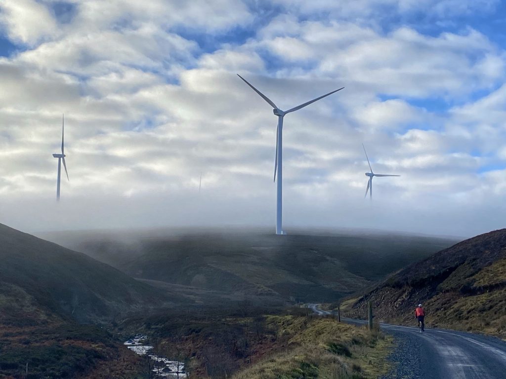
Finally, the track left the side of Dye Water and went right, up a slope to a clearing where many roads met. Here, we also found the second species of giant, in the shape of lofty electricity pylons. The plan was to take what I believe is known as the SSEB road from here, which tracks the line of pylons over the moor.

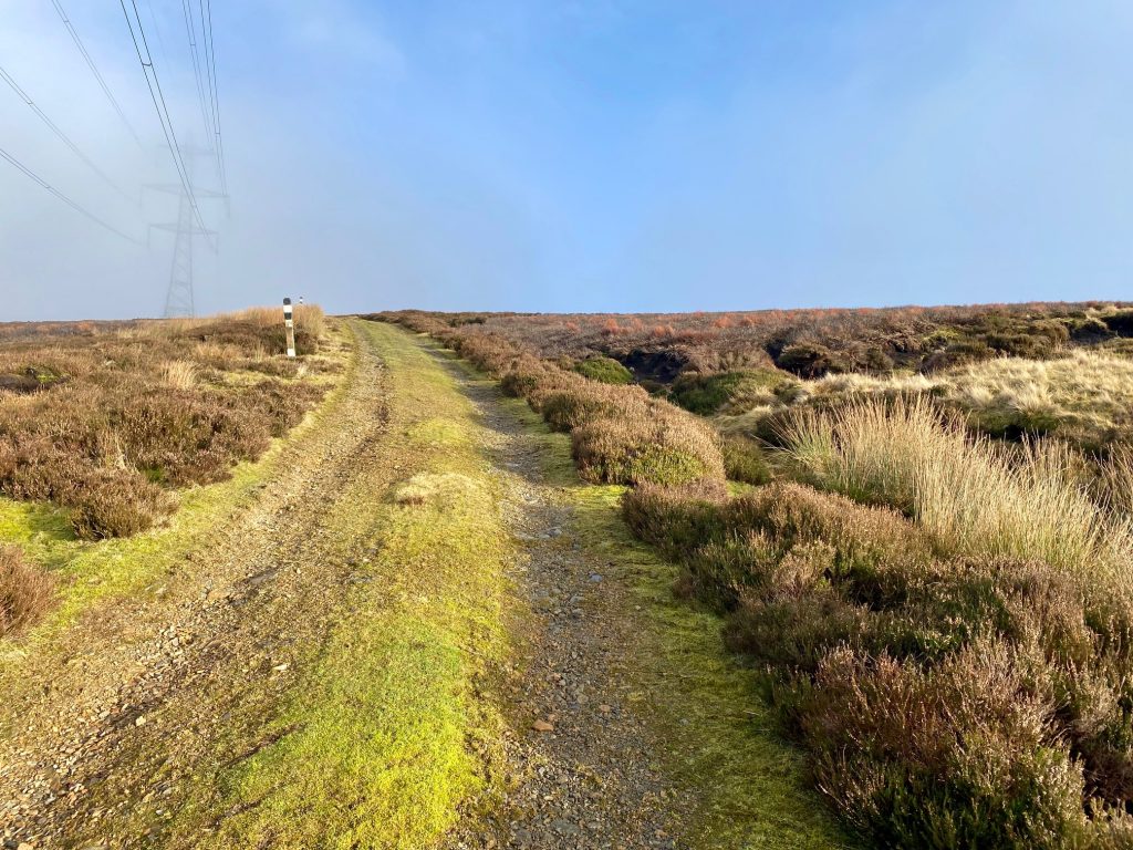
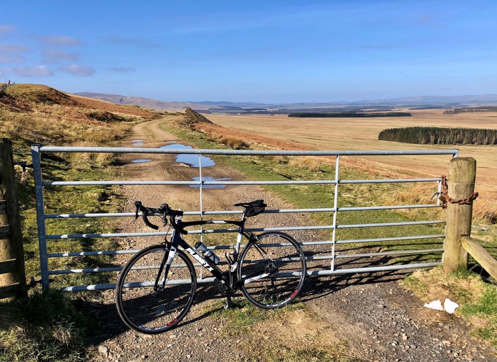
The SSEB road – excellent landrover track

For the first time, the surface was less than perfect. It was loose rough gravel over some soft, spongy, muddy material. That made it harder to progress, but thankfully it didn’t last long, as it went off to the left and the SSEB road continued as a very decent landrover track.

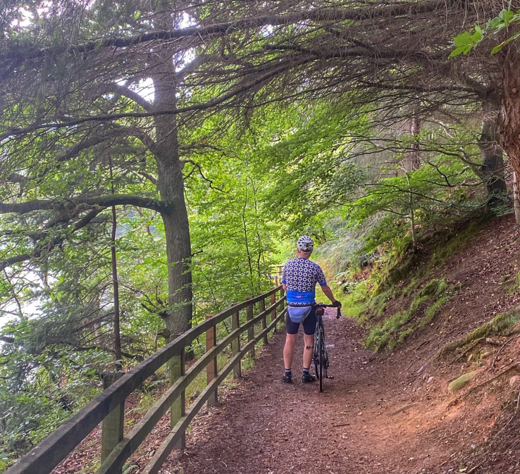
There then followed a steep down and up, where we both had to push our bikes, and after that some glorious rapid descent with just enough jeopardy in the shape of occasional bumpy bits to give a wee adrenalin boost. If I’d been riding a mountain bike, it would have been too easy!

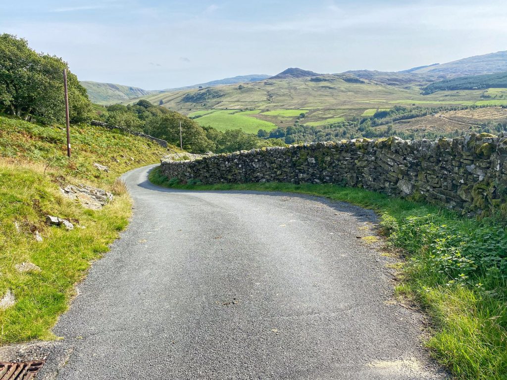
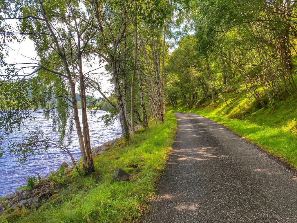
Finally, we joined the Gifford Road, turning right in the direction of Longformacus. We went along for about a mile when we came to a sign pointing left to a track known as the Herring Road. This is a historic path, leading from the coast at Dunbar, where (you’ve guessed it) herring were landed then transported by foot some not inconsiderable distance to the borders town of Lauder.
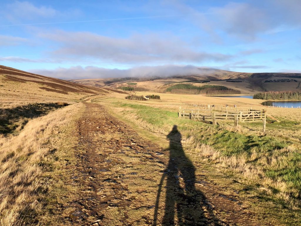
The Herring Road

The track is fairly well surfaced for the most part, but the sandy, slightly muddy surface made it quite heavy going. Fairly soon, we caught sight of Whiteadder Reservoir once more, at which point, Colette’s old Garmin that I was using to record the trip decided to call it a day. With only around a mile left, I wasn’t going to get too upset about that. So we continued to follow the Herring Road back to the car, and with the sun on my back and a final short climb, I was feeling positively warm. The car claimed it was 14 degrees when we got back in!

I was tired at the end of our wee adventure, and Colette claimed to be completely exhausted, but she had enjoyed it immensely. It was definitely a lot more fun that yet another jaunt round the same old roads we normally frequent, even though we don’t have as many miles to show for it on Strava afterwards. Time to get looking at the map for more of the same…


Posted in Uncategorized | Leave a comment

21 September 2021 – Snowdonia, from sea to the mountains

Colette and I were spending a week’s family holiday in Aberdovey, at the very south of Snowdonia national park. We had brought our bikes and planned one full day’s cycle as well as the odd short excursion fitted around childminding responsibilities. For the big ride, I’d planned to start at the south side of the Barmouth bridge, an interesting dual rail and foot/cycle bridge that takes you over to the town of Barmouth on the other side.

From there, we would cycle north to Harlech, for a quick look at the famous castle, before looping round and uphill to Trawsfynydd, where we would return via a meticulously planned path through myriad quiet mountain roads.

We parked up at Morfa Mawddach railway station car park and headed for the bridge, only to be confronted by a “path closed” sign. I was quite taken aback by this, but it was clear from the work going on ahead, that we would not be able to squeeze past. My initial instinct was to head back to base and start planning a completely new route on the laptop. However, on second thoughts, we could start by reversing the route as far Dolgellau, where we could devise an alternative outing over a coffee.

So off we went along the Mawddach trail. This is a hard-packed gravel biking trail that runs along the Barmouth estuary for a good 7 or 8 miles. The tide was high, and as soon as we reached the edge, we just had to stop for photos. In the quiet of the morning, egrets and herons were scattered around, fishing in the glassy water. In the channels running between the banks of seagrass, we could see bow waves made by large fish (possibly grey mullet), patrolling just below the surface. And in the background, the mountains of Snowdonia overlooked the scene.

Little egret

It was a magical landscape, which we might have missed if the bridge had been open and we had then only reached this point at the end of the day, with the tide out. So we had an easy, flat ride to start with along the estuary, till we reached the quaint wooden toll bridge at Penmaenpool. We could possibly have crossed there and continued to Barmouth to restart the original route, but the detour would have added too many miles to an already long day, so we carried on towards Dolgellau.

The gravel trails took us all the way to the a car park in the centre of Dolgellau, where we found the Crasdy’r Gader cafe. Once installed at a table with coffees to hand, we began planning our alternative ride.

We still wanted to visit the high ground to the north of Dolgellau, but it would just have to be 10 to 15 miles out, then return. I had the thought initially to buy a sandwich for a picnic lunch in the mountains, but on closer inspection, the map showed up a cafe where we might get a proper lunch. This was at the Coed y Brenin mountain biking visitor centre. The cafe was reputedly open all year round, so we would aim for that. We would head north on the roads I’d intended would take us back on the original route, then loop round onto national cycle path 82, which passes through the mountain biking park.

There was a touch of jeopardy in that route 82 is not recommended for road bikes for some of its length. We would just have to keep our fingers crossed that it wasn’t the bits that we wanted to do…

Our route from Dolgellau was route 82 to start with: a single track road through wooded countryside. After several miles of undulations, a short steep climb took us to the place where we would diverge from 82, and launch into what on the map looked like a maze of small roads and tracks.

Pretty much straight away, we were into 15%+ territory, and I puffed all the way up to the next junction, a kind of letter H shaped crossroads. Immediately on turning left, I was confronted by a “Road Closed” sign. Oh no, here we go again!

I headed back to intercept Colette so she wouldn’t need to climb all the way to bad news, but she suggested that we just forge ahead and chance it. So that is what we did.

The tiny road was a delight to cycle along, running along the west side of a small, wooded river valley. It couldn’t last though; we finally came across workmen repairing the road. In fact, it looked like a small bridge where the repairs spanned the whole of the road. There would have been no possible way to get past, so we U-turned and headed back.

A short way further along, I noticed a fairly well-used track leading down through the trees towards the river. I knew there was a parallel road on the other side of the valley, so I took the chance that we could get down and back up again onto the other road.

We carefully walked our bikes down the track, which would have been ride-able, even for me, on a mountain bike. At the bottom, amidst the moss-covered rocks and trees, we found a footbridge. Interestingly, alongside was a sign saying that gold panning was forbidden. There must be gold in them thar hills then.

A steep scramble took us up to the joining road, where another sign, pointing down the track from which we had just emerged, was showing “trail closed”. Oh well, that was one closure out of three that we managed to dodge.

Getting to the parallel road didn’t mean that our problems were over. This one was a fairly rough gravel surface, through which I had to pick my way carefully on my road bike. It was also fairly steep in places, but it did the trick of finally linking us to the road that we were aiming for, to take us higher into the mountains.

Once back on track, we had a few more challenging steep sections through the woods before emerging into more open countryside, giving better views of the fields and mountain peaks beyond. After topping out, we had the rare treat of some swift downhill, followed inevitably by more steep uphill.

Although it was hard going in places, we were in the kind of countryside we love to cycle: remote, quiet and scenic. Add in a sunny day with hardly a breath of wind, then it was hard to beat. We had a clear view to the north, where all the peaks bar one were visible. The one clouded peak was most likely Snowdon itself.

We stopped heading north when we intersected with route 82. That took us downhill to a bend in the road, where under a bridge, a river had cut a deep channel, before opening out into a wide pool. This was very similar to the place we’d found earlier in the month near Dalry, except this time we didn’t have time for me to take a dip. We needed to press on to our lunch stop.

This meant another few steep climbs, before route 82 took a turn for the worse. That being a right turn away from good quality tarmac onto rough gravel. Although the track was heading downhill, this wasn’t a good thing, as my road bike was bumping and rattling and I was afraid it might break, or at least have a puncture if I went any faster than about 7 mph. I was happier when we got to uphill sections, which could be negotiated in more comfort.

Colette on the other hand, was surprised to hear my complaints, as she wasn’t having the same problems. Oh yes, that would be because she was riding a gravel bike! A gravel bike would be very advisable for anyone living in this area.

Lunch!!!

Eventually, we found ourselves outside the Coed y Brenin visitor centre and cafe. We locked up the bikes and went into the cafe at around 2pm. I was shocked to see that the hot food counter was empty. I stood speechless with my head in my hands, as the lady serving told us that they had staff shortages and she was just about to close up. So we hastily ordered a coffee and one of the remaining bagged sponge cakes for our lunch. Not exactly the sort of lunch we had in mind, but it filled a gap. Colette wasn’t so happy and declared that she doesn’t want to eat another cake ever again. I wonder how long that will last!

Although route 82 continued through the mountain biking centre, I didn’t expect it to turn back to tarmac any time soon, so we took the decision to decamp to the nearby A470, which took us in the same direction, only a lot faster. The traffic wasn’t too bad, and it wasn’t long before we has passed through the village of Ganllwyd (I think it is pronounced something like “ganshwee”).

Shortly after that, I took a risk and turned left off the main road, to cross the river and rejoin route 82. As I’d hoped, we were back onto tarmac, and the road here zig-zagged joyfully through the forest.

Quite soon, we reached the part of route 82 by which we’d arrived earlier, then continued onwards past Dolgellau and back onto the flat gravel path along the estuary. The path was much busier now, and as expected, the tide was now out. There were no more interesting birds to be seen, but that was fine. They were already committed to Colette’s memory card from our earlier passage along this track.

When we arrived back at the car, we were very satisfied with our day out, despite it being a cobbled together afterthought compared to the original plan. We weren’t at all disappointed that it was one of our slowest rides ever, due in part to going carefully on the almost 50% gravel path component, and also to the numerous very steep sections. The day provided us with quiet roads, beautiful scenery and glorious weather, as well as a few moments of jeopardy to make it that bit more memorable. It might also not come as a surprise that with a big birthday coming up, I’ve been Googling gravel bikes!


Posted in Uncategorized | Leave a comment

08 September 2021 – Moniaive and Dalry

After a summer with more than the usual share of long hot days, we finally came to what looked like being the last one, and were determined to make the best use of it. So we broke some new ground with a trip to the southwest.

We arrived in Moniaive with a light mist pegging back the temperature a little to start with, so I set off in arm warmers. Our route went west to begin, along the A702. In planning the route, the aim was to keep the A-roads to a minimum, but to be fair most A-roads in Dumfries and Galloway are fine, apart from the A75. 

A few miles in, after passing through Kirkland, dominated by its kirk and large cemetary, we turned to the right onto the B729, signposted for Dumfries. The route was mostly downhill at this point, so we made good time through the gently rolling countryside. The smoothly contoured hillocks looked like they could have come straight from Tellytubby land, apart from the fact that they were grazed by sheep instead of rabbits.

As we approached Dunscore, we started going steadily uphill, reminding us that the route wasn’t going to be freewheeling all the way, and by the time I’d reached the centre of the village, it was time for the arm warmers to go.

We turned off onto a minor road, and the traffic reduced from occasional to almost non-existent. Although minor, the road had been fairly recently resurfaced, leaving plenty of residual loose gravel to be wary of. It was necessary to keep within the lanes cleared by car tyres rather than take the usual lines round corners. We were glad when we left it behind at the next junction.

By now, we were transitioning to more remote country characterised by rougher pasture dotted with cows up to their oxters in long grass and ferns. To our right, the ground rose to a craggy ridge, with areas of bare rock showing through. I was enjoying the ride so much, I felt it must be my favourite of the year.

After some flat road, we started to climb through woodland, where we found other worldly spider hammocks, highlighted by dew, festooning the roadside grass and heather. We stopped for photos and Colette commented that she was having the best time and this must be high up on her all time favourite rides. So it wasn’t just me!

A bit later, we diverted onto a very minor road that clearly wasn’t much used and had fallen into disrepair, with some huge holes here and there. Thankfully there were warnings painted onto the road, and they were pretty easy to dodge round on a bike. At the other end of this road, we came out of woodland into more open countryside, where we passed some scattered houses. From there, the road was immaculate, leading us quickly down towards the A712, where we could see traffic for the first time in ages.

We turned right onto the A712, which wasn’t all that bad in terms of traffic, especially as we were riding mostly fast downhill all the way to the next junction. At the junction, we turned right again onto the A713. Although we were pretty much in virgin territory with this ride, I did recognise the Ken Bridge hotel from the time a few years ago when we rode a circuit round Loch Ken.

The A713 was moderately busy, and with a long, lazy left bend to the road, a slow, heavy lorry had trouble seeing far enough to overtake, leading to bit of a tailback behind us. Once it managed to get past, we returned to more peaceful riding, but we were still keen to get back onto the minor roads as soon as we could.

A small mental miscalculation meant that we arrived at St John’s Town of Dalry a couple of miles earlier than I had expected. Since that was to be our lunch stop, it was a very welcome mistake. We spied a catering truck in the grounds of the seemingly closed Lochinvar Hotel and ordered some lunch, then sat and ate it out in the sunshine at one of the benches.

We were fed and underway quite promptly, heading through Dalry and out steeply via Main Street, before turning right onto the B7000. This was a steady climb on the map, but in reality, it was more a series of undulations with an overall sense of gaining altitude. The views out to the left were beautiful, and we felt like we’d discovered yet another great cycling road.

At a sharp bend, we came to a bridge over the Water of Ken. I was trying to see over the parapet as I crossed, but it was a bit too high, so I stopped at the far end and walked back to have a peer over the side at the waterfall that I could hear. It looked lovely, and what’s more, over the other side was a mini ravine, where the water flowed dark and deep away from the fall, then opened up into a large pool.

In the warm sunshine, it looked so inviting. I told Colette that was the kind of place I’d love to have a dip if I ever got the chance. Then I thought, why not? The sun was out and I was feeling hot. We had plenty of time and we were there by ourselves, so if I didn’t do it now, when would I ever do it?

The only problem was that I didn’t fancy going in in my cycling shorts. I’d decided on a skinny dip when we noticed a couple with a dog pull up and head over to the water side. OK, shorts it would be, and I’d deal with the consequences of cycling in a “wet nappy” later.

I got myself onto a flat rock next to the pool, splashed my face with water and then jumped in. The water was lovely and surprisingly warm (or maybe non-cold would be a better description). I swam over through the ravine with the intention of going under the bridge to the waterfall, but as I got closer, it became obvious that a large rock was blocking the ravine making further progress impossible.

No worries, I was happy to just have a quick dip, so turned around and scrambled out of the water. I dressed and dried off very quickly (apart from the pad of my cycling shorts). As we cycled off, I was feeling energised and refreshed, which was good as there was a short sharp climb lying in wait at the far end of the bridge.

At the top of the short effort, we turned right at a T-junction and cycled onward into open moorland. After crossing the Water of Ken once more, we began our final climb. The scenery continued to delight, so I was pleased not to be powering up the gentle gradient, and was thus able to enjoy it for that bit longer. Finally we topped out, and the six mile descent that followed took us all the way back to our starting point in Moniaive.

A couple of Magnums and some cold bottled water were procured in the local store as a necessity, as this was such a hot day, albeit the last scorcher of the year. My shorts were nearly dry by the time I got back in the driving seat for our return home, and the lack of chafing was both welcome and encouraging for future impromptu swimming adventures, although they will remain very much weather dependent.


Posted in Uncategorized | Leave a comment

25 August 2021 – A rare foray into Fife

With a good weather day forecast and looking for some inspiration for a new location for a ride, Colette suggested that we visit some of the seaside villages of Fife. For some reason, we haven’t really spent much time cycling in Fife, so it was worth looking into.

I didn’t really have much idea of where to start when plotting the route, other than we would be having a chippie lunch in Anstruther. I started from the village of Ceres, fairly centrally located in the Kingdom of Fife, and plotted a route to the coast and back. As this was only 30 miles, I then added a little extra detour to bring up the mileage to a more worthwhile 42 miles.

We set off in the car on a still and foggy morning, hoping that the mist would burn back by the time we got to Ceres. We parked up in a handy car park and got set up with the fog still lingering and had to wear an extra layer to start with.

Heading south, we progressed along quiet roads, climbing to start with, through rolling terrain. Unfortunately, we couldn’t see any of the scenery due to the mist. After a few right turns, we were heading back north briefly on a busier A-road, till we took a left and east onto the extra loop I’d added in.

We were enjoying the mainly traffic-free minor roads, which took us to the high point of the day, somewhere to the west of Clatto Hill (which we couldn’t see). After descending, we turned east and passed through the village of Bonnybank, which took us onto the A916. 

The main road wasn’t as busy as I’d feared, and a few miles later, we turned off onto a quieter B-road. With our mileage-adding detour finished, were now heading towards the coast again, when we took another small detour – this time to make sure we came into Upper Largo from the right direction.

Although we haven’t cycled in this area before, I know it well enough from trips in the car, and the road from Lower Largo to Upper Largo I remember to be both steep and busy. I didn’t want us to be crawling up there and causing a tailback of impatient drivers. So I took us into Upper Largo via a series of minor roads.

The roads were quiet for sure, but they weren’t without their undulations, including the steepest climb of the day, which was thankfully quite short. There was a fast descent into Upper Largo, where we met the A917 and the predicted constant stream of traffic flowing through the otherwise pleasant little village.

We received a warm welcome as we entered Upper Largo

When we got a chance, we inserted ourselves into the flow and cycled east out of town. The traffic was busy but there were enough breaks in the oncoming flow for cars to pass without too much of a delay. However, compared to the empty roads we started the day on, this wasn’t very pleasant. At least we were only on the A917 for a couple of miles before turning off onto the B942, which I presumed would be much quieter.

In fact, the B-road was just as busy, and lasted for another 3 miles, passing through Colinsburgh, where a traffic jam was leading to some angry shouting. Further on, a convoy of vehicles headed by a slow moving horse box caught up with us, and some very dodgy overtaking ensued. We were glad to see the back of this road when we took another small diversion, which brought us into Pittenweem from the north.

We decided to have a trip down to the harbour for a quick look around before getting back on track for Anstruther as it was getting on for lunch time. By now the mist had mostly lifted and the sun was beginning to break through, giving us a much better view of the coastline.

Leaving Pittenweem, we were back onto the A917 and all the associated traffic, but it was only for a short while, as Anstruther was just a short ride away. Entering the town, we were immediately stopped by some major road resurfacing works, involving traffic lights and a convoy system. We avoided this by taking some minor roads and rejoined just after roadworks, thereby craftily avoiding riding over sticky fresh tarmac.

A view from our diversion round Anstruther

On finding our way to the harbour, our next aim was to locate the award-winning chip shop to get our lunch. The last time we were there, we got our fish and chips from the “wrong” shop, although they were pretty good to be fair. After consulting Google, we found our way to the Anstruther Fish Bar.

It was notable how much busier Anstruther was than Pittenweem. The harbourside road was thronged with visitors. There was a small queue for the fish bar, but it can’t have been more than about 15 minutes before we were tucking into freshly-cooked fish and chips. Absolutely delicious, and one portion was plenty between two.

Colette went off looking for photo opportunities, going all the way to the end of the harbour wall, while I cleaned up and binned the rubbish. Then we set off vaguely northwards out of Anstruther on the B9131, heading back to our starting point in Ceres.

The ride back was effectively a 6 or 7 mile-long climb, although the gradient was never all that steep. The roads were in pretty good nick and the now hot sun bearing down on our backs made it easy to imagine that we were cycling in Spain. The roads here were by no means quiet, but the level of traffic was quite bearable compared to the A917.

We passed a sign for Kellie Castle and tea rooms. The latter sounded like it might be worth a visit, but it would have involved a 6-mile detour from our chosen route, and that was just a bit too much, so we plodded on, intending to have refreshments after we finished the ride. In fact, it I’d bothered to stop and look at the map, we might have been able to visit without adding much extra distance. Something to keep in mind for a possible future visit.

On our return, with the fog now gone, we had a chance to see more of the countryside. The rolling agricultural heartland of Fife opened up before us in all its colours. Although more than likely coincidental, it’s apt that Ceres was the Roman god of agriculture. 

Our final stretch of road leading to the village looked like it was recently resurfaced in places, and took us onto a fast descent. I had to brake quite hard to stay at 20 mph as the road narrowed through the houses of Ceres. We saw much more of the quaint little village on our return, and it had a busy vibe with plenty of people out and about. 

We might have visited the tea room at the folk history museum next to the car park, but it was booked for a private event, so we just headed home and stopped at the first Co-Op we could find on the way for some Soleros, which hit the spot very nicely!

Overall, we were pleased with this rare foray into Fife, but we could make it even better by giving the ~A917 / B9171 a big body swerve. Any repeat would most definitely need to include another yummy chippie lunch at Anstruther!


Posted in Uncategorized | 1 Comment

07 May 2021 – Innerleithen and Peebles

It had been a long time since we last cycled with most of our Monday Madness chums, but today we had a chance to have a ride with a couple of them: Fiona and John. They were keen to go over the Granites and fit in a lunch break at Fiona’s sister’s house near Peebles.

Colette was a bit concerned about the length of the ride, not having ridden that far for about a year. I was also a little worried about the forecast, with a chance of showers. However, it was a nice bright start to the day, so I decided to take my summer bike and was keeping my fingers crossed that the rain would stay away.

We left North Middleton, across the A7 and up past the quarry towards the start of the Granites climb. Once there, we took it easily so we could chat, and there was a lot of catching up to do. Reminiscing too, since the Tour of the Algarve was on telly the day before, and the finish at the top of Foia reminded us of the scary descent we experienced there with Fiona a couple of years ago. Shivering with cold and battling a howling gale, we were glad to make it down in one piece.

Today we were more suitably attired, and there was hardly any wind to upset us as we freewheeled down the descent after the Granites. After that, we continued to climb again as far as the Piper’s Grave. Before the descent to Innerleithen, I made sure to warn Fiona and John about the state of the road coming up. It was horrible the last time Colette and I went this way. However, I was happy to be proved wrong, as the worst of them had since been filled in.

As we approached Innerleithen, we found the golf course to be busier than ever – a clear sign of the post-lockdown bounce-back. Continuing into the town itself, we felt the temperature drop a few degrees as usual. The local geography seems to trap the cold air there.

We stopped at Adams bakery for some hot pies to transport to our lunch stop that was coming up. We also bought coffees and found a spot in the sun to warm up a little as we drank them. I was so glad that I hadn’t called off due to the potentially iffy weather forecast, as I was really enjoying the relaxed ride and the company.

It was decided to head towards Peebles via the cycle path. Usually it is fairly busy with cyclists and walkers, but it was particularly quiet today for some reason.

After cycling through Cardrona, we found that the building work next to Nashy’s coffee shack had been completed and the normal cycle path had been reinstated. No more detour and ducking as you go under the bridge!

Approaching Peebles, Fiona suggested leaving the path and riding into town on the main road. The principal reason for this being the tricky switchback on the cycle path. I said that I’d prefer to do the switchback for a bit of fun, and would rejoin them further down the road.

So off I went, and nearly fell off as I turned up and sharp right. The path seemed somehow much narrower than I remembered, causing me to stall but not enough to stop completely. I recovered and continued along the path, joining the main road just as John, Fiona and Colette were approaching.

Shortly after that, Fiona called out to stop and go through a gate into the park, where we negotiated a shortcut to miss out Peebles town centre. We had a bit of a wait to cross the footbridge, as social distancing meant that you needed to wait for the bridge to clear completely of traffic coming towards you before starting to cross.

After crossing, we turned left and cycled out of Peebles. Shortly after that, we reached Fiona’s sister’s house, where we wheeled our bikes into the back garden. Eleanor had set out seats for us to have our lunch in the sun. Our pies were still nice and warm, and tasted delicious. Colette’s meat and potato pie in particular was a revelation (I’m definitely going to choose that one next time!). I made a new friend in Isla, Eleanor’s cavalier King Charles spaniel, and we were treated to coffee and cakes after lunch.

At this point, we had a decision to make: to go back either via the Meldons or the way we came. We decided on the latter, as we all hate the bit of road after Eddleston. The best way to go back was not through Peebles however, but rather to continue on the minor road to Cardrona, then pick up the cycle path.

That involved a couple of short hills. My Wahoo showed the gradient gradually increasing up to 12% on one of them, which in retrospect was why Colette groaned when she saw the hill. It was over quickly though, and the descent to Cardrona was over even quicker.

Soon, we were back in Innerleithen and then turning north for the final push home. There was a bit of a headwind as we rode through the golf course, but no need to worry. If that is the case, it usually translates to a tail wind a mile or so further on, as the climb actually begins. Which it did.

We were well entertained by the bird life as we cycled up towards the Piper’s grave. Lapwings flapped acrobatically and oyster catchers and curlews gave us some close fly-pasts to keep our minds off the uphill grind.

A quick water break was had at the lay-by at the top, then we paused again to reconvene after the following descent. I took a photo of the road ahead, not really worrying too much about the dark cloud that was appearing on the horizon.

However, as the final climb progressed, the cloud looked bigger and darker and angrier. Near the top, we felt the wind get up and spots of rain started to fall, so we stopped for a moment and all those in possession of a waterproof put it on.

Then, once we had topped out and approached the start of the descent, we rode into a hailstorm. The stinging hail was unbearable, especially when it hit your lips. I sucked mine in to protect them and descended like a toothless crone.

Colette got ahead and at the turnoff for Middleton carried straight on, deciding to go home via the A7. When Fiona and John appeared, we decided to take the minor road instead, which turned out to be a mistake. The road was muddy and gritty, making braking noisy and less effective for Fiona and me, who were using old-fashioned caliper brakes. John was fine, with his disc brakes and mudguards. I wished I’d taken my winter bike after all!

Finally we reached North Middleton just as the squall subsided.  Soaked, freezing  and shaken, we had somehow made it. It was an experience to rank alongside the Foia descent that we were remembering about at the start of the ride. Despite that, it was a great day out, and Colette was especially chuffed to have coped well with the bigger than normal distance. Onwards and upwards…


Posted in Uncategorized | 2 Comments

03 April 2021 – Tour of Midlothian

Scotland’s second Covid-19 lockdown that began just after last Christmas has now been lifted, but the order is still to stay within your local authority area. So “stay local” was the theme of this tour, which has been planned to stay close to the outskirts of Midlothian. Yes, I know that we have always been allowed to go beyond in order to take exercise, but I needed a theme to plan out the route.

At 62 miles, this turned out to be a bit longer than I’d expected, which in metric terms comes out at 100km. I changed my Wahoo to show kilometers rather than miles for a bit of a change.

I set off in beautiful sunshine with hardly a breath of wind, but it was only about 5 degrees, so I had four layers on. My route took me from North Middleton over to the lime quarry, currently being filled in by an endless procession of NWH lorries. I headed south from there and met Colette coming the other way as she was already out on her own ride as she didn’t fancy 100km!

A few minutes later, I turned right onto the B7007 and began the Granites climb. This is one of the few long, gradual climbs in Midlothian, and today I was certainly taking it gradually – in no hurry, as I was planning on stopping for photos anyway, and was enjoying listening to the twittering of the larks and the curlew’s call.

Close to the top, I stopped at the layby on the right to survey the view to the north. The whole of Midlothian was laid out before me, going all the way to the Pentlands in the distance. This was to be my playground for the day, or field of conflict perhaps (depending on the traffic).

5… 4… 3… 2… 1…

The layby where I stopped is also the entrance to a disused quarry, which is due to be developed (planning permitting) into a rocket test firing facility. We can expect a quite different soundscape to accompany our rides up the Granites in the future.

As the climb topped out a little further along, I passed the welcome to the Scottish Borders sign. I then descended and looped back on very familiar roads towards Midlothian via Heriot and a left turn onto the A7. Shortly after passing Falahill, I reentered Midlothian and turned right onto the Tynehead road.

A few miles of easy cycling took me to the junction with the A68, which I joined briefly before turning off in the direction of Fala Dam. It’s a steep down and up there, through this curious little hamlet. Where exactly is the dam, I often wonder? Well, I finally Googled it, and according to Wikipedia, the dam is a long-lost medieval structure, so I can rest easy on that point now.

The road climbing up from Fala Dam is bordered by high beech hedges, leading to Fala village itself. After Fala, I headed for Humbie, passing the Midlothian boundary in the process, and entering East Lothian.

Entering East Lothian

At Humbie, cyclists were gathered to order their takeaway coffees from the hub. It was certainly a nice day to hang around outside drinking coffee in the sun, but I so much look forward to a time when we’re allowed to go inside and sit down for tea/coffee and a cake at a table like civilised people!

From Humbie, I turned northwest, following the B6371 down to Keith Water and back up again, and all the way down past Peaston to the junction with the A6093 Haddington road. I turned left here, back into Midlothian once more, then turned right onto the minor road heading to Cousland.

The unseasonably good weather combined with the holiday weekend had ensured that pretty much everyone who owned a bike was out riding and having fun. I was waving and saying hello all the way up to Cousland, down the other side and beyond, entering East Lothian once more.

As I approached the traffic lights at Crossgatehall, they turned green with about 30-40 meters to go, so I broke into a sprint. Luckily I managed to just sneak through on amber and got my breath back on the following downhill that goes past Carberry tower.

Left at the roundabout took me through Whitecraig, where I picked up cycle route 1 for a short while. This took me onto cycle path, over the River Esk and into Monktonhall. That was as far north as my route took me, at which point, I turned southwest, in the direction of Old Craighall.

I wasn’t looking forward to this stretch of road much, as it felt very bumpy and uncomfortable the last time I did it. However, it wasn’t nearly as bad this time, on my carbon road bike. Fairly soon, I was back into Midlothian and entering Millerhill.

Enjoying the break with Lucy and Marnie

I was now just over halfway into the route, and due for a refreshment stop. Cue a visit to my strategically located daughter Lucy, whose house came into view! Thanks to Lucy and Dave for providing the refreshments and comfortable seating in their suntrap of a back garden. If I shut my eyes, I could have been relaxing at a cafe in Mallorca, it was so hot.

I had to force myself to get going again, as I was in danger of losing the will to carry on and just lounge in the sun instead. Next, I headed to Shawfair, where I joined the cycle path that takes you all the way to Roslin.

Start of the Shawfair to Roslin path

The path was quite busy, so I was glad that I’d remembered to fit a bell to the bike just before leaving. The path goes quite close to Gilmerton, by which time I had no doubt strayed into the City of Edinburgh local authority area. Not long after, I passed through the underpass beneath the city bypass, where a couple of graffiti artists were just starting on their next creation. I’d have stopped to take a photo, but they were just spraying out the background, so I carried on, entering Midlothian once again.

Bilston viaduct

I passed through Loanhead, over the viaduct and past the former site of the Roslin Institute, which is now a housing estate at the early stages of construction.

A little further on, I reached the centre of Roslin, with its famous chapel to my left, where some believe the Holy Grail to be buried in a deep, inaccessible vault. My own personal quest took me in the opposite direction, towards Bilston.

Once in Bilston, I realised that it must have been a long time since I went along Seafield Road, since the field that was once on my right was now a massive housing estate. I went straight on after the traffic lights at the end of the road, heading towards Easter Bush, which was my place of employment many years ago.

The relocated Roslin Institute was there, along with the whole of Edinburgh University’s Veterinary School. The old Veterinary Field Station was gone, replaced by an impressive modern facade and Midlothian’s own Kelpie standing in pride of place before that.

From there, I carried on through into Bush estate, where I was hoping to find a path that I’d noticed on the map, hoping that 1) it was cycleable, and 2) that it actually existed!

So far, so good…

Well, I found it and first impressions were good, but I had to dismount as the path went steeply downhill with a deep, muddy rut in the middle. It flattened off next to a cottage, but the path was then diverted along a very narrow strip that was thick with black mud. I struggled to push the bike along this section, but luckily it wasn’t particularly long. That was good, as a big group of walkers was assembled at the other end, waiting for me to emerge.

I had come out near Glencorse, where a quaint-looking cottage was nestled in the elbow of a road that descended steeply towards me. After a short, sharp climb, I then sped downwards towards Glencorse House. I got off the bike there to try and catch a glimpse of Glencorse Old Kirk, where my son was married in 2015.

Spot the steeple

Continuing the descent, I came out at the A701 and turned right, passing Glencorse Barracks on my way into Penicuik. The journey into Penicuik was punctuated by a seemingly endless wait at road works, after which I cycled straight through and down some bone-jarring worn out road before turning left onto Pomathorn Road.

The Pomathorn ascent is familiar to me, and not nearly as hard as some people would make out, but at the top of the climb, I turned right onto the B7026 and continued down into Howgate for the first time.

Up to now, I have resisted cycling this section of road, joining Howgate and Leadburn, as the traffic is usually quite heavy. As I expected, the cars were queued up behind me as I cycled slowly up the two climbs out of Howgate. Once over the top of the hill, on the descent to Leadburn, it wasn’t quite so bad.

It came as a surprise to me when planning my route that Leadburn was actually within Midlothian, but pretty much as soon as I turned left from the Leadburn junction onto the Peebles road, I entered the Borders.

After a wee while, at 80km into the ride, I stopped in the layby on the left and took a gel to give me energy for the final push. The landscape here is flat moorland with views for miles in all directions. The road was quite wide, straight and fairly well surfaced too, meaning that cars could overtake safely.

I arrived at Waterheads, where I took the left turn, following the sign for Gorebridge. The road here climbs through two large sweeping bends, then less steeply to the entrance to Portmore Loch. I was now close to the final stretch, and what little wind there was, was behind my back.

It carried me along, past what I call “Pothole Alley” (fairly recently resurfaced), round “Windy Corner” and into Midlothian again. The last border crossing of the day.

Soon, I turned right to go past Gladhouse Reservoir. Given the weather, it was no surprise to find that the crowds had descended. I counted 70 cars parked along the verges of the single track road. So many people have “discovered” Gladhouse during lockdown, that it’s hard to believe that things will go back to peaceful normality next year.

Leaving Gladhouse behind, and turning right after the steep descent, I entered what I think of as “The Shire”, i.e. within walking distance from home. A few kilometers later, my Wahoo told me I’d done 100km, just as I was approaching North Middleton. The tour was over, and what a lovely day out it was too.

Posted in Uncategorized | Leave a comment

13 January 2021: Zumo wrestling

It’s nearly halfway through January and we’ve still not ventured out for our first ride in 2021. We can’t blame COVID-19 for that this time, well not entirely, but instead the weather. It has been snowy or icy most days, and the couple that weren’t were rainy and windy. I suppose we would normally have packed the bikes in the car and driven down to the ice-free coast to get some cycling in, but that is frowned upon at the moment. Exercise should start and finish at your front door. OK then, we can blame COVID after all.

In the meantime, you won’t be surprised to discover that I’ve been using Zwift instead. Even Colette has been driven to using it too! And one of the things that has been preoccupying me is getting to terms with my new turbo trainer, the Elite Zumo.

If you have read last month’s post, I complained that there were no turbos available in my price range. I had my eye on the Zumo for a while, as it is about the least expensive direct drive interactive trainer, and it got some pretty good reviews from the likes of gplama and DC Rainmaker. So when it came back into stock, I went ahead and splashed out on one, and this is going to be something akin to a review of the Zumo then, focusing on the aspects I’m most concerned with.

Setup

First off, I needed to get it set up. The construction (connecting the legs) was straightforward enough. It also needed a cassette to be installed on the trainer’s hub. I eventually settled on an 8-speed 12-25 cassette.  This required the use of two spacers (provided), and I had to hold the cassette in place with a chain whip to get the correct tightness. Once I got that right, the indexing needed a bit of fine tuning for smooth gear changes, and I was ready to go.

Here’s the new turbo in position. If this photo proves anything, it’s that I was more in need of a mat upgrade than anything else. Eeek!

First impressions

For a quick first look, I got it connected to Zwift running on my PC (by Ant+) and tried out a short test ride. The trainer difficulty is set to 50% in Zwift by default, and this was more than enough to feel the gradients change as I tootled along in Watopia. On rolling terrain, my speed from the downhill was carried some way into the following incline, before the gradient started to bite. It all felt quite natural.

The big difference was needing to keep changing gear so much, which came as a bit of a culture shock, even though I was expecting it. I dialed down the “difficulty” setting a bit, so that I can sit in my 39 tooth middle ring most of the time, only needing the big ring for sprints and the little one when I’m completely done in on the Alpe. However, the more I get used to it, I’m sure I will start to increase the “difficulty”.

Pairing and calibration

I tried the Zumo out on my PC and also with Apple TV. Pairing to the PC is via Ant+, however with the Zwift companion app running on my iPhone, I also have the option of pairing to the PC through that, using Bluetooth. With Apple TV, Zumo pairs with Bluetooth, and again, the companion app gives the chance to pair via the iPhone too. When using the PC, there were several options to choose from for power, cadence and controllable trainer. It is best to choose the “FE-C” option in each case. 

On some days, I paired my 4iiii left crank power meter for power and cadence and chose “FE-C” for the controllable trainer. That worked just fine. However, when I tried the “Power Meter Link” option, where Zumo takes over your power meter as power source, things didn’t work so well. The problem was a long (7-10 second) lag between putting power down on the pedals and seeing the output on Zwift. So for example, I might have got myself onto a steep downhill and stopped pedalling, but my avatar carries on pedalling. Then when the gradient next increases and I start pushing hard, my avatar just sits there doing nothing and I grind to a halt! I don’t really see any advantage to Power Meter Link, other than the fact that it smooths out some of the natural power spikes that you get when using a one-sided power meter.

As for calibration, Zwift is supposed to offer a calibration option at the pairing screen. I only saw that on the Apple TV version, not when using the PC. You can also calibrate using Elite’s My E training app. Here, you pedal till you reach the specified speed, then stop and let the flywheel spin down to a halt. It’s a little concerning that you need to pedal significantly faster than the specified speed before it tells you to stop, but if you are expecting this, you just need to increase speed very gradually and be ready to stop as soon as the message appears. Once calibration is complete, it gives you the spindown time in milliseconds.

ERG mode

Interactive trainers have two different modes of operation. The first, sometimes called “sim” mode, is for free riding, where the resistance changes according to the gradient as described above. The second, known as ERG, is specifically for workouts, where you are aiming to hold a specified power output for a specified time interval. With my old “dumb” trainer, it was up to me to use my cadence, gear selection and manual control of trainer resistance to hit the required watts. In reality that was quite tricky, but with ERG mode, the turbo takes charge of the resistance and all you need to do is keep a steady cadence to hit the target. I was very impressed by the way the Zumo takes control of this – it works really well. 

I originally expected that ERG mode would not be available if I was using my power meter for Watts instead of the Zumo’s own estimate. However I was wrong! It still works, although not quite as smoothly. But over an interval of several minutes, it holds very close on average to the target power.

Power accuracy

This is the one area where I’m not really happy with the Zumo, after comparing the power output from the turbo with my power meter. I did my best to follow the recommendations for calibration by first warming up the turbo by pedalling at around 150W for at least 10 minutes before running the calibration. This gave a spindown time of typically 20,200 ms.

Comparison of Zumo (blue) vs 4iiii power meter (red) output during a workout. Zumo reports lower watts than 4iiii, though it gets less bad as the turbo warms up.

I did several comparisons by capturing data from both the Zumo and power meter on workouts. The Zumo power was typically about 7% lower than from the power meter, which I presume to be more accurate. Not a great difference, but I’d rather use the data from the power meter than the Zumo.

Comparison of Zumo (blue) vs 4iiii (red) on Emily’s Short Mix workout after cold calibration.

Then it occurred to me to try a cold calibration. This resulted in a faster spindown of 18,261 ms. I tried a workout and made the comparison, to find that overall the two power readings were in very good agreement. The Zumo was still under reporting watts until the first interval of 255W, but after that it was very close – less than 1% out on the final 3 minutes @ 255W!  

So it is now OK for high intensity (for me) workouts. But if I want to do lower intensity rides at say 150W, the Zumo may yet be under reporting. I still need to check that out. But in the meantime, I have an easy fix – just keep using the power meter data and use the Zumo simply to take care of resistance changes.

Final thoughts on power comparisons

There are a couple of potential factors that might lead to differences between the power output from my crank power meter compared to the turbo trainer.

First is power losses in the transmission – i.e. the gears and chain might be inefficient, leading to watts put in at the crank not transferring to the same amount in the turbo trainer. So you would always expect the Zumo to show a few watts lower. 

Secondly, the single sided power meter is subject to possible bias if one leg is stronger than the other. I’ve heard it said that since the left leg power is simply doubled to give the power meter readout, then any discrepancy in power between the legs is doubled too, making it highly inaccurate. While that might sound sensible, it is in fact tosh.

Take an example where the left leg is outputting 10% more than the right. Say 110W on the left leg vs 100W on the right. The power meter would then read 220W as the total output, when in fact it is 110+100=210W. In fact, the discrepancy now is just 10W, or in other words, about 4.5% out. So the final error is not doubled at all, but still may be significant.

The only way to tell would be to try out a dual sided power meter. I don’t have access to one of those, but I would love to put it to the test. I think the fact that my previous turbo over estimated power compared to the power meter, and the Zumo underestimates, suggests that my power meter, reading in the middle, might just be right.

Conclusion

My conclusion after writing screeds of this technical mumbo jumbo about a turbo trainer is that I REALLY NEED TO GET OUT FOR A PROPER CYCLE. I hope that can be soon.


Posted in Uncategorized | Leave a comment

21-22 November 2020 – To Zwift or not to Zwift

versus

When the rain is lashing down or the roads are covered in snow and ice, I’m glad that I have a turbo trainer setup in a corner of the house. That way, I can just jump on and spend an hour or so on Zwift instead of risking life and limb in the great outdoors.

However, there are often times when the choice isn’t so clear cut. As was the case this weekend. On Saturday morning, I ventured outside briefly and decided it was too chilly for me, choosing Zwift instead. I decided to do the Greatest London Loop, while Colette got wrapped up well and went for an outside cycle. That got me pondering the pros and cons of Zwift vs real life.

For convenience, Zwift surely wins hands down, assuming you have a fully assembled setup, ready to go. It took me 5 minutes to get changed into my minimal cycling gear, fill a water bottle, grab a towel and go down to my Zwift zone. Then another 5 minutes to boot up Zwift, turn on the fan, “calibrate” the power meter, select my route and start pedalling.

The actual experience of Zwift is very much in the eye of the beholder. Clearly not as real as real life, but I do feel the graphics are quite immersive. On the other hand, they do very little to persuade Colette that she isn’t sitting on a stationary lump of metal designed to inflict pain and discomfort.

I’ve been wondering whether upgrading from a “dumb” trainer to an interactive one (which increases or decreases the resistance depending on whether you are going up or down hill) would make things even more realistic. In fact, that was going to be on my wish list for this Christmas, but unfortunately all the models in my price range have been sold out for months (blame Covid!).

My virtual London ride involved some mostly flat tootling around central London before taking the magic underground that comes out in the Surrey hills. Then most of my time was taken up by climbing Leith Hill. This is quite a long slog, starting off at a fairly gentle gradient before ramping up to 10-12% in the last mile or two. Since I don’t actually feel the gradient increasing, I had to keep an eye on it and increase my effort by going to a harder gear to prevent my avatar from just grinding to a halt. I tried to do around 200 Watts for the steep section, as I would be doing something similar to that in real life.

The downhill that followed saw me reach virtual speeds in excess of 45 mph, which sped me towards the finish point in just under an hour. I went back upstairs dripping with sweat and had a 15 minute cool off before taking a shower. I certainly felt like I’d had a good workout, but when Colette came in from the cold, I knew I’d taken the easy option. So I was determined to do a similar ride the next day, but do it outside instead.

When Sunday came, it was less windy, but colder than the day before. The temperature was 4 deg C, feeling like 0 deg C with the wind chill. I got wrapped up with 4 layers on top, plus arm warmers, double socks, full length leggings, thick gloves and a scarf as well. Having to search out all the extra layers and put them on, as well as bringing the bikes out of the shed meant that getting ready added on an extra 10 minutes at least compared to going onto Zwift.

It had rained quite heavily overnight, so the road was wet and a penetrating dampness hung in the air. Despite that, the short 5% climb after leaving the village served to warm me up. By the time I’d done a couple of miles, my top half was toasty warm, while my legs were OK and my feet and fingers remained a little colder than desired.

One of the potential downsides of real life compared to Zwift is that you are at the mercy of overtaking traffic. Luckily the A7 was quite quiet this Sunday morning – only about 4 or 5 cars had gone past by the time I turned off onto minor roads at Heriot.

Once past Heriot, over the bridge and clear of the trees into open countryside, a headwind became evident. It was only a moderate breeze, but it certainly slowed me down. Zwift doesn’t do wind!

Heriot Water

Breathing in the fresh air was refreshing though, and the scenery in the sunshine (yes, it was a lovely sunny day) was uplifting. Looking at my heart rate, I seemed to be working harder than the day before when I was on Zwift, but not going particularly fast.

When I reached the main climb of the ride, named “climb to waterfall” on Strava (though I have no idea where the waterfall is!), I tried to go up at around 10 mph, with HR around 160 bpm. I don’t have a power meter on my winter bike, but on my other bike, this kind of effort would equate to around 200 Watts, and was an attempt to replicate the Leith Hill effort of the day before.

Near the top of the climb, I stopped to speak to Colette as she passed, having set off after me to climb the Granites from the opposite direction. The wind was in her face going up, whilst I had it behind me going down. Wheee! Not nearly as fast as the virtual descent of the day before, but I was happy enough with over 30 mph. It was pointless trying to pedal on this downhill, as my top gear on this bike is just 39 x 11.

Soon, I was home, peeling off damp layers and having another 15 minute cool down before shower time. My body in general felt very similar to how it did on finishing the Zwift workout the day before, but my lungs felt the benefit from breathing in the fresh air deeply for an hour (I’m asthmatic, so that’s important). And added to that, I felt a certain uplift that’s hard to describe from spending time outside in the sunshine.

So, now it’s time for the final scores…

  Zwift IRL
Preparation time 10 min 20 min
Route Greatest London loop Heriot loop
Distance 16.2 mi 16.2 mi
Elevation 1051 ft 1047 ft
HR ave (max) 138 (167) 149 (172)
Power ave (max) 157 (297) W 124 W*
Cadence ave (max) 91 (107) 83 (110)
Speed ave (max) 16.5 (47.6) mph 14.3 (35.1) mph
* estimate from Strava

Some comments: despite the real life ride being apparently harder work (in terms of average heart rate), the Zwift ride was significantly faster. No surprise there, although it would have been a bit faster if I’d used my road bike (honestly!!!). I would discount the estimated average power from Strava, as it can’t factor in things like wind or road conditions or my non-aero winter jacket. I could get my winter bike kitted out with a power meter too, but not seeing power data allows me to just potter on this bike when I like to, without feeling guilty that I’m not pushing the watts!

My final conclusion is that for me, real life beats Zwift if I can get myself suitably dressed and motivated to brave the elements. However, I won’t beat myself up if I choose Zwift instead as any kind of cycling is better than no cycling.

Oh, what’s that? I didn’t mention that you don’t have a filthy bike to clean after your ride if you stick to Zwift? Well, you can just do what I did and sling the dirty thing in the shed and forget about it till next time. Awful I know..


Posted in Uncategorized | Leave a comment

31 July 2020 – Kinloch Rannoch and Loch Tummel

Now we are on Phase 3 of lockdown lifting, it was high time that we did a proper away trip. I thought we should head up north and explore some more roads around Kinloch Rannoch. For that, I knocked up a route using Strava’s new updated route planner, seeing as I’m now paying for it in my Strava subscription. Some of the routing around Pitlochry seemed to use paths rather than roads, but I just had to trust that these would be cycleable.

So we set off bright and early with a fantastic weather forecast to look forward to. Arriving at House of Bruar about 8.15 am, we were too early to get a coffee at the shop, but Colette had planned ahead and packed a flask. We got set up, self caffeinated and departed in the direction of Calvine.

Being early, there was a bit of a chill in the air, so I wore arm warmers to begin with, and the road was still wet from yesterday’s rain. There wasn’t much risk of skidding on the wet road though, as they are built grippy up here.

After Calvine and Struan, we followed the road to Trinafour, which we have done a number of times before. The roads rapidly dried out in the morning sun and my arm warmers came off too. Six miles in, there was a hill waiting for us, but we were warmed up enough to take it in our stride. I stopped to wait for Colette at the first junction after the start of the hill, where the road to Tummel Bridge branches off left. I assumed that we would be taking the direct route to Kinloch Rannoch, which we have done previously, and was slightly disappointed that I hadn’t though to plan to take the other road, as last time we passed, I said that we really need to explore it. Well, as it turned out, Strava had created the route so that we actually took the left turn instead of the direct option and I never realised!

It was a lovely wee climb on a pretty decent road surface and didn’t actually take that long to complete. After that, it was a fast descent all the way down to the B846, where we turned right to head for Kinloch Rannoch. This part of the road had its undulations to slow us down, as well as fantastic views down to the white water of River Tummel on our left.

We reached Kinloch Rannoch shortly after 10am and kept our fingers crossed as we stopped at the cafe. Unfortunately it wasn’t open till 11am, so we were going to miss out on coffee unless we wanted to hang around for nearly an hour.

I remembered seeing a coffee machine in the mini market the last time we visited, so we headed there, donned face coverings and joined the queue to enter the store. Unfortunately, they had to shut down the self service coffee machine, as it posed a risk of Covid contamination apparently. So we made do with a bottle of water and a Lion bar for our morning break.

From Kinloch Rannoch, we headed southeast on the Schiehallion road. We hadn’t got far when I realised that Colette was no longer behind me. I stopped to see if there was a problem and then I understood… there was a big herd of red deer in the field to our right. Photo time for Colette, and also other passing motorists.

This stop also gave us our first glimpse of the triangular shape of Schiehallion mountain in the distance. Very soon, we were climbing; first through woodland, then open countryside. It was all very picturesque despite the sun occasionally being hidden behind high clouds. That might have been a blessing in disguise, as it was hot enough already to be climbing some steep gradients.

It was perfect highland cycling, with very little in the way of vehicular traffic to trouble us on the singletrack road. That was until we reached the Schiehallion car park, which was full to overflowing. Cars were trying to find places to park all along the verge, despite there being signs saying not to.

We left that behind and continued cycling till we had reached halfway through our route. That meant that we could now stop and have our picnic! We found the ideal place to stop at Loch Kinardochy. A short walk from the road took us to a shed belonging to the local angling club, with a couple of bright green fishing boats berthed alongside. We were out of the wind and the sun came back out in time for us to have a lovely restful lunch with a fantastic view across the water. It reminded us very much of our lunch stop last year on our cycle through Mull.

Soon after getting back on the road, we took a left turn and a short climb took us to the high point of the day (just under 1300 ft), before getting into another rip-roaring descent. I was enjoying it too much and missed the right turn to Foss. Luckily, my Wahoo started bleating at me to say I was off route and was able to turn around in time to prevent Colette from making the same mistake.

We continued a gentle descent to Foss and the south bank of Loch Tummel on a narrow singletrack road. I noticed a sign saying something to the effect of: “New gate across road – no parking beyond this point”. It did worry me slightly, but as it turned out, it was a complete fabrication, designed to persuade motorists to turn back. And by the time we’d reached the east end of the loch, we understood the motivation behind the sign…

There were cars parked on the grass verges all along the road next to every potential lochside wild camping spot. Families could be seen enjoying the fantastic weather, splashing in the water alongside their tents and BBQs. I’m fairly sure the locals weren’t enjoying the influx as much, and I’d be prepared to wager that there are far more lochside campers this year that any year before.

Soon, we came upon a tractor trying to cut the grass verges. It was having to leave large spaces uncut due to the cars parked there. We weren’t sure if we were going to be able to get past, but he pulled slightly to the left, leaving about 18 inches of road on the right. I decided to give it a go, but it wasn’t a very appealing prospect, as these were muddy inches of road, with a sharp drop from tarmac to grass at the side.

I got past the tractor and shouted thanks just as my rear wheel skidded on the mud, forcing me to correct, which took me right out in front of the tractor, almost under the front wheel. I was glad that I didn’t fall at that point, or else things could easily have ended badly! Colette had clearly seen this and was reluctant to follow. After a while, the tractor pulled a bit further over and she managed to get past as well. Phew!

Not enough room to pitch a tent here!

The lochside road was pleasant enough, but we had to keep our eye out for oncoming cars, which seemed to arrive in small convoys of about three. Sometimes the third car wasn’t really paying attention, and didn’t notice you till the last minute. Colette commented that while there were lots of oncoming cars, there weren’t any wanting to overtake us. I wondered whether that grass cutting tractor was causing mayhem on the singletrack road, with all the potential passing places full of parked cars…? Accidentally on purpose…?? The locals strike back!!!

The road strayed away from the side of Loch Tummel, and suddenly there were no more parked cars. We stopped at a large monumental arch, which marked the entrance to the Clunie dam and power station. There was a large car park here, which was predictably empty!

Soon, we arrived at Clunie foot bridge, which runs over River Tummel, wide and slow at this point, and dwarfed by the big concrete bridge alongside, which carries the A9 across the river. Strava had routed us across this bridge and some tracks beyond, which turned out to be almost non-existent in places.

We carried our bikes over a wall and up steps, which we might have found annoying, but it gave a bit of variety and it didn’t last all that long before we made our way back to tarmac just to the north of Pitlochry. On the other hand, it has made me wary of trusting Strava routes in future. Maybe I can do something in the settings to exclude off-road paths…???

We cycled along the B8019 towards Killiecrankie, where Colette suggested we stop at the visitor centre, since we still hadn’t found a coffee stop. Unfortunately, despite initial high hopes due to the car park being quite busy, the visitor centre and shop, and importantly, the toilets, were all closed.

Ah well, Blair Atholl wasn’t far away. We stopped at the Spar there, and Colette went in search of ice cream. She emerged triumphant, and we promptly adjourned to a bench in the small park alongside for sedentary enjoyment of those pots of sweet delight. We’re easily pleased, us.

The final leg to Bruar was flat, then false flat, so it should have been easy apart from a slight problem with one of my bottle cages. The bolts had come loose and I didn’t have the correct sized Allen key, so I had to keep stopping and doing my best to tighten them up by hand.

When we arrived at House of Bruar, Colette went in for takeaway coffee while I wheeled both bikes back to the car, wondering why on earth I decided to leave the car at the far end of the car park. After packing everything away, Colette arrived carrying coffee that was far superior to anything we’ve had out of Bruar for years. Maybe they’ve upped their game, or maybe we were just so glad to find coffee at last, any coffee, even though it was right at the very end of the ride.


Posted in Uncategorized | Leave a comment

01 June 2020: Escape from lockdown, phase 1

After several weeks of coronavirus lockdown, Colette and I settled into sort of a routine. Of course we stayed home. Exceptions to that were the weekly shop (i.e. pickup of click & collect from the local Tesco) and near daily exercise, consisting of short local cycle rides in the uncannily good weather.

I made sure to follow the advice of the Scottish government. Professor Leitch repeated pretty much the same line as Michael Gove gave initially: up to one hour of walking, running or cycling per day was acceptable, starting from home. In England, the recommendation was later softened so that there was no time limit, but I saw no such proclamation for us north of the border. Eventually, we were told on 11 May that we could go out for exercise more than once, which was interpreted by most as go as long as you like, as long as you start and finish at home.

For my own part, that wasn’t much help, since an essential ingredient of the longer ride is a cafe stop. OK, the cafes aren’t going to be open now, but we at least need to be allowed to stop and have a nice picnic. So in the interim, we just stuck to our short solo cycles, where I took the opportunity to go that bit faster and enjoy my new carbon road bike, and push a few PRs into the bargain.

Then everything started to change with Phase 1 of the easing of lockdown. We were now allowed to stop for a picnic and to drive a short distance to the start of our exercise activity. Nicola did suggest a 5 mile limit for the drive, but in the next breath said that it would not be policed. To me, that sounded like “use your judgement”. It didn’t take long for us to start hatching a plan for a picnic ride…

We had heard that the car parks at many of the beaches in East Lothian had been closed, leaving the beaches pretty much deserted. So if we arrived on bikes, we could have a safe, socially distanced beach picnic. One of our favourite beaches is at Seacliff, close to Tantallon Castle. While it was possible for us to reach that beach on a day trip from home, it would be a lot easier to drive to Longniddry to start instead.

So that is what we did. We got set up quickly in warm sunshine. I had taken my hybrid bike so that I could take all the picnic things in panniers, including the bulky but essential picnic rug.

We headed for the coast road and quickly found that it was getting much cooler, requiring a stop to put on arm warmers. A haar (mist) was hanging over the coastline, reducing the visibility and temperature, while a few hundred yards inland it was lovely and warm.

Once we reached Aberlady, we moved away from the coast using the “quiet road” to Fenton Barns. It was warmer again, so the arm warmers came back off.

We continued to Kingston, where we turned left and headed towards North Berwick, passing Berwick Law on our right. After turning right at the traffic lights, we could feel the cooling effect of the haar once more, so arm warmers went back on.

It was only a few miles to Seacliff from here, so I was concerned that we would find the beach enveloped in mist and not really the best place for a picnic. We were going to give it a go anyway, but I started thinking of alternative picnic locations, just in case.

We passed Tantallon Castle (closed, like everything else at the moment) and a couple of minutes later, we reached the start of the road leading to Seacliff. The carriageway was mostly blocked off, with a car park closed sign and a man on a chair policing access to the private road. Luckily, as we were on bikes, he waved us through.

We squeezed past the barrier where you would normally pay your £3 for access to the beach car park and continued down to the beach. We found the beautiful sandy beach to be completely deserted and bathed in warm sunshine, while a fog still persisted over the sea, completely blocking out the view of Bass Rock, or even the lighthouse at the south end of the beach.

I set up our picnic blanket on the sand, along with our sandwiches, crisps, fruit and flask of coffee. It was a little early in the day, but who cares! It was time to relax and enjoy our supremely socially distanced beach outing. The only sign of any other people was a 4×4 parked at a jaunty angle next to the tiny harbour hewn into the rocks at the far end of the beach to our left.

A short while later, three policemen also noticed the car and we saw them in the distance going off to have a word with the owner. In the meantime, I lay down on the blanket, while Colette went walkabout along the beach, looking for things to photograph. She was hoping to find gannets diving into the water, but they weren’t anywhere to be seen. However there were terns and nesting fulmars to watch.

All this time, the haar was gradually lifting, so that Bass Rock and the lighthouse finally came into view. We stayed until the guano-covered rock was bright with sunshine, then it was time to pack up and leave.

Once back up the steps to the road where we left the bikes, I removed my shoes and socks to shake out the surprisingly large amount of sand that had worked its way in. We got the bikes ready to leave, but as we were just about to go, the three policemen appeared to check us out.

They asked where we’d cycled from. Colette said Longniddry, which they appeared to find reasonable. “Are you going any further?” asked one. “No, we’re heading back,” I replied. “Good”. I was glad we didn’t mention having driven to Longniddry!

Anyway, it seemed like a nice way to spend the day as a copper, and preferable to policing an overcrowded Portobello beach, which they did at the weekend. We said cheerio and headed off, round the one way system and back to the barricade, where we waved to the deeply tanned man in the chair, before turning left onto the main road.

A short couple of miles took us to Whitekirk, where we turned off the main road and headed southwest. A left turn took us steeply downhill and past Binning Wood. This was a poignant moment for Colette, as one of her friends had been laid to rest there the week before, but due to social distancing rules, she was not able to attend the funeral.

We then rode through East Linton, looking lovely in the sunshine, then turned right to go uphill out of town. I paused just beyond the left turn at the top of the climb to keep clear of traffic. Colette was ready to continue onto the big downhill on the other side before she spotted me at the turnoff, in a mixture of disappointment for having that opportunity snatched away, and also relief in not doing it then having to come all the way back up!

Through Markle and Athelstaneford, we apparently made good time, most likely due to the modest easterly breeze at our backs. I did have a slight problem at that point though, as I was having difficulty uncleating with my left foot. It just wouldn’t come out until I started toppling to the left and all my weight went down on my left foot. That was a bit concerning, so Colette went ahead at junctions, stopping to look and giving me the all clear so that I didn’t need to risk stopping myself.

We were nearly all the way back in Longniddry before it occurred to me that I could uncleat the right foot instead! It’s amazing how set in your ways you can become. Once we were back at the car, I extricated my left shoe for the last time and found, as I suspected, that one of the cleat bolts had fallen out.

With our picnic urge satisfied, we headed home. When we turned on the TV, we discovered that Nicola Sturgeon was not impressed by the number of people flouting the rules of Phase 1 at the weekend, in particular the 5 mile limit for travel to exercise. She was even considering putting it into law. That made me feel uneasy about our trip today. I am certain that what we did was not risky in any way, but I’m not happy going against specific rules. So car-assisted cycles are out for the meantime, and longer, further-ranging cycles starting from home are in…

Posted in Uncategorized | Leave a comment