
The weather forecast this morning said it was going to be nice and sunny and not too windy, so it was time for another outing. This time we opted to take the car to Gifford, then explore some of the roads round there that we hadn’t been on before – the idea being to cycle to Garvald, then over the hill to Whiteadder Reservoir before returning to Gifford.
After a couple of false starts, we got underway, taking the right fork at the church when leaving Gifford. The road rose steadily upwards and we carried straight on at the first junction, ignoring the main road to Garvald – we were going to take the minor one further along.
Soon we came to a 1:7 descent, followed by a steep climb on the other side. It was clear that our progress up the Lammermuirs was going to be a case of two steps forward, one step back. Next we came to a 17% descent with a wide tractor/digger bearing down on me. The problem came after I had reached the bottom and found a matching 17% climb on the other side. The digger did wait patiently behind me as I struggled upwards. I didn’t want to stop and lose momentum, so I pedalled a bit harder than I would have liked to get to the top ASAP. Once at the top, the digger could see to overtake, and I was left feeling exhausted, even though we had only done a couple of miles!
We then came up to the left turn for Garvald, which involved another sharp descent followed by another steep climb with a hairpin bend that had me puffing and panting again. The road then descended into a pleasant valley with, you’ve guessed it, yet another steep climb at the far end, which took us to the village of Garvald.
The road from Garvald rose relentlessly, taking us past Nunraw and Nunraw Abbey, where we stopped to read the info board outside. The history was interesting, with the Cistertians being evicted long ago then returning in the 1950s, taking up residence in a more modern-looking building that you might have expected for an abbey. We didn’t catch sight of any of the white and black robed monks though.
There followed more down and up, taking us past Castle Moffat, which appeared to be a farm with folly-like fortifications. I thought it looked unusual, but Colette didn’t take a photo as the light was poor – the promised sunshine was distinctly lacking.
Going onwards took us up onto treeless moorland. Without any wind to speak of, it was perfectly peaceful, with just the odd grouse call to break the silence. There was still a good amount of climbing to do before we reached the top of the road though, some of it very steep.
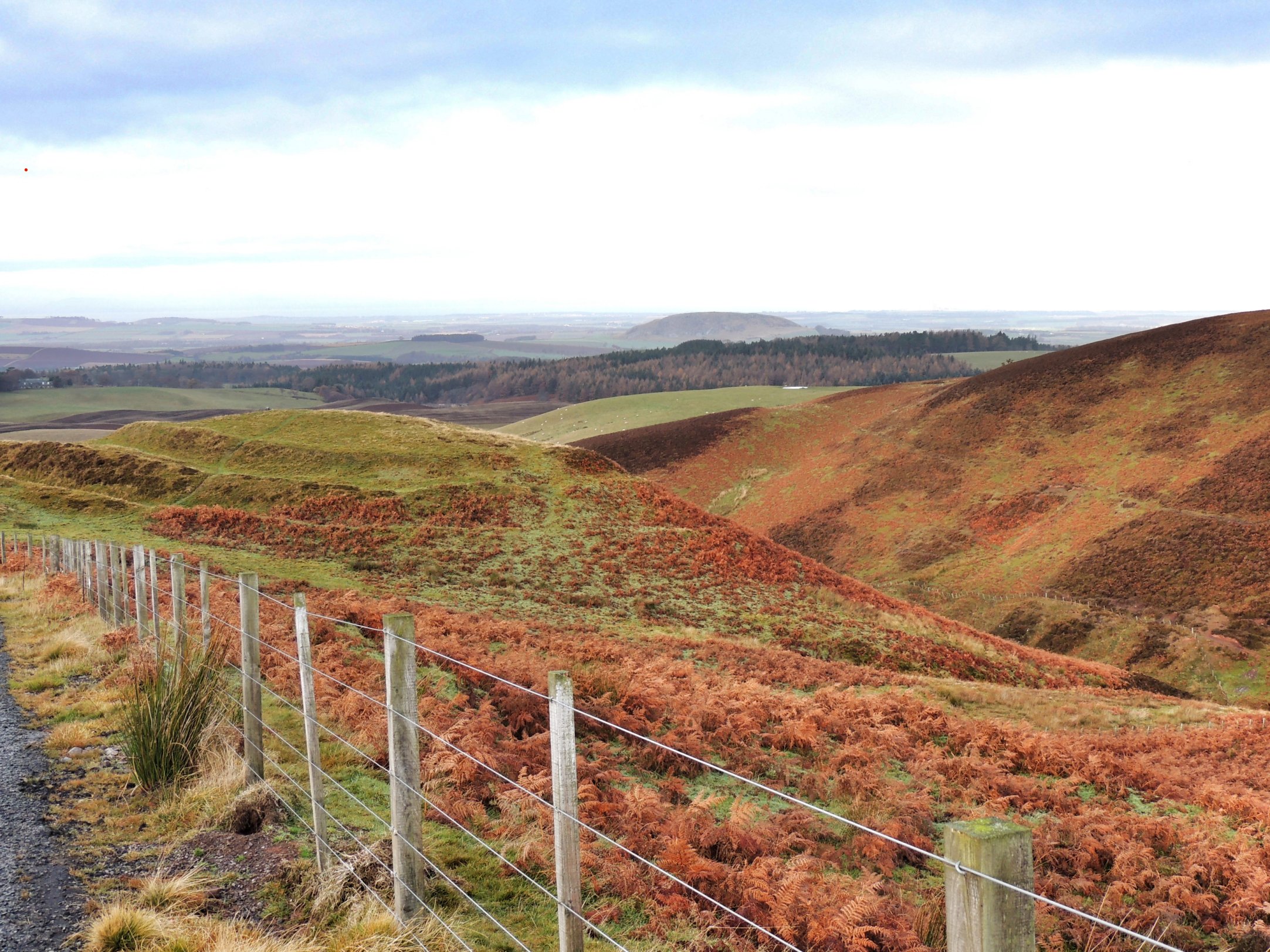
White Castle Fort
We stopped for a wee break at White Castle Fort – a bronze age fort consisting of several concentric circles of earthworks. The view from there down over East Lothian was amazing and Colette wandered round taking photos.
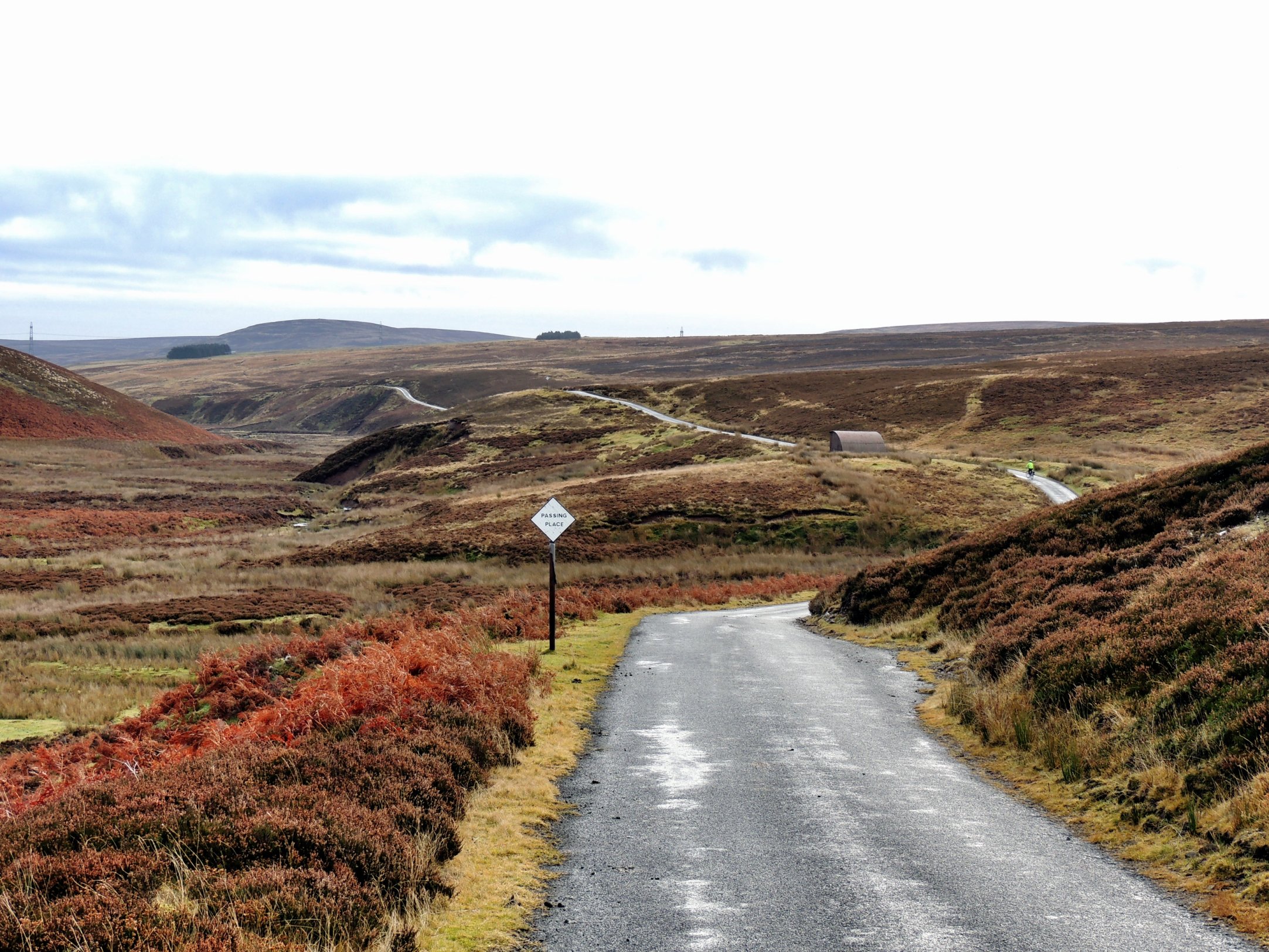
The seemingly endless moor road…
After more climbing, the road reached its highest point and continued in a winding, undulating fashion across the moor. On a summer’s day, and if we weren’t already exhausted, this would be a fantastic road to cycle along. However, our main thought at this time was to reach Whiteadder Reservoir, where we were going to stop for lunch.
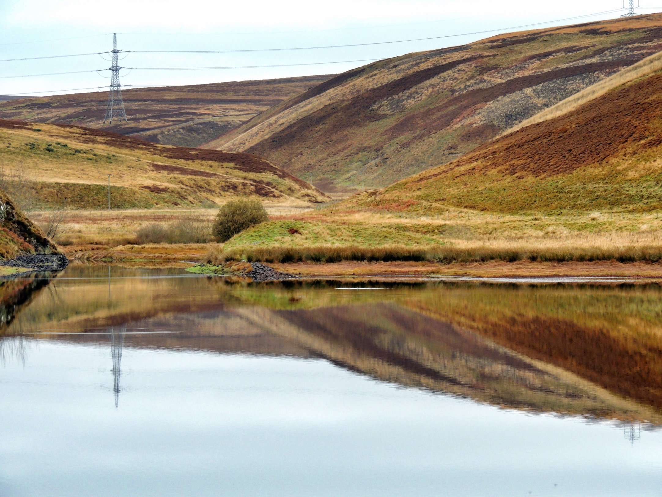
Whiteadder Reservoir
We caught sight of the reservoir after turning a corner and the road downhill from there got us to the waterside quickly. The flask and sandwiches were unpacked and a quick lunch was had. It was too cold to hang around doing nothing and when we got back on our bikes, the stiff climb up from the reservoir served to warm us up again.
Our route back took us along the B6355, which was relatively flat for a while, then turned a corner and began to climb right to the top of the hill as far as the eye could see. It was quite demoralising, and one of those cases where you just need to keep your head down and only look a few yards ahead. Twenty minutes or so later, we reached the highest point on our route, and of our cycling journeys thus far. The OS map puts this at a shade under 1400 feet (the data above from MapMyRide consistently underestimates our climbs!).
The road then turned right, and finally we were onto some consistent downhill. I didn’t go too fast though, as the windchill was cooling me down too much. Lots of braking was needed on a 17% section with a couple of tricky bends throw in – if it had gone on for much longer I’d have got cramp in my right hand, I was squeezing so hard!
It wasn’t long before we’d reached the place where we turned off for Garvald, then there were a couple of steep down and ups to get through before we reached the final run in to Gifford, when the sun finally came out from behind the clouds. We stopped at the cafe and had cups of tea and some of their lovely carrot cake to end our day out. I don’t think we’ve ever done a route with quite so many hills before. It was very hard, but we survived and we’re looking forward to the next one!