
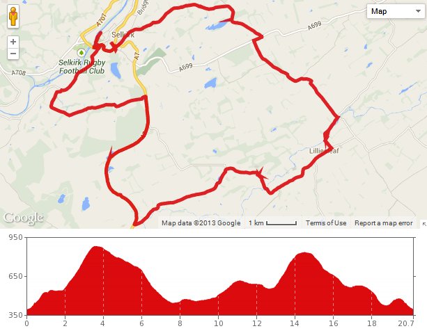
 We were looking for something a bit different, and Colette found on the internet some signposted cycle routes starting in Selkirk. She liked the sound of the magenta route – a loop from Selkirk, running via Midlem and Lilliesleaf. So we put the bikes on the back of the car and drove down to Selkirk, quite slowly as it turned out, due to 4 sets of roadworks on the A7 between Heriot and Gala.
We were supposed to start from the leisure centre on Buccleuch Road, but we couldn’t find it. So we parked close to the Selkirk Victoria Campsite, which can’t have been too far off. The magenta route started at the riverside and ran down to the main bridge across the Ettrick Water. We were supposed to turn left here, towards the town centre, but there were some kind of roadworks in the town and this road had been changed to one way, with the direction of travel going the wrong way for us. We decided to push our bikes up this road on the pavement, rather than take the diversion signs, which might have seen us lose the magenta trail completely.
The road then dipped and climbed sharply taking us to the town centre. From there, we followed the magenta route signs into a residential area. The sign then directed us down another temporary one way system before we came to the edge of town and the bottom of a very steep hill. It was a long, slow slog, but we made our way up to the top of Lindean Moor, with an extensive view out to our left and a big radio (TV?) mast to the right.
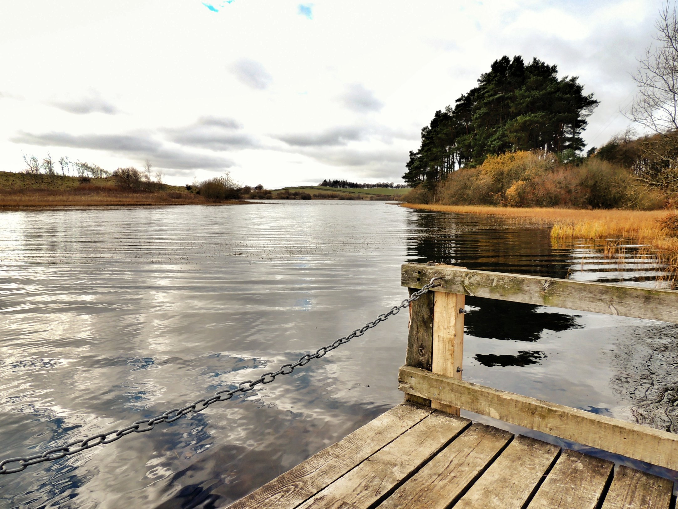
Lindean Reservoir
Following the route, we then reached Lindean Reservoir and paused to read the info boards and look in vain for any signs of wildlife. So we carried on and shortly we reached the village of Midlem. This is a very picturesque little village, and somewhat out of place, as if it had been beamed in from somewhere in the middle of England. There is probably an interesting story behind it, but we didn’t stop to find out and the downward gradient of the road rapidly swept us away out the other side.
By this time, it was approaching noon and we were thinking about stopping to eat our picnic lunch. At Toftbarns, the route took us right, alongside Ale Water until we reached a ford. It looked about 20 feet wide and the depth was hard to predict, so we consulted the route map, which told us that there was a path to a footbridge – I had completely failed to notice that as we passed it earlier.
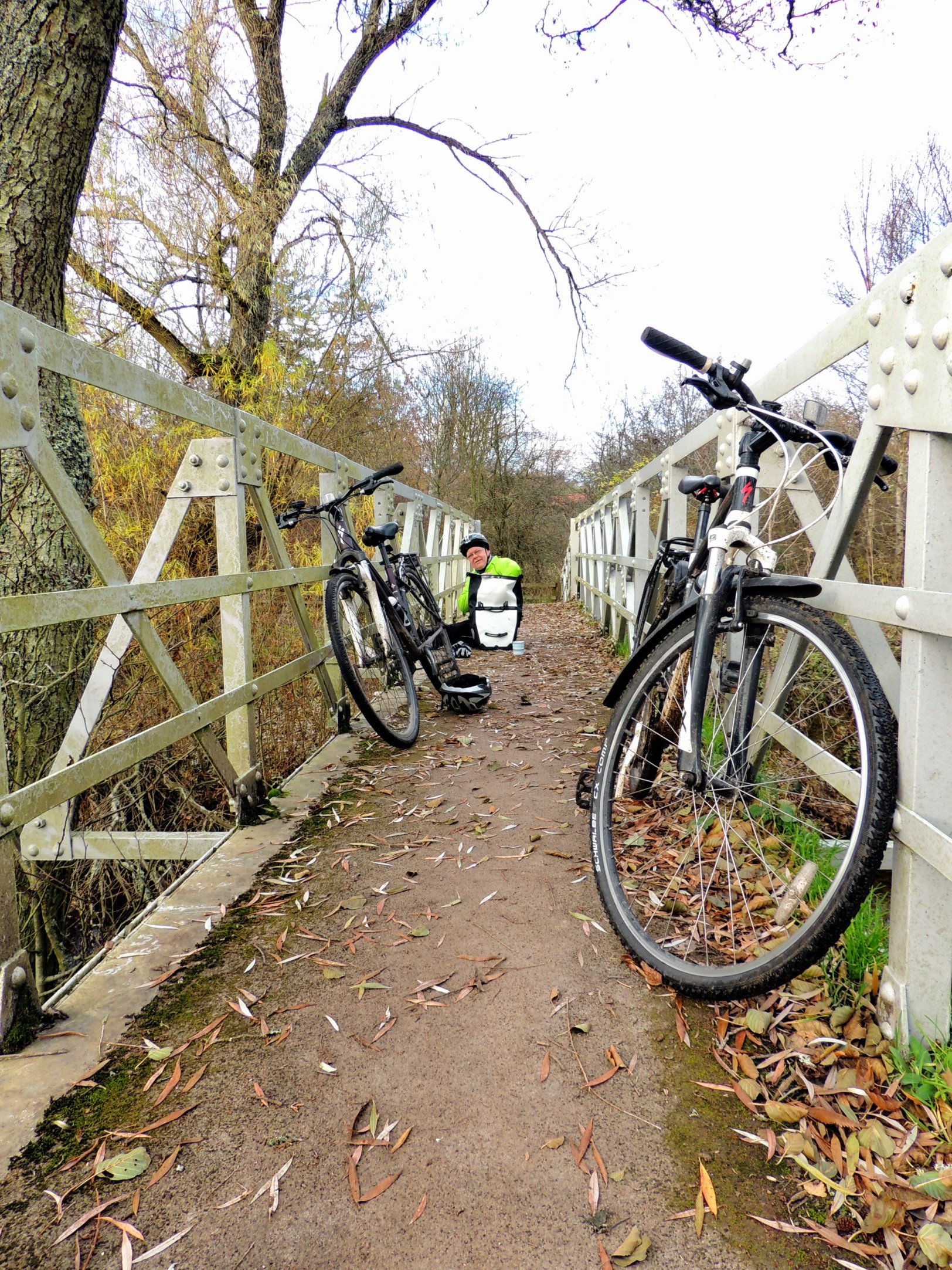
Footbridge over the Ale Water, and time for lunch!
Crossing the footbridge, it occurred to me that this would be a nice place to stop and have lunch. So we unpacked and got our flask of tea and sandwiches out. Soon, we were rushing to pick everything up again as four dogs came to introduce themselves, followed by their lady owner. Perhaps this wasn’t the most convenient place to have a picnic after all!
After we finished, we continued along the narrow path on the other side of the footbridge, to find a proper picnic site just a hundred yards or so further down. We felt quite silly…
The path joined onto a road that led uphill to the village of Lilliesleaf. We turned right onto the narrow road running through the village then took the right fork following the B6400 when we reached the unusually-named Jammy Coo (a gift shop, possibly?).
It had to happen sometime – the dreaded “p”-word.
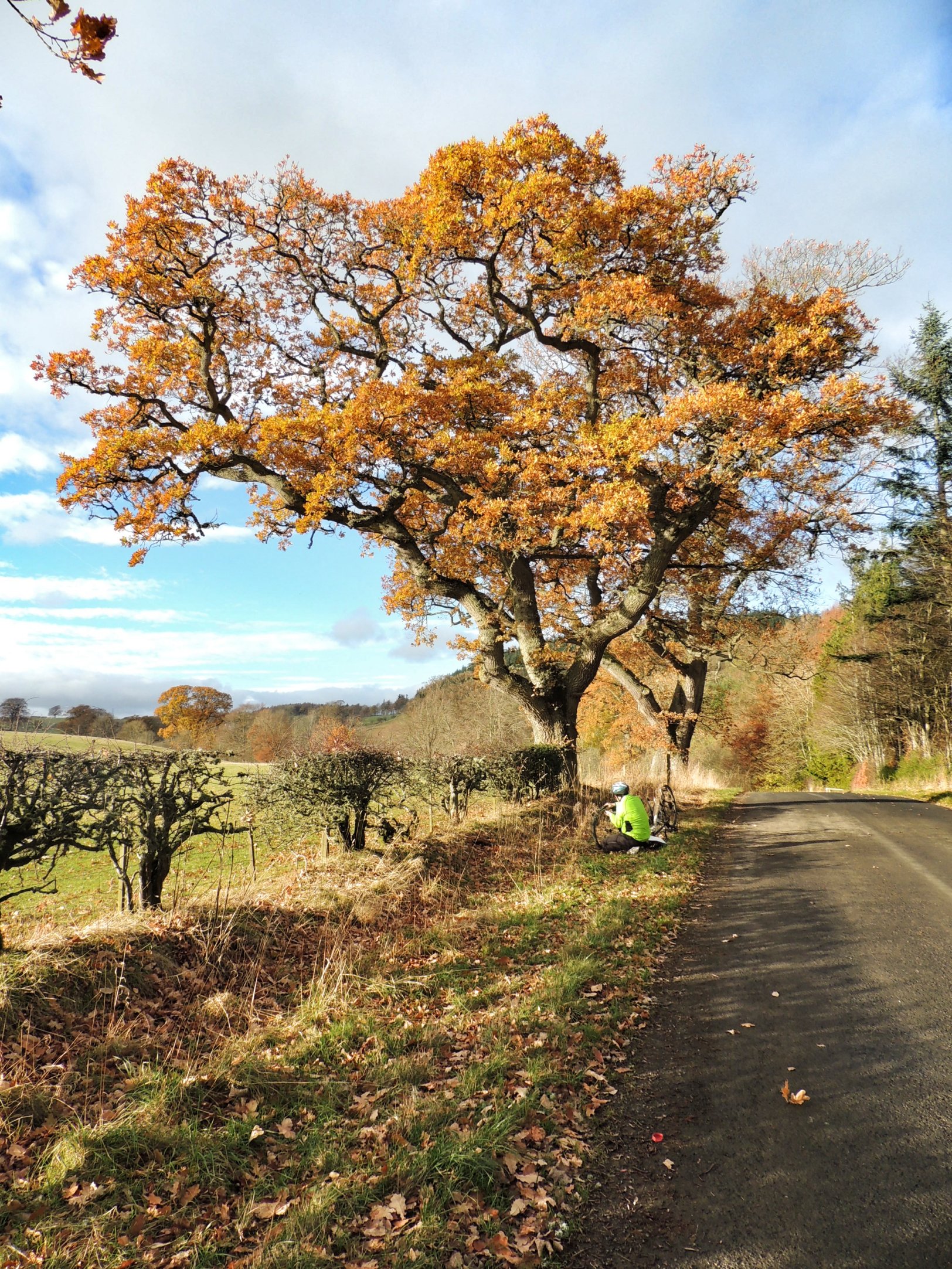
After a mile or so of fairly flat riding, we were going back uphill steeply. I stopped on a corner for Colette to catch up but when I started off again, something didn’t feel right – I had got a puncture: the first I’d ever needed to fix while out cycling. Luckily I had a suitable spare inner tube, and after removing the large thorn, it went on fairly easily. I was a bit blase actually, and forgot to reattach my front brake after putting the wheel back on. That caused a slight quickening of the heartbeat when I realised my omission on the next downhill!
Next we arrived at the hamlet of Clerklands, with some impressively large new houses on show. A side road ran steeply up from there and I hoped this wasn’t our route. We looked around and didn’t see a magenta route sign, so just carried on along the B6400 instead. This is where we made our mistake!
We then reached the A7, and consulting the route guide, we were supposed to turn right then take the first left. When we finally managed to get onto the main road between the fast-moving traffic, we found the road going steeply upwards. It was hard going, and over a mile had passed without any sign of a left turn. We paused in a layby next to a small loch and realised that we must have taken a wrong turn somewhere. However, the road was taking us back in the direction of Selkirk, so if all else failed, the A7 would take us back to the car.
Carrying on, we reached the spot where we were supposed to have turned onto the A7, and very soon afterwards turned left, returning to quiet roads. We started climbing again, reaching the top of another moor, then descended steeply towards Ettrick Water.
We then turned right onto the B7009 which climbed away from the river then descended back into Selkirk. Here, we met up with the one-way road that gave us the trouble initially, but we were going the right way this time. We freewheeled down it, turning right before the bridge, into Victoria Park and back to the car.